
10 Halletts Point
10, 20, 30 Halletts Pt,
Astoria, NY 11102
$3,300 - $6,971
Studio - 2 Beds
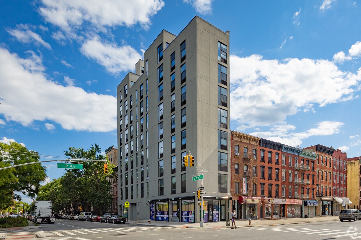

Find your new home at HAP 2 in New York, NY. This property is situated at 2338 Second Ave in the East Harlem area of New York. From amenities to availability, the professional leasing team is ready to help you find your perfect new place. Select from 0 to 3 bedroom apartments. At HAP 2 you're home.
HAP 2 is an apartment community located in New York County and the 10035 ZIP Code. This area is served by the New York City Geographic District # 4 attendance zone.
Laundry Facilities
Roof Terrace
Controlled Access
Bicycle Storage
Air Conditioning
Heating
Dining Room
Kitchen
From its murals to its famous taquerias (where you’ll find New York’s best tacos), East Harlem is considered one of New York’s hottest neighborhoods. You might hear East Harlem referred to as Spanish Harlem or El Barrio, but no matter what you call this trendy neighborhood, it’s an ideal location that’s still affordable by Manhattan standards.
East Harlem is located on Manhattan’s Upper East Side, extending from 96th Street north to the Harlem River, and from 5th Avenue east to the river. The northern section of Central Park, which includes the Museum of the City of New York, Fort Clinton, the Conservatory Garden, and the Butterfly Gardens of Central Park, sits directly across 5th Avenue from the neighborhood. Getting around Manhattan is quick and easy from East Harlem – the subway runs through East Harlem and contains several stations extending from 96th Street to 126th Street.
Learn more about living in East Harlem| Colleges & Universities | Distance | ||
|---|---|---|---|
| Colleges & Universities | Distance | ||
| Drive: | 5 min | 2.1 mi | |
| Drive: | 6 min | 2.3 mi | |
| Drive: | 6 min | 2.5 mi | |
| Drive: | 6 min | 2.6 mi |


Transportation options available in New York include 116 Street (4,6 Line), located 0.4 mile from HAP 2. HAP 2 is near LaGuardia, located 6.0 miles or 13 minutes away, and John F Kennedy International, located 17.3 miles or 26 minutes away.
| Transit / Subway | Distance | ||
|---|---|---|---|
| Transit / Subway | Distance | ||
|
|
Walk: | 8 min | 0.4 mi |
|
|
Walk: | 9 min | 0.5 mi |
|
|
Drive: | 3 min | 1.2 mi |
|
|
Drive: | 4 min | 1.3 mi |
|
|
Drive: | 4 min | 1.5 mi |
| Commuter Rail | Distance | ||
|---|---|---|---|
| Commuter Rail | Distance | ||
|
|
Walk: | 11 min | 0.6 mi |
|
|
Drive: | 4 min | 2.4 mi |
|
|
Drive: | 9 min | 3.5 mi |
| Drive: | 9 min | 3.9 mi | |
|
|
Drive: | 10 min | 4.8 mi |
| Airports | Distance | ||
|---|---|---|---|
| Airports | Distance | ||
|
LaGuardia
|
Drive: | 13 min | 6.0 mi |
|
John F Kennedy International
|
Drive: | 26 min | 17.3 mi |
Scores provided by
Traffic
-Airport
-Businesses
-Scores provided by
HowLoud What is a Sound Score Rating? A Sound Score Rating aggregates noise caused by vehicle traffic, airplane traffic and local sources. How It WorksTime and distance from HAP 2.
| Shopping Centers | Distance | ||
|---|---|---|---|
| Shopping Centers | Distance | ||
| Walk: | 8 min | 0.4 mi | |
| Drive: | 4 min | 1.6 mi | |
| Drive: | 5 min | 1.7 mi |
| Parks and Recreation | Distance | ||
|---|---|---|---|
| Parks and Recreation | Distance | ||
|
Thomas Jefferson Park
|
Walk: | 11 min | 0.6 mi |
|
Marcus Garvey Park
|
Drive: | 4 min | 1.4 mi |
|
Dana Discovery Center
|
Drive: | 5 min | 1.7 mi |
|
Randall's Island Park
|
Drive: | 5 min | 1.8 mi |
|
Morningside Park
|
Drive: | 6 min | 2.6 mi |
| Hospitals | Distance | ||
|---|---|---|---|
| Hospitals | Distance | ||
| Drive: | 4 min | 1.7 mi | |
| Drive: | 4 min | 1.8 mi | |
| Drive: | 5 min | 2.1 mi |
| Military Bases | Distance | ||
|---|---|---|---|
| Military Bases | Distance | ||
| Drive: | 22 min | 10.9 mi | |
| Drive: | 22 min | 11.5 mi |
What Are Walk Score®, Transit Score®, and Bike Score® Ratings?
Walk Score® measures the walkability of any address. Transit Score® measures access to public transit. Bike Score® measures the bikeability of any address.
What is a Sound Score Rating?
A Sound Score Rating aggregates noise caused by vehicle traffic, airplane traffic and local sources.

2338 Second Ave
New York, NY 10035


