
Sun Valley Apartment Homes
1400 Contra Costa Blvd,
Pleasant Hill, CA 94523
$1,995 - $2,275
Studio - 3 Beds
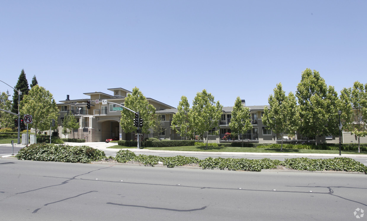
Grayson Creek Apartments is ready for your visit. Come for a visit to view the available floorplans. At Grayson Creek Apartments, you'll have a wide selection of features and amenities. Some of these include: disposal chutes, convenient on-site parking options, and a community picnic area. The team of leasing professionals is ready and waiting for you to visit. Stop by Grayson Creek Apartments today.
Grayson Creek Apartments is an apartment community located in Contra Costa County and the 94523 ZIP Code. This area is served by the Mt. Diablo Unified attendance zone.
Laundry Facilities
Elevator
Playground
Clubhouse
Air Conditioning
Dishwasher
High Speed Internet Access
Granite Countertops
Pleasant Hill is exactly what you’d expect: a pleasant community in the California hills. This suburb offers urban amenities and small-town charm, along with upscale rentals ranging from single-family homes to modern apartments. A charming outdoor shopping center sits in the heart of downtown, along with neighborhood parks, movie theaters, and top-notch public schools like Sequoia Middle. Pleasant Hill offers proximity to even more shopping and entertainment options like Sunvalley Shopping Center and Six Flags in Concord. Suisun Bay is only a few miles north of town, and Walnut Creek sits directly south. Residents of this upscale suburb also have easy access to Berkeley, Oakland, Richmond, and San Francisco thanks to Interstate 680 and State Route 24.
Learn more about living in Pleasant Hill| Colleges & Universities | Distance | ||
|---|---|---|---|
| Colleges & Universities | Distance | ||
| Drive: | 5 min | 1.5 mi | |
| Drive: | 22 min | 12.0 mi | |
| Drive: | 23 min | 14.9 mi | |
| Drive: | 30 min | 19.2 mi |


Transportation options available in Pleasant Hill include Concord Station, located 2.7 miles from Grayson Creek Apartments. Grayson Creek Apartments is near Metro Oakland International, located 29.0 miles or 39 minutes away, and San Francisco International, located 40.9 miles or 57 minutes away.
| Transit / Subway | Distance | ||
|---|---|---|---|
| Transit / Subway | Distance | ||
|
|
Drive: | 7 min | 2.7 mi |
|
|
Drive: | 8 min | 4.0 mi |
|
|
Drive: | 8 min | 4.0 mi |
|
|
Drive: | 7 min | 4.4 mi |
|
|
Drive: | 9 min | 5.6 mi |
| Commuter Rail | Distance | ||
|---|---|---|---|
| Commuter Rail | Distance | ||
|
|
Drive: | 11 min | 7.1 mi |
|
|
Drive: | 24 min | 16.7 mi |
|
|
Drive: | 29 min | 20.4 mi |
| Drive: | 31 min | 22.6 mi | |
|
|
Drive: | 32 min | 24.0 mi |
| Airports | Distance | ||
|---|---|---|---|
| Airports | Distance | ||
|
Metro Oakland International
|
Drive: | 39 min | 29.0 mi |
|
San Francisco International
|
Drive: | 57 min | 40.9 mi |
Time and distance from Grayson Creek Apartments.
| Shopping Centers | Distance | ||
|---|---|---|---|
| Shopping Centers | Distance | ||
| Walk: | 4 min | 0.2 mi | |
| Walk: | 5 min | 0.3 mi | |
| Walk: | 8 min | 0.4 mi |
| Parks and Recreation | Distance | ||
|---|---|---|---|
| Parks and Recreation | Distance | ||
|
Markham Nature Park and Arboretum
|
Drive: | 11 min | 4.3 mi |
|
Larkey Park
|
Drive: | 8 min | 4.8 mi |
|
Lindsay Wildlife Museum
|
Drive: | 8 min | 4.8 mi |
|
Waterbird Regional Preserve
|
Drive: | 8 min | 5.7 mi |
|
John Muir National Historic Site
|
Drive: | 11 min | 5.9 mi |
| Hospitals | Distance | ||
|---|---|---|---|
| Hospitals | Distance | ||
| Drive: | 6 min | 2.6 mi | |
| Drive: | 6 min | 2.7 mi | |
| Drive: | 10 min | 6.1 mi |
What Are Walk Score®, Transit Score®, and Bike Score® Ratings?
Walk Score® measures the walkability of any address. Transit Score® measures access to public transit. Bike Score® measures the bikeability of any address.
What is a Sound Score Rating?
A Sound Score Rating aggregates noise caused by vehicle traffic, airplane traffic and local sources

100 Chilpancingo Pky
Pleasant Hill, CA 94523


