
The Riverdale Tower
3745 Riverdale Ave,
The Bronx, NY 10463
$2,200 - $4,500
Studio - 2 Beds


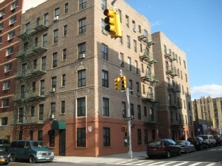
At Geel East 182nd Street in Bronx, experience fine living. The 10453 location in Bronx is an ideal place for residents. Come by to check out the current floorplan options. From amenities to availability, the leasing team will assist you in finding the perfect place. So get a head start on your move. Contact or stop by the Geel East 182nd Street leasing office to find out the availability today.
Geel East 182nd Street is an apartment community located in Bronx County and the 10453 ZIP Code. This area is served by the New York City Geographic District #10 attendance zone.
High Speed Internet Access
Smoke Free
Heating
Oven
Fordham Heights hosts a thriving and energetic section of the city dominated by five- and six-story apartment buildings, with nearby parks and green spaces creating a welcome reprieve from city life. The neighborhood is about a block from the Bronx Zoo, and Fordham University is located off the northeast corner of the neighborhood, along East Fordham Road.
With Manhattan only eight miles to the southwest, a commute to the city takes just a few minutes. Plenty of city amenities are located right in the heart of downtown; Fordham Road hosts a large marketplace with foot traffic rivaling Manhattan's thoroughfares. Rapid growth fueled by local industry and community spirit makes the area a premier destination filled with retail space, natural beauty, and neighborhood energy.
Learn more about living in Fordham HeightsCompare neighborhood and city base rent averages by bedroom.
| Fordham Heights | Bronx, NY | |
|---|---|---|
| Studio | $1,353 | $1,635 |
| 1 Bedroom | $1,409 | $1,630 |
| 2 Bedrooms | $1,575 | $2,092 |
| 3 Bedrooms | $1,843 | $2,356 |
| Colleges & Universities | Distance | ||
|---|---|---|---|
| Colleges & Universities | Distance | ||
| Walk: | 11 min | 0.6 mi | |
| Walk: | 15 min | 0.8 mi | |
| Drive: | 5 min | 1.8 mi | |
| Drive: | 6 min | 1.9 mi |


Transportation options available in Bronx include 182-183 Streets, located 0.0 mile from Geel East 182nd Street. Geel East 182nd Street is near LaGuardia, located 10.2 miles or 21 minutes away, and John F Kennedy International, located 19.7 miles or 30 minutes away.
| Transit / Subway | Distance | ||
|---|---|---|---|
| Transit / Subway | Distance | ||
|
|
Walk: | 0 min | 0.0 mi |
|
|
Walk: | 5 min | 0.3 mi |
|
|
Walk: | 9 min | 0.5 mi |
|
|
Walk: | 9 min | 0.5 mi |
|
|
Walk: | 11 min | 0.6 mi |
| Commuter Rail | Distance | ||
|---|---|---|---|
| Commuter Rail | Distance | ||
|
|
Walk: | 14 min | 0.8 mi |
|
|
Drive: | 4 min | 1.5 mi |
|
|
Drive: | 5 min | 1.6 mi |
|
|
Drive: | 5 min | 1.7 mi |
|
|
Drive: | 6 min | 2.3 mi |
| Airports | Distance | ||
|---|---|---|---|
| Airports | Distance | ||
|
LaGuardia
|
Drive: | 21 min | 10.2 mi |
|
John F Kennedy International
|
Drive: | 30 min | 19.7 mi |
Scores provided by
Traffic
-Airport
-Businesses
-Scores provided by
HowLoud What is a Sound Score Rating? A Sound Score Rating aggregates noise caused by vehicle traffic, airplane traffic and local sources. How It WorksTime and distance from Geel East 182nd Street.
| Shopping Centers | Distance | ||
|---|---|---|---|
| Shopping Centers | Distance | ||
| Walk: | 7 min | 0.4 mi | |
| Drive: | 4 min | 1.2 mi | |
| Drive: | 3 min | 1.2 mi |
| Parks and Recreation | Distance | ||
|---|---|---|---|
| Parks and Recreation | Distance | ||
|
St. James Park
|
Drive: | 3 min | 1.3 mi |
|
Poe Park
|
Drive: | 4 min | 1.5 mi |
|
Roberto Clemente State Park
|
Drive: | 5 min | 1.7 mi |
|
Crotona Park
|
Drive: | 6 min | 2.0 mi |
|
Sherman Creek and Swindler Cove
|
Drive: | 12 min | 5.2 mi |
| Hospitals | Distance | ||
|---|---|---|---|
| Hospitals | Distance | ||
| Drive: | 5 min | 1.4 mi | |
| Drive: | 6 min | 2.3 mi | |
| Drive: | 7 min | 3.0 mi |
| Military Bases | Distance | ||
|---|---|---|---|
| Military Bases | Distance | ||
| Drive: | 20 min | 10.2 mi |
What Are Walk Score®, Transit Score®, and Bike Score® Ratings?
Walk Score® measures the walkability of any address. Transit Score® measures access to public transit. Bike Score® measures the bikeability of any address.
What is a Sound Score Rating?
A Sound Score Rating aggregates noise caused by vehicle traffic, airplane traffic and local sources.
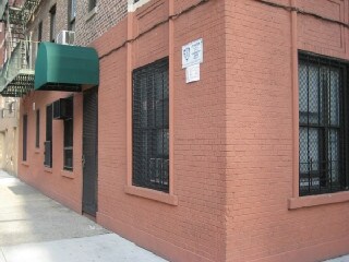
155 E 182nd St
Bronx, NY 10453


