-

-
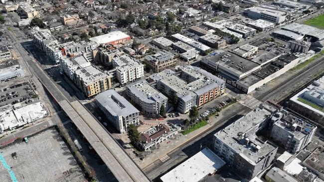
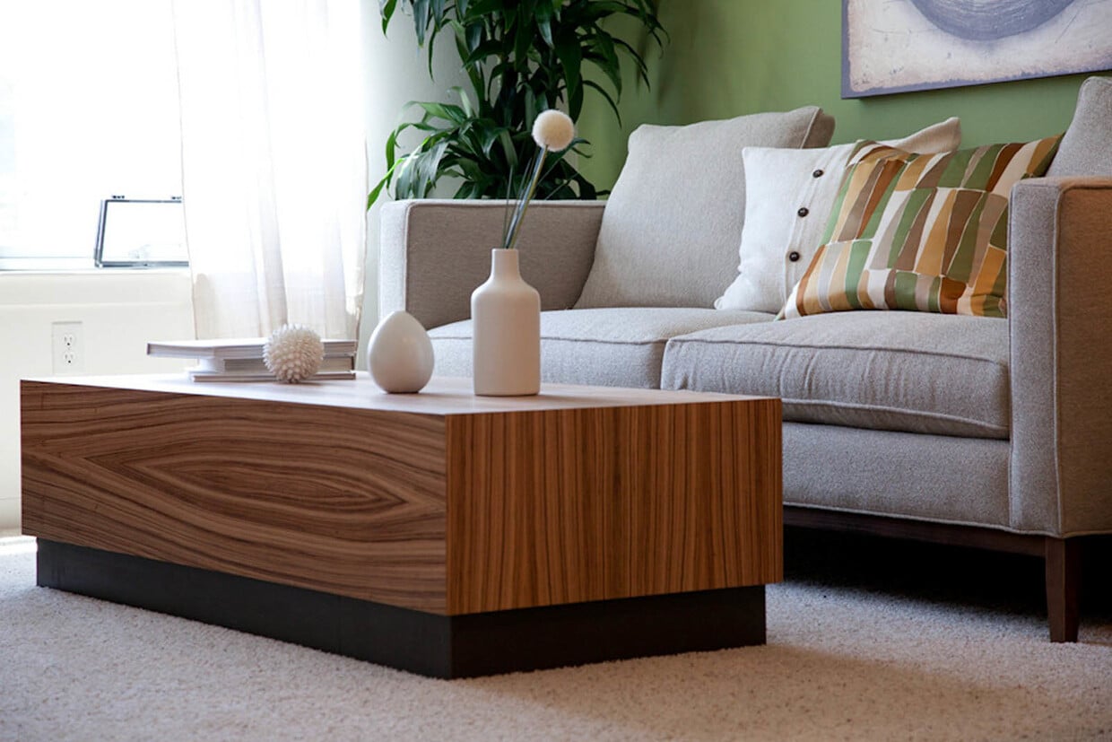
Matterport 3D Exterior
-
Fourth and U
2020 4th St,
Berkeley,
CA
94710
-
Monthly Rent
$2,398 - $3,499
-
Bedrooms
1 - 2 bd
-
Bathrooms
1 - 2 ba
-
Square Feet
615 - 1,152 sq ft

Welcome home to Fourth & U!
Highlights
- Walker's Paradise
- Bike-Friendly Area
- Pool
- Walk-In Closets
- Individual Locking Bedrooms
- Balcony
- Patio
Pricing & Floor Plans
-
Unit S302price $2,398square feet 632availibility Now
-
Unit S331price $2,398square feet 632availibility Now
-
Unit S431price $2,398square feet 632availibility Now
-
Unit S320price $2,485square feet 747availibility Now
-
Unit S227price $2,485square feet 747availibility Now
-
Unit S322price $2,485square feet 747availibility Now
-
Unit S201price $3,499square feet 1,152availibility Now
-
Unit S302price $2,398square feet 632availibility Now
-
Unit S331price $2,398square feet 632availibility Now
-
Unit S431price $2,398square feet 632availibility Now
-
Unit S320price $2,485square feet 747availibility Now
-
Unit S227price $2,485square feet 747availibility Now
-
Unit S322price $2,485square feet 747availibility Now
-
Unit S201price $3,499square feet 1,152availibility Now
Fees and Policies
The fees listed below are community-provided and may exclude utilities or add-ons. All payments are made directly to the property and are non-refundable unless otherwise specified.
-
One-Time Basics
-
Due at Application
-
Application Fee Per ApplicantCharged per applicant.$48
-
-
Due at Application
-
Dogs
-
Pet DepositMax of 2. Charged per pet.$1,000
-
Monthly Pet FeeMax of 2. Charged per pet.$130 / mo
50 lbs. Weight Limit -
-
Cats
-
Pet DepositMax of 2. Charged per pet.$1,000
-
Monthly Pet FeeMax of 2. Charged per pet.$130 / mo
50 lbs. Weight Limit -
Property Fee Disclaimer: Based on community-supplied data and independent market research. Subject to change without notice. May exclude fees for mandatory or optional services and usage-based utilities.
Details
Lease Options
-
3 - 12 Month Leases
-
Short term lease
Property Information
-
Built in 2010
-
171 units/4 stories
Matterport 3D Tours
About Fourth and U
Welcome home to Fourth & U!
Fourth and U is an apartment community located in Alameda County and the 94710 ZIP Code. This area is served by the Berkeley Unified School District attendance zone.
Unique Features
- 24 - Hour Emergency Maintenance
- Bark Park
- Beautifully Maintained Landscaping
- Central Location With Abundant Shopping
- Covered Parking + Additional To Rent
- Credit Building Opportunity W/renttrack
- Deposit - Free Leasing With Rhino
- Easy Access To I-80, 237 & 580 Freeways
- Paw- Approved And Pet Friendly
- Restaurants Nearby
- Smoke - Free Community
- Sparkling Resort Style Pool
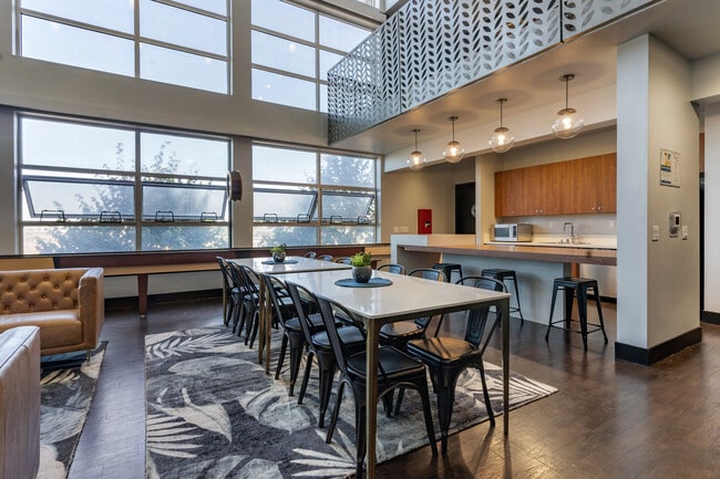
Community Amenities
- Pool
- Individual Locking Bedrooms
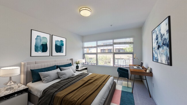
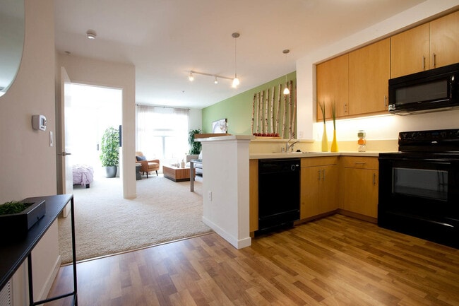
Apartment Features
Washer/Dryer
Air Conditioning
Walk-In Closets
Microwave
- Washer/Dryer
- Air Conditioning
- Heating
- Stainless Steel Appliances
- Kitchen
- Microwave
- Oven
- Range
- Refrigerator
- Quartz Countertops
- Vinyl Flooring
- Vaulted Ceiling
- Walk-In Closets
- Balcony
- Patio
Southwest Berkeley is bounded by University Avenue to the north, Sacramento Street to the East, Alcatraz Avenue to the south and the San Francisco Bay to the west. Southwest Berkeley comprises a fascinating mix of the educational and the industrial. Less dense than the more inland parts of Berkeley, Southwest Berkeley has a diverse mix of apartment and home rentals that will delight students and families alike. Convenient access to the illustrious university make this a great option for students and staff, but any renter will love the restaurant and retail options that make this walkable locale so convenient.
Learn more about living in Southwest BerkeleyCompare neighborhood and city base rent averages by bedroom.
| Southwest Berkeley | Berkeley, CA | |
|---|---|---|
| Studio | $2,120 | $2,088 |
| 1 Bedroom | $2,456 | $2,258 |
| 2 Bedrooms | $2,843 | $3,308 |
| 3 Bedrooms | $4,005 | $4,356 |
- Pool
- Individual Locking Bedrooms
- 24 - Hour Emergency Maintenance
- Bark Park
- Beautifully Maintained Landscaping
- Central Location With Abundant Shopping
- Covered Parking + Additional To Rent
- Credit Building Opportunity W/renttrack
- Deposit - Free Leasing With Rhino
- Easy Access To I-80, 237 & 580 Freeways
- Paw- Approved And Pet Friendly
- Restaurants Nearby
- Smoke - Free Community
- Sparkling Resort Style Pool
- Washer/Dryer
- Air Conditioning
- Heating
- Stainless Steel Appliances
- Kitchen
- Microwave
- Oven
- Range
- Refrigerator
- Quartz Countertops
- Vinyl Flooring
- Vaulted Ceiling
- Walk-In Closets
- Balcony
- Patio
| Monday | Closed |
|---|---|
| Tuesday | 9am - 6pm |
| Wednesday | 9am - 6pm |
| Thursday | 9am - 6pm |
| Friday | 9am - 6pm |
| Saturday | 9am - 6pm |
| Sunday | Closed |
| Colleges & Universities | Distance | ||
|---|---|---|---|
| Colleges & Universities | Distance | ||
| Drive: | 6 min | 1.8 mi | |
| Drive: | 10 min | 2.9 mi | |
| Drive: | 10 min | 5.7 mi | |
| Drive: | 12 min | 6.3 mi |


View GreatSchools Rating Methodology
Data provided by GreatSchools.org © 2026. All rights reserved.
Transportation options available in Berkeley include North Berkeley, located 1.2 miles from Fourth and U. Fourth and U is near Metro Oakland International, located 16.1 miles or 24 minutes away, and San Francisco International, located 23.7 miles or 36 minutes away.
| Transit / Subway | Distance | ||
|---|---|---|---|
| Transit / Subway | Distance | ||
|
|
Drive: | 4 min | 1.2 mi |
|
|
Drive: | 6 min | 1.9 mi |
|
|
Drive: | 8 min | 2.7 mi |
|
|
Drive: | 7 min | 3.5 mi |
|
|
Drive: | 13 min | 7.1 mi |
| Commuter Rail | Distance | ||
|---|---|---|---|
| Commuter Rail | Distance | ||
|
|
Walk: | 1 min | 0.1 mi |
| Drive: | 7 min | 2.2 mi | |
| Drive: | 11 min | 6.6 mi | |
|
|
Drive: | 13 min | 7.6 mi |
| Drive: | 18 min | 11.3 mi |
| Airports | Distance | ||
|---|---|---|---|
| Airports | Distance | ||
|
Metro Oakland International
|
Drive: | 24 min | 16.1 mi |
|
San Francisco International
|
Drive: | 36 min | 23.7 mi |
Time and distance from Fourth and U.
| Shopping Centers | Distance | ||
|---|---|---|---|
| Shopping Centers | Distance | ||
| Walk: | 19 min | 1.0 mi | |
| Drive: | 3 min | 1.1 mi | |
| Drive: | 5 min | 1.6 mi |
| Parks and Recreation | Distance | ||
|---|---|---|---|
| Parks and Recreation | Distance | ||
|
McLaughlin Eastshore State Park
|
Walk: | 14 min | 0.8 mi |
|
Strawberry Creek Park
|
Walk: | 16 min | 0.8 mi |
|
Cedar-Rose Park
|
Drive: | 4 min | 1.3 mi |
|
Shorebird Nature Center
|
Drive: | 3 min | 1.3 mi |
|
Shorebird Park
|
Drive: | 4 min | 1.5 mi |
| Hospitals | Distance | ||
|---|---|---|---|
| Hospitals | Distance | ||
| Drive: | 10 min | 3.3 mi | |
| Drive: | 10 min | 3.5 mi | |
| Drive: | 9 min | 5.6 mi |
| Military Bases | Distance | ||
|---|---|---|---|
| Military Bases | Distance | ||
| Drive: | 12 min | 5.5 mi | |
| Drive: | 15 min | 6.7 mi |
Fourth and U Photos
-
Fourth and U
-
Shattuck 1BR, 1BA - 630SF
-
-
-
-
-
-
-
Models
-
1 Bedroom
-
Addison
-
1 Bedroom
-
Vine
-
2 Bedrooms
-
Shattuck 1BR, 1BA - 630SF
Nearby Apartments
Within 50 Miles of Fourth and U
-
Lafayette Oaks
949 East St
Lafayette, CA 94549
$2,506 - $3,204
1-3 Br 9.9 mi
-
Woodchase Apartments
2795 San Leandro Blvd
San Leandro, CA 94578
$1,999 - $2,399
1-2 Br 13.5 mi
-
Bay Village
1107 Porter St
Vallejo, CA 94590
Call for Rent
1-2 Br 15.1 mi
-
Bridgecreek
1599 S Novato Blvd
Novato, CA 94947
$3,429 - $3,623
2 Br 22.0 mi
-
2727 Edison
2727 Edison St
San Mateo, CA 94403
$4,014 - $4,114
2 Br 22.5 mi
-
Capri Creek
1900 Sestri Ln
Petaluma, CA 94954
$2,262 - $3,754
1-3 Br 33.4 mi
Fourth and U has units with in‑unit washers and dryers, making laundry day simple for residents.
Utilities are not included in rent. Residents should plan to set up and pay for all services separately.
Contact this property for parking details.
Fourth and U has one to two-bedrooms with rent ranges from $2,398/mo. to $3,499/mo.
Yes, Fourth and U welcomes pets. Breed restrictions, weight limits, and additional fees may apply. View this property's pet policy.
A good rule of thumb is to spend no more than 30% of your gross income on rent. Based on the lowest available rent of $2,398 for a one-bedroom, you would need to earn about $95,920 per year to qualify. Want to double-check your budget? Calculate how much rent you can afford with our Rent Affordability Calculator.
Fourth and U is not currently offering any rent specials. Check back soon, as promotions change frequently.
Yes! Fourth and U offers 7 Matterport 3D Tours. Explore different floor plans and see unit level details, all without leaving home.
What Are Walk Score®, Transit Score®, and Bike Score® Ratings?
Walk Score® measures the walkability of any address. Transit Score® measures access to public transit. Bike Score® measures the bikeability of any address.
What is a Sound Score Rating?
A Sound Score Rating aggregates noise caused by vehicle traffic, airplane traffic and local sources.
2020 4th St
Berkeley, CA 94710
Property Manager Responded