Forest Lane

6200 N Wayne Rd, Westland, MI 48185

2 Weeks Ago
Share Listing
Favorites
Forest Lane
Share Listing
Favorites

About Forest Lane

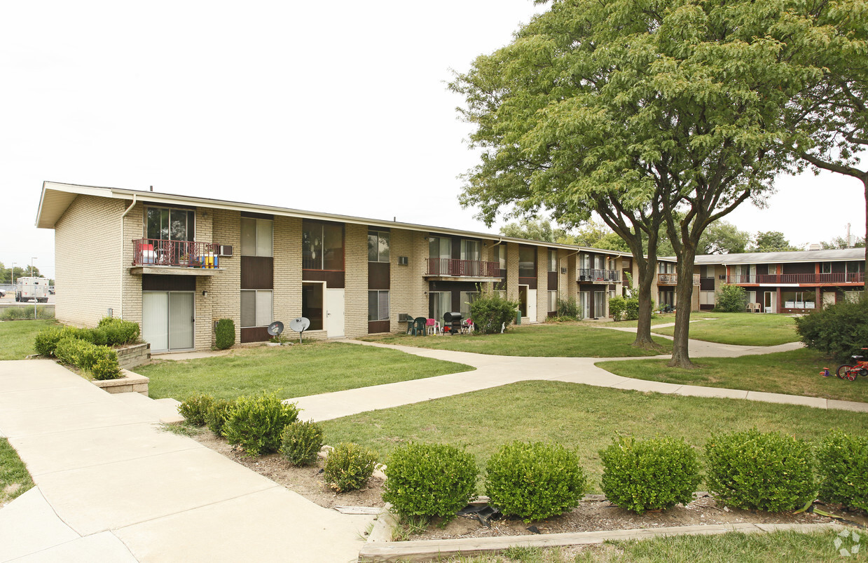
Find your new home at Forest Lane in Westland, MI. You'll find this community on N. Wayne Rd. in the 48185 area of Westland. The leasing team will assist you in finding your new home. Contact us today to see available floor plans and make your move to Forest Lane.

Forest Lane is an apartment community located in Wayne County and the 48185 ZIP Code. This area is served by the Wayne-Westland Community School District attendance zone.

Community Amenities

  • Trash Pickup - Curbside
  • Walk-Up
  • Courtyard

Apartment Features

Air Conditioning

High Speed Internet Access

Refrigerator

Tub/Shower

  • High Speed Internet Access
  • Air Conditioning
  • Heating
  • Smoke Free
  • Tub/Shower
  • Disposal
  • Oven
  • Range
  • Refrigerator
  • Balcony
Location
6200 N Wayne Rd, Westland,
MI 48185
Get Directions
City - Westland

Westland sits about 16 miles west of downtown Detroit, carrying the quiet confidence of a city that knows what it is: a well-connected, grounded Wayne County community with real substance beneath its suburban surface. Covering roughly 21 square miles, it holds a population of more than 84,000 residents and benefits from direct access to Interstates 96 and 275, making it a practical base for anyone working in the broader metro area. The city adopted the Compassionate Cities Movement, a reflection of its long-standing investment in community outreach and civic engagement. Its history runs deep, stretching back to a Potawatomi village in the 18th century, and the Westland Historic Village Park keeps that heritage visible for anyone curious about the city's roots.

The housing mix here leans toward garden-style apartment communities and ranch-style rentals, with options ranging from studios to spacious two- and three-bedroom floor plans.

Learn more about living in Westland 
Education
Colleges & Universities Distance
Drive: 10 min 4.9 mi
Drive: 18 min 8.8 mi
Drive: 17 min 10.3 mi
Drive: 18 min 11.5 mi
Forest Lane is within 10 minutes or 4.9 miles from Madonna University. It is also near Schoolcraft College and Henry Ford Community College.
Schools
Public Elementary School
Grades K-5
405 Students
Attendance Zone
Public Elementary & Middle School
Grades PK-8
150 Students
Nearby
Public Elementary School
Grades 5-6
838 Students
Attendance Zone
Public Middle & High School
Grades 6-12
1,311 Students
Attendance Zone
Public Middle School
Grades 6-8
796 Students
Attendance Zone
Private Elementary & Middle School
Grades PK-8
113 Students
Nearby
Private Middle & High School
Grades 6-12
82 Students
Nearby
Transportation

Forest Lane is near Detroit Metro Wayne County, located 12.5 miles or 22 minutes away.

Commuter Rail Distance
Drive: 21 min 10.4 mi
Drive: 31 min 21.2 mi
Drive: 30 min 21.9 mi
Drive: 38 min 23.8 mi
Drive: 43 min 26.2 mi
Airports Distance
Airports Distance
Detroit Metro Wayne County
Drive: 22 min 12.5 mi

Walkability Near Forest Lane

Getting Around
Moderately Walkable
Walkability
60 / 100
Limited Public Transit
Transit
30 / 100
Exceptionally Drivable
Drivability
90 / 100
Moderately Bikeable
Bikeability
60 / 100

Scores provided by

What do Walkability, Transit, Drivability, and Bikeability mean? Walkability measures the walking distance to day-to-day needs. Transit measures access to public transportation. Drivability measures congestion, parking availability, and access to major roads. Bikeability measures the suitability for cycling. How It Works
-
Soundscore
- / 100

Traffic

-

Airport

-

Businesses

-

Scores provided by

HowLoud What is a Sound Score Rating? A Sound Score Rating aggregates noise caused by vehicle traffic, airplane traffic and local sources. How It Works
Points of Interest

Time and distance from Forest Lane.

Shopping Centers Distance
Walk: 3 min 0.2 mi
Walk: 4 min 0.2 mi
Walk: 4 min 0.2 mi
Forest Lane has 3 shopping centers within 0.2 mile, which is about a 4-minute walk. The miles and minutes will be for the farthest away property.
Parks and Recreation Distance
Holliday Forest & Wildlife Preserve
Drive: 5 min 1.9 mi
Nankin Mills Nature Center
Drive: 6 min 2.9 mi
Goudy Park and Amphitheatre
Drive: 8 min 3.8 mi
Bell Creek Recreation Area
Drive: 15 min 8.7 mi
Lola Valley Park
Drive: 16 min 9.7 mi
Forest Lane has 5 parks within 9.7 miles, including Holliday Forest & Wildlife Preserve, Nankin Mills Nature Center, and Goudy Park and Amphitheatre.
Hospitals Distance
Hospitals Distance
Drive: 8 min 4.6 mi
Drive: 9 min 4.8 mi
Drive: 11 min 5.3 mi
Forest Lane has 3 hospitals within 5.3 miles, the nearest is Walter P. Reuther Psychiatric Hospital which is 4.6 miles away and a 8 minute drive.
Military Bases Distance
Drive: 112 min 87.0 mi
Drive: 108 min 95.7 mi
Forest Lane is 87.0 miles from Camp Perry Air Guard Station, and is convenient to other military bases, including Army Air Support.

Explore Similar Rentals Nearby