
Airo at South Bay
12530 Crenshaw Blvd,
Hawthorne, CA 90250
$2,625 - $3,525
Studio - 2 Beds
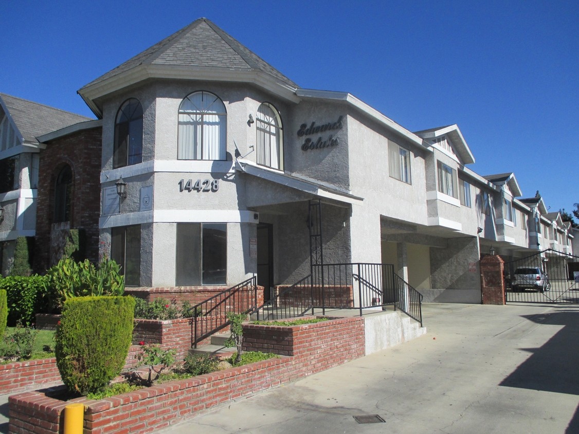
Experience Hawthorne living at Edwards Estates. You'll find this community on Cerise Ave in Hawthorne. From amenities to availability, the professional leasing team is excited to help you find your new place. Contact us or stop by today.
Edwards Estates is an apartment community located in Los Angeles County and the 90250 ZIP Code. This area is served by the Lawndale Elementary attendance zone.
Laundry Facilities
Recycling
Grill
Gated
Dishwasher
High Speed Internet Access
Disposal
Ceiling Fans
Residents living in Bodger Park – El Camino Village enjoy the diverse cuisines throughout the neighborhood. The local park’s expansive green space features a community garden and jungle gym.
The community of Bodger Park – El Camino Village is located inside the Interstate 405, Interstate 105, and Interstate 10 loop. From family-owned grocery stores to the open-air market on Redondo Beach Boulevard – there are plenty of shopping opportunities.
El Camino College and South Bay Galleria are south of the neighborhood. When you live here, you’re close to the pier at Manhattan Beach and LAX.
Learn more about living in Bodger Park-El Camino Village| Colleges & Universities | Distance | ||
|---|---|---|---|
| Colleges & Universities | Distance | ||
| Drive: | 4 min | 2.2 mi | |
| Drive: | 8 min | 3.7 mi | |
| Drive: | 15 min | 8.0 mi | |
| Drive: | 14 min | 9.4 mi |


Transportation options available in Hawthorne include Crenshaw Station, located 2.1 miles from Edwards Estates. Edwards Estates is near Los Angeles International, located 8.5 miles or 14 minutes away, and Long Beach (Daugherty Field), located 14.4 miles or 21 minutes away.
| Transit / Subway | Distance | ||
|---|---|---|---|
| Transit / Subway | Distance | ||
|
|
Drive: | 4 min | 2.1 mi |
|
|
Drive: | 5 min | 2.7 mi |
|
|
Drive: | 6 min | 3.3 mi |
|
|
Drive: | 7 min | 4.3 mi |
|
|
Drive: | 9 min | 5.1 mi |
| Commuter Rail | Distance | ||
|---|---|---|---|
| Commuter Rail | Distance | ||
|
|
Drive: | 22 min | 15.9 mi |
|
|
Drive: | 24 min | 16.1 mi |
|
|
Drive: | 26 min | 17.8 mi |
|
|
Drive: | 29 min | 19.3 mi |
| Drive: | 25 min | 19.9 mi |
| Airports | Distance | ||
|---|---|---|---|
| Airports | Distance | ||
|
Los Angeles International
|
Drive: | 14 min | 8.5 mi |
|
Long Beach (Daugherty Field)
|
Drive: | 21 min | 14.4 mi |
Time and distance from Edwards Estates.
| Shopping Centers | Distance | ||
|---|---|---|---|
| Shopping Centers | Distance | ||
| Walk: | 5 min | 0.3 mi | |
| Walk: | 6 min | 0.3 mi | |
| Walk: | 10 min | 0.5 mi |
| Parks and Recreation | Distance | ||
|---|---|---|---|
| Parks and Recreation | Distance | ||
|
Compton Creek Natural Park at George Washington Elementary
|
Drive: | 10 min | 5.6 mi |
|
Madrona Marsh Preserve & Nature Center
|
Drive: | 12 min | 6.6 mi |
|
Dockweiler State Beach
|
Drive: | 12 min | 6.8 mi |
|
Watts Towers-Rodia State Park
|
Drive: | 12 min | 7.8 mi |
|
Watts Senior Center & Rose Garden
|
Drive: | 12 min | 8.2 mi |
| Hospitals | Distance | ||
|---|---|---|---|
| Hospitals | Distance | ||
| Drive: | 5 min | 3.3 mi | |
| Drive: | 9 min | 4.8 mi | |
| Drive: | 10 min | 5.8 mi |
| Military Bases | Distance | ||
|---|---|---|---|
| Military Bases | Distance | ||
| Drive: | 7 min | 4.0 mi |
What Are Walk Score®, Transit Score®, and Bike Score® Ratings?
Walk Score® measures the walkability of any address. Transit Score® measures access to public transit. Bike Score® measures the bikeability of any address.
What is a Sound Score Rating?
A Sound Score Rating aggregates noise caused by vehicle traffic, airplane traffic and local sources

14428 Cerise Ave
Hawthorne, CA 90250
")


