
Hue Soul
431 Dr Martin Luther King Jr Blvd,
East Orange, NJ 07018
$2,200 - $2,500
1 Bed
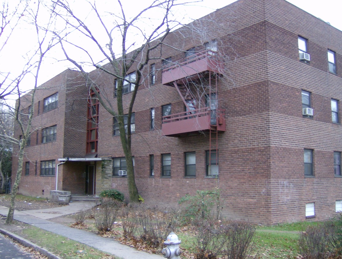

Experience a new place to live at East Orange Comm Homes in East Orange, NJ. This community is located in East Orange on Chelsea Ave. Be sure to come for a visit to check out the apartment floorplan options. From availability to location, the professional leasing team is excited to help you find your perfect new place. It's time to love where you live. Stop by for a visit today.
East Orange Comm Homes is an apartment community located in Essex County and the 07018 ZIP Code. This area is served by the East Orange School District attendance zone.
With large apartment complexes and mid-century, single-family Victorian and colonial-style homes for rent, Lower Vailsburg has a sense of retro charm that extends to the many small businesses lining the commercial streets. Residents here take so much pride in their community that many blocks have their own neighborhood associations.
You can run into many of your neighbors hanging out at Vailsburg Park, a 30-acre green space originally designed by noted landscape architect Frederick Olmsted. Soccer fields, baseball diamonds, and bocce ball courts attract locals, with a playground and a concert area for special events. Downtown Newark sits only three miles to the east, but you can meet up with your neighbors closer to home at casual spots like Bones Kitchen or Kayla & Dewitts.
Learn more about living in Lower VailsburgCompare neighborhood and city base rent averages by bedroom.
| Lower Vailsburg | East Orange, NJ | |
|---|---|---|
| Studio | $998 | $1,364 |
| 1 Bedroom | $1,068 | $1,536 |
| 2 Bedrooms | $1,333 | $2,115 |
| 3 Bedrooms | $832 | $2,028 |
| Colleges & Universities | Distance | ||
|---|---|---|---|
| Colleges & Universities | Distance | ||
| Drive: | 6 min | 2.1 mi | |
| Drive: | 5 min | 2.4 mi | |
| Drive: | 4 min | 2.6 mi | |
| Drive: | 5 min | 2.6 mi |

Transportation options available in East Orange include Norfolk Street, located 2.1 miles from East Orange Comm Homes. East Orange Comm Homes is near Newark Liberty International, located 8.2 miles or 13 minutes away, and LaGuardia, located 29.3 miles or 45 minutes away.
| Transit / Subway | Distance | ||
|---|---|---|---|
| Transit / Subway | Distance | ||
|
|
Drive: | 4 min | 2.1 mi |
|
|
Drive: | 4 min | 2.1 mi |
|
|
Drive: | 4 min | 2.4 mi |
|
|
Drive: | 4 min | 2.6 mi |
|
|
Drive: | 6 min | 3.4 mi |
| Commuter Rail | Distance | ||
|---|---|---|---|
| Commuter Rail | Distance | ||
|
|
Walk: | 17 min | 0.9 mi |
|
|
Drive: | 3 min | 1.5 mi |
|
|
Drive: | 5 min | 2.4 mi |
|
|
Drive: | 4 min | 2.4 mi |
|
|
Drive: | 8 min | 2.7 mi |
| Airports | Distance | ||
|---|---|---|---|
| Airports | Distance | ||
|
Newark Liberty International
|
Drive: | 13 min | 8.2 mi |
|
LaGuardia
|
Drive: | 45 min | 29.3 mi |
Scores provided by
Traffic
-Airport
-Businesses
-Scores provided by
HowLoud What is a Sound Score Rating? A Sound Score Rating aggregates noise caused by vehicle traffic, airplane traffic and local sources. How It WorksTime and distance from East Orange Comm Homes.
| Shopping Centers | Distance | ||
|---|---|---|---|
| Shopping Centers | Distance | ||
| Walk: | 17 min | 0.9 mi | |
| Drive: | 3 min | 1.3 mi |
| Parks and Recreation | Distance | ||
|---|---|---|---|
| Parks and Recreation | Distance | ||
|
Newark Museum and Dreyfuss Planetarium
|
Drive: | 5 min | 2.7 mi |
|
Edison National Historic Site
|
Drive: | 8 min | 3.6 mi |
|
Branch Brook Park
|
Drive: | 8 min | 3.8 mi |
|
Turtle Back Zoo
|
Drive: | 11 min | 5.3 mi |
|
Kearny Marsh
|
Drive: | 12 min | 5.8 mi |
| Hospitals | Distance | ||
|---|---|---|---|
| Hospitals | Distance | ||
| Walk: | 6 min | 0.3 mi | |
| Drive: | 3 min | 2.0 mi | |
| Drive: | 4 min | 2.5 mi |
| Military Bases | Distance | ||
|---|---|---|---|
| Military Bases | Distance | ||
| Drive: | 18 min | 12.0 mi | |
| Drive: | 24 min | 13.2 mi | |
| Drive: | 30 min | 15.4 mi |
What Are Walk Score®, Transit Score®, and Bike Score® Ratings?
Walk Score® measures the walkability of any address. Transit Score® measures access to public transit. Bike Score® measures the bikeability of any address.
What is a Sound Score Rating?
A Sound Score Rating aggregates noise caused by vehicle traffic, airplane traffic and local sources.


