
Anton Menlo
3639 Haven Ave,
Menlo Park, CA 94025
$3,499 - $6,941
Studio - 3 Beds
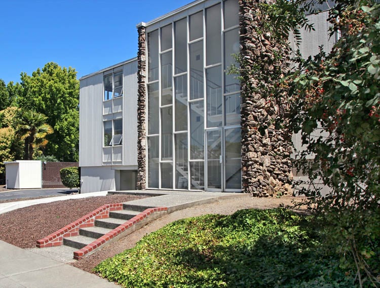
East Creek Apartments in Menlo Park, CA is ready for you to visit. The professional leasing staff is ready and waiting to help you find your perfect new place. Be sure to check out the current floorplan options. East Creek Apartments offers a variety of amenities including: balconies, reservable storage spaces, and dining rooms. Get moving on finding your next place. Contact or stop by East Creek Apartments to check the availability and schedule a tour today!
East Creek Apartments is an apartment community located in San Mateo County and the 94025 ZIP Code. This area is served by the Menlo Park City Elementary School District attendance zone.
Dishwasher
High Speed Internet Access
Refrigerator
Disposal
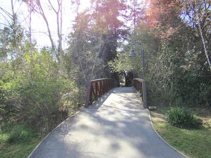
Linfield Oaks is a beautiful community full of charming homes, manicured lawns, and gorgeous tree cover. The neighborhood itself is almost entirely residential, but it offers direct access to a broad variety of amenities. Burgess Park offers everything from swimming to soccer facilities, and several other public parks can be reached by foot or bike in no time.
The Stanford Shopping Center and University Avenue are both practically right next door, giving Linfield Oaks residents near-endless selection of shopping, dining, and nightlife just minutes away. The Menlo Park division of the VA Palo Alto Health Care System is just up Willow Road, making it an excellent location for medical professionals.
Learn more about living in Linfield OaksCompare neighborhood and city base rent averages by bedroom.
| Linfield Oaks | Menlo Park, CA | |
|---|---|---|
| Studio | - | $3,050 |
| 1 Bedroom | $2,604 | $3,493 |
| 2 Bedrooms | $3,293 | $4,785 |
| 3 Bedrooms | $4,714 | $6,667 |
| Colleges & Universities | Distance | ||
|---|---|---|---|
| Colleges & Universities | Distance | ||
| Drive: | 6 min | 2.1 mi | |
| Drive: | 12 min | 3.7 mi | |
| Drive: | 14 min | 7.0 mi | |
| Drive: | 19 min | 8.9 mi |


Transportation options available in Menlo Park include Bayshore Nasa Station, located 9.3 miles from East Creek Apartments. East Creek Apartments is near Norman Y Mineta San Jose International, located 16.9 miles or 25 minutes away, and San Francisco International, located 19.9 miles or 29 minutes away.
| Transit / Subway | Distance | ||
|---|---|---|---|
| Transit / Subway | Distance | ||
| Drive: | 15 min | 9.3 mi | |
| Drive: | 15 min | 9.7 mi | |
|
|
Drive: | 16 min | 9.9 mi |
|
|
Drive: | 17 min | 9.9 mi |
| Drive: | 17 min | 10.2 mi |
| Commuter Rail | Distance | ||
|---|---|---|---|
| Commuter Rail | Distance | ||
| Drive: | 4 min | 1.2 mi | |
| Drive: | 5 min | 1.8 mi | |
| Drive: | 11 min | 4.1 mi | |
| Drive: | 12 min | 4.8 mi | |
| Drive: | 15 min | 7.7 mi |
| Airports | Distance | ||
|---|---|---|---|
| Airports | Distance | ||
|
Norman Y Mineta San Jose International
|
Drive: | 25 min | 16.9 mi |
|
San Francisco International
|
Drive: | 29 min | 19.9 mi |
Scores provided by
Traffic
BusyAirport
CalmBusinesses
ActiveScores provided by
HowLoud What is a Sound Score Rating? A Sound Score Rating aggregates noise caused by vehicle traffic, airplane traffic and local sources. How It WorksTime and distance from East Creek Apartments.
| Shopping Centers | Distance | ||
|---|---|---|---|
| Shopping Centers | Distance | ||
| Drive: | 4 min | 1.3 mi | |
| Drive: | 4 min | 1.4 mi | |
| Drive: | 7 min | 2.4 mi |
| Parks and Recreation | Distance | ||
|---|---|---|---|
| Parks and Recreation | Distance | ||
|
El Palo Alto Park
|
Walk: | 2 min | 0.0 mi |
|
Burgess Park
|
Walk: | 8 min | 0.5 mi |
|
Hopkins Creekside Park
|
Walk: | 13 min | 0.7 mi |
|
Fremont Park
|
Drive: | 5 min | 1.5 mi |
|
Jack W. Lyle Park
|
Drive: | 5 min | 1.9 mi |
| Hospitals | Distance | ||
|---|---|---|---|
| Hospitals | Distance | ||
| Drive: | 8 min | 2.9 mi | |
| Drive: | 9 min | 3.2 mi | |
| Drive: | 12 min | 6.3 mi |
| Military Bases | Distance | ||
|---|---|---|---|
| Military Bases | Distance | ||
| Drive: | 18 min | 9.7 mi |
Fitness Center Pool In Unit Washer & Dryer High-Speed Internet Stainless Steel Appliances Package Service
What Are Walk Score®, Transit Score®, and Bike Score® Ratings?
Walk Score® measures the walkability of any address. Transit Score® measures access to public transit. Bike Score® measures the bikeability of any address.
What is a Sound Score Rating?
A Sound Score Rating aggregates noise caused by vehicle traffic, airplane traffic and local sources.

120-122 E Creek Dr
Menlo Park, CA 94025


