Deer Ridge

1200 Burt Hill Dr SW, Fort Payne, AL 35968

Share Listing
Favorites
Deer Ridge
Share Listing
Favorites

Highlights

  • Porch
  • Walk-In Closets
  • Picnic Area
  • Grill

About Deer Ridge

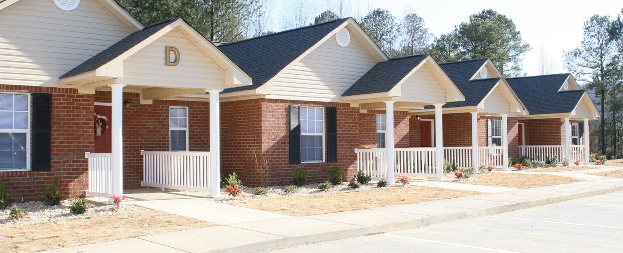
At Deer Ridge in Fort Payne, you've discovered your new place. This community can be found at 1200 Burt Hill Dr. Sw in the 35968 area of Fort Payne. Here at this community, the leasing staff will assist you in finding the perfect place. Schedule a time to check out the apartment floorplan options. Contact us or drop by to schedule a tour today and find your new place at Deer Ridge.

Deer Ridge is an apartment community located in De Kalb County and the 35968 ZIP Code. This area is served by the Fort Payne City School District attendance zone.

Community Amenities

Laundry Facilities

Grill

Laundry Service

Picnic Area

  • Laundry Facilities
  • Laundry Service
  • Grill
  • Picnic Area

Apartment Features

Air Conditioning

Dishwasher

Washer/Dryer Hookup

Walk-In Closets

  • Washer/Dryer Hookup
  • Air Conditioning
  • Heating
  • Ceiling Fans
  • Cable Ready
  • Sprinkler System
  • Dishwasher
  • Kitchen
  • Microwave
  • Range
  • Refrigerator
  • Walk-In Closets
  • Porch
Location
1200 Burt Hill Dr SW, Fort Payne,
AL 35968
Get Directions
Education
Colleges & Universities Distance
Drive: 53 min 39.2 mi
Drive: 71 min 46.6 mi
Drive: 74 min 48.8 mi
Deer Ridge is within 53 minutes or 39.2 miles from Gadsden State Comm. Coll.. It is also near Shorter University and Berry College.
Schools
Public Elementary School
Grades 3-4
493 Students
Attendance Zone
Public Elementary, Middle & High School
Grades PK-12
1,264 Students
Nearby
Public Elementary School
Grades PK-5
808 Students
Attendance Zone
Public Middle School
Grades 6-8
787 Students
Attendance Zone
Public High School
Grades 9-12
1,058 Students
Attendance Zone
Private Elementary, Middle & High School
Grades K-12
33 Students
Nearby
Private Elementary, Middle & High School
Grades PK-12
559 Students
Nearby
Transportation

Walkability Near Deer Ridge

Getting Around
Fairly Walkable
Walkability
40 / 100
Exceptionally Drivable
Drivability
100 / 100
Not Bikeable
Bikeability
10 / 100

Scores provided by

What do Walkability, Transit, Drivability, and Bikeability mean? Walkability measures the walking distance to day-to-day needs. Transit measures access to public transportation. Drivability measures congestion, parking availability, and access to major roads. Bikeability measures the suitability for cycling. How It Works
-
Soundscore
- / 100

Traffic

-

Airport

-

Businesses

-

Scores provided by

HowLoud What is a Sound Score Rating? A Sound Score Rating aggregates noise caused by vehicle traffic, airplane traffic and local sources. How It Works
Points of Interest

Time and distance from Deer Ridge.

Shopping Centers Distance
Walk: 8 min 0.4 mi
Drive: 5 min 2.0 mi
Drive: 5 min 2.2 mi
Deer Ridge has 3 shopping centers within 2.2 miles, which is about a 5-minute drive. The miles and minutes will be for the farthest away property.
Parks and Recreation Distance
Little River Canyon National Preserve
Drive: 28 min 10.2 mi
DeSoto State Park
Drive: 37 min 14.8 mi
Deer Ridge has 2 parks within 14.8 miles, including Little River Canyon National Preserve, and DeSoto State Park.
Military Bases Distance
Drive: 118 min 68.0 mi
Drive: 105 min 70.7 mi
Drive: 104 min 75.2 mi
Deer Ridge has 3 military bases within 75.2 miles, the nearest is Fort McClellan which is 68.0 miles away and a 118 minute drive.