
5421 at Dublin Station
5421 Campbell Ln,
Dublin, CA 94568
$2,399 - $6,175
Studio - 3 Beds


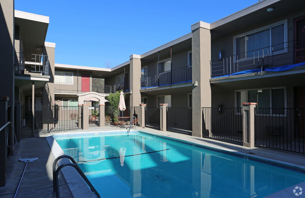
Come home to Cypress Gardens in Pleasanton. The address for this community is at 444-484 Division St. in the 94566 area of Pleasanton. Be sure to check out the apartment floorplan options. You'll experience a variety of features and amenities at this community. Some of these include: high-speed internet access, smoke free options, and convenient on-site parking options. Experience a better way of living at Cypress Gardens. Stop by the leasing office to schedule your tour.
Cypress Gardens is an apartment community located in Alameda County and the 94566 ZIP Code. This area is served by the Pleasanton Unified attendance zone.
High Speed Internet Access
Smoke Free
Range
Kitchen
The cities of Livermore, Dublin and Pleasanton form a loosely shaped triangle within California's Tri-Valley region, a cluster of three small valleys about 33 miles east of San Francisco and 35 miles northeast of San Jose. Known for its Mediterranean climate, rolling hills and historic vineyards, this once bucolic region now boasts three separate downtown areas, a bustling business community and some of the best wineries in the state.
At the eastern end of the region lies the city of Livermore. Once known as Livermores, Livermore Ranch and Nottingham, the city sits at the center of Livermore Valley, a historic region dotted with more than 5,000 acres of mostly family-owned vineyards. A pastoral neighborhood known for its charming yet functional hilltop windmills, Livermore hosts the internationally recognized and sometimes controversial center of scientific research, Lawrence Livermore National Laboratories.
Learn more about living in Dublin/Pleasanton/LivermoreCompare neighborhood and city base rent averages by bedroom.
| Dublin/Pleasanton/Livermore | Pleasanton, CA | |
|---|---|---|
| Studio | $2,347 | $2,184 |
| 1 Bedroom | $2,483 | $2,524 |
| 2 Bedrooms | $2,932 | $2,949 |
| 3 Bedrooms | $3,600 | $3,788 |
| Colleges & Universities | Distance | ||
|---|---|---|---|
| Colleges & Universities | Distance | ||
| Drive: | 16 min | 7.6 mi | |
| Drive: | 16 min | 8.0 mi | |
| Drive: | 19 min | 11.8 mi | |
| Drive: | 27 min | 17.3 mi |


Transportation options available in Pleasanton include Dublin Pleasanton Station, located 3.8 miles from Cypress Gardens. Cypress Gardens is near Metro Oakland International, located 23.7 miles or 32 minutes away, and Norman Y Mineta San Jose International, located 26.8 miles or 37 minutes away.
| Transit / Subway | Distance | ||
|---|---|---|---|
| Transit / Subway | Distance | ||
|
|
Drive: | 8 min | 3.8 mi |
|
|
Drive: | 9 min | 5.3 mi |
|
|
Drive: | 24 min | 14.2 mi |
|
|
Drive: | 23 min | 14.3 mi |
|
|
Drive: | 29 min | 16.1 mi |
| Commuter Rail | Distance | ||
|---|---|---|---|
| Commuter Rail | Distance | ||
| Walk: | 7 min | 0.4 mi | |
| Walk: | 8 min | 0.4 mi | |
| Drive: | 12 min | 6.7 mi | |
| Drive: | 13 min | 6.9 mi | |
| Drive: | 19 min | 10.2 mi |
| Airports | Distance | ||
|---|---|---|---|
| Airports | Distance | ||
|
Metro Oakland International
|
Drive: | 32 min | 23.7 mi |
|
Norman Y Mineta San Jose International
|
Drive: | 37 min | 26.8 mi |
Time and distance from Cypress Gardens.
| Shopping Centers | Distance | ||
|---|---|---|---|
| Shopping Centers | Distance | ||
| Walk: | 11 min | 0.6 mi | |
| Walk: | 11 min | 0.6 mi | |
| Drive: | 4 min | 1.1 mi |
| Parks and Recreation | Distance | ||
|---|---|---|---|
| Parks and Recreation | Distance | ||
|
Shadow Cliffs Regional Recreation Area
|
Drive: | 8 min | 2.7 mi |
|
Dublin Hills Regional Parks
|
Drive: | 19 min | 8.1 mi |
|
Niles Canyon Railway
|
Drive: | 23 min | 13.2 mi |
|
Pleasanton Ridge Regional Park
|
Drive: | 23 min | 14.3 mi |
|
Garin/Dry Creek Pioneer Parks
|
Drive: | 29 min | 16.6 mi |
| Hospitals | Distance | ||
|---|---|---|---|
| Hospitals | Distance | ||
| Drive: | 6 min | 2.5 mi | |
| Drive: | 18 min | 11.9 mi | |
| Drive: | 24 min | 14.6 mi |
| Military Bases | Distance | ||
|---|---|---|---|
| Military Bases | Distance | ||
| Drive: | 42 min | 29.5 mi |
What Are Walk Score®, Transit Score®, and Bike Score® Ratings?
Walk Score® measures the walkability of any address. Transit Score® measures access to public transit. Bike Score® measures the bikeability of any address.
What is a Sound Score Rating?
A Sound Score Rating aggregates noise caused by vehicle traffic, airplane traffic and local sources
444-484 Division St
Pleasanton, CA 94566


