
Crossroads
5378 Clayton Rd,
Concord,
CA
94521
-
Monthly Rent
$2,225 - $2,430
-
Bedrooms
1 - 2 bd
-
Bathrooms
1 - 2 ba
-
Square Feet
625 - 825 sq ft
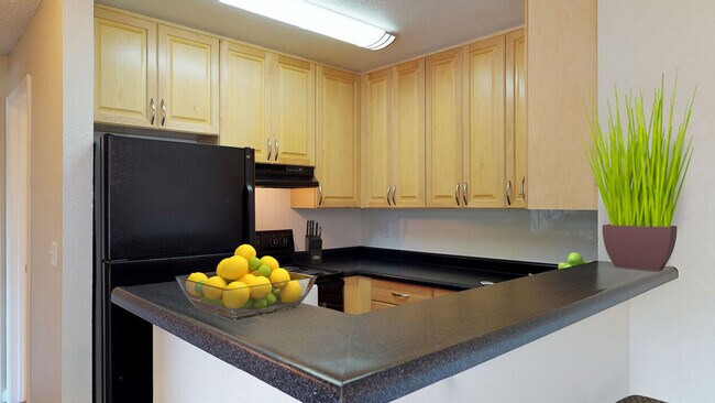
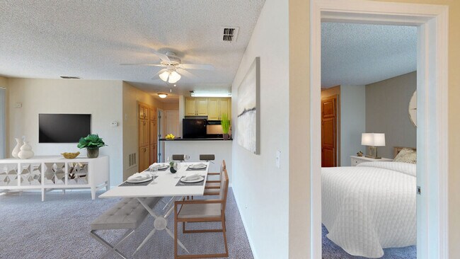
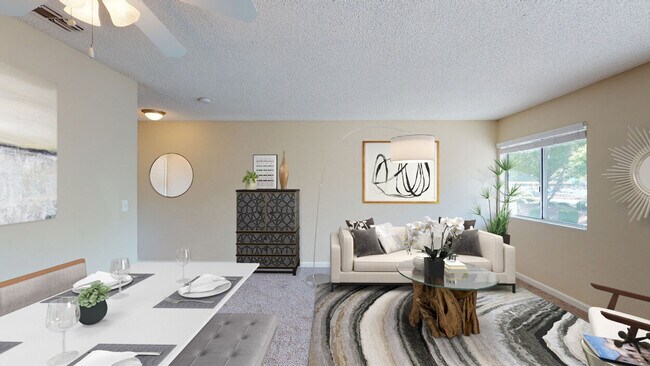
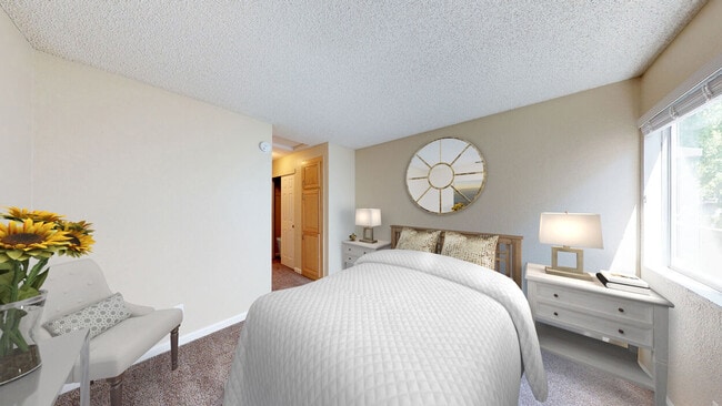
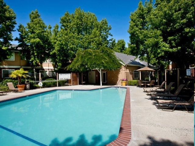
Style That Inspires. Crossroads apartment home community offers one- and two-bedroom floor plans with granite-style countertops, private patios, and energy-efficient appliances. Amenities including a resort-style pool and on-site pet park make Crossroads a place that you and your furry friend will want to call home.
Highlights
- Pool
- Dog Park
- Patio
Pricing & Floor Plans
-
Unit 90Lprice $2,225square feet 625availibility Now
-
Unit 88Hprice $2,235square feet 625availibility Now
-
Unit 90Aprice $2,430square feet 825availibility May 9
-
Unit 90Lprice $2,225square feet 625availibility Now
-
Unit 88Hprice $2,235square feet 625availibility Now
-
Unit 90Aprice $2,430square feet 825availibility May 9
Fees and Policies
The fees listed below are community-provided and may exclude utilities or add-ons. All payments are made directly to the property and are non-refundable unless otherwise specified. Use the Cost Calculator to determine costs based on your needs.
-
Utilities & Essentials
-
Utility Billing Administration FeeMonthly required fee Charged per unit.$6 / mo
-
Utility ElectricMonthly required fee. Charged per unit.Varies / mo
-
Utility Stormwater DrainageMonthly required fee. Charged per unit.Varies / mo
-
Utility WaterMonthly required fee. Charged per unit.Varies / mo
-
Renters Liability InsuranceResident or property insurance liability coverage. Charged per unit.Varies / mo
-
Utility Gas and Hot Water EnergyMonthly required fee. Charged per unit.Varies / mo
-
Utility SewerMonthly required fee. Charged per unit.Varies / mo
-
Utility Telecom Data ServicesMonthly required fee. Charged per unit.Varies / mo
-
Utility Trash ServicesMonthly required fee. Charged per unit.Varies / mo
-
-
One-Time Basics
-
Due at Application
-
Application FeePer adult application including guarantors Charged per applicant.$56
-
-
Due at Move-In
-
Security Deposit One BedCost may vary based on approved credit Charged per unit.$700
-
Security Deposit Two BedCost may vary based on approved credit Charged per unit.$800
-
-
Due at Application
-
Pet Deposit Cat or DogRefundable deposit per pet Charged per pet.$500
-
Pet Rent Cat or DogMonthly fee per pet Charged per pet.$55
-
Surface Lot
-
Onsite Clothing WasherCost per load Charged per unit.$2
-
Lease Hold Cancellation ChargeSituational fee per apartment Charged per unit.$200
-
Initial Pet Screening Cat or DogCost for screening per pet Charged per unit.$30
-
Add or Replace Garage RemoteCost for garage remote replacement Charged per unit.$50
-
Apartment Lock ChangeApartment lock change charge Charged per unit.$85
-
Additional Security DepositBased on credit up to one months rent. Charged per unit.Varies one-time
-
Renewal Pet Screening Cat or DogCost for renewal screening per pet Charged per unit.$20
-
Add or Replace KeyCost for apartment or mailbox key replacement Charged per unit.$25
-
Non Sufficient Payment FeeCharge based on non sufficient funds Charged per unit.$35
-
Add or Replace FobCost for apartment or mailbox fob replacement Charged per unit.$50
-
Property or Unit DamageCharge based on damage upon move out. Charged per unit.Varies one-time
-
Credit Reporting FeeMonthly optional service per person Charged per unit.$4.99 / mo
-
Late Rent FeeCharge based on late rent Charged per unit.$75
-
Early Lease Termination Buy OutCost is up to two months rent. Charged per unit.Varies one-time
-
Utility Vacant Cost RecoveryUsage based situational fee. Charged per unit.Varies one-time
-
Early Lease Termination Rent ResponsibleVaries based on relet period and lease rate. Charged per unit.Varies one-time
Property Fee Disclaimer: Based on community-supplied data and independent market research. Subject to change without notice. May exclude fees for mandatory or optional services and usage-based utilities.
Details
Lease Options
-
2 - 15 Month Leases
Property Information
-
Built in 1986
-
130 units/2 stories
About Crossroads
Style That Inspires. Crossroads apartment home community offers one- and two-bedroom floor plans with granite-style countertops, private patios, and energy-efficient appliances. Amenities including a resort-style pool and on-site pet park make Crossroads a place that you and your furry friend will want to call home.
Crossroads is an apartment community located in Contra Costa County and the 94521 ZIP Code. This area is served by the Mt. Diablo Unified School District attendance zone.
Unique Features
- Covered Parking
- Energy Efficient Appliances
- In Unit Washer & Dryer - Stackable
- Laundry Care Center
- Patio or Balcony
- Programmable Thermostats/Nests
- Two-Tone Paint Schemes
Community Amenities
- Pool
- Playground
- Dog Park
Apartment Features
Air Conditioning
Dishwasher
Patio
Ceiling Fans
- Air Conditioning
- Ceiling Fans
- Dishwasher
- Patio
The city of Concord exhibits all the character, charm, and natural beauty you’d expect of the Bay Area. South Concord, stretching from Clayton Road down towards Walnut Creek, provides renters with all of the appeal of the city in a more livable, affordable setting.
This vibrant suburban area houses a variety of rentals sandwiched between Lime Ride Open Space and Sunvalley Shopping Center. If you want value and space in a palm-tree-adorned atmopshere, look no further. Perfect for commuters thanks to I-680 to the west, South Concord provides families with a picturesque setting near the conveniences of the city, and the culture of the Bay Area.
Learn more about living in South ConcordCompare neighborhood and city base rent averages by bedroom.
| South Concord | Concord, CA | |
|---|---|---|
| Studio | $1,864 | $1,759 |
| 1 Bedroom | $1,970 | $1,929 |
| 2 Bedrooms | $2,261 | $2,255 |
| 3 Bedrooms | $2,644 | $2,782 |
- Dog Park
- Pool
- Playground
- Covered Parking
- Energy Efficient Appliances
- In Unit Washer & Dryer - Stackable
- Laundry Care Center
- Patio or Balcony
- Programmable Thermostats/Nests
- Two-Tone Paint Schemes
- Air Conditioning
- Ceiling Fans
- Dishwasher
- Patio
| Monday | 10am - 6pm |
|---|---|
| Tuesday | 10am - 6pm |
| Wednesday | 10am - 6pm |
| Thursday | 10am - 6pm |
| Friday | 10am - 6pm |
| Saturday | 10am - 5pm |
| Sunday | Closed |
| Colleges & Universities | Distance | ||
|---|---|---|---|
| Colleges & Universities | Distance | ||
| Drive: | 19 min | 7.7 mi | |
| Drive: | 17 min | 9.1 mi | |
| Drive: | 29 min | 14.1 mi | |
| Drive: | 39 min | 24.8 mi |


View GreatSchools Rating Methodology
Data provided by GreatSchools.org © 2026. All rights reserved.
Transportation options available in Concord include Concord, located 4.6 miles from Crossroads. Crossroads is near Metro Oakland International, located 31.4 miles or 46 minutes away, and San Francisco International, located 43.4 miles or 65 minutes away.
| Transit / Subway | Distance | ||
|---|---|---|---|
| Transit / Subway | Distance | ||
|
|
Drive: | 11 min | 4.6 mi |
|
|
Drive: | 14 min | 6.3 mi |
|
|
Drive: | 13 min | 7.0 mi |
|
|
Drive: | 14 min | 9.3 mi |
|
|
Drive: | 17 min | 9.4 mi |
| Commuter Rail | Distance | ||
|---|---|---|---|
| Commuter Rail | Distance | ||
|
|
Drive: | 25 min | 13.0 mi |
| Drive: | 36 min | 22.8 mi | |
|
|
Drive: | 36 min | 24.5 mi |
|
|
Drive: | 38 min | 26.0 mi |
|
|
Drive: | 46 min | 31.8 mi |
| Airports | Distance | ||
|---|---|---|---|
| Airports | Distance | ||
|
Metro Oakland International
|
Drive: | 46 min | 31.4 mi |
|
San Francisco International
|
Drive: | 65 min | 43.4 mi |
Time and distance from Crossroads.
| Shopping Centers | Distance | ||
|---|---|---|---|
| Shopping Centers | Distance | ||
| Walk: | 1 min | 0.1 mi | |
| Walk: | 7 min | 0.4 mi | |
| Walk: | 10 min | 0.5 mi |
| Parks and Recreation | Distance | ||
|---|---|---|---|
| Parks and Recreation | Distance | ||
|
Markham Nature Park and Arboretum
|
Drive: | 8 min | 3.5 mi |
|
The Ruth Bancroft Garden
|
Drive: | 10 min | 5.5 mi |
|
Arbolado Park
|
Drive: | 12 min | 5.5 mi |
|
Castle Rock Regional Recreation Area
|
Drive: | 16 min | 6.9 mi |
|
Diablo Foothills Regional Park
|
Drive: | 18 min | 7.1 mi |
| Hospitals | Distance | ||
|---|---|---|---|
| Hospitals | Distance | ||
| Drive: | 12 min | 5.2 mi | |
| Drive: | 13 min | 5.5 mi | |
| Drive: | 11 min | 5.9 mi |
Crossroads Photos
-
Crossroads
-
-
-
-
-
-
-
-
Models
-
Sierra
-
1 Bedroom
-
Shasta
-
2 Bedrooms
Nearby Apartments
Within 50 Miles of Crossroads
-
Oak & Iron
1100 Lincoln Ave
Walnut Creek, CA 94596
$2,144 - $2,825
1-3 Br 6.3 mi
-
Centro Callan
100 Callan Ave
San Leandro, CA 94577
$2,474 - $8,590
1-3 Br 18.9 mi
-
Jones Berkeley
1500 San Pablo Ave
Berkeley, CA 94702
$4,095 - $4,916
2 Br 19.0 mi
-
SKAIA
330 17th St
Oakland, CA 94612
$2,434 - $8,687
1-2 Br 19.5 mi
-
Towers at Rincon
88 Howard St
San Francisco, CA 94105
$4,340 - $4,944 Total Monthly Price
1-2 Br 26.0 mi
-
50 Jones
50 Jones St
San Francisco, CA 94102
$2,660 - $4,816
1-2 Br 27.3 mi
Crossroads does not offer in-unit laundry or shared facilities. Please contact the property to learn about nearby laundry options.
Utilities are not included in rent. Residents should plan to set up and pay for all services separately.
Parking is available at Crossroads. Contact this property for details.
Crossroads has one to two-bedrooms with rent ranges from $2,225/mo. to $2,430/mo.
Yes, Crossroads welcomes pets. Breed restrictions, weight limits, and additional fees may apply. View this property's pet policy.
A good rule of thumb is to spend no more than 30% of your gross income on rent. Based on the lowest available rent of $2,225 for a one-bedroom, you would need to earn about $89,000 per year to qualify. Want to double-check your budget? Calculate how much rent you can afford with our Rent Affordability Calculator.
Crossroads is not currently offering any rent specials. Check back soon, as promotions change frequently.
While Crossroads does not offer Matterport 3D tours, renters can request a tour directly through our online platform.
What Are Walk Score®, Transit Score®, and Bike Score® Ratings?
Walk Score® measures the walkability of any address. Transit Score® measures access to public transit. Bike Score® measures the bikeability of any address.
What is a Sound Score Rating?
A Sound Score Rating aggregates noise caused by vehicle traffic, airplane traffic and local sources.
5378 Clayton Rd
Concord, CA 94521
Property Manager Responded