
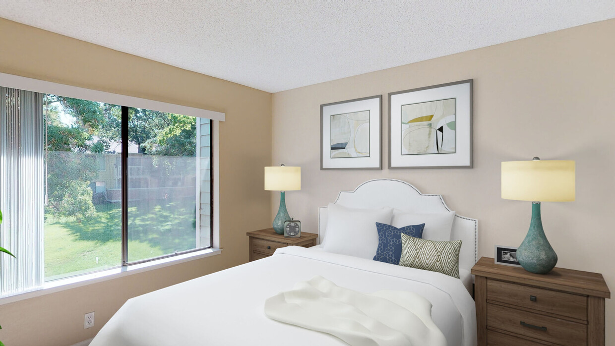
Chardonnay Gardens
2991 College Ave,
Livermore, CA 94550
$2,650 - $3,699
1-3 Beds
Bedrooms
1 bd
Bathrooms
1 ba
Square Feet
636 sq ft
Start your day enjoying a hot cup of coffee while light pours through your oversized windows. In the evening enjoy relaxing on your private patio while catching up with an old friend. The Crossing at Arroyo Trail offers beautifully designed one- and two-bedroom apartments in a park-like setting conveniently located within minutes of nature trails, shopping, dining, and entertainment options.
Start your day enjoying a hot cup of coffee while light pours through your oversized windows. In the evening enjoy relaxing on your private patio while catching up with an old friend. The Crossing at Arroyo Trail offers beautifully designed one- and two-bedroom apartments in a park-like setting conveniently located within minutes of nature trails, shopping, dining, and entertainment options.
Crossing at Arroyo Trail is an apartment community located in Alameda County and the 94551 ZIP Code. This area is served by the Livermore Valley Joint Unified School District attendance zone.
Unique Features
Pool
Fitness Center
Laundry Facilities
Playground
Washer/Dryer
Air Conditioning
Dishwasher
High Speed Internet Access
Walk-In Closets
Refrigerator
Tub/Shower
Disposal
The cities of Livermore, Dublin and Pleasanton form a loosely shaped triangle within California's Tri-Valley region, a cluster of three small valleys about 33 miles east of San Francisco and 35 miles northeast of San Jose. Known for its Mediterranean climate, rolling hills and historic vineyards, this once bucolic region now boasts three separate downtown areas, a bustling business community and some of the best wineries in the state.
At the eastern end of the region lies the city of Livermore. Once known as Livermores, Livermore Ranch and Nottingham, the city sits at the center of Livermore Valley, a historic region dotted with more than 5,000 acres of mostly family-owned vineyards. A pastoral neighborhood known for its charming yet functional hilltop windmills, Livermore hosts the internationally recognized and sometimes controversial center of scientific research, Lawrence Livermore National Laboratories.
Learn more about living in Dublin/Pleasanton/LivermoreCompare neighborhood and city base rent averages by bedroom.
| Dublin/Pleasanton/Livermore | Livermore, CA | |
|---|---|---|
| Studio | $2,402 | $2,951 |
| 1 Bedroom | $2,569 | $2,385 |
| 2 Bedrooms | $3,100 | $2,788 |
| 3 Bedrooms | $3,659 | $3,422 |
| Colleges & Universities | Distance | ||
|---|---|---|---|
| Colleges & Universities | Distance | ||
| Drive: | 8 min | 3.7 mi | |
| Drive: | 19 min | 12.3 mi | |
| Drive: | 24 min | 15.7 mi | |
| Drive: | 23 min | 16.2 mi |


Transportation options available in Livermore include Dublin Pleasanton Station, located 9.2 miles from Crossing at Arroyo Trail. Crossing at Arroyo Trail is near Metro Oakland International, located 28.0 miles or 36 minutes away, and Norman Y Mineta San Jose International, located 30.6 miles or 41 minutes away.
| Transit / Subway | Distance | ||
|---|---|---|---|
| Transit / Subway | Distance | ||
|
|
Drive: | 13 min | 9.2 mi |
|
|
Drive: | 13 min | 9.5 mi |
| Commuter Rail | Distance | ||
|---|---|---|---|
| Commuter Rail | Distance | ||
| Drive: | 3 min | 1.6 mi | |
| Drive: | 12 min | 5.7 mi | |
| Drive: | 11 min | 6.2 mi | |
| Drive: | 30 min | 19.8 mi | |
| Drive: | 31 min | 19.8 mi |
| Airports | Distance | ||
|---|---|---|---|
| Airports | Distance | ||
|
Metro Oakland International
|
Drive: | 36 min | 28.0 mi |
|
Norman Y Mineta San Jose International
|
Drive: | 41 min | 30.6 mi |
Scores provided by
Traffic
-Airport
-Businesses
-Scores provided by
HowLoud What is a Sound Score Rating? A Sound Score Rating aggregates noise caused by vehicle traffic, airplane traffic and local sources. How It WorksTime and distance from Crossing at Arroyo Trail.
| Shopping Centers | Distance | ||
|---|---|---|---|
| Shopping Centers | Distance | ||
| Walk: | 11 min | 0.6 mi | |
| Walk: | 13 min | 0.7 mi | |
| Walk: | 15 min | 0.8 mi |
| Parks and Recreation | Distance | ||
|---|---|---|---|
| Parks and Recreation | Distance | ||
|
Shadow Cliffs Regional Recreation Area
|
Drive: | 8 min | 3.9 mi |
|
Brushy Peak Regional Preserve
|
Drive: | 16 min | 9.0 mi |
|
Del Valle Regional Park
|
Drive: | 27 min | 9.8 mi |
|
Los Vaqueros Watershed
|
Drive: | 18 min | 10.5 mi |
| Hospitals | Distance | ||
|---|---|---|---|
| Hospitals | Distance | ||
| Drive: | 11 min | 6.5 mi |
| Military Bases | Distance | ||
|---|---|---|---|
| Military Bases | Distance | ||
| Drive: | 46 min | 33.4 mi | |
| Drive: | 48 min | 35.4 mi | |
| Drive: | 58 min | 37.3 mi |

Pets Allowed Fitness Center Pool In Unit Washer & Dryer Patio Stainless Steel Appliances Hardwood Floors
Pets Allowed Fitness Center Pool In Unit Washer & Dryer Clubhouse Stainless Steel Appliances Granite Countertops
Pets Allowed Fitness Center Pool In Unit Washer & Dryer Clubhouse Business Center

Pets Allowed Fitness Center Pool High-Speed Internet Concierge
What Are Walk Score®, Transit Score®, and Bike Score® Ratings?
Walk Score® measures the walkability of any address. Transit Score® measures access to public transit. Bike Score® measures the bikeability of any address.
What is a Sound Score Rating?
A Sound Score Rating aggregates noise caused by vehicle traffic, airplane traffic and local sources.

156 N Murrieta Blvd
Livermore, CA 94551


