
Twelve31
1231 W Francisquito Ave,
West Covina, CA 91790
$2,170 - $2,735
1-2 Beds

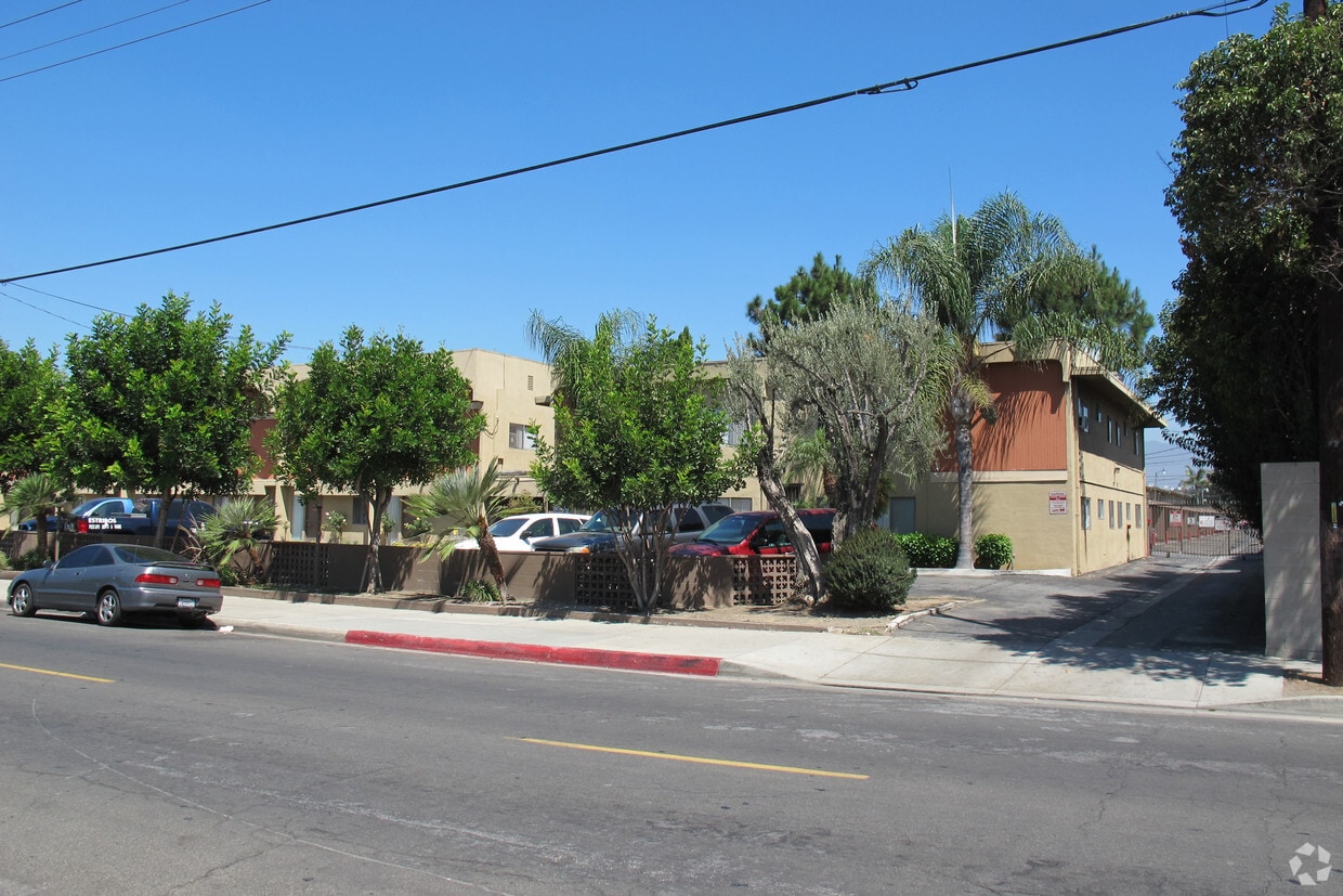
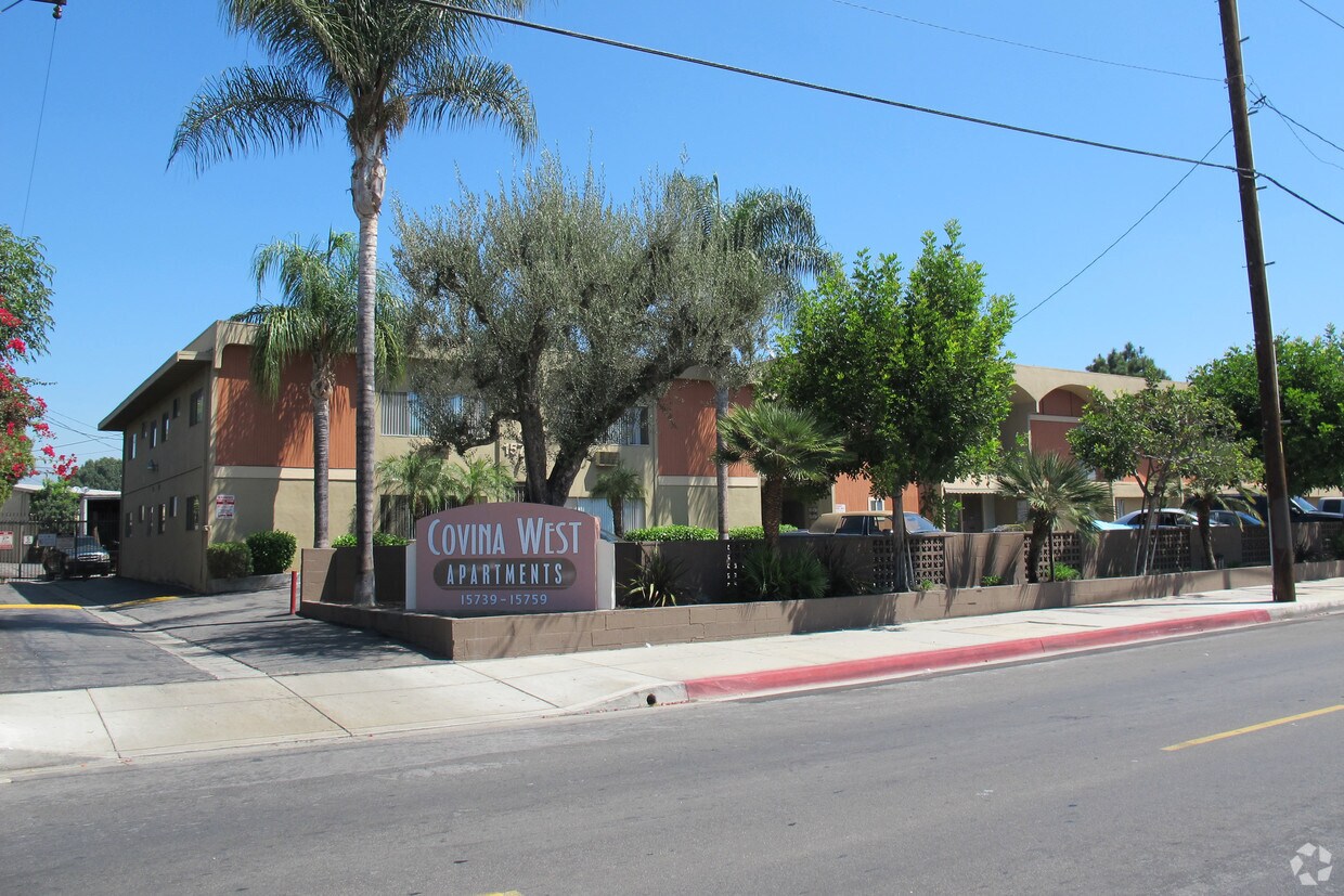

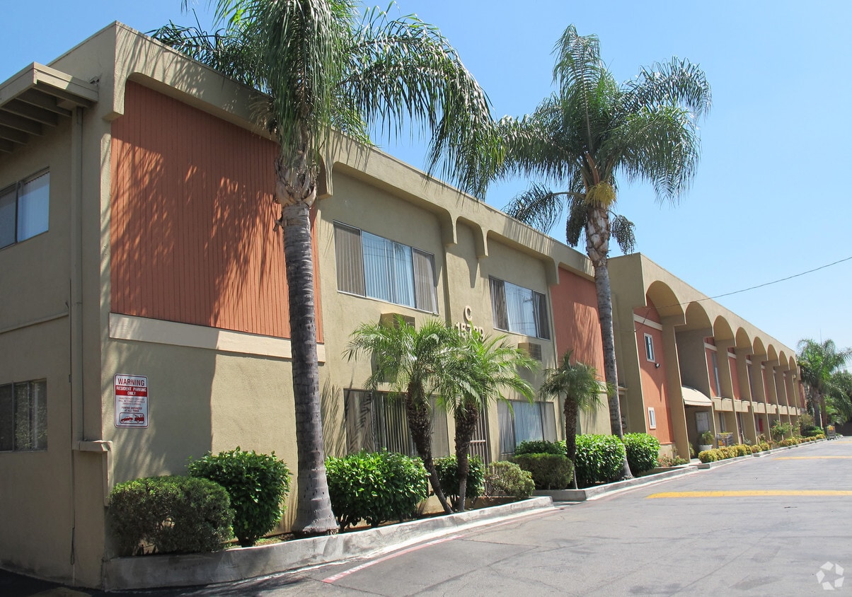
Discover Covina West in La Puente, CA. You'll find this community at 15757 Francisquito Ave in the 91744 area of La Puente. Let the leasing team show you everything this community has to offer. So get a head start on your move. Contact or stop by Covina West to discuss your new apartment! Covina West is an apartment located in Los Angeles County and the 91744 ZIP Code. This area is served by the West Covina Unified attendance zone.
Covina West is an apartment community located in Los Angeles County and the 91744 ZIP Code. This area is served by the West Covina Unified attendance zone.
Unique Features
Pool
Laundry Facilities
Playground
Controlled Access
Air Conditioning
High Speed Internet Access
Patio
Smoke Free
Nestled in the heart of the San Gabriel Valley, La Puente is a suburban city just south of West Covina and north of Hacienda Heights. While La Puente is primarily residential, it is also home to a lively commercial corridor on North Hacienda Boulevard filled with a wide variety of restaurants, markets, and shops. Retail opportunities are even more plentiful at the adjacent Puente Hills Mall.
La Puente contains numerous baseball fields and basketball courts in its own city park. Several parks within close proximity to La Puente include the Santa Fe Dam Recreation Area, Whittier Narrows Recreation Area, and Frank G. Bonelli Regional Park. Getting from La Puente to the many attractions in nearby Downtown Los Angeles and Anaheim is simple with access to the 10 Interstate and 60 Freeway.
Learn more about living in La Puente| Colleges & Universities | Distance | ||
|---|---|---|---|
| Colleges & Universities | Distance | ||
| Drive: | 13 min | 7.3 mi | |
| Drive: | 15 min | 8.3 mi | |
| Drive: | 14 min | 8.4 mi | |
| Drive: | 16 min | 8.6 mi |


Transportation options available in La Puente include Irwindale Station, located 6.2 miles from Covina West. Covina West is near Ontario International, located 22.3 miles or 30 minutes away, and Long Beach (Daugherty Field), located 27.3 miles or 38 minutes away.
| Transit / Subway | Distance | ||
|---|---|---|---|
| Transit / Subway | Distance | ||
| Drive: | 12 min | 6.2 mi | |
| Drive: | 13 min | 7.6 mi | |
| Drive: | 17 min | 8.7 mi | |
| Drive: | 16 min | 9.4 mi | |
| Drive: | 18 min | 10.9 mi |
| Commuter Rail | Distance | ||
|---|---|---|---|
| Commuter Rail | Distance | ||
|
|
Drive: | 9 min | 3.7 mi |
|
|
Drive: | 10 min | 5.7 mi |
|
|
Drive: | 13 min | 7.0 mi |
|
|
Drive: | 16 min | 8.1 mi |
|
|
Drive: | 19 min | 13.6 mi |
| Airports | Distance | ||
|---|---|---|---|
| Airports | Distance | ||
|
Ontario International
|
Drive: | 30 min | 22.3 mi |
|
Long Beach (Daugherty Field)
|
Drive: | 38 min | 27.3 mi |
Time and distance from Covina West.
| Shopping Centers | Distance | ||
|---|---|---|---|
| Shopping Centers | Distance | ||
| Walk: | 4 min | 0.3 mi | |
| Walk: | 7 min | 0.4 mi | |
| Walk: | 12 min | 0.6 mi |
| Parks and Recreation | Distance | ||
|---|---|---|---|
| Parks and Recreation | Distance | ||
|
Galster Wilderness Park Nature Center
|
Drive: | 7 min | 2.7 mi |
|
Covina Park
|
Drive: | 9 min | 5.0 mi |
|
Santa Fe Dam Recreation Area
|
Drive: | 19 min | 7.0 mi |
|
Santa Fe Dam Nature Center
|
Drive: | 19 min | 7.0 mi |
|
Schabarum Regional Park
|
Drive: | 14 min | 7.2 mi |
| Hospitals | Distance | ||
|---|---|---|---|
| Hospitals | Distance | ||
| Drive: | 5 min | 2.2 mi | |
| Drive: | 7 min | 4.1 mi | |
| Drive: | 9 min | 5.2 mi |
| Military Bases | Distance | ||
|---|---|---|---|
| Military Bases | Distance | ||
| Drive: | 37 min | 21.2 mi |
What Are Walk Score®, Transit Score®, and Bike Score® Ratings?
Walk Score® measures the walkability of any address. Transit Score® measures access to public transit. Bike Score® measures the bikeability of any address.
What is a Sound Score Rating?
A Sound Score Rating aggregates noise caused by vehicle traffic, airplane traffic and local sources
15757 Francisquito Ave
La Puente, CA 91744


