
Premier Luxury Apartments
9600 Franklin,
Franklin Park, IL 60131
$1,798 - $2,698
1-2 Beds
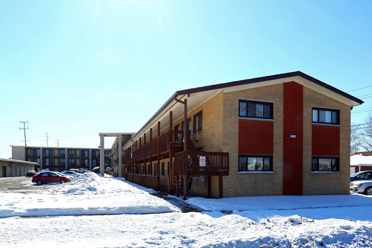

Come home to Chestnut Villa in Franklin Park, IL. This community is located on Chestnut Ave in the 60131 area of Franklin Park. Discover a wide selection of amenities and features at this community. These include: high-speed internet access, smoke-free options, and convenient on-site parking options. The leasing team is eager for your visit. It's time to find your new home. Contact or stop by the Chestnut Villa leasing office to discuss your new apartment.
Chestnut Villa is an apartment community located in Cook County and the 60131 ZIP Code. This area is served by the Franklin Park School District 84 attendance zone.
Air Conditioning
Dishwasher
High Speed Internet Access
Microwave
Franklin Park is a compact Cook County village of roughly 18,000 residents tucked just south of O'Hare International Airport, about 17 miles west of downtown Chicago. Named after real estate broker Lesser Franklin, who helped incorporate the town in the late 1800s by luring businesses with free land, the village carries a genuine working-town character that sets it apart from its suburban neighbors. Its position where I-294, I-190, and I-90 converge makes it an exceptionally practical base for commuters, and two Metra rail stations connect residents directly into the city.
The rental market here leans toward single-family homes and smaller apartment communities, offering a more grounded, residential feel than the high-rise corridors closer to Chicago. Grand Avenue serves as the commercial spine, lined with local shops, eateries, and everyday conveniences.
Learn more about living in Franklin Park| Colleges & Universities | Distance | ||
|---|---|---|---|
| Colleges & Universities | Distance | ||
| Drive: | 5 min | 2.1 mi | |
| Drive: | 9 min | 4.1 mi | |
| Drive: | 12 min | 4.7 mi | |
| Drive: | 11 min | 4.7 mi |


Transportation options available in Franklin Park include Rosemont Station, located 5.9 miles from Chestnut Villa. Chestnut Villa is near Chicago O'Hare International, located 7.0 miles or 12 minutes away, and Chicago Midway International, located 16.7 miles or 27 minutes away.
| Transit / Subway | Distance | ||
|---|---|---|---|
| Transit / Subway | Distance | ||
|
|
Drive: | 10 min | 5.9 mi |
|
|
Drive: | 13 min | 6.1 mi |
|
|
Drive: | 13 min | 6.6 mi |
|
|
Drive: | 11 min | 7.0 mi |
|
|
Drive: | 14 min | 7.5 mi |
| Commuter Rail | Distance | ||
|---|---|---|---|
| Commuter Rail | Distance | ||
|
|
Walk: | 12 min | 0.6 mi |
|
|
Drive: | 3 min | 1.2 mi |
|
|
Drive: | 3 min | 1.5 mi |
|
|
Drive: | 4 min | 1.8 mi |
|
|
Drive: | 16 min | 5.6 mi |
| Airports | Distance | ||
|---|---|---|---|
| Airports | Distance | ||
|
Chicago O'Hare International
|
Drive: | 12 min | 7.0 mi |
|
Chicago Midway International
|
Drive: | 27 min | 16.7 mi |
Scores provided by
Traffic
ActiveAirport
ActiveBusinesses
ActiveScores provided by
HowLoud What is a Sound Score Rating? A Sound Score Rating aggregates noise caused by vehicle traffic, airplane traffic and local sources. How It WorksTime and distance from Chestnut Villa.
| Shopping Centers | Distance | ||
|---|---|---|---|
| Shopping Centers | Distance | ||
| Walk: | 7 min | 0.4 mi | |
| Walk: | 18 min | 1.0 mi | |
| Drive: | 3 min | 1.3 mi |
| Parks and Recreation | Distance | ||
|---|---|---|---|
| Parks and Recreation | Distance | ||
|
Cernan Earth and Space Center
|
Drive: | 4 min | 1.9 mi |
|
Schiller Woods
|
Drive: | 8 min | 3.3 mi |
|
Tyrell Trailside Museum / Thatcher Woods
|
Drive: | 9 min | 4.1 mi |
|
Riis Park
|
Drive: | 9 min | 4.3 mi |
|
Catherine Chevalier Woods
|
Drive: | 11 min | 5.4 mi |
| Hospitals | Distance | ||
|---|---|---|---|
| Hospitals | Distance | ||
| Drive: | 6 min | 2.5 mi | |
| Drive: | 6 min | 3.5 mi | |
| Drive: | 8 min | 4.0 mi |
| Military Bases | Distance | ||
|---|---|---|---|
| Military Bases | Distance | ||
| Drive: | 24 min | 16.2 mi | |
| Drive: | 33 min | 21.7 mi | |
| Drive: | 44 min | 26.8 mi |
What Are Walk Score®, Transit Score®, and Bike Score® Ratings?
Walk Score® measures the walkability of any address. Transit Score® measures access to public transit. Bike Score® measures the bikeability of any address.
What is a Sound Score Rating?
A Sound Score Rating aggregates noise caused by vehicle traffic, airplane traffic and local sources.

9403-9407 Chestnut Ave
Franklin Park, IL 60131


