
PORTOLA MEADOWS
1160 Portola Meadows Rd,
Livermore, CA 94551
$2,450 - $2,500
2 Beds

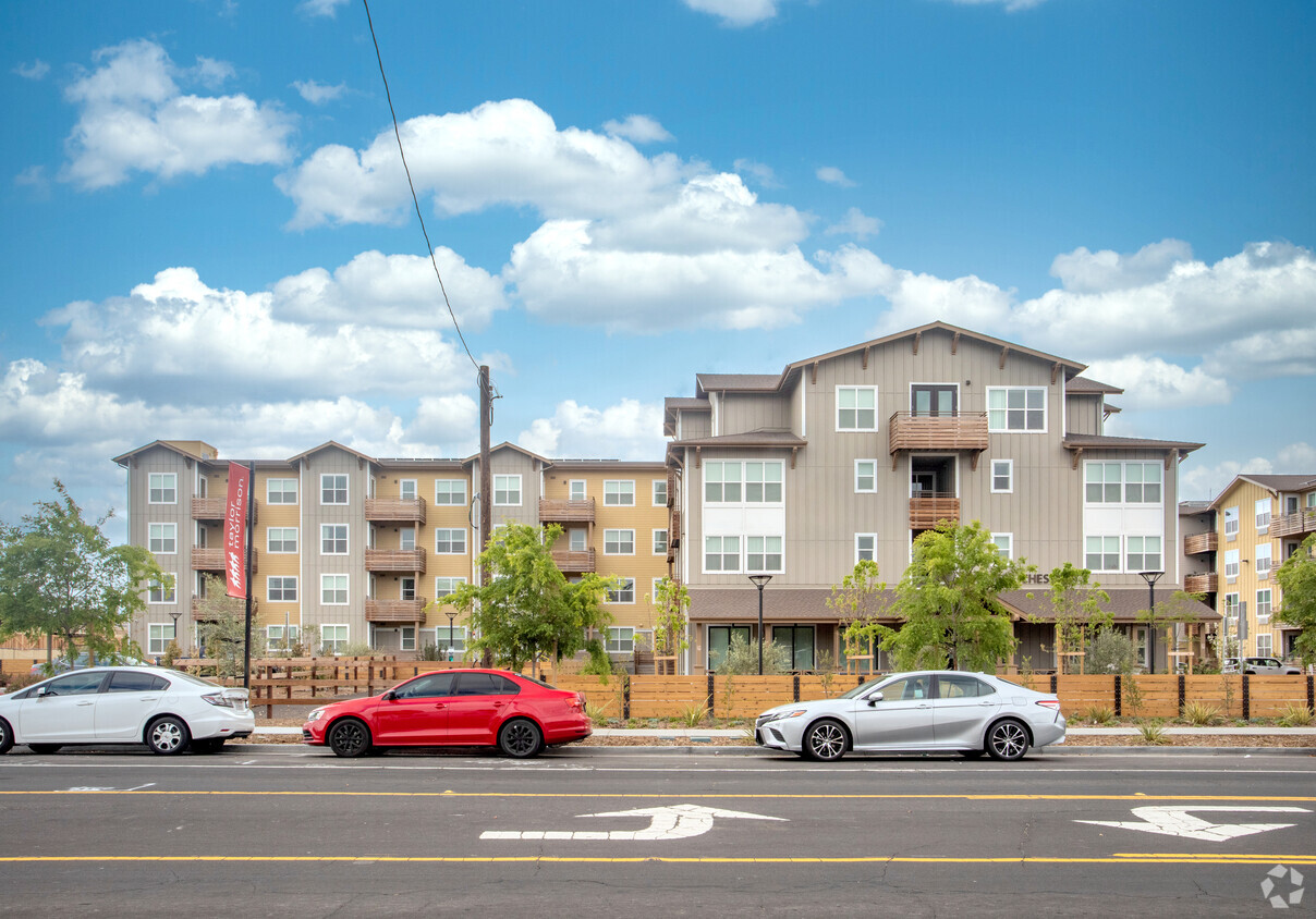
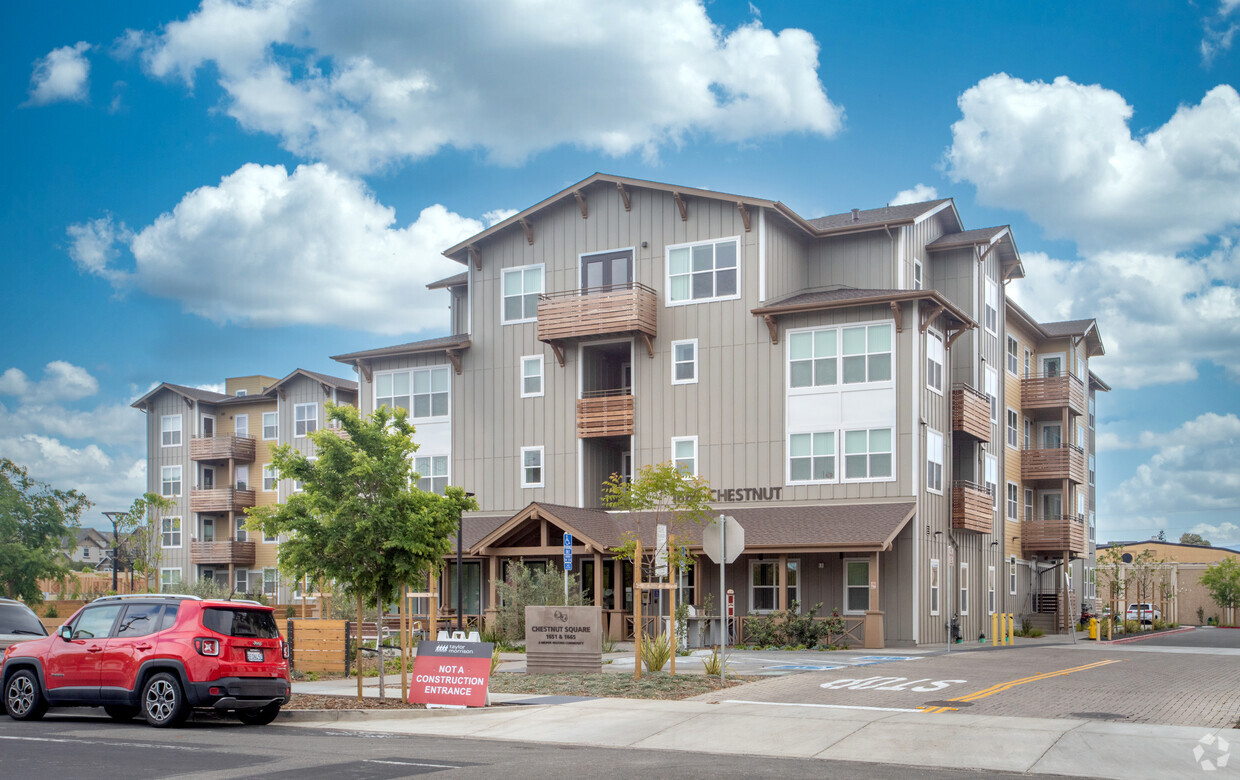
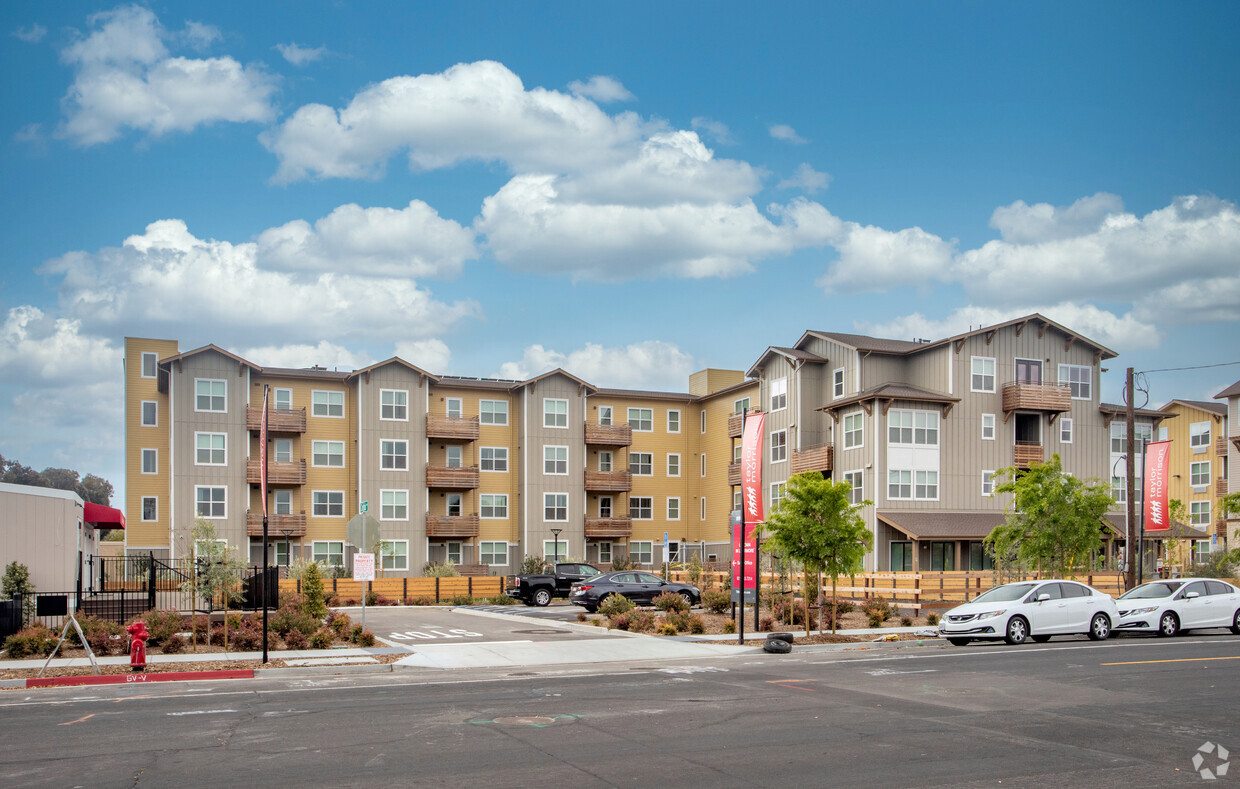
Find your new apartment at Chestnut Square Family Housing in Livermore, CA. This community is located on Chestnut St. in the Downtown Livermore area of Livermore. The leasing team is eager for your visit. At Chestnut Square Family Housing you're right at home.
Chestnut Square Family Housing is an apartment community located in Alameda County and the 94551 ZIP Code. This area is served by the Livermore Valley Joint Unified attendance zone.
Elevator
Controlled Access
Grill
24 Hour Access
Air Conditioning
Dishwasher
Refrigerator
Tub/Shower
Located in California's wine country, Livermore combines scientific innovation with small-town charm. The city houses the Lawrence Livermore National Laboratory and Sandia National Laboratories, reflecting its evolution from agricultural roots. Current rental rates average $2,278 for one-bedroom apartments. The walkable downtown district along First Street features local shops and restaurants, while South Livermore Valley showcases over 40 wineries, including Wente Vineyards and Concannon Vineyard - both pioneering establishments from the 1880s that helped establish California's wine industry.
The Livermore Area Recreation and Park District maintains 1,842 acres of parks and open spaces, including Sycamore Grove Park and Robertson Park, offering trails and recreational facilities. The Mediterranean climate creates ideal conditions for outdoor activities and wine growing.
Learn more about living in Livermore| Colleges & Universities | Distance | ||
|---|---|---|---|
| Colleges & Universities | Distance | ||
| Drive: | 10 min | 4.3 mi | |
| Drive: | 20 min | 12.9 mi | |
| Drive: | 21 min | 15.1 mi | |
| Drive: | 25 min | 16.2 mi |


Transportation options available in Livermore include Dublin Pleasanton Station, located 9.7 miles from Chestnut Square Family Housing. Chestnut Square Family Housing is near Metro Oakland International, located 28.5 miles or 37 minutes away, and Norman Y Mineta San Jose International, located 31.2 miles or 42 minutes away.
| Transit / Subway | Distance | ||
|---|---|---|---|
| Transit / Subway | Distance | ||
|
|
Drive: | 13 min | 9.7 mi |
|
|
Drive: | 13 min | 10.1 mi |
| Commuter Rail | Distance | ||
|---|---|---|---|
| Commuter Rail | Distance | ||
| Walk: | 14 min | 0.7 mi | |
| Walk: | 14 min | 0.8 mi | |
| Drive: | 8 min | 4.2 mi | |
| Drive: | 13 min | 6.8 mi | |
| Drive: | 13 min | 6.8 mi |
| Airports | Distance | ||
|---|---|---|---|
| Airports | Distance | ||
|
Metro Oakland International
|
Drive: | 37 min | 28.5 mi |
|
Norman Y Mineta San Jose International
|
Drive: | 42 min | 31.2 mi |
Time and distance from Chestnut Square Family Housing.
| Shopping Centers | Distance | ||
|---|---|---|---|
| Shopping Centers | Distance | ||
| Walk: | 3 min | 0.2 mi | |
| Walk: | 4 min | 0.2 mi | |
| Walk: | 6 min | 0.4 mi |
| Parks and Recreation | Distance | ||
|---|---|---|---|
| Parks and Recreation | Distance | ||
|
Shadow Cliffs Regional Recreation Area
|
Drive: | 9 min | 4.4 mi |
|
Brushy Peak Regional Preserve
|
Drive: | 15 min | 7.9 mi |
|
Del Valle Regional Park
|
Drive: | 26 min | 9.0 mi |
|
Los Vaqueros Watershed
|
Drive: | 16 min | 9.4 mi |
|
Carnegie State Vehicle Recreation Area
|
Drive: | 22 min | 12.3 mi |
| Hospitals | Distance | ||
|---|---|---|---|
| Hospitals | Distance | ||
| Drive: | 12 min | 7.9 mi |
What Are Walk Score®, Transit Score®, and Bike Score® Ratings?
Walk Score® measures the walkability of any address. Transit Score® measures access to public transit. Bike Score® measures the bikeability of any address.
What is a Sound Score Rating?
A Sound Score Rating aggregates noise caused by vehicle traffic, airplane traffic and local sources
1665 Chestnut St
Livermore, CA 94551


