
MI Place at First Radio
450 W Westfield Ave,
Roselle Park, NJ 07204
$2,225 - $3,555
1-2 Beds
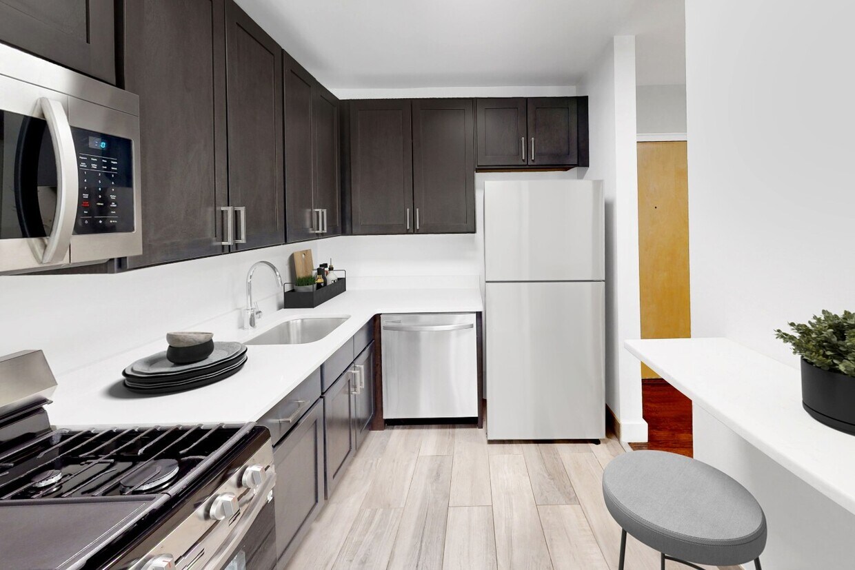
Find your perfect home at Carlyle Apartments in Roselle, NJ, where small-town charm meets modern convenience. Our spacious apartments boast new wall-to-wall carpeting and ample closet space, ideal for your lifestyle. Enjoy the ease of included utilities and on-site laundry, plus the added convenience of on-site parking. Our pet-friendly community is close to scenic trails, making it perfect for dog walks. Located within the diverse and community-focused Roselle Public School District, Carlyle Apartments offers an ideal setting for families. With easy access to major transit routes and local shopping, it provides a blend of tranquility and accessibility for both relaxation and city adventures.
Carlyle is an apartment community located in Union County and the 07203 ZIP Code. This area is served by the Roselle Public School District attendance zone.
Unique Features
Air Conditioning
High Speed Internet Access
Walk-In Closets
Smoke Free
Tucked into Union County about 18 miles from New York City, Roselle is a compact New Jersey borough that carries a lot of history in just three square miles. Incorporated in 1894, the borough has deep roots, dating back to the original Elizabethtown settlement in 1664, and that fascinating history adds a unique character to the community.
Roselle’s streets are largely residential and tree-lined, giving the borough a settled, neighborhood feel while keeping commuters within reach of Newark and New York City. The housing mix reflects the area’s established character, with classic single-family homes, two- and three-family houses, and a selection of apartment communities offering studio through multi-bedroom floor plans. Renters looking for well-maintained spaces without the density of a major metro will find solid options here.
Learn more about living in Roselle| Colleges & Universities | Distance | ||
|---|---|---|---|
| Colleges & Universities | Distance | ||
| Drive: | 7 min | 2.8 mi | |
| Drive: | 8 min | 3.3 mi | |
| Drive: | 11 min | 3.7 mi | |
| Drive: | 18 min | 9.9 mi |


Transportation options available in Roselle include 8Th Street Light Rail Station, located 10.1 miles from Carlyle. Carlyle is near Newark Liberty International, located 11.9 miles or 17 minutes away, and LaGuardia, located 31.1 miles or 51 minutes away.
| Transit / Subway | Distance | ||
|---|---|---|---|
| Transit / Subway | Distance | ||
| Drive: | 20 min | 10.1 mi | |
|
|
Drive: | 17 min | 10.2 mi |
|
|
Drive: | 17 min | 10.2 mi |
|
|
Drive: | 17 min | 10.4 mi |
|
|
Drive: | 17 min | 10.7 mi |
| Commuter Rail | Distance | ||
|---|---|---|---|
| Commuter Rail | Distance | ||
|
|
Walk: | 14 min | 0.7 mi |
|
|
Drive: | 6 min | 2.3 mi |
|
|
Drive: | 6 min | 2.7 mi |
|
|
Drive: | 7 min | 3.1 mi |
|
|
Drive: | 8 min | 3.6 mi |
| Airports | Distance | ||
|---|---|---|---|
| Airports | Distance | ||
|
Newark Liberty International
|
Drive: | 17 min | 11.9 mi |
|
LaGuardia
|
Drive: | 51 min | 31.1 mi |
Scores provided by
Traffic
-Airport
-Businesses
-Scores provided by
HowLoud What is a Sound Score Rating? A Sound Score Rating aggregates noise caused by vehicle traffic, airplane traffic and local sources. How It WorksTime and distance from Carlyle.
| Shopping Centers | Distance | ||
|---|---|---|---|
| Shopping Centers | Distance | ||
| Drive: | 3 min | 1.1 mi | |
| Drive: | 4 min | 1.3 mi | |
| Drive: | 5 min | 1.9 mi |
| Parks and Recreation | Distance | ||
|---|---|---|---|
| Parks and Recreation | Distance | ||
|
William Miller Sperry Observatory
|
Drive: | 9 min | 3.5 mi |
|
Hawk Rise Sanctuary
|
Drive: | 13 min | 5.1 mi |
|
Cora Hartshorn Arboretum
|
Drive: | 19 min | 7.4 mi |
|
Staten Island Industrial Park
|
Drive: | 15 min | 7.6 mi |
|
Liberty State Park
|
Drive: | 17 min | 7.8 mi |
| Hospitals | Distance | ||
|---|---|---|---|
| Hospitals | Distance | ||
| Drive: | 9 min | 3.2 mi | |
| Drive: | 11 min | 4.3 mi | |
| Drive: | 12 min | 7.3 mi |
| Military Bases | Distance | ||
|---|---|---|---|
| Military Bases | Distance | ||
| Drive: | 17 min | 7.0 mi | |
| Drive: | 14 min | 7.4 mi | |
| Drive: | 22 min | 15.7 mi |
What Are Walk Score®, Transit Score®, and Bike Score® Ratings?
Walk Score® measures the walkability of any address. Transit Score® measures access to public transit. Bike Score® measures the bikeability of any address.
What is a Sound Score Rating?
A Sound Score Rating aggregates noise caused by vehicle traffic, airplane traffic and local sources.

154 W 2nd Ave
Roselle, NJ 07203


