
Cannery Row
22550 SW Highland Dr,
Sherwood,
OR
97140
-
Monthly Rent
$1,752 - $3,238
-
Bedrooms
Studio - 3 bd
-
Bathrooms
1 - 2 ba
-
Square Feet
544 - 1,174 sq ft
Highlights
- Pet Washing Station
- Picnic Area
- Elevator
- Grill
- Balcony
- Property Manager on Site
- Patio
Pricing & Floor Plans
-
Unit 277price $1,752square feet 624availibility Now
-
Unit 177price $1,863square feet 624availibility Now
-
Unit 112price $1,930square feet 965availibility Now
-
Unit 201price $2,399square feet 1,174availibility Now
-
Unit 277price $1,752square feet 624availibility Now
-
Unit 177price $1,863square feet 624availibility Now
-
Unit 112price $1,930square feet 965availibility Now
-
Unit 201price $2,399square feet 1,174availibility Now
Fees and Policies
The fees listed below are community-provided and may exclude utilities or add-ons. All payments are made directly to the property and are non-refundable unless otherwise specified. Use the Cost Calculator to determine costs based on your needs.
-
One-Time Basics
-
Due at Application
-
Application Fee Per ApplicantCharged per applicant.$45
-
-
Due at Move-In
-
Administrative FeeCharged per unit.$0
-
-
Due at Application
-
Storage Unit
Property Fee Disclaimer: Based on community-supplied data and independent market research. Subject to change without notice. May exclude fees for mandatory or optional services and usage-based utilities.
Details
Lease Options
-
12 - 15 Month Leases
-
Short term lease
Property Information
-
Built in 2013
-
101 units/3 stories
Matterport 3D Tours
Select a unit to view pricing & availability
About Cannery Row
Old town Sherwood charm meets downtown Sherwood convenience at Cannery Row! Our beautiful community is centrally located near shops, fine dining, and exciting entertainment destinations. Let Cannery Row be your gateway to quality and convenience in Sherwood, Oregon.
Cannery Row is an apartment community located in Washington County and the 97140 ZIP Code. This area is served by the Sherwood School District 88j attendance zone.
Unique Features
- BBQ with Picnic Area
- Bike Racks
- Hardwood Inspired Floors
- Large Closets
- Off Street Parking
- Outdoor Fire Pit with lounge Seating
- Patio/Balcony
- Pet Wash Station
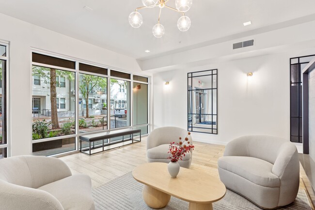
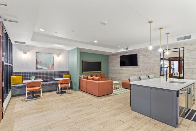
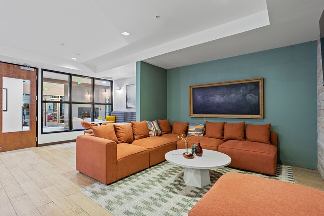
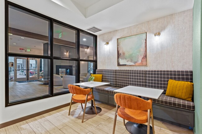
Community Amenities
Fitness Center
Elevator
Clubhouse
Grill
- Maintenance on site
- Property Manager on Site
- Pet Washing Station
- Elevator
- Clubhouse
- Lounge
- Fitness Center
- Grill
- Picnic Area
Apartment Features
Washer/Dryer
Air Conditioning
Dishwasher
High Speed Internet Access
- High Speed Internet Access
- Washer/Dryer
- Air Conditioning
- Smoke Free
- Cable Ready
- Dishwasher
- Kitchen
- Microwave
- Refrigerator
- Window Coverings
- Balcony
- Patio
Sherwood/Tualatin South is a large town off Interstate 5 just 12 miles south of Portland. The dynamic town is made up of cozy suburban neighborhoods, schools, and community parks that attract many residents. Many of the modern rentals are clustered in the far western and northeastern corners of town. The northeastern section of Sherwood/Tualatin South is also the commercial district. Tualatin Lake at the Commons, a business plaza centered around the lake, Nyberg Rivers, an outdoor mall, and more entertaining retail centers are nestled in this section of town. More amenities offered by Sherwood/Tualatin South include peaceful parks and trails like the ones along Rock Creek. Portland’s big-city amenities and Washington’s breathtaking national and state parks are all a short drive away as well.
Learn more about living in Sherwood/Tualatin SouthCompare neighborhood and city base rent averages by bedroom.
| Sherwood/Tualatin South | Sherwood, OR | |
|---|---|---|
| Studio | $1,337 | $1,472 |
| 1 Bedroom | $1,559 | $1,719 |
| 2 Bedrooms | $1,748 | $1,890 |
| 3 Bedrooms | $2,068 | $2,281 |
- Maintenance on site
- Property Manager on Site
- Pet Washing Station
- Elevator
- Clubhouse
- Lounge
- Grill
- Picnic Area
- Fitness Center
- BBQ with Picnic Area
- Bike Racks
- Hardwood Inspired Floors
- Large Closets
- Off Street Parking
- Outdoor Fire Pit with lounge Seating
- Patio/Balcony
- Pet Wash Station
- High Speed Internet Access
- Washer/Dryer
- Air Conditioning
- Smoke Free
- Cable Ready
- Dishwasher
- Kitchen
- Microwave
- Refrigerator
- Window Coverings
- Balcony
- Patio
| Monday | 8am - 5pm |
|---|---|
| Tuesday | 8am - 5pm |
| Wednesday | 8am - 5pm |
| Thursday | 8am - 5pm |
| Friday | 8am - 5pm |
| Saturday | Closed |
| Sunday | Closed |
| Colleges & Universities | Distance | ||
|---|---|---|---|
| Colleges & Universities | Distance | ||
| Drive: | 14 min | 6.9 mi | |
| Drive: | 16 min | 9.1 mi | |
| Drive: | 21 min | 10.8 mi | |
| Drive: | 26 min | 12.7 mi |


View GreatSchools Rating Methodology
Data provided by GreatSchools.org © 2026. All rights reserved.
Transportation options available in Sherwood include Millikan Way, located 11.6 miles from Cannery Row. Cannery Row is near Portland International, located 28.5 miles or 46 minutes away.
| Transit / Subway | Distance | ||
|---|---|---|---|
| Transit / Subway | Distance | ||
|
|
Drive: | 23 min | 11.6 mi |
|
|
Drive: | 24 min | 12.0 mi |
|
|
Drive: | 25 min | 12.2 mi |
|
|
Drive: | 24 min | 12.8 mi |
| Commuter Rail | Distance | ||
|---|---|---|---|
| Commuter Rail | Distance | ||
|
|
Drive: | 9 min | 4.6 mi |
|
|
Drive: | 12 min | 6.0 mi |
|
|
Drive: | 16 min | 7.3 mi |
|
|
Drive: | 20 min | 10.2 mi |
|
|
Drive: | 24 min | 12.7 mi |
| Airports | Distance | ||
|---|---|---|---|
| Airports | Distance | ||
|
Portland International
|
Drive: | 46 min | 28.5 mi |
Time and distance from Cannery Row.
| Shopping Centers | Distance | ||
|---|---|---|---|
| Shopping Centers | Distance | ||
| Walk: | 13 min | 0.7 mi | |
| Walk: | 17 min | 0.9 mi | |
| Walk: | 18 min | 1.0 mi |
| Parks and Recreation | Distance | ||
|---|---|---|---|
| Parks and Recreation | Distance | ||
|
Tualatin River National Wildlife Refuge
|
Drive: | 6 min | 2.7 mi |
|
Magness Memorial Tree Farm
|
Drive: | 12 min | 5.1 mi |
|
Graham Oaks Nature Park
|
Drive: | 13 min | 6.0 mi |
|
Cooper Mountain Nature Park
|
Drive: | 16 min | 8.4 mi |
|
Molalla River State Park
|
Drive: | 23 min | 11.3 mi |
| Hospitals | Distance | ||
|---|---|---|---|
| Hospitals | Distance | ||
| Drive: | 11 min | 5.5 mi | |
| Drive: | 11 min | 7.0 mi |
| Military Bases | Distance | ||
|---|---|---|---|
| Military Bases | Distance | ||
| Drive: | 43 min | 24.1 mi | |
| Drive: | 68 min | 41.5 mi |
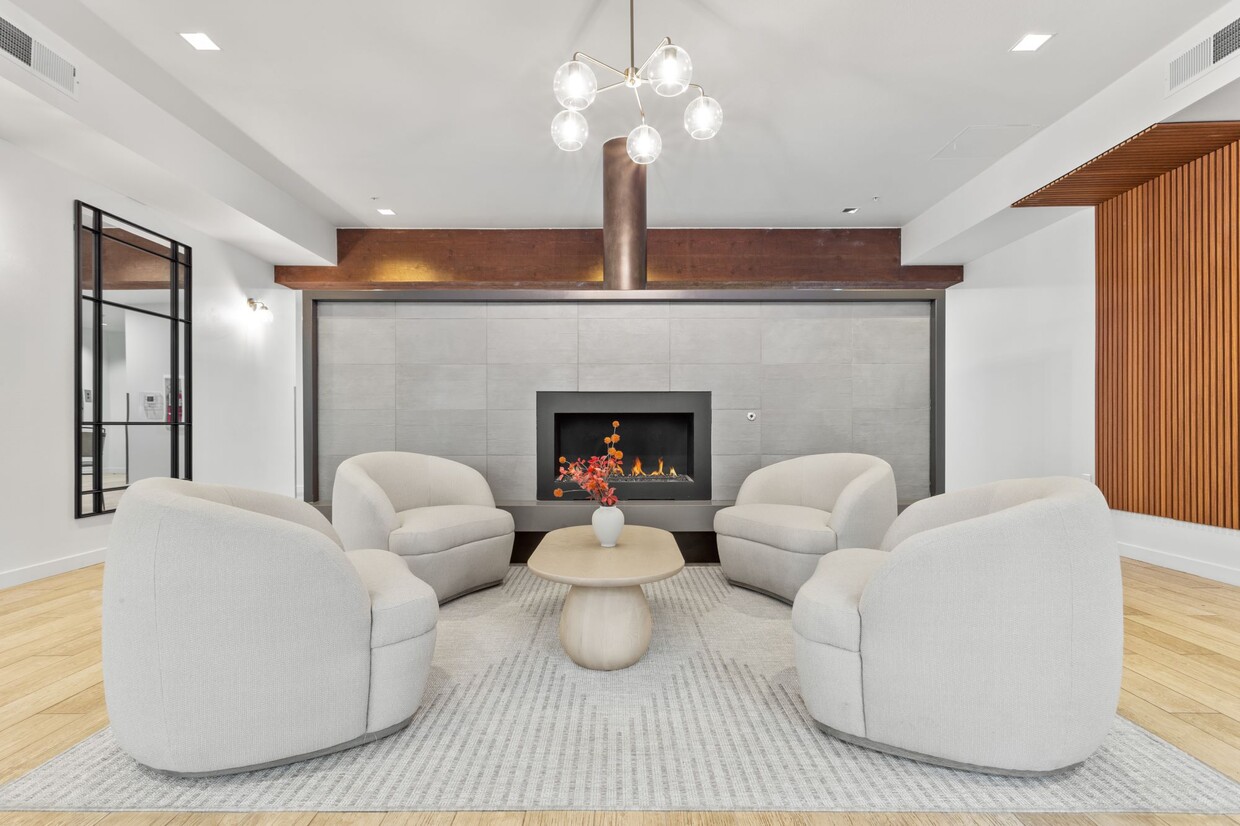
Cannery Row Photos
-
-
2BR, 2BA - 1,157 SF
-
-
-
-
-
-
-
Models
-
Studio
-
1 Bedroom
-
1 Bedroom
-
2 Bedrooms
-
2 Bedrooms
-
3 Bedrooms
Nearby Apartments
Within 50 Miles of Cannery Row
-
Bridge Creek Apartments
29697 SW Rose Ln
Wilsonville, OR 97070
Call for Rent
1-3 Br 5.4 mi
-
Boulder Creek
6600 SW Wilsonville Rd
Wilsonville, OR 97070
Call for Rent
1-3 Br 5.4 mi
-
Sygnii
13285 SW Hawks Beard St
Tigard, OR 97223
$1,644 - $3,202
1-3 Br 6.0 mi
-
Kruseway Commons
4933 Parkview Dr
Lake Oswego, OR 97035
$1,360 - $4,676
1-3 Br 6.9 mi
-
Shenandoah
9735 SW Hall Blvd
Tigard, OR 97223
$1,325 - $1,575
1-2 Br 7.3 mi
-
Deveraux Glen
10600 SW Taylor St
Portland, OR 97225
$1,715 - $4,973
1-4 Br 11.3 mi
Cannery Row has units with in‑unit washers and dryers, making laundry day simple for residents.
Utilities are not included in rent. Residents should plan to set up and pay for all services separately.
Contact this property for parking details.
Cannery Row has studios to three-bedrooms with rent ranges from $1,752/mo. to $3,238/mo.
Yes, Cannery Row welcomes pets. Breed restrictions, weight limits, and additional fees may apply. View this property's pet policy.
A good rule of thumb is to spend no more than 30% of your gross income on rent. Based on the lowest available rent of $1,752 for a one-bedroom, you would need to earn about $70,080 per year to qualify. Want to double-check your budget? Calculate how much rent you can afford with our Rent Affordability Calculator.
Cannery Row is offering 1 Month Free for eligible applicants, with rental rates starting at $1,752.
Yes! Cannery Row offers 5 Matterport 3D Tours. Explore different floor plans and see unit level details, all without leaving home.
What Are Walk Score®, Transit Score®, and Bike Score® Ratings?
Walk Score® measures the walkability of any address. Transit Score® measures access to public transit. Bike Score® measures the bikeability of any address.
What is a Sound Score Rating?
A Sound Score Rating aggregates noise caused by vehicle traffic, airplane traffic and local sources.
22550 SW Highland Dr
Sherwood, OR 97140