
Altura at the Groves
11821 Skylark Cir,
Whittier, CA 90606
$2,612 - $5,201
1-3 Beds
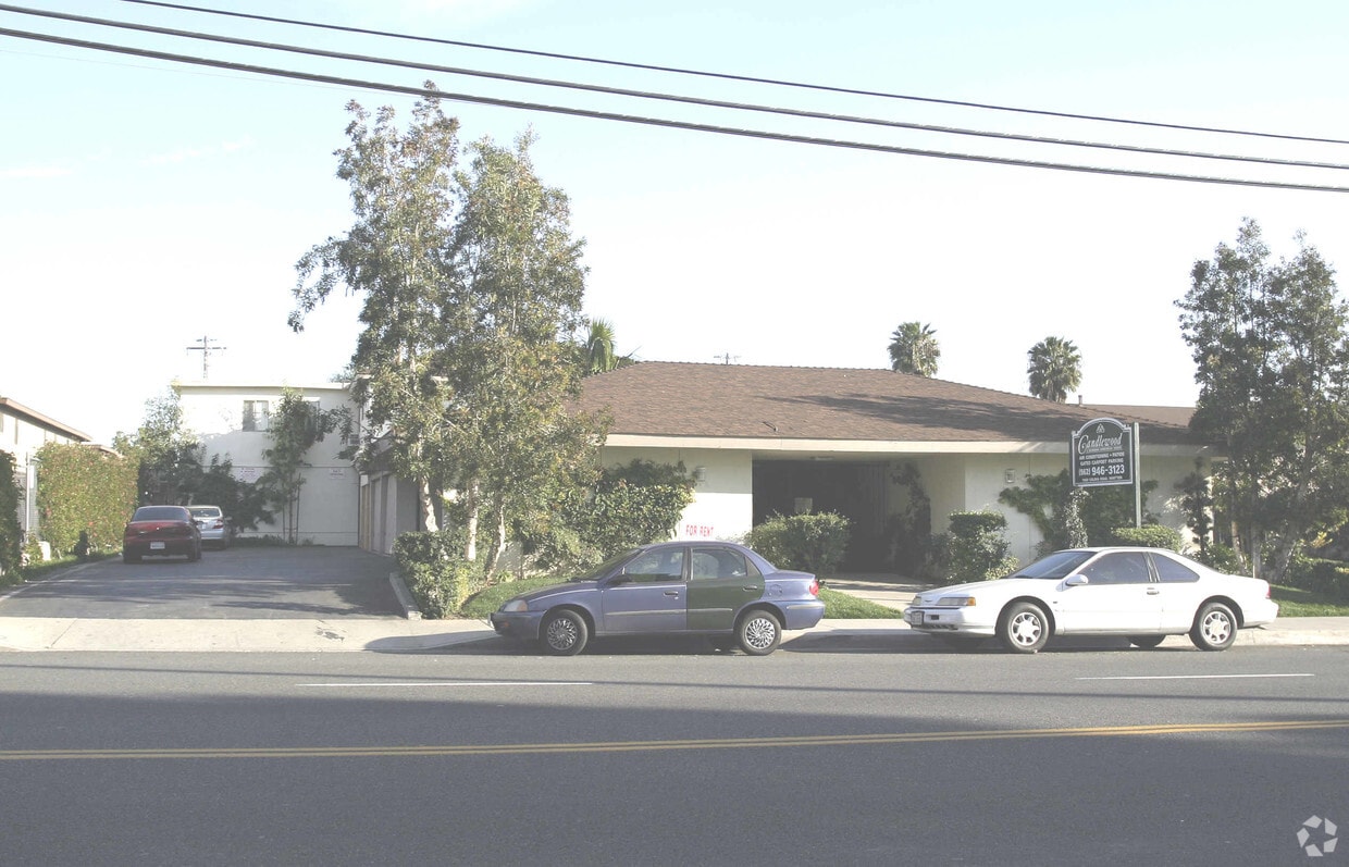
Meet your new home at Candlewood in Whittier, CA. In the 90604 area of Whittier on Colima Rd., residents have easy connection to a variety of attractions nearby. Be sure to come for a visit to view the available floorplans. At this community, you'll have top amenities and features available to you including: balconies, recycling, and smoke free options. Welcome home to Candlewood. Contact or drop by the leasing office to check the availability and set up a tour today.
Candlewood is an apartment community located in Los Angeles County and the 90604 ZIP Code. This area is served by the East Whittier City Elementary attendance zone.
East Whittier City is a sprawling suburb of Whitter that’s filled with winding residential streets, golf courses, parks, retailers, schools, and more. Whittwood Town Center sits along Whittier Boulevard and offers big-box retailers, popular restaurants, and a supermarket. Nearby is Whittier Hospital Medical Center, La Serna High School, Friendly Hills Country Club, and scenic nature trails like the Arroyo San Miguel Trail. Residents of East Whittier City enjoy easy access to the heart of Whittier, where you’ll find local restaurants, cafes, pubs, and shops. East Whittier City is also proximate to Anaheim, Los Angeles, Santa Ana, and Long Beach. Apartments and houses for rent in East Whittier City range from mid-range to upscale.
Learn more about living in East Whittier City| Colleges & Universities | Distance | ||
|---|---|---|---|
| Colleges & Universities | Distance | ||
| Drive: | 5 min | 2.2 mi | |
| Drive: | 10 min | 5.1 mi | |
| Drive: | 15 min | 6.9 mi | |
| Drive: | 17 min | 11.1 mi |


Transportation options available in Whittier include Norwalk, located 6.4 miles from Candlewood. Candlewood is near Long Beach (Daugherty Field), located 16.2 miles or 27 minutes away, and John Wayne/Orange County, located 23.6 miles or 31 minutes away.
| Transit / Subway | Distance | ||
|---|---|---|---|
| Transit / Subway | Distance | ||
|
|
Drive: | 12 min | 6.4 mi |
|
|
Drive: | 12 min | 7.2 mi |
| Commuter Rail | Distance | ||
|---|---|---|---|
| Commuter Rail | Distance | ||
|
|
Drive: | 5 min | 2.4 mi |
|
|
Drive: | 8 min | 4.7 mi |
|
|
Drive: | 17 min | 8.7 mi |
|
|
Drive: | 16 min | 9.2 mi |
|
|
Drive: | 18 min | 10.5 mi |
| Airports | Distance | ||
|---|---|---|---|
| Airports | Distance | ||
|
Long Beach (Daugherty Field)
|
Drive: | 27 min | 16.2 mi |
|
John Wayne/Orange County
|
Drive: | 31 min | 23.6 mi |
Time and distance from Candlewood.
| Shopping Centers | Distance | ||
|---|---|---|---|
| Shopping Centers | Distance | ||
| Walk: | 4 min | 0.2 mi | |
| Walk: | 6 min | 0.3 mi | |
| Walk: | 7 min | 0.4 mi |
| Parks and Recreation | Distance | ||
|---|---|---|---|
| Parks and Recreation | Distance | ||
|
La Habra Historical Museum
|
Drive: | 9 min | 4.9 mi |
|
Children's Museum at La Habra
|
Drive: | 10 min | 5.0 mi |
|
Pio Pico State Historic Park
|
Drive: | 12 min | 8.0 mi |
|
Schabarum Regional Park
|
Drive: | 17 min | 8.7 mi |
|
Whittier Narrows Nature Center
|
Drive: | 18 min | 12.4 mi |
| Hospitals | Distance | ||
|---|---|---|---|
| Hospitals | Distance | ||
| Drive: | 4 min | 2.1 mi | |
| Drive: | 7 min | 4.1 mi | |
| Drive: | 10 min | 5.0 mi |
| Military Bases | Distance | ||
|---|---|---|---|
| Military Bases | Distance | ||
| Drive: | 19 min | 10.3 mi | |
| Drive: | 41 min | 25.1 mi |
What Are Walk Score®, Transit Score®, and Bike Score® Ratings?
Walk Score® measures the walkability of any address. Transit Score® measures access to public transit. Bike Score® measures the bikeability of any address.
What is a Sound Score Rating?
A Sound Score Rating aggregates noise caused by vehicle traffic, airplane traffic and local sources

11500 Colima Rd
Whittier, CA 90604


 - Violet on Virgil")

