
Twelve31
1231 W Francisquito Ave,
West Covina, CA 91790
$2,200 - $2,685
1-2 Beds
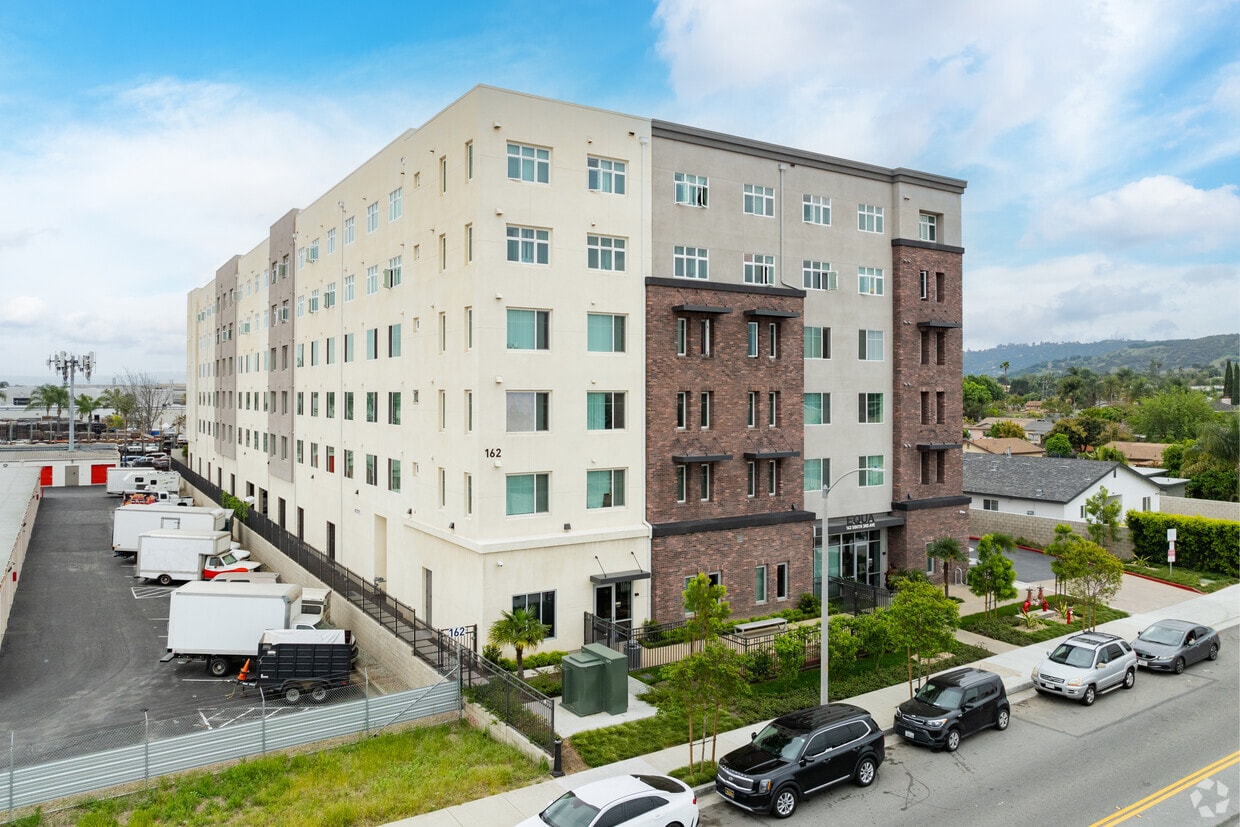
Experience La Puente living at Equa. This community is located at 162 S 3rd Ave in the Bassett area of La Puente. The professional leasing staff is ready to help you find the perfect apartment. So get a head start on your move. Contact or stop by Equa to see available floor plans!
Avocado Heights/ Equa is an apartment community located in Los Angeles County and the 91746 ZIP Code. This area is served by the Bassett Unified School District attendance zone.
Fitness Center
Laundry Facilities
Elevator
Playground
Air Conditioning
Dishwasher
Patio
Kitchen
La Puente sits about 20 miles east of downtown Los Angeles in the San Gabriel Valley, where its name — Spanish for "The Bridge" — quietly nods to a history stretching back to the 1769 Portolá expedition. The city covers just four square miles but packs in a densely settled, close-knit atmosphere shaped by deep roots and a strong sense of place. Positioned near West Covina to the north and Hacienda Heights to the south, La Puente offers easy access to the broader Los Angeles metro while maintaining a distinctly suburban character. East Los Angeles College serves students throughout the region, reinforcing the area's connection to higher education.
The housing stock here leans toward single-family homes and smaller apartment communities, with a mix of older ranch-style residences and low-rise rentals spread across tree-lined streets.
Learn more about living in La PuenteCompare neighborhood and city base rent averages by bedroom.
| Bassett | La Puente, CA | |
|---|---|---|
| Studio | $1,481 | $1,434 |
| 1 Bedroom | $1,886 | $1,616 |
| 2 Bedrooms | $2,013 | $1,825 |
| 3 Bedrooms | $2,306 | $1,938 |
| Colleges & Universities | Distance | ||
|---|---|---|---|
| Colleges & Universities | Distance | ||
| Drive: | 7 min | 3.9 mi | |
| Drive: | 17 min | 8.8 mi | |
| Drive: | 17 min | 10.0 mi | |
| Drive: | 18 min | 12.6 mi |


Transportation options available in La Puente include Monrovia Station, located 8.3 miles from Avocado Heights/ Equa. Avocado Heights/ Equa is near Long Beach (Daugherty Field), located 24.1 miles or 33 minutes away, and Ontario International, located 25.0 miles or 33 minutes away.
| Transit / Subway | Distance | ||
|---|---|---|---|
| Transit / Subway | Distance | ||
| Drive: | 14 min | 8.3 mi | |
| Drive: | 13 min | 9.2 mi | |
| Drive: | 14 min | 9.3 mi | |
| Drive: | 16 min | 11.9 mi | |
| Drive: | 17 min | 12.5 mi |
| Commuter Rail | Distance | ||
|---|---|---|---|
| Commuter Rail | Distance | ||
|
|
Drive: | 8 min | 3.7 mi |
|
|
Drive: | 8 min | 4.2 mi |
|
|
Drive: | 14 min | 8.3 mi |
|
|
Drive: | 19 min | 11.1 mi |
|
|
Drive: | 18 min | 12.0 mi |
| Airports | Distance | ||
|---|---|---|---|
| Airports | Distance | ||
|
Long Beach (Daugherty Field)
|
Drive: | 33 min | 24.1 mi |
|
Ontario International
|
Drive: | 33 min | 25.0 mi |
Scores provided by
Traffic
ActiveAirport
CalmBusinesses
ActiveScores provided by
HowLoud What is a Sound Score Rating? A Sound Score Rating aggregates noise caused by vehicle traffic, airplane traffic and local sources. How It WorksTime and distance from Avocado Heights/ Equa.
| Shopping Centers | Distance | ||
|---|---|---|---|
| Shopping Centers | Distance | ||
| Walk: | 12 min | 0.6 mi | |
| Walk: | 14 min | 0.8 mi | |
| Walk: | 16 min | 0.9 mi |
| Parks and Recreation | Distance | ||
|---|---|---|---|
| Parks and Recreation | Distance | ||
|
Whittier Narrows Nature Center
|
Drive: | 9 min | 4.5 mi |
|
Whittier Narrows Recreation Area
|
Drive: | 12 min | 6.4 mi |
|
Galster Wilderness Park Nature Center
|
Drive: | 13 min | 7.2 mi |
|
Santa Fe Dam Recreation Area
|
Drive: | 22 min | 7.6 mi |
|
Santa Fe Dam Nature Center
|
Drive: | 22 min | 7.6 mi |
| Hospitals | Distance | ||
|---|---|---|---|
| Hospitals | Distance | ||
| Drive: | 4 min | 2.2 mi | |
| Drive: | 7 min | 3.7 mi | |
| Drive: | 9 min | 4.2 mi |
| Military Bases | Distance | ||
|---|---|---|---|
| Military Bases | Distance | ||
| Drive: | 35 min | 26.1 mi | |
| Drive: | 38 min | 30.6 mi | |
| Drive: | 48 min | 34.0 mi |
Pets Allowed Fitness Center Pool In Unit Washer & Dryer Clubhouse Balcony
Pets Allowed Fitness Center Pool Dishwasher Refrigerator Kitchen
What Are Walk Score®, Transit Score®, and Bike Score® Ratings?
Walk Score® measures the walkability of any address. Transit Score® measures access to public transit. Bike Score® measures the bikeability of any address.
What is a Sound Score Rating?
A Sound Score Rating aggregates noise caused by vehicle traffic, airplane traffic and local sources.

162 S 3rd Ave
La Puente, CA 91746


 - Violet on Virgil")

