
Wescove Apartments
801 Wescove Pl,
West Covina, CA 91790
2 Beds $2,950 - $4,826
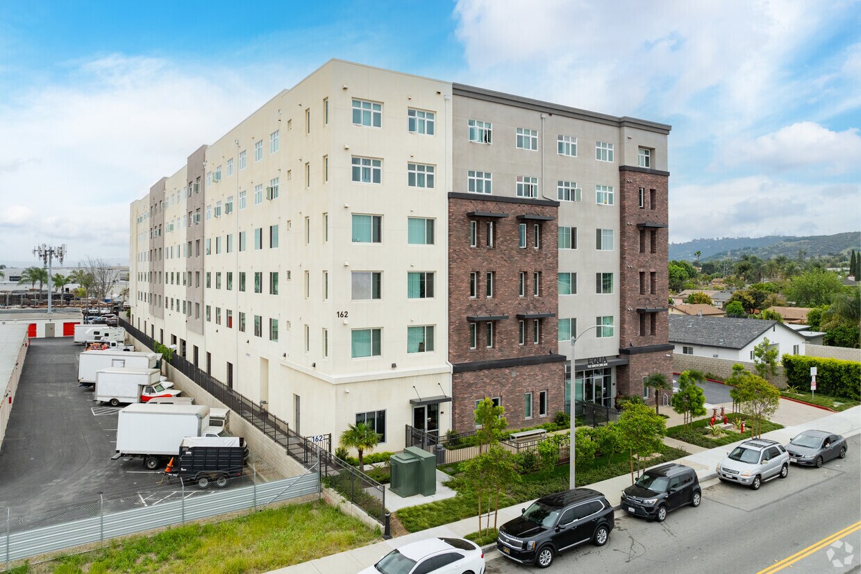
Experience La Puente living at Equa. This community is located at 162 S 3rd Ave in the Bassett area of La Puente. The professional leasing staff is ready to help you find the perfect apartment. So get a head start on your move. Contact or stop by Equa to see available floor plans!
Avocado Heights/ Equa is an apartment community located in Los Angeles County and the 91746 ZIP Code. This area is served by the Bassett Unified attendance zone.
Gimnasio
Instalaciones de lavandería
Ascensor
Parque infantil
Aire acondicionado
Lavavajillas
Patio
Cocina
Nestled in the heart of the San Gabriel Valley, La Puente is a suburban city just south of West Covina and north of Hacienda Heights. While La Puente is primarily residential, it is also home to a lively commercial corridor on North Hacienda Boulevard filled with a wide variety of restaurants, markets, and shops. Retail opportunities are even more plentiful at the adjacent Puente Hills Mall.
La Puente contains numerous baseball fields and basketball courts in its own city park. Several parks within close proximity to La Puente include the Santa Fe Dam Recreation Area, Whittier Narrows Recreation Area, and Frank G. Bonelli Regional Park. Getting from La Puente to the many attractions in nearby Downtown Los Angeles and Anaheim is simple with access to the 10 Interstate and 60 Freeway.
Learn more about living in La Puente| Colleges & Universities | Distance | ||
|---|---|---|---|
| Colleges & Universities | Distance | ||
| Drive: | 7 min | 3.9 mi | |
| Drive: | 17 min | 8.8 mi | |
| Drive: | 17 min | 10.0 mi | |
| Drive: | 18 min | 12.6 mi |


Transportation options available in La Puente include Monrovia Station, located 8.3 miles from Avocado Heights/ Equa. Avocado Heights/ Equa is near Long Beach (Daugherty Field), located 24.1 miles or 33 minutes away, and Ontario International, located 25.0 miles or 33 minutes away.
| Transit / Subway | Distance | ||
|---|---|---|---|
| Transit / Subway | Distance | ||
| Drive: | 14 min | 8.3 mi | |
| Drive: | 13 min | 9.2 mi | |
| Drive: | 14 min | 9.3 mi | |
| Drive: | 16 min | 11.9 mi | |
| Drive: | 17 min | 12.5 mi |
| Commuter Rail | Distance | ||
|---|---|---|---|
| Commuter Rail | Distance | ||
|
|
Drive: | 8 min | 3.7 mi |
|
|
Drive: | 8 min | 4.2 mi |
|
|
Drive: | 14 min | 8.3 mi |
|
|
Drive: | 19 min | 11.1 mi |
|
|
Drive: | 18 min | 12.0 mi |
| Airports | Distance | ||
|---|---|---|---|
| Airports | Distance | ||
|
Long Beach (Daugherty Field)
|
Drive: | 33 min | 24.1 mi |
|
Ontario International
|
Drive: | 33 min | 25.0 mi |
Time and distance from Avocado Heights/ Equa.
| Shopping Centers | Distance | ||
|---|---|---|---|
| Shopping Centers | Distance | ||
| Walk: | 12 min | 0.6 mi | |
| Walk: | 14 min | 0.8 mi | |
| Walk: | 16 min | 0.9 mi |
| Parks and Recreation | Distance | ||
|---|---|---|---|
| Parks and Recreation | Distance | ||
|
Whittier Narrows Nature Center
|
Drive: | 9 min | 4.5 mi |
|
Whittier Narrows Recreation Area
|
Drive: | 12 min | 6.4 mi |
|
Galster Wilderness Park Nature Center
|
Drive: | 13 min | 7.2 mi |
|
Santa Fe Dam Recreation Area
|
Drive: | 22 min | 7.6 mi |
|
Santa Fe Dam Nature Center
|
Drive: | 22 min | 7.6 mi |
| Hospitals | Distance | ||
|---|---|---|---|
| Hospitals | Distance | ||
| Drive: | 4 min | 2.2 mi | |
| Drive: | 7 min | 3.7 mi | |
| Drive: | 9 min | 4.2 mi |
| Military Bases | Distance | ||
|---|---|---|---|
| Military Bases | Distance | ||
| Drive: | 35 min | 26.1 mi | |
| Drive: | 38 min | 30.6 mi |
What Are Walk Score®, Transit Score®, and Bike Score® Ratings?
Walk Score® measures the walkability of any address. Transit Score® measures access to public transit. Bike Score® measures the bikeability of any address.
What is a Sound Score Rating?
A Sound Score Rating aggregates noise caused by vehicle traffic, airplane traffic and local sources

162 S 3rd Ave
La Puente, CA 91746


 - Violet on Virgil")

