
$3,600
/ Month
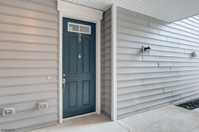
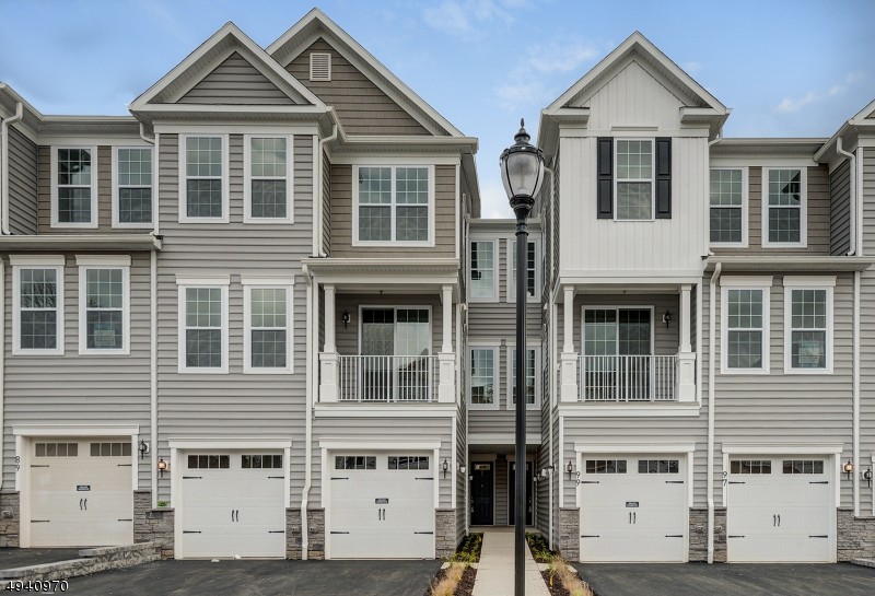
99 Aspen Dr Unit 1023
Cedar Grove, NJ 07009
Favorites
99 Aspen Dr Unit 1023

Favorites
Check Back Soon for Upcoming Availability
| Beds | Baths | Average SF |
|---|---|---|
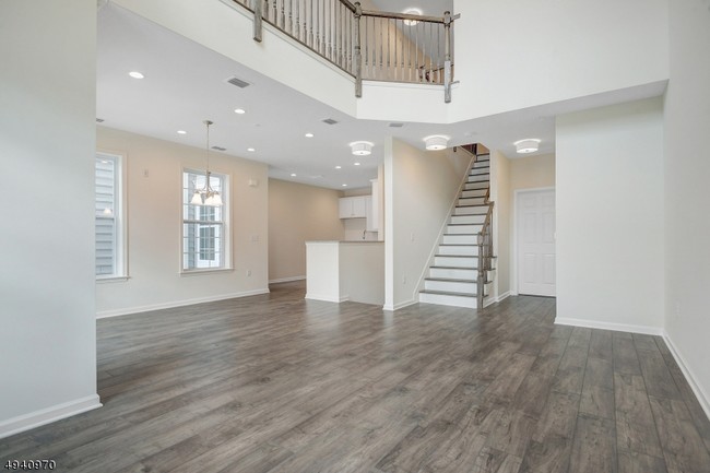
| 3 Bedrooms 3 Bedrooms 3 Br | 2.5 Baths 2.5 Baths 2.5 Ba | 2,039 SF |
Fees and Policies
The fees listed below are community-provided and may exclude utilities or add-ons. All payments are made directly to the property and are non-refundable unless otherwise specified.
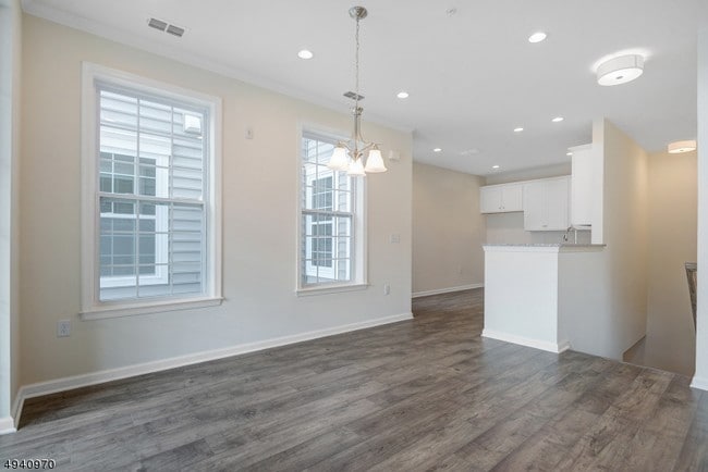
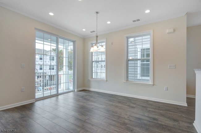
About This Property
Be the first to live in this Luxury New Construction Yale II Townhouse at Hilltop in Cedar Grove. Enter the private entrance on the ground floor with access to the spacious 1 car garage,
99 Aspen Dr is an apartment community located in Essex County and the 07009 ZIP Code.
Features
- Carpet
99 Aspen Dr,
Cedar Grove,
NJ
07009
Located about 20 miles northwest of New York City, Cedar Grove provides residents with a tranquil small-town atmosphere in Essex County. Pompton Avenue is Cedar Grove’s main commercial thoroughfare, where a bevy of quaint shops and diverse restaurants sit along a tree-lined street.
Several parks offer plenty of options for outdoor recreation in Cedar Grove, including the expansive Mills Reservation County Park, Hilltop Reservation, and Cedar Grove Community Park. Cedar Grove is also within minutes of Verona Park, Eagle Rock Reservation, and Brookdale Park. Quick access to numerous NJ Transit rail stations and major highways affords residents easy commutes and travels from Cedar Grove.
Learn more about living in Cedar Grove
Amenities
- Carpet
Education
| Colleges & Universities | Distance | ||
|---|---|---|---|
| Colleges & Universities | Distance | ||
| Drive: | 6 min | 2.6 mi | |
| Drive: | 9 min | 4.3 mi | |
| Drive: | 9 min | 5.4 mi | |
| Drive: | 12 min | 6.3 mi |
99 Aspen Dr Unit 1023 is within 6 minutes or 2.6 miles from Caldwell College. It is also near Montclair State University and Berkeley College.
Transportation options available in Cedar Grove include Grove Street, located 6.6 miles from 99 Aspen Dr Unit 1023. 99 Aspen Dr Unit 1023 is near Newark Liberty International, located 15.2 miles or 26 minutes away, and LaGuardia, located 31.6 miles or 46 minutes away.
| Transit / Subway | Distance | ||
|---|---|---|---|
| Transit / Subway | Distance | ||
|
|
Drive: | 12 min | 6.6 mi |
|
|
Drive: | 13 min | 7.0 mi |
|
|
Drive: | 13 min | 7.1 mi |
|
|
Drive: | 13 min | 7.3 mi |
|
|
Drive: | 13 min | 7.5 mi |
| Commuter Rail | Distance | ||
|---|---|---|---|
| Commuter Rail | Distance | ||
|
|
Drive: | 6 min | 2.3 mi |
|
|
Drive: | 5 min | 2.6 mi |
|
|
Drive: | 7 min | 2.7 mi |
|
|
Drive: | 7 min | 3.0 mi |
|
|
Drive: | 8 min | 3.3 mi |
| Airports | Distance | ||
|---|---|---|---|
| Airports | Distance | ||
|
Newark Liberty International
|
Drive: | 26 min | 15.2 mi |
|
LaGuardia
|
Drive: | 46 min | 31.6 mi |
Walkability Near 99 Aspen Dr Cedar Grove, NJ 07009
Getting Around
 What do Walkability, Transit, Drivability, and Bikeability mean?
Walkability measures the walking distance to day-to-day needs.
Transit measures access to public transportation.
Drivability measures congestion, parking availability, and access to major roads.
Bikeability measures the suitability for cycling.
How It Works
What do Walkability, Transit, Drivability, and Bikeability mean?
Walkability measures the walking distance to day-to-day needs.
Transit measures access to public transportation.
Drivability measures congestion, parking availability, and access to major roads.
Bikeability measures the suitability for cycling.
How It Works
Fairly Walkable
Walkability
40
/ 100
Limited Public Transit
Transit
20
/ 100
Exceptionally Drivable
Drivability
90
/ 100
Exceptionally Bikeable
Bikeability
90
/ 100
Scores provided by
-
Soundscore™
-
/ 100
Traffic
-Airport
-Businesses
-Scores provided by
HowLoud What is a Sound Score Rating? A Sound Score Rating aggregates noise caused by vehicle traffic, airplane traffic and local sources. How It WorksTime and distance from 99 Aspen Dr Unit 1023.
| Shopping Centers | Distance | ||
|---|---|---|---|
| Shopping Centers | Distance | ||
| Walk: | 19 min | 1.0 mi | |
| Drive: | 3 min | 1.2 mi | |
| Drive: | 3 min | 1.5 mi |
99 Aspen Dr Unit 1023 has 3 shopping centers within 1.5 miles, which is about a 3-minute drive. The miles and minutes will be for the farthest away property.
| Parks and Recreation | Distance | ||
|---|---|---|---|
| Parks and Recreation | Distance | ||
|
Presby Memorial Iris Gardens
|
Drive: | 6 min | 2.6 mi |
|
Van Vleck House & Gardens
|
Drive: | 6 min | 3.2 mi |
|
NJ Audubon Essex County Environmental Center
|
Drive: | 11 min | 6.7 mi |
|
Edison National Historic Site
|
Drive: | 14 min | 7.0 mi |
|
Fairfield Farm
|
Drive: | 14 min | 8.0 mi |
99 Aspen Dr Unit 1023 has 5 parks within 8.0 miles, including Presby Memorial Iris Gardens, Van Vleck House & Gardens, and Edison National Historic Site.
| Hospitals | Distance | ||
|---|---|---|---|
| Hospitals | Distance | ||
| Walk: | 15 min | 0.8 mi | |
| Drive: | 13 min | 7.9 mi | |
| Drive: | 14 min | 8.5 mi |
99 Aspen Dr Unit 1023 has 3 hospitals within 8.5 miles, the nearest is Essex County Hospital Center which is 0.8 mile away and a 15 minute walk.
| Military Bases | Distance | ||
|---|---|---|---|
| Military Bases | Distance | ||
| Drive: | 31 min | 19.0 mi | |
| Drive: | 38 min | 21.7 mi | |
| Drive: | 37 min | 24.3 mi |
99 Aspen Dr Unit 1023 has 3 military bases within 24.3 miles, the nearest is Military Ocean Terminal which is 19.0 miles away and a 31 minute drive.
You May Also Like
How do I access Social Services in New Jersey?
Statewide service is free, confidential, multilingual and always open. Three easy ways to reach Social Services in NJ: Dial 2-1-1; text your zip code to 898-211; or chat at https://www.nj211.org
Similar Rentals Nearby
-
-
-
-
-
1 / 15
 3 Beds$7,027+Total Monthly PriceTotal Monthly Price NewPrices include required monthly fees of $94.Base Rent:3 Beds$6,932+2 Months Free
Pets Allowed Fitness Center Pool In Unit Washer & Dryer Stainless Steel Appliances
-
-
-
1 / 28

-
-


What Are Walk Score®, Transit Score®, and Bike Score® Ratings?
Walk Score® measures the walkability of any address. Transit Score® measures access to public transit. Bike Score® measures the bikeability of any address.
What is a Sound Score Rating?
A Sound Score Rating aggregates noise caused by vehicle traffic, airplane traffic and local sources.
99 Aspen Dr
Cedar Grove, NJ 07009