

$1,850 / Month
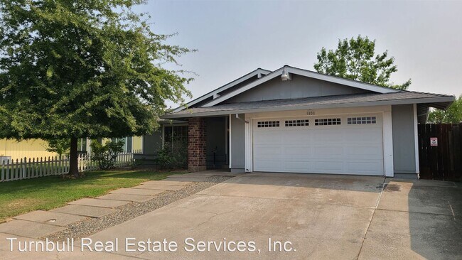
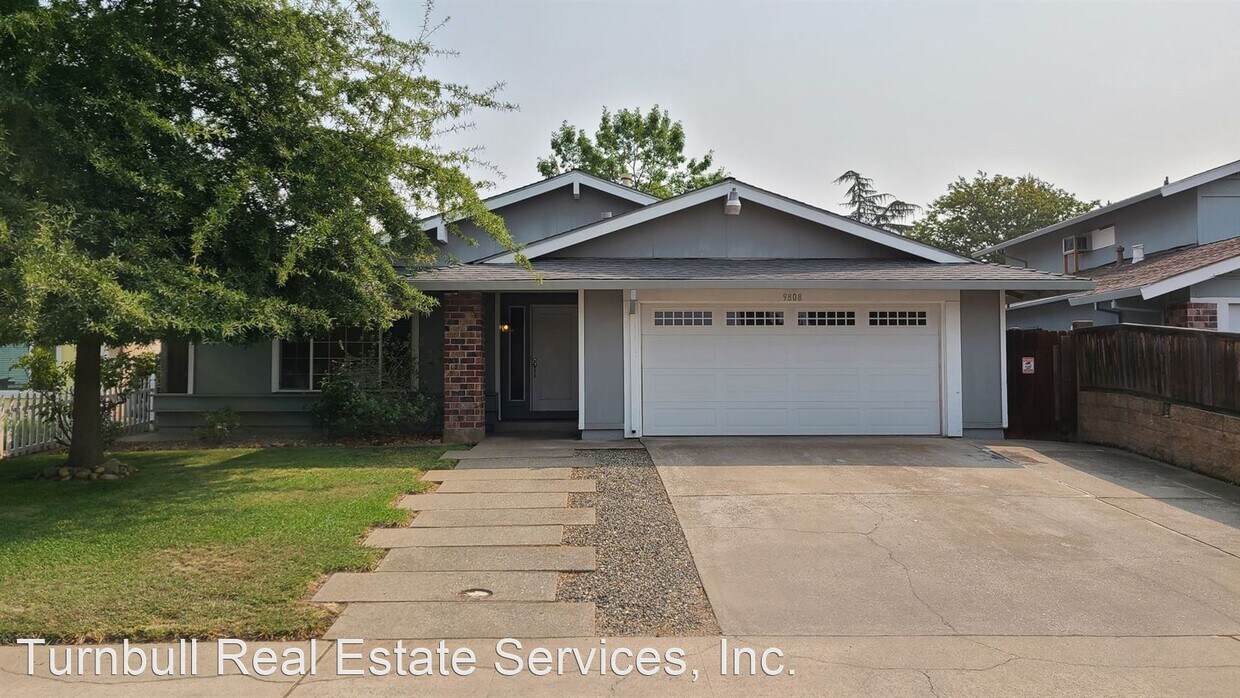
9808 Bexley Dr
Sacramento, CA 95827
2 Weeks Ago
Favorites
9808 Bexley Dr

Favorites
Check Back Soon for Upcoming Availability
| Beds | Baths | Average SF |
|---|---|---|
| 3 Bedrooms 3 Bedrooms 3 Br | 2 Baths 2 Baths 2 Ba | 1,514 SF |
About This Property
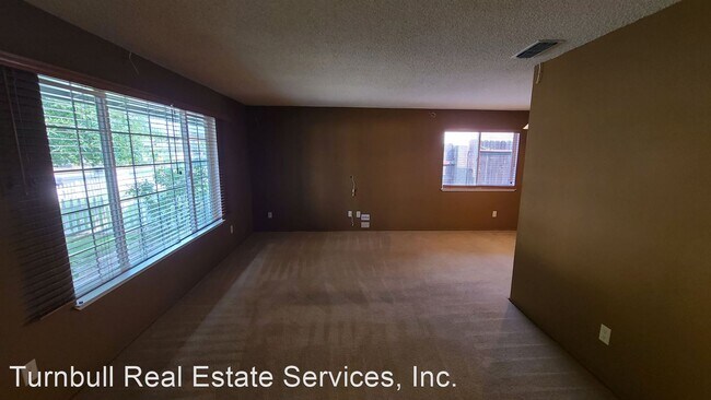
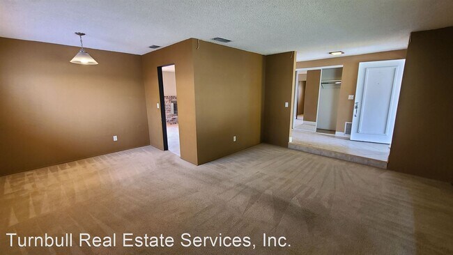
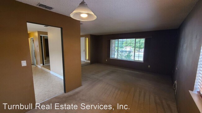
(916) 597-0987 - GREAT 3 BD / 2 BTH SINGLE FAMILY HOME!! - This 3bd/2bth Single Family Home is priced to move. This property features a tiled entry way, great living room with surround sound availability and space for a formal dining area. Spacious bright kitchen w/ large island in middle. Both bathrooms have been updated, along w/ a brick patio situated in a lush backyard. Very close to Abraham Lincoln Elementary. More photos to come! 1 yr lease. Deposit $2000. For showings please email Aaron at aaron@turnbullresrvcs.com. Rent includes sewer and trash. Pets negotiable. Nearest schools are Abraham Lincoln Elementary, James Marshall Elementary and Rosemont High. Rental Requirements: Min FICO score 640 w/ no collections. Tenants combined make 3x the amount of rent. 2 yrs continuous employment. Excellent rental references. (RLNE6097512)
9808 Bexley Dr is a house located in Sacramento County and the 95827 ZIP Code. This area is served by the Sacramento City Unified attendance zone.
Location
Get Directions
Lincoln Village is a small residential neighborhood on the east side of Sacramento, near Mather Airport. Positioned right alongside Lincoln Highway, the atmosphere is largely suburban, allowing easy access to Downtown in around fifteen minutes. Several schools in and around the neighborhood give local students the option of walking to class, and Lincoln Village Community Park provides a great venue to spend quality time outdoors. Nearby, the West Wind Sacramento 6 Drive-In is a popular spot to catch a movie, and Zinfandel Plaza serves as a major shopping destination.
Learn more about living in Lincoln VillageBelow are rent ranges for similar nearby apartments
Education
| Colleges & Universities | Distance | ||
|---|---|---|---|
| Colleges & Universities | Distance | ||
| Drive: | 11 min | 6.6 mi | |
| Drive: | 17 min | 11.4 mi | |
| Drive: | 23 min | 11.8 mi | |
| Drive: | 24 min | 13.5 mi |
9808 Bexley Dr is within 11 minutes or 6.6 miles from Sacramento State. It is also near Sacramento City College and American River College.
Schools


Public Elementary School
Grades K-3
372 Students
Nearby
Public Elementary School
Grades K-6
535 Students
Attendance Zone
Public Middle School
Grades 7-8
671 Students
Attendance Zone
Public High School
Grades 9-12
1,514 Students
Attendance Zone
Private Elementary, Middle & High School
Grades K-12
908 Students
Nearby
Private Elementary School
Grades PK-2
Nearby
School data provided by
 The GreatSchools Rating helps parents compare schools within a state based on a variety of school quality indicators and provides a helpful picture of how effectively each school serves all of its students. Ratings are on a scale of 1 (below average) to 10 (above average) and can include test scores, college readiness, academic progress, advanced courses, equity, discipline and attendance data. We also advise parents to visit schools, consider other information on school performance and programs, and consider family needs as part of the school selection process.
View GreatSchools Rating Methodology
Data provided by GreatSchools.org © 2025. All rights reserved.
View GreatSchools Rating Methodology
Data provided by GreatSchools.org © 2025. All rights reserved.
Transportation options available in Sacramento include Mather Field/Mills, located 1.8 miles from 9808 Bexley Dr. 9808 Bexley Dr is near Sacramento International, located 22.9 miles or 31 minutes away.
| Transit / Subway | Distance | ||
|---|---|---|---|
| Transit / Subway | Distance | ||
|
|
Drive: | 4 min | 1.8 mi |
|
|
Drive: | 4 min | 2.2 mi |
|
|
Drive: | 5 min | 2.6 mi |
|
|
Drive: | 6 min | 3.2 mi |
|
|
Drive: | 7 min | 4.5 mi |
| Commuter Rail | Distance | ||
|---|---|---|---|
| Commuter Rail | Distance | ||
| Drive: | 18 min | 12.6 mi | |
|
|
Drive: | 31 min | 17.7 mi |
|
|
Drive: | 32 min | 19.4 mi |
|
|
Drive: | 30 min | 24.6 mi |
|
|
Drive: | 46 min | 31.7 mi |
| Airports | Distance | ||
|---|---|---|---|
| Airports | Distance | ||
|
Sacramento International
|
Drive: | 31 min | 22.9 mi |
Time and distance from 9808 Bexley Dr.
| Shopping Centers | Distance | ||
|---|---|---|---|
| Shopping Centers | Distance | ||
| Walk: | 12 min | 0.6 mi | |
| Drive: | 3 min | 1.7 mi | |
| Drive: | 3 min | 1.7 mi |
9808 Bexley Dr has 3 shopping centers within 1.7 miles, which is about a 3-minute walk. The miles and minutes will be for the farthest away property.
| Parks and Recreation | Distance | ||
|---|---|---|---|
| Parks and Recreation | Distance | ||
|
River Bend Park
|
Drive: | 11 min | 2.8 mi |
|
Rossmoor Bar County Park
|
Drive: | 11 min | 4.8 mi |
|
Lower Sunrise Recreational Area
|
Drive: | 12 min | 7.3 mi |
|
Ancil Hoffman Park
|
Drive: | 20 min | 10.3 mi |
|
Effie Yeaw Nature Center
|
Drive: | 20 min | 10.3 mi |
9808 Bexley Dr has 5 parks within 10.3 miles, including River Bend Park, Rossmoor Bar County Park, and Lower Sunrise Recreational Area.
| Hospitals | Distance | ||
|---|---|---|---|
| Hospitals | Distance | ||
| Drive: | 9 min | 6.1 mi | |
| Drive: | 12 min | 7.3 mi | |
| Drive: | 13 min | 8.8 mi |
9808 Bexley Dr has 3 hospitals within 8.8 miles, the nearest is Sutter Center for Psychiatry which is 6.1 miles away and a 9 minute drive.
| Military Bases | Distance | ||
|---|---|---|---|
| Military Bases | Distance | ||
| Drive: | 33 min | 16.7 mi |
9808 Bexley Dr is 16.7 miles and a 33 minute drive from McClellan Air Force Base.
You May Also Like
Similar Rentals Nearby


What Are Walk Score®, Transit Score®, and Bike Score® Ratings?
Walk Score® measures the walkability of any address. Transit Score® measures access to public transit. Bike Score® measures the bikeability of any address.
What is a Sound Score Rating?
A Sound Score Rating aggregates noise caused by vehicle traffic, airplane traffic and local sources
9808 Bexley Dr
Sacramento, CA 95827