
$2,000
/ Month
975 Murrieta Blvd
Livermore, CA 94550
1 Day Ago
|
Edit
Favorites
925-600-1818
-
Bedrooms
2
-
Bathrooms
1
-
Square Feet
846 sq ft
-
Available
Available Now
975 Murrieta Blvd

Favorites
About This Home
$2,000 deposit,
Available Now
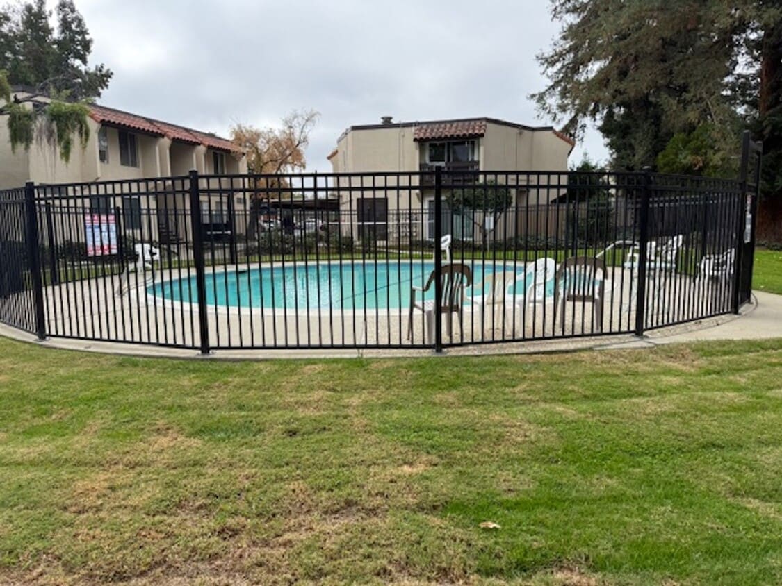
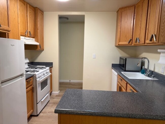
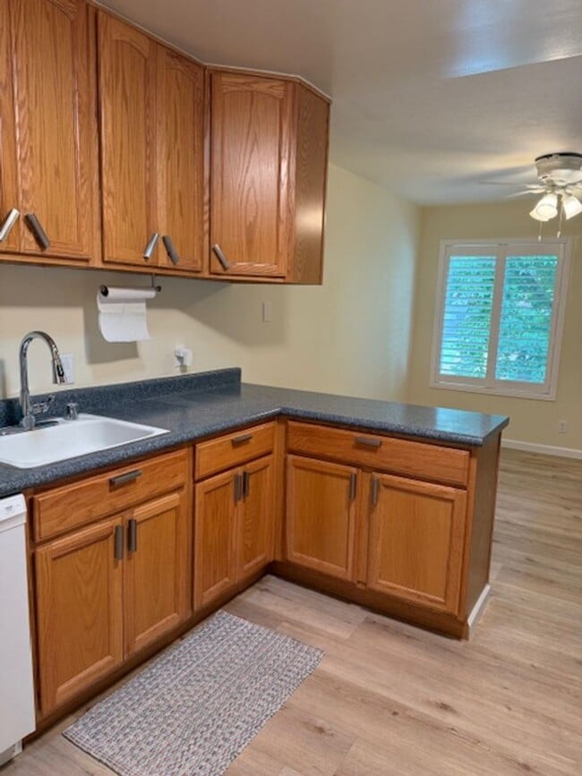
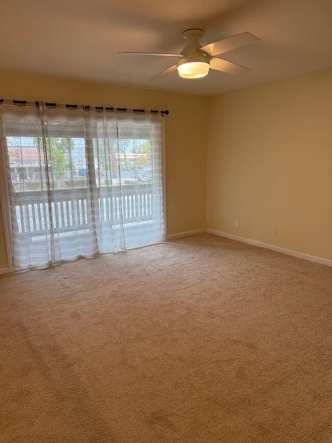
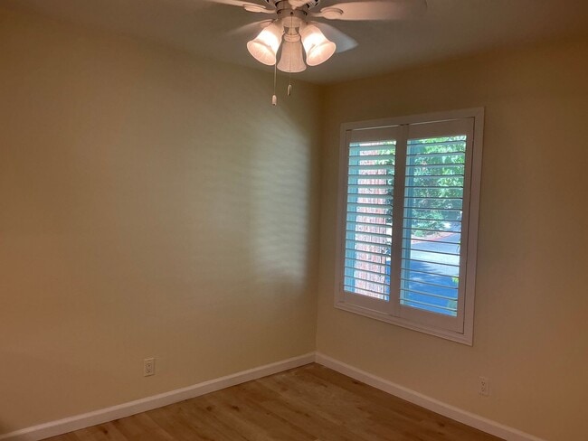
This fresh and stylish upstairs condo is ideally located in the heart of Livermore — just a short walk to the high school and downtown shops, restaurants, and entertainment. Offering modern updates, bright living spaces, and a desirable location, this home is perfect for anyone seeking comfort and convenience. Enjoy brand-new flooring and fresh paint throughout. The open floor plan creates a spacious feel, while the beautifully upgraded kitchen features stylish wood cabinets, a gas range, refrigerator, microwave, and new vinyl flooring. The inviting family room opens to a private patio through a large sliding glass door, filling the home with natural light. You’ll find two nicely sized bedrooms that overlook the sparkling community pool — the perfect place to relax and unwind. Property Features: 2 Bedrooms, 1 Bathroom 1 covered parking spot only Washer and dryer are coin operated in common area Bright open floor plan with new flooring and fresh paint Upgraded kitchen with wood cabinets, gas range, refrigerator, and microwave Private patio with sliding glass door access Upstairs location with pool views Shutters throughout Water and trash included in rent Access to community pool Conveniently located near downtown Livermore, schools, shopping, restaurants, and freeway access Applicant Qualifications: Minimum 700 credit score Verifiable income of at least 3x the monthly rent Positive rental history with prior landlord verification Please hold off on submitting applications until the decision-maker has viewed the property Apply now at Silver Creek Property Management DRE#01890488
Unique Features
- Washer and dryer in common area. Coin operated
- 1 covered parking spot
- No Washer and Dryer In Unit
- Water and Trash Utilities Incl. With Rent
975 Murrieta Blvd is a house located in Alameda County and the 94550 ZIP Code. This area is served by the Livermore Valley Joint Unified attendance zone.
* Price shown is base rent. Excludes user-selected optional fees and variable or usage-based fees and required charges due at or prior to move-in or at move-out. Price, availability, fees, and any applicable rent special are subject to change without notice.
* Square footage definitions vary. Displayed square footage is approximate.
Fees and Policies
The fees below are based on community-supplied data and may exclude additional fees and utilities.
-
One-Time Basics
-
Due at Move-In
-
Security Deposit - RefundableCharged per unit.$2,000
-
-
Due at Move-In
Property Fee Disclaimer: Based on community-supplied data and independent market research. Subject to change without notice. May exclude fees for mandatory or optional services and usage-based utilities.
Contact
- Listed by Silver Creek Property Management | Silver Creek Property Management
- Phone Number
- Contact
Location
Get Directions
Amenities
- Washer and dryer in common area. Coin operated
- 1 covered parking spot
- No Washer and Dryer In Unit
- Water and Trash Utilities Incl. With Rent
The cities of Livermore, Dublin and Pleasanton form a loosely shaped triangle within California's Tri-Valley region, a cluster of three small valleys about 33 miles east of San Francisco and 35 miles northeast of San Jose. Known for its Mediterranean climate, rolling hills and historic vineyards, this once bucolic region now boasts three separate downtown areas, a bustling business community and some of the best wineries in the state.
At the eastern end of the region lies the city of Livermore. Once known as Livermores, Livermore Ranch and Nottingham, the city sits at the center of Livermore Valley, a historic region dotted with more than 5,000 acres of mostly family-owned vineyards. A pastoral neighborhood known for its charming yet functional hilltop windmills, Livermore hosts the internationally recognized and sometimes controversial center of scientific research, Lawrence Livermore National Laboratories.
Learn more about living in Dublin/Pleasanton/Livermore
Education
| Colleges & Universities | Distance | ||
|---|---|---|---|
| Colleges & Universities | Distance | ||
| Drive: | 9 min | 4.2 mi | |
| Drive: | 20 min | 12.9 mi | |
| Drive: | 23 min | 15.1 mi | |
| Drive: | 24 min | 15.7 mi |
975 Murrieta Blvd is within 9 minutes or 4.2 miles from Las Positas College. It is also near Diablo Valley Coll, San Ramon and San Joaquin Delta, Mtn. House.
Schools


Public Elementary School
Grades K-5
478 Students
Nearby
Public Elementary & Middle School
Grades K-8
786 Students
Attendance Zone
Public High School
Grades 9-12
2,279 Students
Attendance Zone
Private Elementary, Middle & High School
Grades 1-12
Nearby
Private Elementary School
Grades PK-3
Nearby
Private Elementary & Middle School
Grades K-8
Nearby
School data provided by
 The GreatSchools Rating helps parents compare schools within a state based on a variety of school quality indicators and provides a helpful picture of how effectively each school serves all of its students. Ratings are on a scale of 1 (below average) to 10 (above average) and can include test scores, college readiness, academic progress, advanced courses, equity, discipline and attendance data. We also advise parents to visit schools, consider other information on school performance and programs, and consider family needs as part of the school selection process.
View GreatSchools Rating Methodology
Data provided by GreatSchools.org © 2025. All rights reserved.
View GreatSchools Rating Methodology
Data provided by GreatSchools.org © 2025. All rights reserved.
Transportation options available in Livermore include Dublin Pleasanton Station, located 9.7 miles from 975 Murrieta Blvd. 975 Murrieta Blvd is near Metro Oakland International, located 28.5 miles or 37 minutes away, and Norman Y Mineta San Jose International, located 30.6 miles or 42 minutes away.
| Transit / Subway | Distance | ||
|---|---|---|---|
| Transit / Subway | Distance | ||
|
|
Drive: | 14 min | 9.7 mi |
|
|
Drive: | 14 min | 10.1 mi |
| Commuter Rail | Distance | ||
|---|---|---|---|
| Commuter Rail | Distance | ||
| Drive: | 3 min | 1.4 mi | |
| Drive: | 4 min | 1.6 mi | |
| Drive: | 9 min | 5.0 mi | |
| Drive: | 12 min | 6.2 mi | |
| Drive: | 13 min | 6.3 mi |
| Airports | Distance | ||
|---|---|---|---|
| Airports | Distance | ||
|
Metro Oakland International
|
Drive: | 37 min | 28.5 mi |
|
Norman Y Mineta San Jose International
|
Drive: | 42 min | 30.6 mi |
Time and distance from 975 Murrieta Blvd.
| Shopping Centers | Distance | ||
|---|---|---|---|
| Shopping Centers | Distance | ||
| Walk: | 4 min | 0.2 mi | |
| Walk: | 8 min | 0.4 mi | |
| Walk: | 12 min | 0.6 mi |
975 Murrieta Blvd has 3 shopping centers within 0.6 mile, which is about a 12-minute walk. The miles and minutes will be for the farthest away property.
| Parks and Recreation | Distance | ||
|---|---|---|---|
| Parks and Recreation | Distance | ||
|
Shadow Cliffs Regional Recreation Area
|
Drive: | 8 min | 3.9 mi |
|
Brushy Peak Regional Preserve
|
Drive: | 16 min | 7.9 mi |
|
Del Valle Regional Park
|
Drive: | 26 min | 9.3 mi |
|
Los Vaqueros Watershed
|
Drive: | 18 min | 9.4 mi |
975 Murrieta Blvd has 4 parks within 9.4 miles, including Shadow Cliffs Regional Recreation Area, Brushy Peak Regional Preserve, and Del Valle Regional Park.
| Hospitals | Distance | ||
|---|---|---|---|
| Hospitals | Distance | ||
| Drive: | 11 min | 6.4 mi |
975 Murrieta Blvd is 6.4 miles and a 11 minute drive from Stanford Health Care - ValleyCare.
You May Also Like
Similar Rentals Nearby


What Are Walk Score®, Transit Score®, and Bike Score® Ratings?
Walk Score® measures the walkability of any address. Transit Score® measures access to public transit. Bike Score® measures the bikeability of any address.
What is a Sound Score Rating?
A Sound Score Rating aggregates noise caused by vehicle traffic, airplane traffic and local sources

975 Murrieta Blvd
Livermore, CA 94550