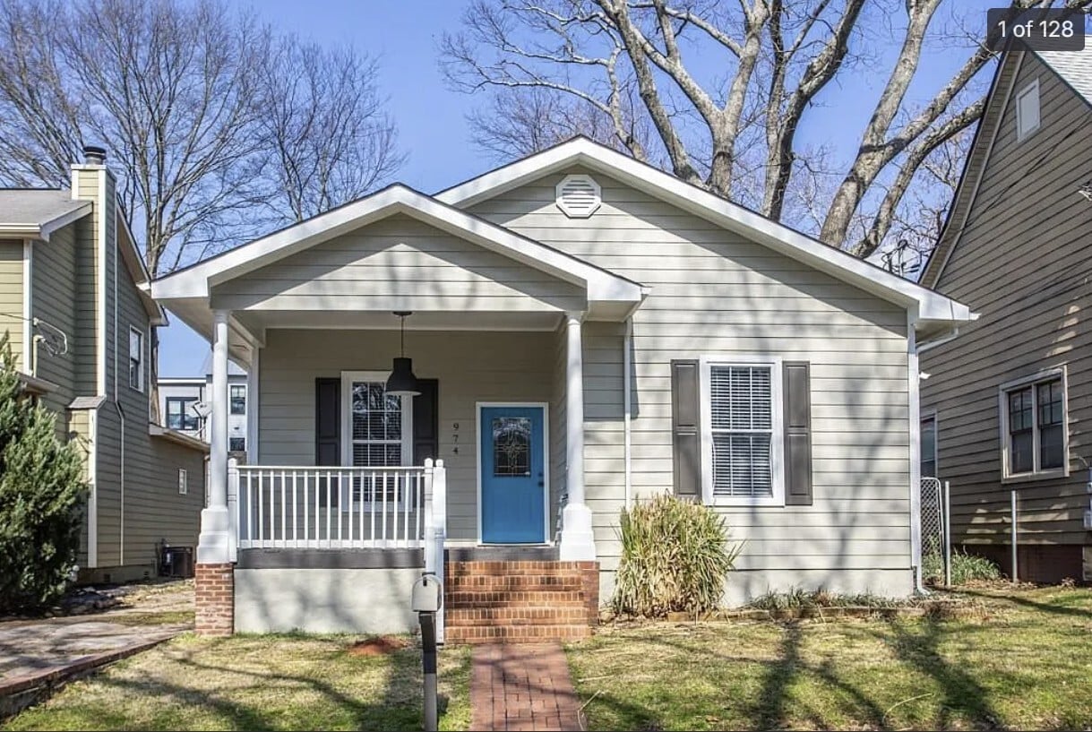
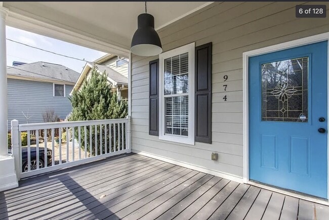
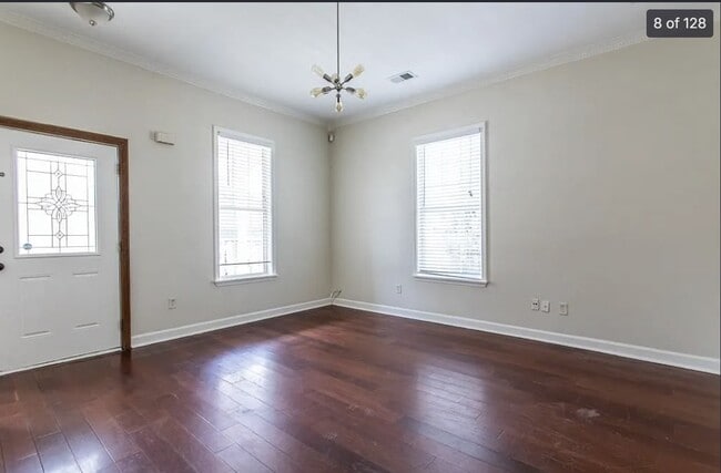
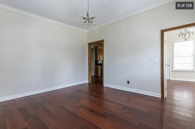
974 Mauldin St SE
Atlanta, GA 30316
-
Bedrooms
4
-
Bathrooms
2
-
Square Feet
1,800 sq ft
-
Available
Available Jun 26

Contact
- Contact
Listed on the National Register of Historic Places, Atlanta neighborhood Reynoldstown draws an eclectic mix of residents who appreciate in-town living. Formed in the 1860s and nestled between Cabbagetown on its west and Edgewood on its east, this pedestrian-friendly location allows residents a quick and easy commute three miles west to Downtown Atlanta and five miles east to Downtown Decatur. Many apartment buildings are clustered near DeKalb Avenue to the north, giving locals nearby Memorial Drive, I-20, and MARTA as transportation options.
Locals enjoy playing cornhole and gathering at the multi-use center in centrally located Lang-Carson Park. For food, the casual dining at Homegrown, which displays and sells antiques and art, draws rave reviews. At ParkGrounds, locals drink and eat while their dogs run in the yard.
Learn more about living in Reynoldstown| Colleges & Universities | Distance | ||
|---|---|---|---|
| Colleges & Universities | Distance | ||
| Drive: | 5 min | 2.4 mi | |
| Drive: | 9 min | 3.4 mi | |
| Drive: | 9 min | 4.4 mi | |
| Drive: | 11 min | 5.0 mi |


View GreatSchools Rating Methodology
Data provided by GreatSchools.org © 2026. All rights reserved.
Transportation options available in Atlanta include Inman Park/Reynoldstown, located 1.6 miles from 974 Mauldin St SE. 974 Mauldin St SE is near Hartsfield - Jackson Atlanta International, located 11.0 miles or 19 minutes away.
| Transit / Subway | Distance | ||
|---|---|---|---|
| Transit / Subway | Distance | ||
|
|
Drive: | 4 min | 1.6 mi |
|
|
Drive: | 4 min | 1.7 mi |
|
|
Drive: | 4 min | 1.8 mi |
|
|
Drive: | 3 min | 1.8 mi |
|
|
Drive: | 4 min | 1.9 mi |
| Commuter Rail | Distance | ||
|---|---|---|---|
| Commuter Rail | Distance | ||
|
|
Drive: | 11 min | 5.6 mi |
| Airports | Distance | ||
|---|---|---|---|
| Airports | Distance | ||
|
Hartsfield - Jackson Atlanta International
|
Drive: | 19 min | 11.0 mi |
Scores provided by
Traffic
-Airport
-Businesses
-Scores provided by
HowLoud What is a Sound Score Rating? A Sound Score Rating aggregates noise caused by vehicle traffic, airplane traffic and local sources. How It WorksTime and distance from 974 Mauldin St SE.
| Shopping Centers | Distance | ||
|---|---|---|---|
| Shopping Centers | Distance | ||
| Walk: | 7 min | 0.4 mi | |
| Walk: | 8 min | 0.5 mi | |
| Walk: | 14 min | 0.7 mi |
| Parks and Recreation | Distance | ||
|---|---|---|---|
| Parks and Recreation | Distance | ||
|
Trees Atlanta
|
Walk: | 6 min | 0.3 mi |
|
Trees Atlanta TreeHouse
|
Walk: | 18 min | 0.9 mi |
|
Zoo Atlanta
|
Drive: | 5 min | 2.1 mi |
|
The Georgia Capitol Museum
|
Drive: | 4 min | 2.2 mi |
|
Freedom Park Bird and Butterfly Garden
|
Drive: | 6 min | 2.6 mi |
| Hospitals | Distance | ||
|---|---|---|---|
| Hospitals | Distance | ||
| Drive: | 5 min | 2.2 mi | |
| Drive: | 5 min | 2.3 mi | |
| Drive: | 6 min | 3.1 mi |
| Military Bases | Distance | ||
|---|---|---|---|
| Military Bases | Distance | ||
| Drive: | 13 min | 7.0 mi | |
| Drive: | 21 min | 10.5 mi | |
| Drive: | 32 min | 19.2 mi |
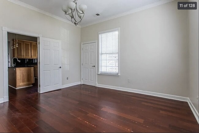
974 Mauldin St SE Photos
What Are Walk Score®, Transit Score®, and Bike Score® Ratings?
Walk Score® measures the walkability of any address. Transit Score® measures access to public transit. Bike Score® measures the bikeability of any address.
What is a Sound Score Rating?
A Sound Score Rating aggregates noise caused by vehicle traffic, airplane traffic and local sources.

974 Mauldin St SE
Atlanta, GA 30316