

$1,150
/ Month
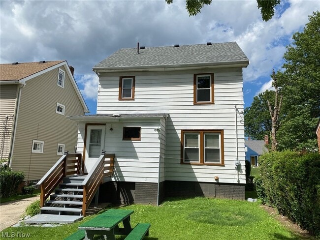
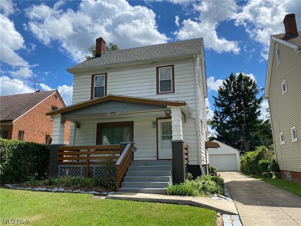
9702 Park Heights Ave
Garfield Heights, OH 44125
2 Weeks Ago
|
Edit
Favorites
9702 Park Heights Ave

Favorites
Check Back Soon for Upcoming Availability
| Beds | Baths | Average SF |
|---|---|---|
| 3 Bedrooms 3 Bedrooms 3 Br | 1 Bath 1 Bath 1 Ba | — |
About This Property
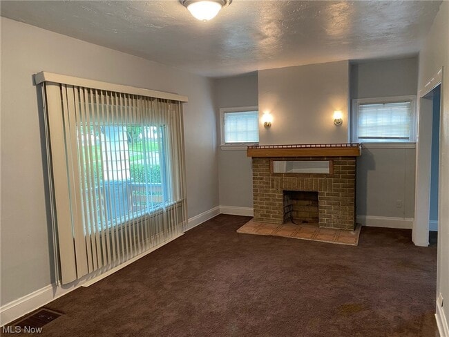
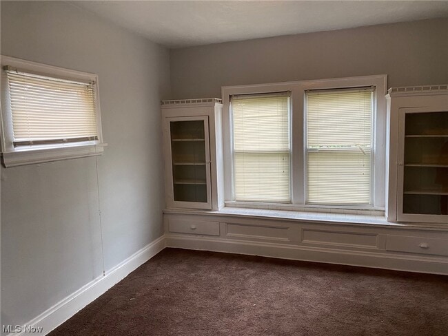
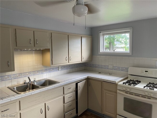
SINGLE FAMILY HOME READY FOR OCCUPANCY. Rent includes water and sewer. Tenant is responsible for gas and electric utilities. This large colonial style home comes with a large living room and dining room and 3 nice size bedrooms. This home also comes with a large front porch and 2 car detached garage. This home has been freshly painted throughout and ready for occupancy. This home has easy access to Interstate 480. All applications must be submitted for consideration by the owner. There is an application fee of $35.99 per adult for credit/criminal/prior evictions. The owner does not accept any voucher programs.
9702 Park Heights Ave is a house located in Cuyahoga County and the 44125 ZIP Code. This area is served by the Garfield Heights City Schools attendance zone.
House Features
- Porch
Location
Get Directions
Located just ten miles south of Cleveland, Garfield Heights offers residents the best of suburban living on the outskirts of a big city. Convenience to multiple freeways makes commuting from Garfield Heights a breeze. Access to Garfield Park Reservation, Bacci Park, and the Cuyahoga River offers a host of opportunities for outdoor recreation near Garfield Heights at any moment.
Garfield Heights is also close to numerous golf courses in addition to major attractions like the Cleveland Metroparks Zoo and Cuyahoga Valley National Park. The commercial corridor in Garfield Heights stretches along Turney Road, with a variety of retailers, shops, and restaurants. Garfield Heights residents can also venture into Downtown Cleveland to catch a sporting event at Quicken Loans Arena or Progressive Field, peruse Tower City Center, and purchase fresh meat and produce at the West Side Market.
Learn more about living in Garfield Heights
Amenities
- Porch
Education
| Colleges & Universities | Distance | ||
|---|---|---|---|
| Colleges & Universities | Distance | ||
| Drive: | 12 min | 7.5 mi | |
| Drive: | 18 min | 7.7 mi | |
| Drive: | 19 min | 7.7 mi | |
| Drive: | 16 min | 8.9 mi |
9702 Park Heights Ave is within 12 minutes or 7.5 miles from Cuyahoga C.C., Metropolitan. It is also near Case Western Reserve and Cleveland Institute of Art.
Schools


Public Elementary & Middle School
Grades PK-9
360 Students
Nearby
Public Elementary School
Grades K-5
323 Students
Nearby
Public High School
Grades 9-12
1,109 Students
Attendance Zone
Private Elementary & Middle School
Grades PK-8
245 Students
Nearby
Private High School
Grades 9-12
355 Students
Nearby
School data provided by
 The GreatSchools Rating helps parents compare schools within a state based on a variety of school quality indicators and provides a helpful picture of how effectively each school serves all of its students. Ratings are on a scale of 1 (below average) to 10 (above average) and can include test scores, college readiness, academic progress, advanced courses, equity, discipline and attendance data. We also advise parents to visit schools, consider other information on school performance and programs, and consider family needs as part of the school selection process.
View GreatSchools Rating Methodology
Data provided by GreatSchools.org © 2025. All rights reserved.
View GreatSchools Rating Methodology
Data provided by GreatSchools.org © 2025. All rights reserved.
Transportation options available in Garfield Heights include East 79 (Blue Line), located 4.8 miles from 9702 Park Heights Ave. 9702 Park Heights Ave is near Cleveland-Hopkins International, located 14.4 miles or 24 minutes away.
| Transit / Subway | Distance | ||
|---|---|---|---|
| Transit / Subway | Distance | ||
|
|
Drive: | 12 min | 4.8 mi |
|
|
Drive: | 15 min | 6.2 mi |
|
|
Drive: | 14 min | 6.5 mi |
|
|
Drive: | 15 min | 6.9 mi |
|
|
Drive: | 15 min | 7.3 mi |
| Commuter Rail | Distance | ||
|---|---|---|---|
| Commuter Rail | Distance | ||
| Drive: | 7 min | 3.1 mi | |
| Drive: | 10 min | 4.8 mi | |
|
|
Drive: | 20 min | 10.5 mi |
| Drive: | 21 min | 10.9 mi | |
|
Boston Mill
|
Drive: | 29 min | 17.1 mi |
| Airports | Distance | ||
|---|---|---|---|
| Airports | Distance | ||
|
Cleveland-Hopkins International
|
Drive: | 24 min | 14.4 mi |
Time and distance from 9702 Park Heights Ave.
| Shopping Centers | Distance | ||
|---|---|---|---|
| Shopping Centers | Distance | ||
| Walk: | 8 min | 0.4 mi | |
| Drive: | 3 min | 1.1 mi | |
| Drive: | 7 min | 2.6 mi |
9702 Park Heights Ave has 3 shopping centers within 2.6 miles, which is about a 7-minute walk. The miles and minutes will be for the farthest away property.
| Parks and Recreation | Distance | ||
|---|---|---|---|
| Parks and Recreation | Distance | ||
|
Garfield Park Nature Center
|
Drive: | 5 min | 2.1 mi |
|
CanalWay Center
|
Drive: | 10 min | 4.2 mi |
|
Ohio & Erie Canal Reservation
|
Drive: | 8 min | 4.4 mi |
|
Bedford Reservation
|
Drive: | 14 min | 6.1 mi |
|
West Creek Reservation
|
Drive: | 16 min | 6.6 mi |
9702 Park Heights Ave has 5 parks within 6.6 miles, including Garfield Park Nature Center, CanalWay Center, and Ohio & Erie Canal Reservation.
| Hospitals | Distance | ||
|---|---|---|---|
| Hospitals | Distance | ||
| Walk: | 19 min | 1.0 mi | |
| Drive: | 13 min | 5.2 mi | |
| Drive: | 12 min | 7.5 mi |
9702 Park Heights Ave has 3 hospitals within 7.5 miles, the nearest is Marymount Hospital which is 1.0 miles away and a 19 minute walk.
| Military Bases | Distance | ||
|---|---|---|---|
| Military Bases | Distance | ||
| Drive: | 95 min | 78.5 mi | |
| Drive: | 105 min | 86.3 mi |
9702 Park Heights Ave is 78.5 miles from Mansfield Lahm Airport Air Guard Station, and is convenient to other military bases, including Camp Perry Air Guard Station.
You May Also Like
Similar Rentals Nearby


What Are Walk Score®, Transit Score®, and Bike Score® Ratings?
Walk Score® measures the walkability of any address. Transit Score® measures access to public transit. Bike Score® measures the bikeability of any address.
What is a Sound Score Rating?
A Sound Score Rating aggregates noise caused by vehicle traffic, airplane traffic and local sources
9702 Park Heights Ave
Garfield Heights, OH 44125