

$2,700 / Month
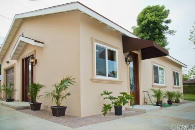
9519 Lower Azusa Rd
Temple City, CA 91780
2 Weeks Ago
Favorites
9519 Lower Azusa Rd

Favorites
Check Back Soon for Upcoming Availability
| Beds | Baths | Average SF |
|---|---|---|
| 2 Bedrooms 2 Bedrooms 2 Br | 2 Baths 2 Baths 2 Ba | 1,100 SF |
Fees and Policies
The fees below are based on community-supplied data and may exclude additional fees and utilities.
- Parking
-
Other--
Details
Utilities Included
-
Trash Removal
Lease Options
-
12 Months
About This Property
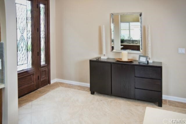
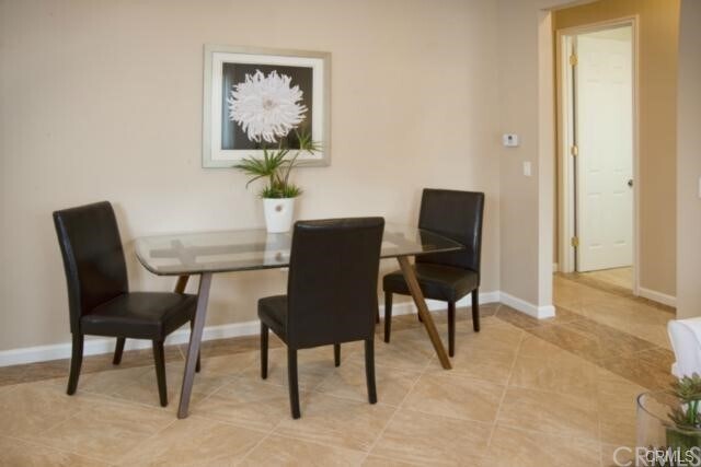
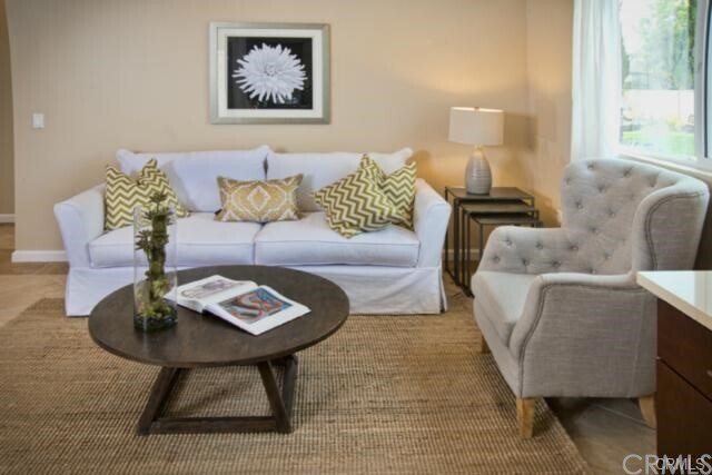
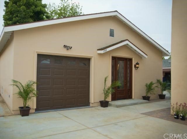
Beautiful Back house built in 2014 with height ceiling. Good size of the Room. Ready to move in. Close to grocery stores, Supermarket, restaurants, cafe, bank and Major Freeways 210, 10, 60.
9519 Lower Azusa Rd is a house located in Los Angeles County and the 91780 ZIP Code. This area is served by the Temple City Unified attendance zone.
House Features
- Air Conditioning
- Heating
Location
Get Directions
Temple City, located roughly 12 miles northeast of Downtown Los Angeles, provides a suburban setting just minutes from busy LA. With Angeles National Forest just minutes east, residents can go camping, hiking, horseback riding, and even off-roading. Some destinations near Temple City include Hermit Falls, the Mount Wilson Observatory, and Monrovia Canyon Park -- home to a 30-foot waterfall.
Temple City is famous for its Camellia Festival, held every year since 1944. The festival is held in February and attracts more than 20,000 visitors to the city. The three-day festival includes a parade, a carnival, and an art show. The city also hosts a farmer's market, a classic car show, and a summer concert series, held in the park. Temple City has a large shopping district along Las Tunas Drive and Rosemead Boulevard.
Learn more about living in Temple City
Amenities
- Air Conditioning
- Heating
Expenses
Utilities Included
Trash Removal
Included
Education
| Colleges & Universities | Distance | ||
|---|---|---|---|
| Colleges & Universities | Distance | ||
| Drive: | 13 min | 6.9 mi | |
| Drive: | 15 min | 7.0 mi | |
| Drive: | 14 min | 7.5 mi | |
| Drive: | 16 min | 7.6 mi |
9519 Lower Azusa Rd is within 13 minutes or 6.9 miles from Rio Hondo Community College. It is also near Caltech and Pasadena City College.
Schools


Public Elementary School
Grades K-6
382 Students
Nearby
Public Elementary School
Grades K-3
544 Students
Attendance Zone
Public Middle School
Grades 7-8
823 Students
Attendance Zone
Public High School
Grades 9-12
1,803 Students
Attendance Zone
Private Elementary, Middle & High School
Grades K-12
Nearby
Private Elementary & Middle School
Grades K-8
159 Students
Nearby
School data provided by
 The GreatSchools Rating helps parents compare schools within a state based on a variety of school quality indicators and provides a helpful picture of how effectively each school serves all of its students. Ratings are on a scale of 1 (below average) to 10 (above average) and can include test scores, college readiness, academic progress, advanced courses, equity, discipline and attendance data. We also advise parents to visit schools, consider other information on school performance and programs, and consider family needs as part of the school selection process.
View GreatSchools Rating Methodology
Data provided by GreatSchools.org © 2025. All rights reserved.
View GreatSchools Rating Methodology
Data provided by GreatSchools.org © 2025. All rights reserved.
Transportation options available in Temple City include Sierra Madre Villa Station, located 5.2 miles from 9519 Lower Azusa Rd. 9519 Lower Azusa Rd is near Bob Hope, located 25.5 miles or 35 minutes away, and Long Beach (Daugherty Field), located 28.2 miles or 38 minutes away.
| Transit / Subway | Distance | ||
|---|---|---|---|
| Transit / Subway | Distance | ||
|
|
Drive: | 9 min | 5.2 mi |
| Drive: | 10 min | 5.6 mi | |
| Drive: | 11 min | 5.7 mi | |
|
|
Drive: | 15 min | 7.2 mi |
|
|
Drive: | 13 min | 8.1 mi |
| Commuter Rail | Distance | ||
|---|---|---|---|
| Commuter Rail | Distance | ||
|
|
Drive: | 5 min | 2.2 mi |
|
|
Drive: | 13 min | 6.7 mi |
|
|
Drive: | 18 min | 9.6 mi |
|
|
Drive: | 20 min | 14.8 mi |
| Drive: | 19 min | 16.1 mi |
| Airports | Distance | ||
|---|---|---|---|
| Airports | Distance | ||
|
Bob Hope
|
Drive: | 35 min | 25.5 mi |
|
Long Beach (Daugherty Field)
|
Drive: | 38 min | 28.2 mi |
Time and distance from 9519 Lower Azusa Rd.
| Shopping Centers | Distance | ||
|---|---|---|---|
| Shopping Centers | Distance | ||
| Walk: | 2 min | 0.1 mi | |
| Walk: | 7 min | 0.4 mi | |
| Walk: | 18 min | 1.0 mi |
9519 Lower Azusa Rd has 3 shopping centers within 1.0 mile, which is about a 18-minute walk. The miles and minutes will be for the farthest away property.
| Parks and Recreation | Distance | ||
|---|---|---|---|
| Parks and Recreation | Distance | ||
|
Whittier Narrows Recreation Area
|
Drive: | 11 min | 4.1 mi |
|
Los Angeles County Arboretum
|
Drive: | 9 min | 4.6 mi |
|
Whittier Narrows Nature Center
|
Drive: | 11 min | 6.0 mi |
|
Chilao Visitor Center
|
Drive: | 11 min | 6.0 mi |
|
Huntington Botanical Gardens
|
Drive: | 14 min | 6.5 mi |
9519 Lower Azusa Rd has 5 parks within 6.5 miles, including Whittier Narrows Recreation Area, Los Angeles County Arboretum, and Chilao Visitor Center.
| Hospitals | Distance | ||
|---|---|---|---|
| Hospitals | Distance | ||
| Walk: | 17 min | 0.9 mi | |
| Drive: | 7 min | 3.5 mi | |
| Drive: | 7 min | 3.8 mi |
9519 Lower Azusa Rd has 3 hospitals within 3.8 miles, the nearest is BHC Alhambra Hospital which is 0.9 mile away and a 17 minute walk.
| Military Bases | Distance | ||
|---|---|---|---|
| Military Bases | Distance | ||
| Drive: | 38 min | 29.8 mi | |
| Drive: | 39 min | 30.2 mi |
9519 Lower Azusa Rd is 29.8 miles from Los Angeles Air Force Base, and is convenient to other military bases, including Los Alamitos Army Airfield.
You May Also Like
Similar Rentals Nearby


What Are Walk Score®, Transit Score®, and Bike Score® Ratings?
Walk Score® measures the walkability of any address. Transit Score® measures access to public transit. Bike Score® measures the bikeability of any address.
What is a Sound Score Rating?
A Sound Score Rating aggregates noise caused by vehicle traffic, airplane traffic and local sources
9519 Lower Azusa Rd
Temple City, CA 91780