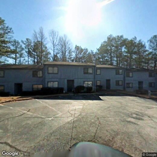
935 Pine Oak Trl
935 Pine Oak Trl
Austell, GA 30168
Favorites
935 Pine Oak Trl

Favorites
Check Back Soon for Upcoming Availability
935 Pine Oak Trl,
Austell,
GA
30168
Austell encompasses a relatively large part of Cobb County real estate just 17 miles west of Atlanta. You’ll find new residential developments comprised of affordable single-family homes and apartments in and around Sweetwater Creek and the locally owned businesses along U.S. Highway 78. There are three community parks in the center of Austell that add to the area’s park-like feel. Many residents commute into Atlanta and Marietta for work, and any commute is made easy thanks to the highways and nearby Perimeter (Interstate 285) that will connect you to the rest of Atlanta.
Learn more about living in Austell
Education
| Colleges & Universities | Distance | ||
|---|---|---|---|
| Colleges & Universities | Distance | ||
| Drive: | 11 min | 5.1 mi | |
| Drive: | 17 min | 11.0 mi | |
| Drive: | 17 min | 11.0 mi | |
| Drive: | 17 min | 11.3 mi |
935 Pine Oak Trl is within 11 minutes or 5.1 miles from Chatt. Tech, Austell. It is also near Morehouse College and Morehouse School of Medicine.
Transportation options available in Austell include Hamilton E Holmes, located 7.7 miles from 935 Pine Oak Trl. 935 Pine Oak Trl is near Hartsfield - Jackson Atlanta International, located 20.4 miles or 31 minutes away.
| Transit / Subway | Distance | ||
|---|---|---|---|
| Transit / Subway | Distance | ||
|
|
Drive: | 13 min | 7.7 mi |
|
|
Drive: | 13 min | 8.7 mi |
|
|
Drive: | 17 min | 10.4 mi |
|
|
Drive: | 16 min | 10.4 mi |
|
|
Drive: | 18 min | 12.2 mi |
| Commuter Rail | Distance | ||
|---|---|---|---|
| Commuter Rail | Distance | ||
|
|
Drive: | 25 min | 16.8 mi |
| Airports | Distance | ||
|---|---|---|---|
| Airports | Distance | ||
|
Hartsfield - Jackson Atlanta International
|
Drive: | 31 min | 20.4 mi |
Walkability Near 935 Pine Oak Trl Austell, GA 30168
Getting Around
 What do Walkability, Transit, Drivability, and Bikeability mean?
Walkability measures the walking distance to day-to-day needs.
Transit measures access to public transportation.
Drivability measures congestion, parking availability, and access to major roads.
Bikeability measures the suitability for cycling.
How It Works
What do Walkability, Transit, Drivability, and Bikeability mean?
Walkability measures the walking distance to day-to-day needs.
Transit measures access to public transportation.
Drivability measures congestion, parking availability, and access to major roads.
Bikeability measures the suitability for cycling.
How It Works
Somewhat Walkable
Walkability
30
/ 100
Limited Public Transit
Transit
30
/ 100
Exceptionally Drivable
Drivability
100
/ 100
Somewhat Bikeable
Bikeability
20
/ 100
Scores provided by
-
Soundscore™
-
/ 100
Traffic
-Airport
-Businesses
-Scores provided by
HowLoud What is a Sound Score Rating? A Sound Score Rating aggregates noise caused by vehicle traffic, airplane traffic and local sources. How It WorksTime and distance from 935 Pine Oak Trl.
| Shopping Centers | Distance | ||
|---|---|---|---|
| Shopping Centers | Distance | ||
| Drive: | 3 min | 1.2 mi | |
| Drive: | 5 min | 1.9 mi | |
| Drive: | 5 min | 2.1 mi |
935 Pine Oak Trl has 3 shopping centers within 2.1 miles, which is about a 5-minute drive. The miles and minutes will be for the farthest away property.
| Parks and Recreation | Distance | ||
|---|---|---|---|
| Parks and Recreation | Distance | ||
|
Sweetwater Creek State Park
|
Drive: | 13 min | 6.5 mi |
|
Silver Comet Trail
|
Drive: | 18 min | 8.4 mi |
|
Cascade Springs Nature Preserve
|
Drive: | 15 min | 9.8 mi |
|
West Atlanta Watershed Alliance (WAWA)
|
Drive: | 17 min | 10.4 mi |
|
Atlanta BeltLine Southwest Connector Spur Trail
|
Drive: | 20 min | 11.6 mi |
935 Pine Oak Trl has 5 parks within 11.6 miles, including Sweetwater Creek State Park, Silver Comet Trail, and Cascade Springs Nature Preserve.
| Hospitals | Distance | ||
|---|---|---|---|
| Hospitals | Distance | ||
| Drive: | 15 min | 7.9 mi | |
| Drive: | 19 min | 9.1 mi | |
| Drive: | 15 min | 10.8 mi |
935 Pine Oak Trl has 3 hospitals within 10.8 miles, the nearest is WellStar Cobb Hospital which is 7.9 miles away and a 15 minute drive.
| Military Bases | Distance | ||
|---|---|---|---|
| Military Bases | Distance | ||
| Drive: | 21 min | 13.2 mi | |
| Drive: | 29 min | 14.2 mi | |
| Drive: | 39 min | 23.7 mi |
935 Pine Oak Trl has 3 military bases within 23.7 miles, the nearest is Fort McPherson which is 13.2 miles away and a 21 minute drive.
You May Also Like
-
The Collection Bellwood Park
1071 Bolton Rd NW
Atlanta, GA 30331
$1,975 - $2,450
3 Br 4.9 mi
-
Springside Powder Springs Apartments & Townhomes
4484 Marietta St
Powder Springs, GA 30127
$1,443 - $2,915
1-2 Br 8.3 mi
-
Solis Dresden Village
1350 Dresden Dr
Brookhaven, GA 30319
$2,381 - $6,691 Total Monthly Price
1-4 Br 15.4 mi
Similar Rentals Nearby
-
-
1 Bed$1,468+2 Beds$2,178+3 Beds$2,441+Total Monthly PriceTotal Monthly Price NewPrices include base rent and required monthly fees of $125. Variable costs based on usage may apply.Base Rent:1 Bed$1,342+2 Beds$2,052+3 Beds$2,315+2 Months Free
Pets Allowed Pool In Unit Washer & Dryer Clubhouse Stainless Steel Appliances Granite Countertops Gated
-
1 Bed$1,409+2 Beds$1,639+3 Beds$2,264+Total Monthly PriceTotal Monthly Price NewPrices include required monthly fees of $143.Base Rent:1 Bed$1,265+2 Beds$1,495+3 Beds$2,120+Specials
Pets Allowed Fitness Center Pool Kitchen Walk-In Closets Clubhouse
-
1 Bed$2,051+2 Beds$2,353+Total Monthly PriceTotal Monthly Price NewPrices include base rent and required monthly fees of $4. Variable costs based on usage may apply.Base Rent:1 Bed$2,046+2 Beds$2,348+Specials
Pets Allowed Pool In Unit Washer & Dryer Walk-In Closets Maintenance on site Microwave Granite Countertops
-
-
-
-
1 Bed$1,703+2 Beds$1,978+3 Beds$2,493+Total Monthly PriceTotal Monthly Price NewPrices include base rent and required monthly fees of $108 - $111. Variable costs based on usage may apply.Base Rent:1 Bed$1,595+2 Beds$1,870+3 Beds$2,385
Pets Allowed Fitness Center Walk-In Closets Stainless Steel Appliances Controlled Access Hardwood Floors EV Charging
-
-


What Are Walk Score®, Transit Score®, and Bike Score® Ratings?
Walk Score® measures the walkability of any address. Transit Score® measures access to public transit. Bike Score® measures the bikeability of any address.
What is a Sound Score Rating?
A Sound Score Rating aggregates noise caused by vehicle traffic, airplane traffic and local sources.