
$2,800
/ Month
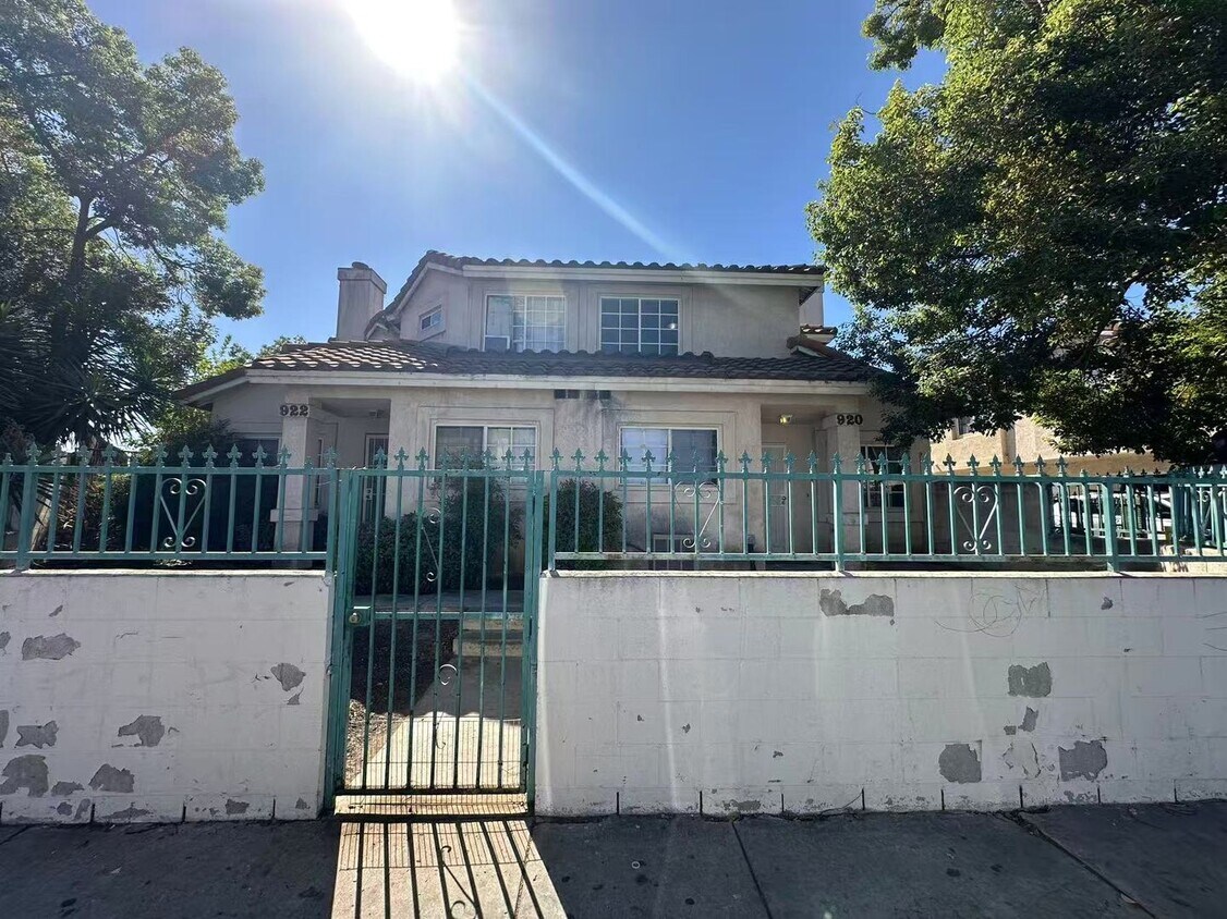
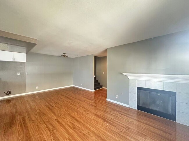
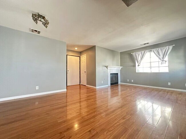
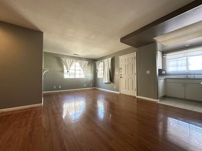
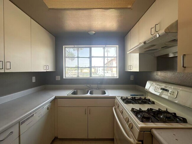
920 N Unruh Ave
La Puente, CA 91744
Today
Favorites
-
Bedrooms
3
-
Bathrooms
2.5
-
Square Feet
1,073 sq ft
920 N Unruh Ave

Favorites
Contact
- Listed by Ideal Property Management Inc | Ideal Property Management Inc
Location
Get Directions
Located 20 miles east of Downtown Los Angeles, Hacienda La Puente lie in Los Angeles County. Known simply to locals as “Hacienda,” the area is home to a vibrant culture. State Route 60 runs through an urban hub with a suburban feel in the San Gabriel Valley region. Hacienda stretches into the hills, drawing a culturally diverse demographic. The neighborhood parks have stunning panoramic views, and local grocery stores stock a wide range of foods. Affordable apartments in and around Hacienda and the Hacienda Heights area will put you just minutes from the heart of LA.
Learn more about living in Hacienda La Puente
Education
| Colleges & Universities | Distance | ||
|---|---|---|---|
| Colleges & Universities | Distance | ||
| Drive: | 12 min | 7.1 mi | |
| Drive: | 12 min | 7.4 mi | |
| Drive: | 17 min | 8.9 mi | |
| Drive: | 17 min | 9.1 mi |
920 N Unruh Ave is within 12 minutes or 7.4 miles from Rio Hondo Community College. It is also near Mt. San Antonio College and Whittier College.
Transportation options available in La Puente include Irwindale Station, located 7.2 miles from 920 N Unruh Ave. 920 N Unruh Ave is near Ontario International, located 23.1 miles or 31 minutes away, and Long Beach (Daugherty Field), located 26.3 miles or 36 minutes away.
| Transit / Subway | Distance | ||
|---|---|---|---|
| Transit / Subway | Distance | ||
| Drive: | 13 min | 7.2 mi | |
| Drive: | 14 min | 8.4 mi | |
| Drive: | 18 min | 9.5 mi | |
| Drive: | 17 min | 10.4 mi | |
| Drive: | 18 min | 10.7 mi |
| Commuter Rail | Distance | ||
|---|---|---|---|
| Commuter Rail | Distance | ||
|
|
Drive: | 9 min | 4.9 mi |
|
|
Drive: | 12 min | 6.5 mi |
|
|
Drive: | 11 min | 6.9 mi |
|
|
Drive: | 15 min | 7.9 mi |
|
|
Drive: | 20 min | 13.3 mi |
| Airports | Distance | ||
|---|---|---|---|
| Airports | Distance | ||
|
Ontario International
|
Drive: | 31 min | 23.1 mi |
|
Long Beach (Daugherty Field)
|
Drive: | 36 min | 26.3 mi |
Time and distance from 920 N Unruh Ave.
| Shopping Centers | Distance | ||
|---|---|---|---|
| Shopping Centers | Distance | ||
| Walk: | 7 min | 0.4 mi | |
| Walk: | 8 min | 0.5 mi | |
| Walk: | 9 min | 0.5 mi |
920 N Unruh Ave has 3 shopping centers within 0.5 mile, which is about a 9-minute walk. The miles and minutes will be for the farthest away property.
| Parks and Recreation | Distance | ||
|---|---|---|---|
| Parks and Recreation | Distance | ||
|
Galster Wilderness Park Nature Center
|
Drive: | 8 min | 4.3 mi |
|
Covina Park
|
Drive: | 10 min | 5.8 mi |
|
Schabarum Regional Park
|
Drive: | 13 min | 6.3 mi |
|
Whittier Narrows Nature Center
|
Drive: | 11 min | 6.9 mi |
|
Santa Fe Dam Nature Center
|
Drive: | 20 min | 8.0 mi |
920 N Unruh Ave has 5 parks within 8.0 miles, including Galster Wilderness Park Nature Center, Covina Park, and Schabarum Regional Park.
| Hospitals | Distance | ||
|---|---|---|---|
| Hospitals | Distance | ||
| Drive: | 5 min | 2.9 mi | |
| Drive: | 5 min | 3.2 mi | |
| Drive: | 11 min | 6.0 mi |
920 N Unruh Ave has 3 hospitals within 6.0 miles, the nearest is Kaiser Foundation Hospital - Baldwin Park which is 2.9 miles away and a 5 minute drive.
| Military Bases | Distance | ||
|---|---|---|---|
| Military Bases | Distance | ||
| Drive: | 36 min | 20.2 mi |
920 N Unruh Ave is 20.2 miles and a 36 minute drive from Los Alamitos Army Airfield.
You May Also Like
Similar Rentals Nearby


What Are Walk Score®, Transit Score®, and Bike Score® Ratings?
Walk Score® measures the walkability of any address. Transit Score® measures access to public transit. Bike Score® measures the bikeability of any address.
What is a Sound Score Rating?
A Sound Score Rating aggregates noise caused by vehicle traffic, airplane traffic and local sources

920 N Unruh Ave
La Puente, CA 91744