
$1,310 / Month
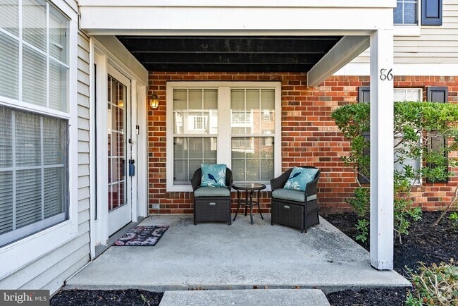
90-92 High St
Mount Holly, NJ 08060
2 Weeks Ago
Favorites
90-92 High St

Favorites
Check Back Soon for Upcoming Availability
| Beds | Baths | Average SF |
|---|---|---|
| 2 Bedrooms 2 Bedrooms 2 Br | 1 Bath 1 Bath 1 Ba | — |
About This Property
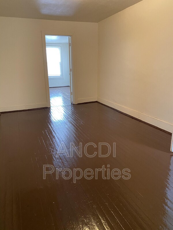
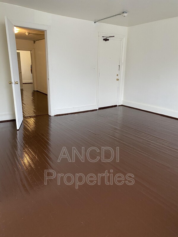
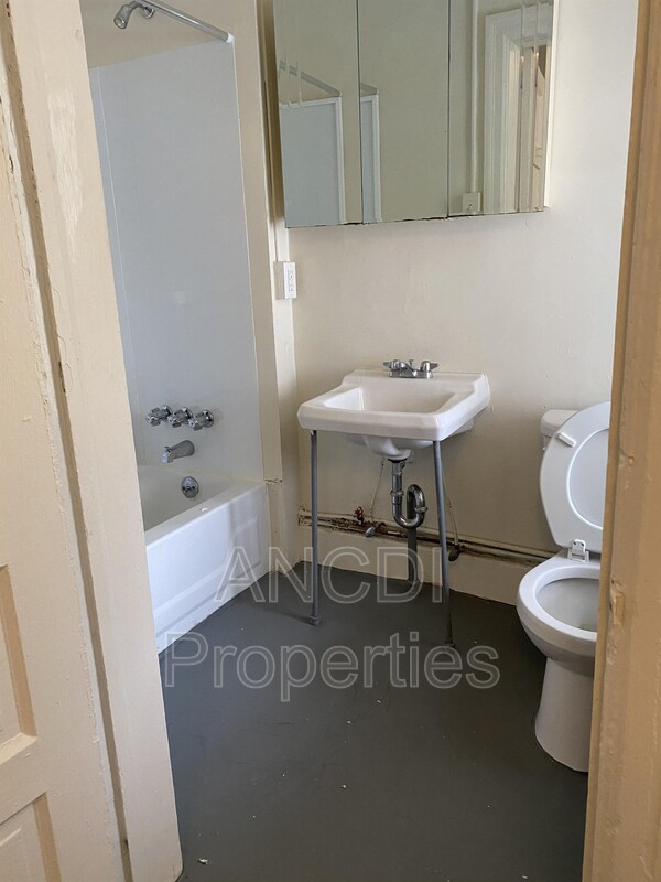
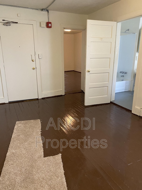
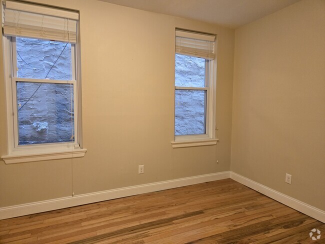
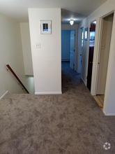
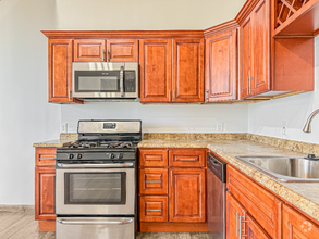
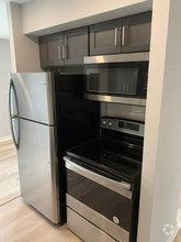
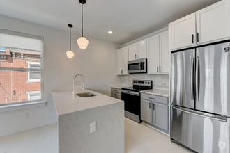
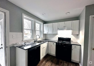
2 bedroom, 1 bathroom third floor unit in desirable section of Mount Holly. Within walking distance to bus stops, many restaurants and shops! Hardwood floors throughout. Large windows for lots of natural light! 2nd bedroom has option for private entrance. Gas range, baseboard heat. Tenant pays gas heat and electric. Landlord pays water and sewer. Off street parking available behind the building - watch for signs to ensure permitted parking! 1.5 month security deposit required.
90-92 High St is a condo located in Burlington County and the 08060 ZIP Code. This area is served by the Mount Holly Township Public attendance zone.
Location
Get Directions
Education
| Colleges & Universities | Distance | ||
|---|---|---|---|
| Colleges & Universities | Distance | ||
| Drive: | 12 min | 6.7 mi | |
| Drive: | 16 min | 9.2 mi | |
| Drive: | 29 min | 16.0 mi | |
| Drive: | 32 min | 17.6 mi |
90-92 High St is within 12 minutes or 6.7 miles from Burlington Co., Mount Laurel. It is also near Burlington Co. Coll Pemberton and Holy Family University.
Schools


Public Elementary & Middle School
Grades 5-8
449 Students
Attendance Zone
Public Elementary School
Grades 2-4
332 Students
Attendance Zone
Public Elementary School
Grades PK-1
330 Students
Attendance Zone
Public High School
Grades 9-12
1,981 Students
Attendance Zone
Private Elementary, Middle & High School
Grades 1-12
16 Students
Nearby
Private Elementary & Middle School
Grades PK-8
165 Students
Nearby
School data provided by
 The GreatSchools Rating helps parents compare schools within a state based on a variety of school quality indicators and provides a helpful picture of how effectively each school serves all of its students. Ratings are on a scale of 1 (below average) to 10 (above average) and can include test scores, college readiness, academic progress, advanced courses, equity, discipline and attendance data. We also advise parents to visit schools, consider other information on school performance and programs, and consider family needs as part of the school selection process.
View GreatSchools Rating Methodology
View GreatSchools Rating Methodology
Transportation options available in Mount Holly include Burlington Towne Center, located 6.9 miles from 90-92 High St. 90-92 High St is near Trenton Mercer, located 26.0 miles or 40 minutes away, and Philadelphia International, located 30.0 miles or 46 minutes away.
| Transit / Subway | Distance | ||
|---|---|---|---|
| Transit / Subway | Distance | ||
|
|
Drive: | 11 min | 6.9 mi |
|
|
Drive: | 13 min | 7.7 mi |
|
|
Drive: | 16 min | 9.8 mi |
|
|
Drive: | 16 min | 9.9 mi |
|
|
Drive: | 19 min | 12.4 mi |
| Commuter Rail | Distance | ||
|---|---|---|---|
| Commuter Rail | Distance | ||
|
|
Drive: | 19 min | 10.3 mi |
|
|
Drive: | 19 min | 10.8 mi |
|
|
Drive: | 22 min | 12.6 mi |
|
|
Drive: | 24 min | 13.2 mi |
|
|
Drive: | 25 min | 13.7 mi |
| Airports | Distance | ||
|---|---|---|---|
| Airports | Distance | ||
|
Trenton Mercer
|
Drive: | 40 min | 26.0 mi |
|
Philadelphia International
|
Drive: | 46 min | 30.0 mi |
Time and distance from 90-92 High St.
| Shopping Centers | Distance | ||
|---|---|---|---|
| Shopping Centers | Distance | ||
| Walk: | 17 min | 0.9 mi | |
| Walk: | 18 min | 0.9 mi | |
| Drive: | 3 min | 1.1 mi |
90-92 High St has 3 shopping centers within 1.1 miles, which is about a 3-minute walk. The miles and minutes will be for the farthest away property.
| Parks and Recreation | Distance | ||
|---|---|---|---|
| Parks and Recreation | Distance | ||
|
Rancocas Nature Center
|
Drive: | 4 min | 2.0 mi |
|
Historic Smithville Park
|
Drive: | 5 min | 2.2 mi |
|
Rancocas State Park
|
Drive: | 8 min | 3.4 mi |
|
Paws Farm Nature Center
|
Drive: | 9 min | 5.8 mi |
|
Johnson's Corner Farm
|
Drive: | 12 min | 7.5 mi |
90-92 High St has 5 parks within 7.5 miles, including Rancocas Nature Center, Historic Smithville Park, and Rancocas State Park.
| Hospitals | Distance | ||
|---|---|---|---|
| Hospitals | Distance | ||
| Walk: | 16 min | 0.9 mi | |
| Drive: | 6 min | 3.7 mi | |
| Drive: | 15 min | 7.2 mi |
90-92 High St has 3 hospitals within 7.2 miles, the nearest is Virtua Memorial Hospital of Burlington County which is 0.9 mile away and a 16 minute walk.
| Military Bases | Distance | ||
|---|---|---|---|
| Military Bases | Distance | ||
| Drive: | 21 min | 11.6 mi | |
| Drive: | 32 min | 16.1 mi |
90-92 High St is 11.6 miles from McGuire Air Force Base, and is convenient to other military bases, including Fort Dix Military Reservation New Hanover.
You May Also Like
Similar Rentals Nearby
-
-
-
-
-
-
 $1,3952 Beds, 1 Bath, 894 sq ftApartment for Rent
 -
 $1,3952 Beds, 2 Baths, 1,350 sq ftApartment for Rent
 -
 $1,4002 Beds, 2 Baths, 900 sq ftApartment for Rent
 -
 $2,1232 Beds, 2 Baths, 995 sq ftApartment for Rent
 -
 $2,2003 Beds, 1 Bath, 950 sq ftApartment for Rent
What Are Walk Score®, Transit Score®, and Bike Score® Ratings?
Walk Score® measures the walkability of any address. Transit Score® measures access to public transit. Bike Score® measures the bikeability of any address.
What is a Sound Score Rating?
A Sound Score Rating aggregates noise caused by vehicle traffic, airplane traffic and local sources
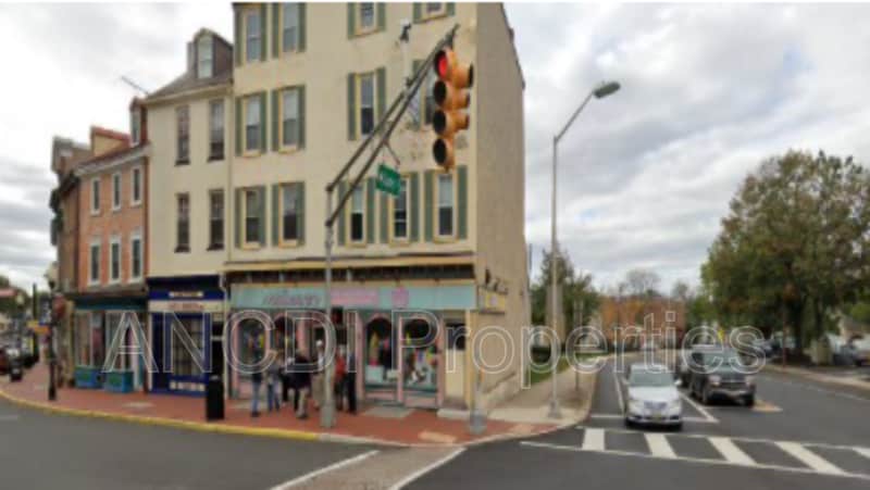
90-92 High St
Mount Holly, NJ 08060