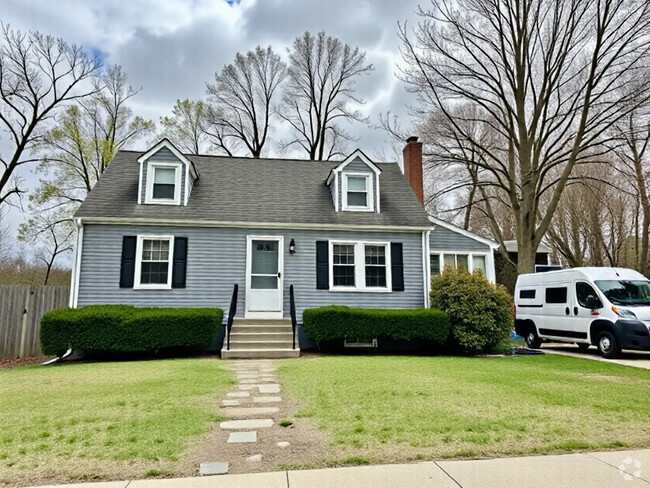
$3,250 / Month
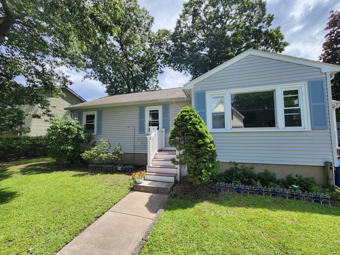
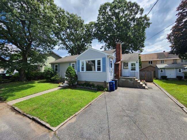
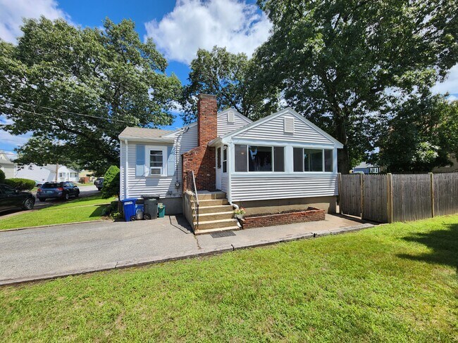
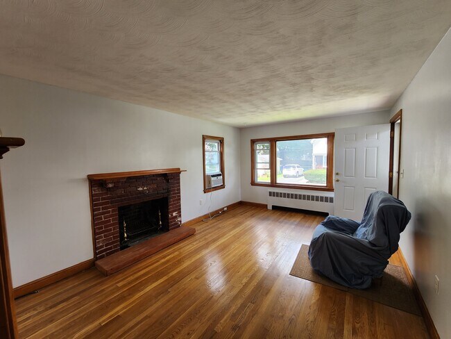
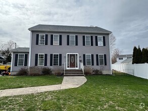
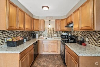
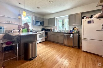
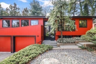
9 Gregg St
Woburn, MA 01801
2 Weeks Ago
Favorites
9 Gregg St

Favorites
Check Back Soon for Upcoming Availability
| Beds | Baths | Average SF |
|---|---|---|
| 3 Bedrooms 3 Bedrooms 3 Br | 1 Bath 1 Bath 1 Ba | 1,344 SF |
Fees and Policies
The fees below are based on community-supplied data and may exclude additional fees and utilities.
- Dogs Allowed
-
Fees not specified
- Cats Allowed
-
Fees not specified
- Parking
-
Other--
Details
Utilities Included
-
Trash Removal
-
Sewer
9 Gregg St is a house located in Middlesex County and the 01801 ZIP Code.
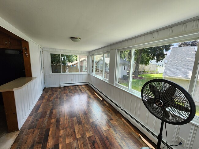
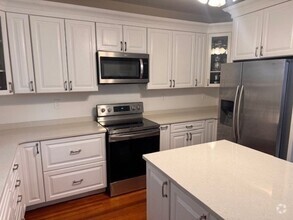
House Features
- Washer/Dryer
- Storage Space
- Tub/Shower
Location
Get Directions
Walnut Hill is a small neighborhood conveniently located along Interstate 93 about 10 miles north of Boston. This area consists of residential neighborhoods and commercial spaces. Renters have the choice between a few modern apartments located throughout town. The northern section of town, closest to the Interstate 93 and 95 junction, is filled with businesses, plazas, and a variety of dining options. The southern section of town features many residential areas and scenic parks like Cranberry Bog Conservation Area. Immediately south of town, residents have more choices for outdoor recreation at the large green spaces and trails surrounding the North and Middle Reservoirs.
Learn more about living in Walnut HillBelow are rent ranges for similar nearby apartments
Amenities
- Washer/Dryer
- Storage Space
- Tub/Shower
Expenses
Utilities Included
Trash Removal, Sewer
Included
Education
| Colleges & Universities | Distance | ||
|---|---|---|---|
| Colleges & Universities | Distance | ||
| Drive: | 11 min | 6.7 mi | |
| Drive: | 14 min | 8.5 mi | |
| Drive: | 15 min | 8.9 mi | |
| Drive: | 16 min | 9.6 mi |
9 Gregg St is within 11 minutes or 6.7 miles from Tufts Univ., Medford. It is also near Lesley University, Porter and Lesley University.
Transportation options available in Woburn include Oak Grove Station, located 5.2 miles from 9 Gregg St. 9 Gregg St is near General Edward Lawrence Logan International, located 13.0 miles or 21 minutes away, and Manchester Boston Regional, located 42.3 miles or 59 minutes away.
| Transit / Subway | Distance | ||
|---|---|---|---|
| Transit / Subway | Distance | ||
|
|
Drive: | 10 min | 5.2 mi |
|
|
Drive: | 10 min | 6.5 mi |
| Drive: | 11 min | 6.7 mi | |
| Drive: | 11 min | 7.2 mi | |
|
|
Drive: | 12 min | 7.7 mi |
| Commuter Rail | Distance | ||
|---|---|---|---|
| Commuter Rail | Distance | ||
|
|
Drive: | 7 min | 3.0 mi |
|
|
Drive: | 7 min | 3.1 mi |
|
|
Drive: | 8 min | 3.4 mi |
|
|
Drive: | 9 min | 3.7 mi |
|
|
Drive: | 8 min | 3.9 mi |
| Airports | Distance | ||
|---|---|---|---|
| Airports | Distance | ||
|
General Edward Lawrence Logan International
|
Drive: | 21 min | 13.0 mi |
|
Manchester Boston Regional
|
Drive: | 59 min | 42.3 mi |
Time and distance from 9 Gregg St.
| Shopping Centers | Distance | ||
|---|---|---|---|
| Shopping Centers | Distance | ||
| Drive: | 3 min | 1.4 mi | |
| Drive: | 4 min | 1.8 mi | |
| Drive: | 5 min | 2.1 mi |
9 Gregg St has 3 shopping centers within 2.1 miles, which is about a 5-minute drive. The miles and minutes will be for the farthest away property.
| Parks and Recreation | Distance | ||
|---|---|---|---|
| Parks and Recreation | Distance | ||
|
Walter D. Stone Memorial Zoo
|
Drive: | 6 min | 2.9 mi |
|
Middlesex Fells Reservation
|
Drive: | 7 min | 3.3 mi |
|
Friends of Middlesex Fells Reservation
|
Drive: | 11 min | 4.5 mi |
|
Breakheart Reservation
|
Drive: | 16 min | 6.2 mi |
|
Mystic River Reservation
|
Drive: | 10 min | 7.0 mi |
9 Gregg St has 5 parks within 7.0 miles, including Walter D. Stone Memorial Zoo, Middlesex Fells Reservation, and Friends of Middlesex Fells Reservation.
| Hospitals | Distance | ||
|---|---|---|---|
| Hospitals | Distance | ||
| Drive: | 5 min | 2.0 mi | |
| Drive: | 10 min | 4.6 mi | |
| Drive: | 11 min | 5.4 mi |
9 Gregg St has 3 hospitals within 5.4 miles, the nearest is Winchester Hospital which is 2.0 miles away and a 5 minute drive.
| Military Bases | Distance | ||
|---|---|---|---|
| Military Bases | Distance | ||
| Drive: | 18 min | 9.7 mi | |
| Drive: | 31 min | 17.6 mi |
9 Gregg St is 9.7 miles from Hanscom Air Force Base, and is convenient to other military bases, including Fort Pickering.
You May Also Like
Similar Rentals Nearby
What Are Walk Score®, Transit Score®, and Bike Score® Ratings?
Walk Score® measures the walkability of any address. Transit Score® measures access to public transit. Bike Score® measures the bikeability of any address.
What is a Sound Score Rating?
A Sound Score Rating aggregates noise caused by vehicle traffic, airplane traffic and local sources

9 Gregg St
Woburn, MA 01801