

$4,200
/ Month
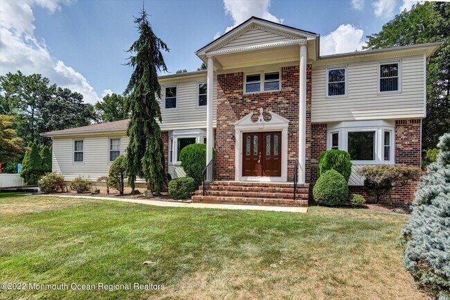
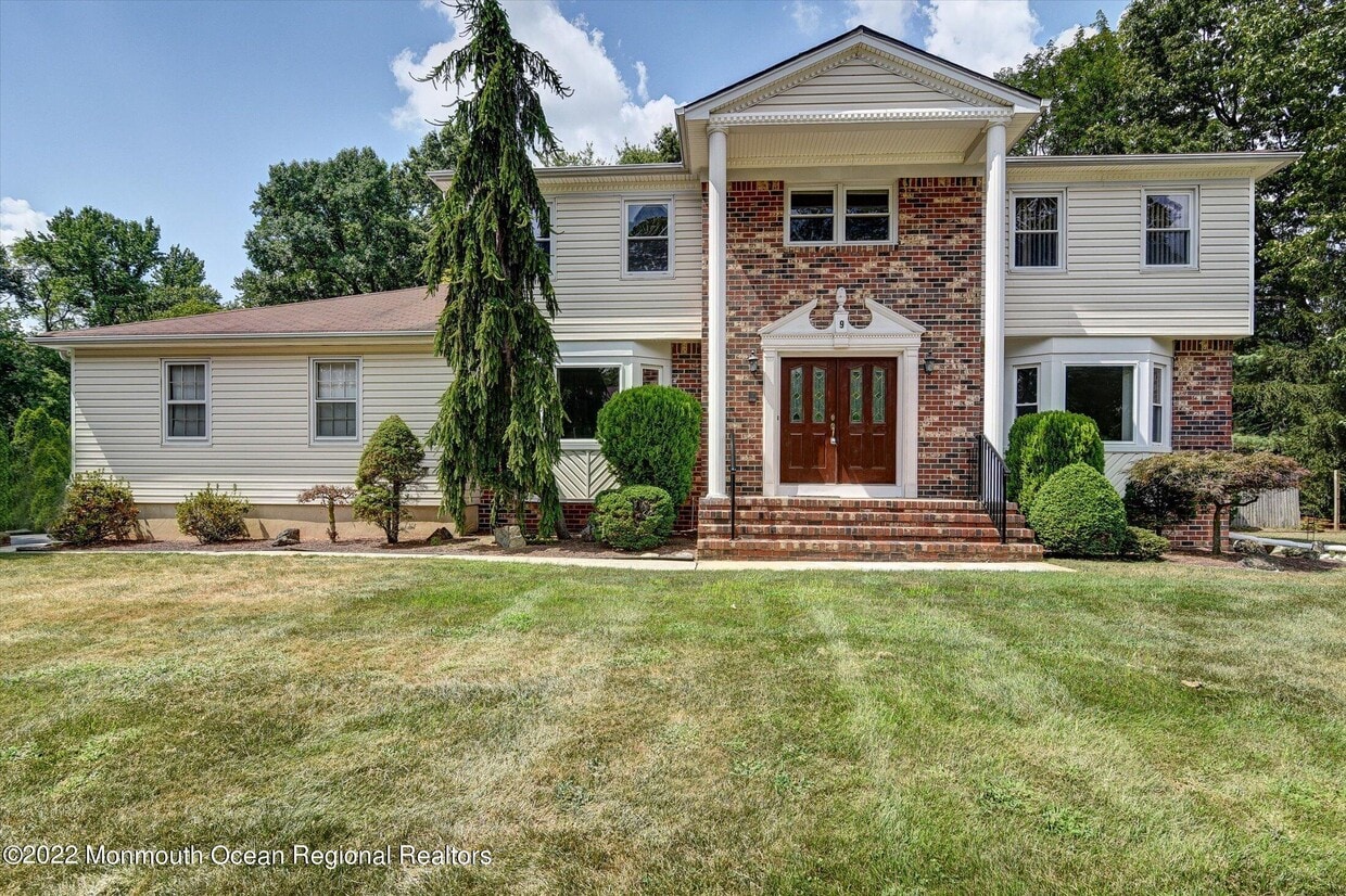
9 Adams St
Marlboro, NJ 07751
Favorites
9 Adams St

Favorites
Check Back Soon for Upcoming Availability
| Beds | Baths | Average SF |
|---|---|---|
| 5 Bedrooms 5 Bedrooms 5 Br | 3 Baths 3 Baths 3 Ba | 3,156 SF |
Fees and Policies
The fees listed below are community-provided and may exclude utilities or add-ons. All payments are made directly to the property and are non-refundable unless otherwise specified.
- Parking
-
Garage--
Details
Lease Options
-
12 Months
About This Property
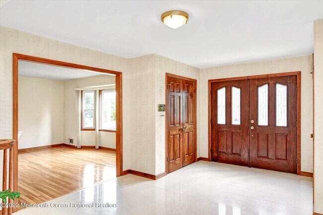
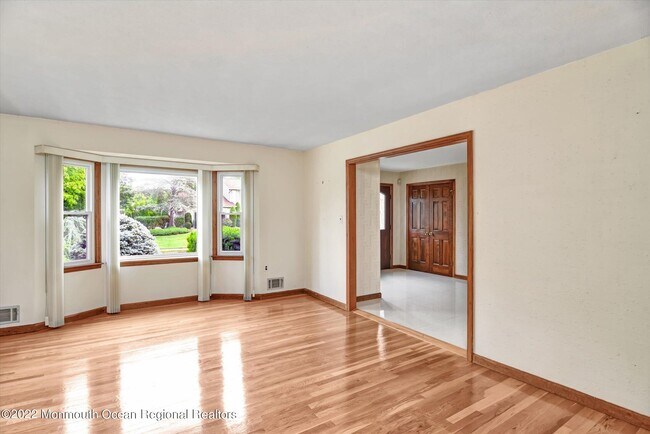
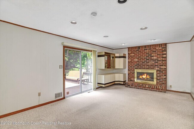
Located in the renowned Marlboro K-8 School District, Freehold Regional High School District & Monmouth County Vocational High School District. Spacious 5 bedrooms 3 full baths home in a desirable Triangle oaks in Morganville. One of the bedrooms is on the main level. East facing home with plenty of sunlight. Hardwood floors under all carpets. 2 side-entry garages. Close to NY buses, Costco, Whole Foods, Walmart, and restaurants. Don't miss it!
9 Adams St is a house located in Monmouth County and the 07751 ZIP Code. This area is served by the Marlboro Township Board Of Education School District attendance zone.
House Features
- Basement
9 Adams St,
Marlboro,
NJ
07751
The city of Marlboro is an upscale suburb of New Jersey home to top-notch public schools, sprawling community parks, and picturesque neighborhoods. Marlboro Elementary School is one of the few outstanding schools in town, and you’ll find families frequenting the Marlboro Recreation Center and Big Brook Park, featuring a scenic stream, wildlife watching opportunities, walking trails, and even archeological areas with fossils and artifacts.
Marlboro is also home to the Bella Vista Country Club and excellent local restaurants like Cuzin’s Seafood Clam Bar and Crown Palace. This welcoming community is only a few miles off Raritan Bay and the Keansburg Amusement Park. Getting to New York City from Marlboro is a breeze, seeing as its only 40 miles from town. The walkable neighborhoods, tree-lined streets, and stately homes keep families interested in this upscale New Jersey suburb.
Learn more about living in Marlboro
Amenities
- Basement
Education
| Colleges & Universities | Distance | ||
|---|---|---|---|
| Colleges & Universities | Distance | ||
| Drive: | 15 min | 8.0 mi | |
| Drive: | 16 min | 8.7 mi | |
| Drive: | 21 min | 11.9 mi | |
| Drive: | 27 min | 17.4 mi |
9 Adams St is within 15 minutes or 8.0 miles from Brookdale C.C., Freehold. It is also near Brookdale C.C., Lincroft and Brookdale C.C., Hazlet Campus.
Schools


Public Elementary School
Grades PK-5
353 Students
Nearby
Public Elementary & Middle School
Grades K-8
580 Students
Nearby
Public Elementary School
Grades K-5
493 Students
Attendance Zone
Public Middle School
Grades 6-8
1,004 Students
Attendance Zone
Public High School
Grades 9-12
1,816 Students
Attendance Zone
Private Elementary, Middle & High School
Grades K-12
146 Students
Nearby
Private Elementary & Middle School
Grades PK-8
134 Students
Nearby
School data provided by
 The GreatSchools Rating helps parents compare schools within a state based on a variety of school quality indicators and provides a helpful picture of how effectively each school serves all of its students. Ratings are on a scale of 1 (below average) to 10 (above average) and can include test scores, college readiness, academic progress, advanced courses, equity, discipline and attendance data. We also advise parents to visit schools, consider other information on school performance and programs, and consider family needs as part of the school selection process.
View GreatSchools Rating Methodology
Data provided by GreatSchools.org © 2026. All rights reserved.
View GreatSchools Rating Methodology
Data provided by GreatSchools.org © 2026. All rights reserved.
Walkability Near 9 Adams St Marlboro, NJ 07751
Getting Around
 What do Walkability, Transit, Drivability, and Bikeability mean?
Walkability measures the walking distance to day-to-day needs.
Transit measures access to public transportation.
Drivability measures congestion, parking availability, and access to major roads.
Bikeability measures the suitability for cycling.
How It Works
What do Walkability, Transit, Drivability, and Bikeability mean?
Walkability measures the walking distance to day-to-day needs.
Transit measures access to public transportation.
Drivability measures congestion, parking availability, and access to major roads.
Bikeability measures the suitability for cycling.
How It Works
Somewhat Walkable
Walkability
30
/ 100
Minimal Public Transit
Transit
0
/ 100
Exceptionally Drivable
Drivability
100
/ 100
Fairly Bikeable
Bikeability
40
/ 100
Scores provided by
-
Soundscore™
-
/ 100
Traffic
-Airport
-Businesses
-Scores provided by
HowLoud What is a Sound Score Rating? A Sound Score Rating aggregates noise caused by vehicle traffic, airplane traffic and local sources. How It WorksYou May Also Like
How do I access Social Services in New Jersey?
Statewide service is free, confidential, multilingual and always open. Three easy ways to reach Social Services in NJ: Dial 2-1-1; text your zip code to 898-211; or chat at https://www.nj211.org
Similar Rentals Nearby
-
-
 4 Beds, 2 Baths, 1,612 sq ft$4,500Total Monthly PriceTotal Monthly Price NewPrices include all required monthly fees.88 Dutch Lane Rd
 -
 5 Beds, 3 Baths, 2,478 sq ft$4,800Total Monthly PriceTotal Monthly Price NewPrices include all required monthly fees.12 Mershon Ln
 -
 4 Beds, 2 Baths, 1,440 sq ft$3,800Total Monthly PriceTotal Monthly Price NewPrices include all required monthly fees.869 Gates Ave
 -
 4 Beds, 3 Baths, 2,152 sq ft$25,000Total Monthly PriceTotal Monthly Price NewPrices include all required monthly fees.417 15th Ave
 -
 5 Beds, 3 Baths$7,000Total Monthly PriceTotal Monthly Price NewPrices include all required monthly fees.124 2nd Ave
 -
 4 Beds, 3 Baths, 1,786 sq ft$6,500Total Monthly PriceTotal Monthly Price NewPrices include all required monthly fees.229 1st Ave
 -
 4 Beds, 2 Baths, 2,220 sq ft$5,000Total Monthly PriceTotal Monthly Price NewPrices include all required monthly fees.101 St Louis Ave
 -
 6 Beds, 3 Baths, 1,965 sq ft$5,000Total Monthly PriceTotal Monthly Price NewPrices include all required monthly fees.319 Arnold Ave
 -
 4 Beds, 2 Baths, 1,724 sq ft$5,000Total Monthly PriceTotal Monthly Price NewPrices include all required monthly fees.305 Baltimore Ave
What Are Walk Score®, Transit Score®, and Bike Score® Ratings?
Walk Score® measures the walkability of any address. Transit Score® measures access to public transit. Bike Score® measures the bikeability of any address.
What is a Sound Score Rating?
A Sound Score Rating aggregates noise caused by vehicle traffic, airplane traffic and local sources.
9 Adams St
Marlboro, NJ 07751