

$2,800
/ Month
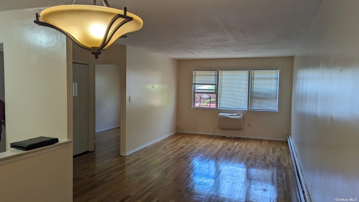
89-35 Pontiac St
Queens, NY 11427
Favorites
89-35 Pontiac St

Favorites
Check Back Soon for Upcoming Availability
| Beds | Baths | Average SF |
|---|---|---|
| 3 Bedrooms 3 Bedrooms 3 Br | 1.5 Baths 1.5 Baths 1.5 Ba | — |
About This Property
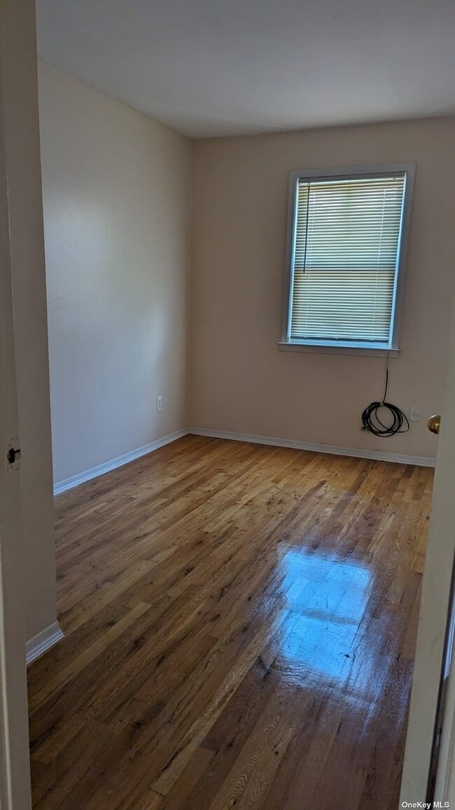
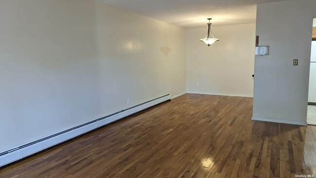
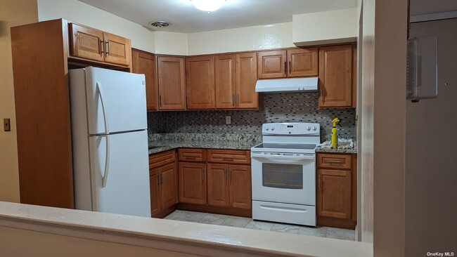
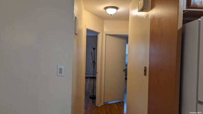
Lovely and Spacious Apartment featuring three bedrooms,Formal Dining Room,Eat in Kitchen,One and half bath. Close to Hillside or Jamaica Avenue,Shops,schools,Parks,Cross Island Parkway,Grand Central Parkway,Public Transportation,Long Island Rail Road. Tenants pay gas (cooking only) and electric. Based on information submitted to the MLS GRID as of [see last changed date above]. All data is obtained from various sources and may not have been verified by broker or MLS GRID. Supplied Open House Information is subject to change without notice. All information should be independently reviewed and verified for accuracy. Properties may or may not be listed by the office/agent presenting the information. Some IDX listings have been excluded from this website. Prices displayed on all Sold listings are the Last Known Listing Price and may not be the actual selling price.
89-35 Pontiac St is a house located in Queens County and the 11427 ZIP Code. This area is served by the New York City Geographic District #26 attendance zone.
89-35 Pontiac St,
Queens,
NY
11427
Live like royalty in the borough that has some of the best cuisine, entertainment, and attractions in the city. Queens is a sprawling New York City borough, covering 109 square miles — the most land of all the city’s boroughs.
If you’re looking for a borough where you can get a little more bang for your buck, Queens has a much lower cost of living compared to Manhattan — by more than 56 percent. Groceries, entertainment, and even transportation costs are lower in Queens, making it an attractive borough for those who want to enjoy everything New York City has to offer, but at a lower price tag.
Like most of NYC, getting around Queens is a breeze. There are more than 80 rail stations, and the borough is extremely walkable and bike-friendly. It’s also home to John F. Kennedy International Airport and LaGuardia Airport. For those with cars, Queens provides easy access to I-678, I-495, and I-295.
When you live in Queens, you aren’t in a concrete jungle.
Learn more about living in QueensBelow are rent ranges for similar nearby apartments
| Beds | Average Size | Lowest | Typical | Premium |
|---|---|---|---|---|
| Studio Studio Studio | 496 Sq Ft | $1,779 | $2,218 | $2,709 |
| 1 Bed 1 Bed 1 Bed | 667 Sq Ft | $1,917 | $2,798 | $4,535 |
| 2 Beds 2 Beds 2 Beds | 1102 Sq Ft | $1,595 | $3,565 | $9,384 |
| 3 Beds 3 Beds 3 Beds | 1651 Sq Ft | $2,025 | $3,511 | $4,995 |
| 4 Beds 4 Beds 4 Beds | 1052 Sq Ft | $1,040 | $6,067 | $29,625 |
Education
| Colleges & Universities | Distance | ||
|---|---|---|---|
| Colleges & Universities | Distance | ||
| Drive: | 5 min | 2.7 mi | |
| Drive: | 8 min | 3.9 mi | |
| Drive: | 9 min | 4.6 mi | |
| Drive: | 12 min | 5.4 mi |
89-35 Pontiac St is within 5 minutes or 2.7 miles from Queensborough Comm. Coll.. It is also near St. John's University and York College.
Schools


Public Elementary School
Grades PK-5
431 Students
Nearby
Public Elementary School
Grades PK-5
737 Students
Attendance Zone
Public Middle School
Grades 6-8
895 Students
Attendance Zone
Public High School
Grades 9-12
603 Students
Nearby
Private Elementary, Middle & High School
Grades K-12
47 Students
Nearby
Private Elementary & Middle School
Grades PK-8
235 Students
Nearby
School data provided by
 The GreatSchools Rating helps parents compare schools within a state based on a variety of school quality indicators and provides a helpful picture of how effectively each school serves all of its students. Ratings are on a scale of 1 (below average) to 10 (above average) and can include test scores, college readiness, academic progress, advanced courses, equity, discipline and attendance data. We also advise parents to visit schools, consider other information on school performance and programs, and consider family needs as part of the school selection process.
View GreatSchools Rating Methodology
Data provided by GreatSchools.org © 2026. All rights reserved.
View GreatSchools Rating Methodology
Data provided by GreatSchools.org © 2026. All rights reserved.
Transportation options available in Queens include Jamaica-179 Street, located 3.0 miles from 89-35 Pontiac St. 89-35 Pontiac St is near John F Kennedy International, located 9.9 miles or 17 minutes away, and LaGuardia, located 10.3 miles or 17 minutes away.
| Transit / Subway | Distance | ||
|---|---|---|---|
| Transit / Subway | Distance | ||
|
|
Drive: | 5 min | 3.0 mi |
|
|
Drive: | 6 min | 3.5 mi |
|
|
Drive: | 7 min | 4.1 mi |
|
|
Drive: | 8 min | 4.5 mi |
|
|
Drive: | 9 min | 4.5 mi |
| Commuter Rail | Distance | ||
|---|---|---|---|
| Commuter Rail | Distance | ||
|
|
Drive: | 2 min | 1.1 mi |
|
|
Drive: | 4 min | 1.9 mi |
|
|
Drive: | 6 min | 2.3 mi |
|
|
Drive: | 6 min | 2.7 mi |
|
|
Drive: | 6 min | 2.9 mi |
| Airports | Distance | ||
|---|---|---|---|
| Airports | Distance | ||
|
John F Kennedy International
|
Drive: | 17 min | 9.9 mi |
|
LaGuardia
|
Drive: | 17 min | 10.3 mi |
Walkability Near 89-35 Pontiac St Queens, NY 11427
Getting Around
 What do Walkability, Transit, Drivability, and Bikeability mean?
Walkability measures the walking distance to day-to-day needs.
Transit measures access to public transportation.
Drivability measures congestion, parking availability, and access to major roads.
Bikeability measures the suitability for cycling.
How It Works
What do Walkability, Transit, Drivability, and Bikeability mean?
Walkability measures the walking distance to day-to-day needs.
Transit measures access to public transportation.
Drivability measures congestion, parking availability, and access to major roads.
Bikeability measures the suitability for cycling.
How It Works
Moderately Walkable
Walkability
70
/ 100
Strong Public Transit
Transit
80
/ 100
Fairly Drivable
Drivability
50
/ 100
Moderately Bikeable
Bikeability
60
/ 100
Scores provided by
Active
Soundscore™
72
/ 100
Traffic
BusyAirport
CalmBusinesses
ActiveScores provided by
HowLoud What is a Sound Score Rating? A Sound Score Rating aggregates noise caused by vehicle traffic, airplane traffic and local sources. How It WorksTime and distance from 89-35 Pontiac St.
| Shopping Centers | Distance | ||
|---|---|---|---|
| Shopping Centers | Distance | ||
| Drive: | 2 min | 1.1 mi | |
| Drive: | 3 min | 1.4 mi |
89-35 Pontiac St has 2 shopping centers within 1.4 miles, which is about a 3-minute drive. The miles and minutes will be for the farthest away property.
| Parks and Recreation | Distance | ||
|---|---|---|---|
| Parks and Recreation | Distance | ||
|
Queens County Farm Museum
|
Drive: | 4 min | 1.9 mi |
|
Alley Pond Park
|
Drive: | 4 min | 2.5 mi |
|
Cunningham Park
|
Drive: | 5 min | 2.8 mi |
|
Alley Pond Environmental Center
|
Drive: | 6 min | 3.9 mi |
|
Detective Keith L. Williams Park
|
Drive: | 9 min | 4.2 mi |
89-35 Pontiac St has 5 parks within 4.2 miles, including Alley Pond Park, Queens County Farm Museum, and Cunningham Park.
| Hospitals | Distance | ||
|---|---|---|---|
| Hospitals | Distance | ||
| Walk: | 22 min | 1.2 mi | |
| Drive: | 7 min | 4.2 mi | |
| Drive: | 9 min | 5.1 mi |
89-35 Pontiac St has 3 hospitals within 5.1 miles, the nearest is Creedmoor Psychiatric Center which is 1.2 miles away and a 22 minute walk.
| Military Bases | Distance | ||
|---|---|---|---|
| Military Bases | Distance | ||
| Drive: | 10 min | 7.0 mi | |
| Drive: | 30 min | 18.6 mi | |
| Drive: | 38 min | 20.1 mi |
89-35 Pontiac St has 3 military bases within 20.1 miles, the nearest is Fort Totten US Govt Reservation which is 7.0 miles away and a 10 minute drive.
You May Also Like
Similar Rentals Nearby
-
-

-

-

-
 4 Beds, 3 Baths$4,900Total Monthly PriceTotal Monthly Price NewPrices include all required monthly fees.69-51 181st St
 -
 6 Beds, 6 Baths$20,000Total Monthly PriceTotal Monthly Price NewPrices include all required monthly fees.215-40 27th Ave
 -
 3 Beds, 2 Baths, 1,000 sq ft$3,300Total Monthly PriceTotal Monthly Price NewPrices include all required monthly fees.135-32 82nd Ave
 -
 4 Beds, 2 Baths$4,300Total Monthly PriceTotal Monthly Price NewPrices include all required monthly fees.20 Union Ave
 -
 4 Beds, 3 Baths, 1,600 sq ft$12,500Total Monthly PriceTotal Monthly Price NewPrices include all required monthly fees.81 Barnes St
 -
 3 Beds, 2 Baths, 1,120 sq ft$4,200Total Monthly PriceTotal Monthly Price NewPrices include all required monthly fees.14 1st St
What Are Walk Score®, Transit Score®, and Bike Score® Ratings?
Walk Score® measures the walkability of any address. Transit Score® measures access to public transit. Bike Score® measures the bikeability of any address.
What is a Sound Score Rating?
A Sound Score Rating aggregates noise caused by vehicle traffic, airplane traffic and local sources.
89-35 Pontiac St
Queens, NY 11427