$1,365 / Month
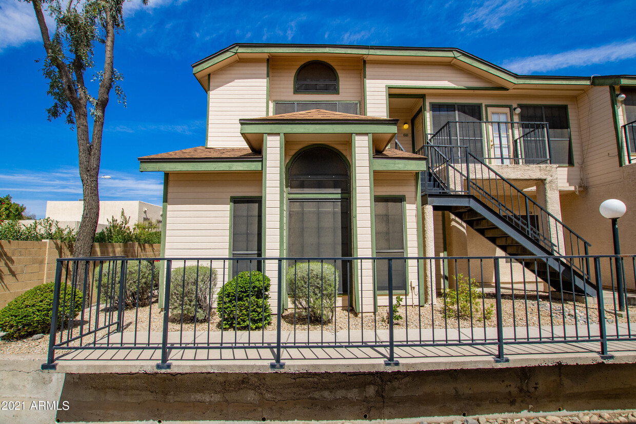
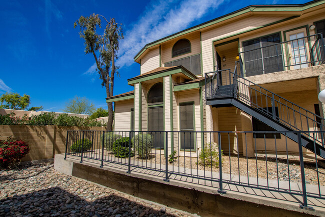
8888 N 47th Ave Unit 256
Glendale, AZ 85302
2 Weeks Ago
Favorites
8888 N 47th Ave Unit 256

Favorites
Check Back Soon for Upcoming Availability
| Beds | Baths | Average SF |
|---|---|---|
| 2 Bedrooms 2 Bedrooms 2 Br | 2 Baths 2 Baths 2 Ba | — |
About This Property
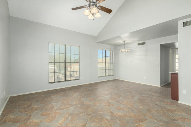
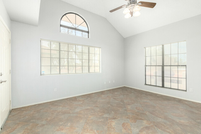
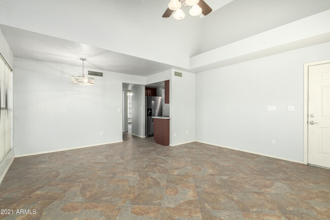
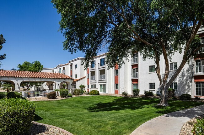
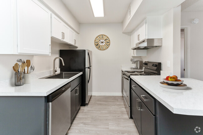
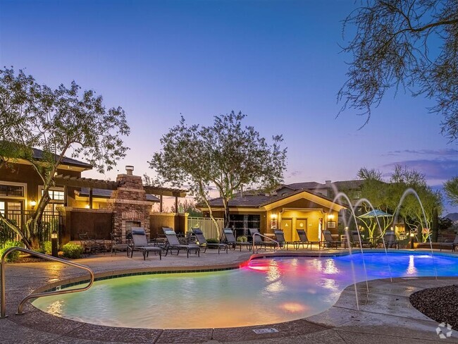
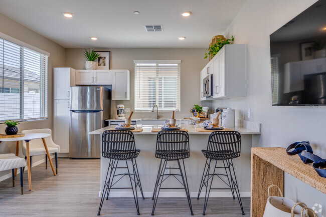
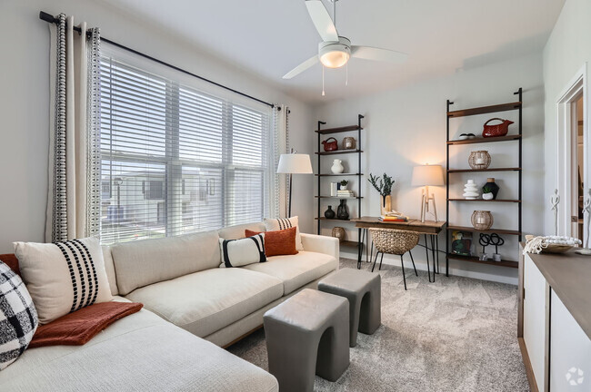
Come see this cute 2 bedroom, 2 full bath end unit condo. It features newly remodeled kitchen and bathrooms, vaulted ceilings, fresh paint, stainless steel appliances and inside laundry washer and dryer hookup. Master bedroom includes a private on suite bathroom. Garage for secure parking and easy entry access to your unit. Enjoy the sparkling pool in this very well kept condo community conveniently located close to shopping, restaurants, and Glendale Community College. Walking distance to Apollo High School and Horizon Elementary School. Rent includes, garbage, water, sewer, and HOA monthly fee. Beware of scams! This listing NOT posted on Craigslist. No wires will be required or requested.
8888 N 47th Ave is an apartment community located in Maricopa County and the 85302 ZIP Code.
Location
Get Directions
Extending south from West Peoria Avenue to West Northern Avenue, South Peoria provides easy access to Highway 101, Peoria Town Center, Sun City, Arizona State University West Campus, and Glendale Community College. Once named one of the best places to live in the US, Peoria offers a vibrant downtown with plenty to see and do. Catch a live performance at the Center for the Performing Arts or Theater Works, cheer on local sports teams at the Peoria Sports Complex, and enjoy exploring the shops along Bell Road.
Taking full advantage of the sunshine, desert landscape, and palm trees, South Peoria’s parks provide a range of outdoor activities for residents to enjoy. Thunderbird Park provides trails for walking and biking along the canal, a playground, disc golf course, and more. Those with pets will appreciate Sunnyslope Dog Park, located at the corner of West Olive Avenue and North 71st Avenue.
Learn more about living in South PeoriaBelow are rent ranges for similar nearby apartments
Education
| Colleges & Universities | Distance | ||
|---|---|---|---|
| Colleges & Universities | Distance | ||
| Drive: | 6 min | 2.3 mi | |
| Drive: | 7 min | 3.4 mi | |
| Drive: | 7 min | 3.4 mi | |
| Drive: | 9 min | 4.2 mi |
8888 N 47th Ave Unit 256 is within 6 minutes or 2.3 miles from Glendale Community College. It is also near Argosy University and Arizona State University, West.
Transportation options available in Glendale include 19Th Ave/Dunlap, located 3.7 miles from 8888 N 47th Ave Unit 256. 8888 N 47th Ave Unit 256 is near Phoenix Sky Harbor International, located 18.1 miles or 28 minutes away, and Phoenix-Mesa Gateway, located 44.9 miles or 60 minutes away.
| Transit / Subway | Distance | ||
|---|---|---|---|
| Transit / Subway | Distance | ||
|
|
Drive: | 8 min | 3.7 mi |
|
|
Drive: | 9 min | 4.7 mi |
|
|
Drive: | 10 min | 5.4 mi |
|
|
Drive: | 11 min | 6.5 mi |
|
|
Drive: | 14 min | 7.8 mi |
| Airports | Distance | ||
|---|---|---|---|
| Airports | Distance | ||
|
Phoenix Sky Harbor International
|
Drive: | 28 min | 18.1 mi |
|
Phoenix-Mesa Gateway
|
Drive: | 60 min | 44.9 mi |
Time and distance from 8888 N 47th Ave Unit 256.
| Shopping Centers | Distance | ||
|---|---|---|---|
| Shopping Centers | Distance | ||
| Walk: | 1 min | 0.1 mi | |
| Walk: | 9 min | 0.5 mi | |
| Walk: | 11 min | 0.6 mi |
8888 N 47th Ave Unit 256 has 3 shopping centers within 0.6 mile, which is about a 11-minute walk. The miles and minutes will be for the farthest away property.
| Parks and Recreation | Distance | ||
|---|---|---|---|
| Parks and Recreation | Distance | ||
|
Acoma Park
|
Drive: | 9 min | 4.7 mi |
|
Maryvale Park
|
Drive: | 11 min | 5.4 mi |
|
North Mountain Park
|
Drive: | 13 min | 6.5 mi |
|
Conocido Park
|
Drive: | 13 min | 6.7 mi |
|
El Oso Park
|
Drive: | 18 min | 8.9 mi |
8888 N 47th Ave Unit 256 has 5 parks within 8.9 miles, including Acoma Park, Maryvale Park, and North Mountain Park.
| Hospitals | Distance | ||
|---|---|---|---|
| Hospitals | Distance | ||
| Drive: | 6 min | 2.8 mi | |
| Drive: | 8 min | 4.1 mi | |
| Drive: | 10 min | 5.3 mi |
8888 N 47th Ave Unit 256 has 3 hospitals within 5.3 miles, the nearest is Aurora Behavioral Health System which is 2.8 miles away and a 6 minute drive.
| Military Bases | Distance | ||
|---|---|---|---|
| Military Bases | Distance | ||
| Drive: | 23 min | 12.6 mi | |
| Drive: | 29 min | 17.9 mi | |
| Drive: | 103 min | 75.6 mi |
8888 N 47th Ave Unit 256 has 3 military bases within 75.6 miles, the nearest is Luke Air Force Base which is 12.6 miles away and a 23 minute drive.
You May Also Like
Similar Rentals Nearby
-
-
1 / 16
-
-
-
-
-
-
-
-


What Are Walk Score®, Transit Score®, and Bike Score® Ratings?
Walk Score® measures the walkability of any address. Transit Score® measures access to public transit. Bike Score® measures the bikeability of any address.
What is a Sound Score Rating?
A Sound Score Rating aggregates noise caused by vehicle traffic, airplane traffic and local sources

8888 N 47th Ave
Glendale, AZ 85302