

$2,500
/ Month
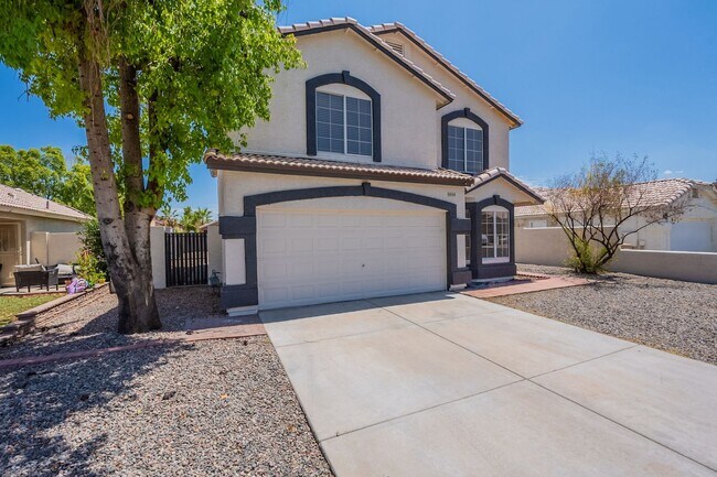
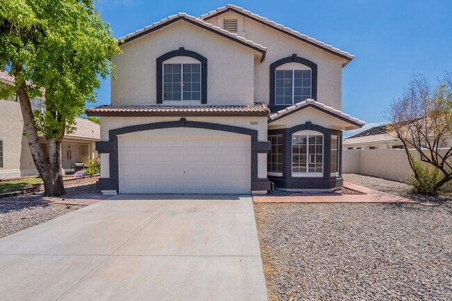
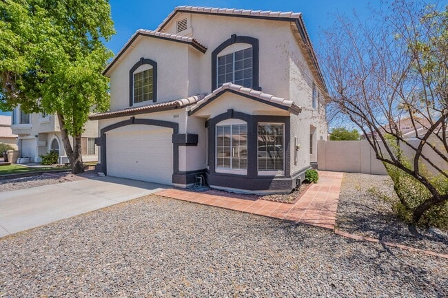
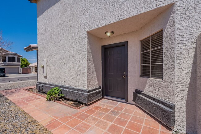
8844 W Christopher Michael Ln
Peoria, AZ 85345
Today
|
Edit
Favorites
480-577-3126
-
Bedrooms
5
-
Bathrooms
2.5
-
Square Feet
2,270 sq ft
-
Available
Available Now
8844 W Christopher Michael Ln

Favorites
About This Home
$2,500 deposit,
Available Now
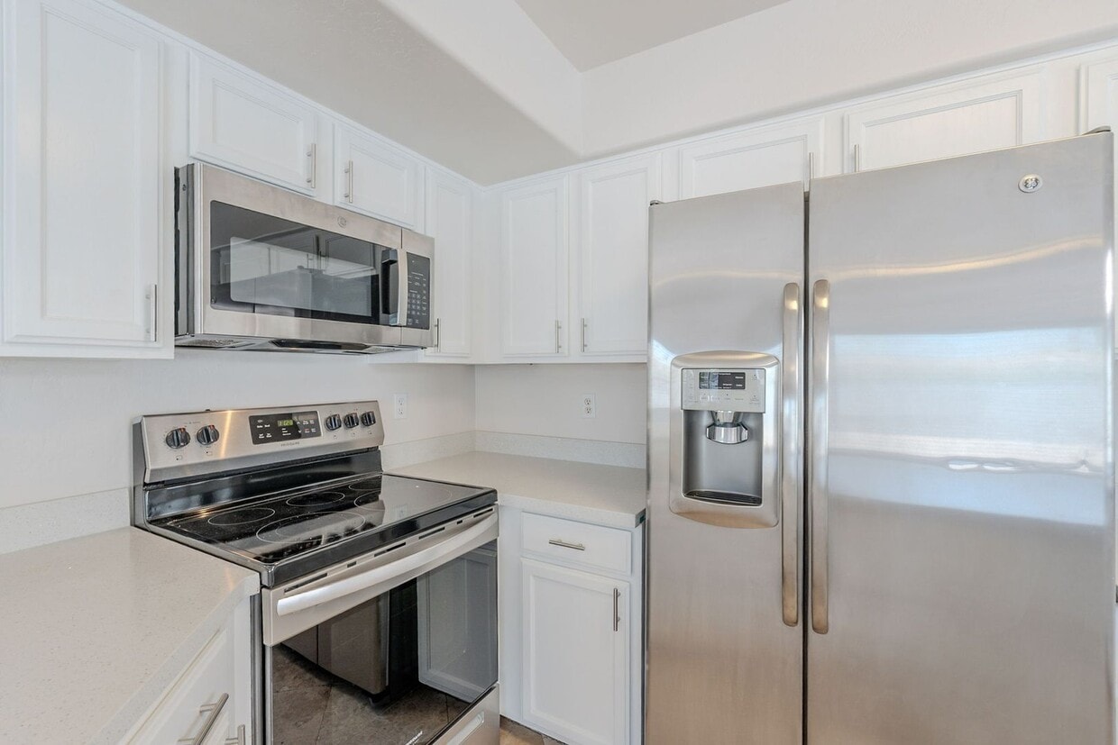
Welcome to your next home, perfectly situated near P83, Westgate Entertainment District, Glendale Sports Complex, and Arrowhead Towne Center! This spacious 5-bedroom, 2.5-bathroom home offers comfort, convenience, and room to grow in one of Glendale’s most desirable areas. Step inside to soaring vaulted ceilings and an open layout filled with natural light. The home features a generous loft—ideal for a home office, game room, or additional lounge space—with its own balcony access. The kitchen is a chef’s dream, complete with a center island, walk-in pantry, and stainless steel appliances. Enjoy being minutes from shopping, dining, entertainment, and major freeways—everything you need is right at your doorstep. *No Smoking. No Cats.*
8844 W Christopher Michael Ln is a house located in Maricopa County and the 85345 ZIP Code. This area is served by the Peoria Unified attendance zone.
* Price shown is base rent. Excludes user-selected optional fees and variable or usage-based fees and required charges due at or prior to move-in or at move-out. Price, availability, fees, and any applicable rent special are subject to change without notice.
* Square footage definitions vary. Displayed square footage is approximate.
Fees and Policies
The fees below are based on community-supplied data and may exclude additional fees and utilities.
- One-Time Basics
- Due at Move-In
- Security Deposit - Refundable$2,500
- Due at Move-In
Property Fee Disclaimer: Based on community-supplied data and independent market research. Subject to change without notice. May exclude fees for mandatory or optional services and usage-based utilities.
Contact
- Listed by White | White Fig Homes Property Management, LLC
- Phone Number
- Contact
Location
Get Directions
Extending south from West Peoria Avenue to West Northern Avenue, South Peoria provides easy access to Highway 101, Peoria Town Center, Sun City, Arizona State University West Campus, and Glendale Community College. Once named one of the best places to live in the US, Peoria offers a vibrant downtown with plenty to see and do. Catch a live performance at the Center for the Performing Arts or Theater Works, cheer on local sports teams at the Peoria Sports Complex, and enjoy exploring the shops along Bell Road.
Taking full advantage of the sunshine, desert landscape, and palm trees, South Peoria’s parks provide a range of outdoor activities for residents to enjoy. Thunderbird Park provides trails for walking and biking along the canal, a playground, disc golf course, and more. Those with pets will appreciate Sunnyslope Dog Park, located at the corner of West Olive Avenue and North 71st Avenue.
Learn more about living in South Peoria
Education
| Colleges & Universities | Distance | ||
|---|---|---|---|
| Colleges & Universities | Distance | ||
| Drive: | 10 min | 4.4 mi | |
| Drive: | 15 min | 6.8 mi | |
| Drive: | 15 min | 7.4 mi | |
| Drive: | 15 min | 9.4 mi |
8844 W Christopher Michael Ln is within 10 minutes or 4.4 miles from Glendale Community College. It is also near Thunderbird, West Campus and Arizona State University, West.
Schools


Public Elementary & Middle School
Grades PK-8
598 Students
Attendance Zone
Public Middle & High School
Grades 7-12
1,566 Students
Attendance Zone
Private Elementary, Middle & High School
Grades K-12
Nearby
Private Elementary & Middle School
Grades PK-8
69 Students
Nearby
School data provided by
 The GreatSchools Rating helps parents compare schools within a state based on a variety of school quality indicators and provides a helpful picture of how effectively each school serves all of its students. Ratings are on a scale of 1 (below average) to 10 (above average) and can include test scores, college readiness, academic progress, advanced courses, equity, discipline and attendance data. We also advise parents to visit schools, consider other information on school performance and programs, and consider family needs as part of the school selection process.
View GreatSchools Rating Methodology
Data provided by GreatSchools.org © 2025. All rights reserved.
View GreatSchools Rating Methodology
Data provided by GreatSchools.org © 2025. All rights reserved.
Transportation options available in Peoria include Metro Pkwy, located 8.3 miles from 8844 W Christopher Michael Ln. 8844 W Christopher Michael Ln is near Phoenix Sky Harbor International, located 20.3 miles or 34 minutes away.
| Transit / Subway | Distance | ||
|---|---|---|---|
| Transit / Subway | Distance | ||
|
|
Drive: | 17 min | 8.3 mi |
|
|
Drive: | 18 min | 9.1 mi |
|
|
Drive: | 19 min | 9.2 mi |
|
|
Drive: | 19 min | 9.6 mi |
|
|
Drive: | 20 min | 10.2 mi |
| Airports | Distance | ||
|---|---|---|---|
| Airports | Distance | ||
|
Phoenix Sky Harbor International
|
Drive: | 34 min | 20.3 mi |
Time and distance from 8844 W Christopher Michael Ln.
| Shopping Centers | Distance | ||
|---|---|---|---|
| Shopping Centers | Distance | ||
| Walk: | 4 min | 0.2 mi | |
| Walk: | 15 min | 0.8 mi | |
| Walk: | 19 min | 1.0 mi |
8844 W Christopher Michael Ln has 3 shopping centers within 1.0 mile, which is about a 19-minute walk. The miles and minutes will be for the farthest away property.
| Parks and Recreation | Distance | ||
|---|---|---|---|
| Parks and Recreation | Distance | ||
|
Challenger Space Center
|
Drive: | 12 min | 7.6 mi |
|
El Oso Park
|
Drive: | 16 min | 7.9 mi |
|
Acoma Park
|
Drive: | 17 min | 8.9 mi |
|
Maryvale Park
|
Drive: | 17 min | 9.0 mi |
|
Conocido Park
|
Drive: | 19 min | 11.2 mi |
8844 W Christopher Michael Ln has 5 parks within 11.2 miles, including Challenger Space Center, El Oso Park, and Acoma Park.
| Hospitals | Distance | ||
|---|---|---|---|
| Hospitals | Distance | ||
| Drive: | 7 min | 3.3 mi | |
| Drive: | 8 min | 3.8 mi | |
| Drive: | 12 min | 6.2 mi |
8844 W Christopher Michael Ln has 3 hospitals within 6.2 miles, the nearest is Banner Boswell Medical Center which is 3.3 miles away and a 7 minute drive.
| Military Bases | Distance | ||
|---|---|---|---|
| Military Bases | Distance | ||
| Drive: | 15 min | 9.0 mi | |
| Drive: | 35 min | 20.1 mi | |
| Drive: | 96 min | 72.0 mi |
8844 W Christopher Michael Ln has 3 military bases within 72.0 miles, the nearest is Luke Air Force Base which is 9.0 miles away and a 15 minute drive.
You May Also Like
Similar Rentals Nearby


What Are Walk Score®, Transit Score®, and Bike Score® Ratings?
Walk Score® measures the walkability of any address. Transit Score® measures access to public transit. Bike Score® measures the bikeability of any address.
What is a Sound Score Rating?
A Sound Score Rating aggregates noise caused by vehicle traffic, airplane traffic and local sources
8844 W Christopher Michael Ln
Peoria, AZ 85345