$995
/ Month
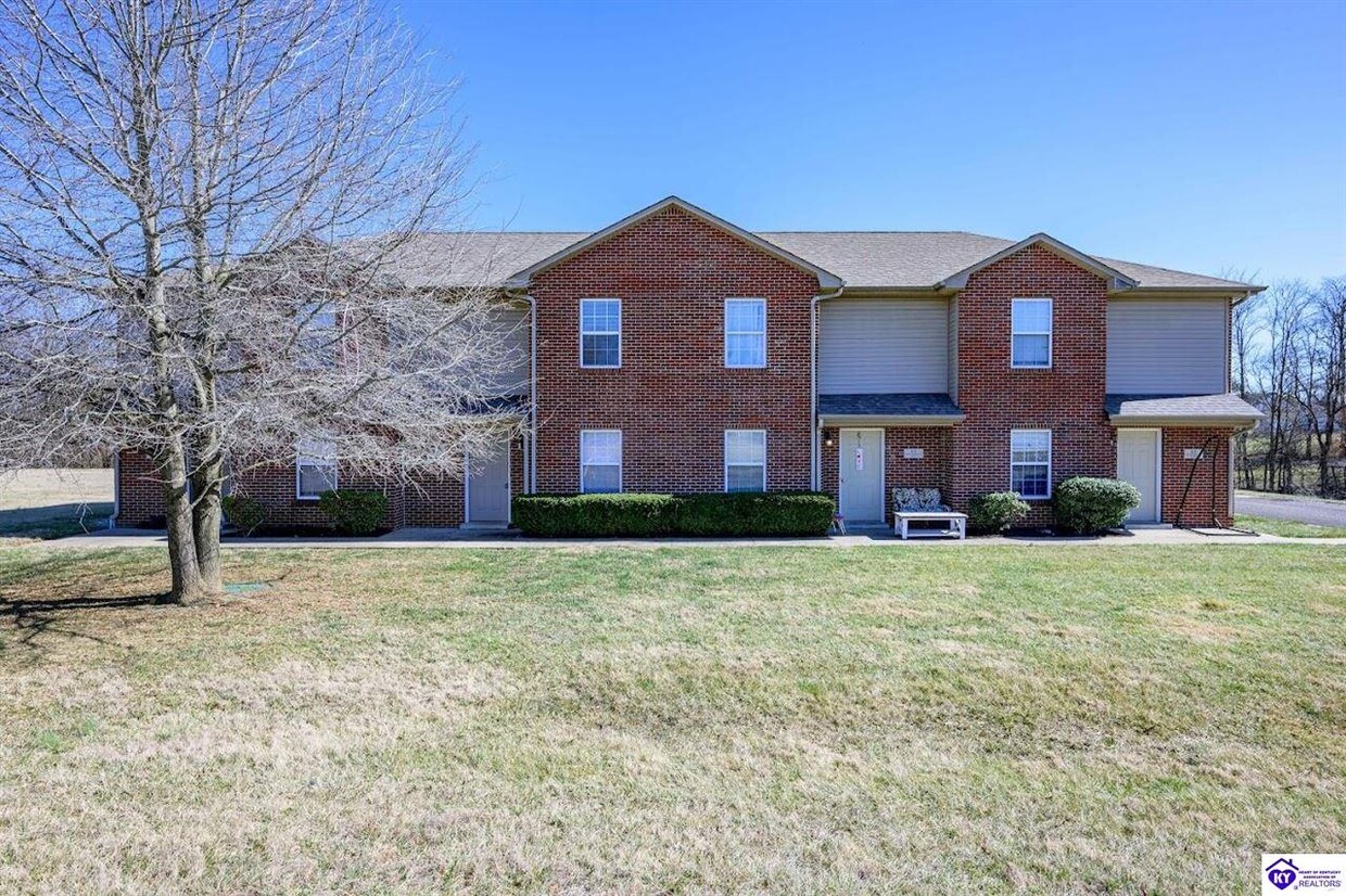
88 Pointers Ct
Rineyville, KY 40162
Favorites
88 Pointers Ct

Favorites
Check Back Soon for Upcoming Availability
| Beds | Baths | Average SF |
|---|---|---|
| 2 Bedrooms 2 Bedrooms 2 Br | 2 Baths 2 Baths 2 Ba | 1,216 SF |
Fees and Policies
The fees listed below are community-provided and may exclude utilities or add-ons. All payments are made directly to the property and are non-refundable unless otherwise specified.
About This Property
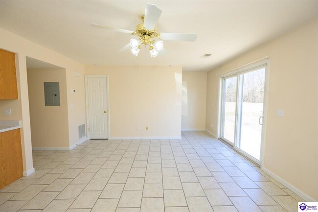
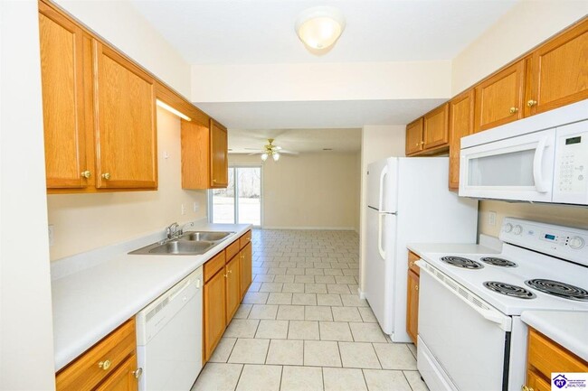
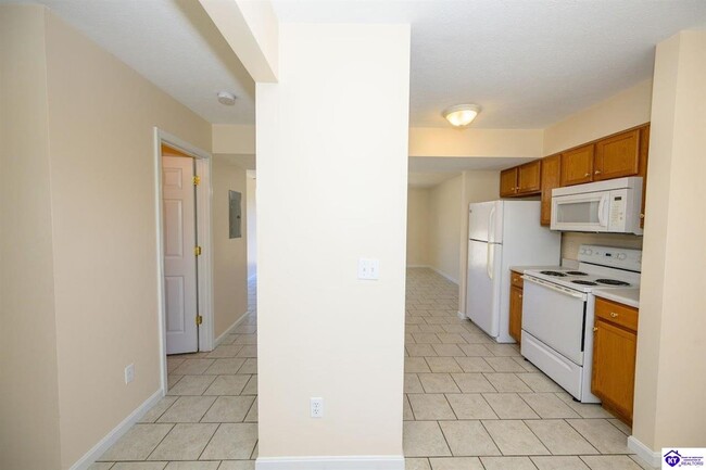
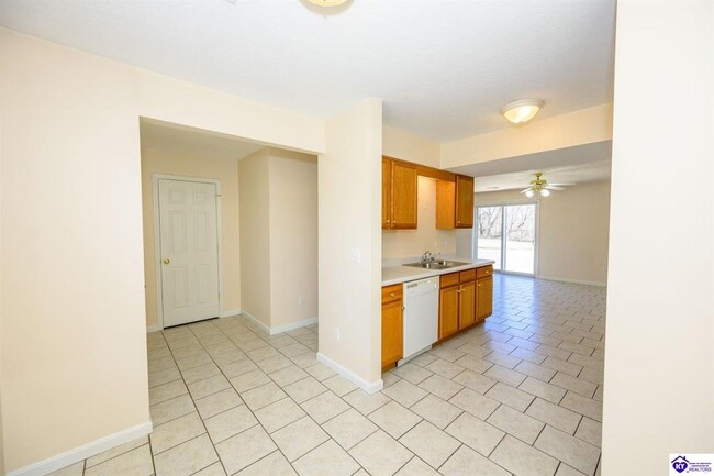
Townhome now available in Rineyville. Recently painted. Tile on main floor, carpet on 2nd floor. Large open living room. (Photos similar to unit) Washer/Dryer: Stackable style (Provided). Disclosure: Condition unknown. If this laundry center becomes inoperable, we will remove; not repair or replace.
88 Pointers Ct is a townhome located in Hardin County and the 40162 ZIP Code. This area is served by the Hardin County attendance zone.
Townhome Features
- Washer/Dryer Hookup
- Air Conditioning
- Heating
88 Pointers Ct,
Rineyville,
KY
40162
Amenities
- Washer/Dryer Hookup
- Air Conditioning
- Heating
Education
| Colleges & Universities | Distance | ||
|---|---|---|---|
| Colleges & Universities | Distance | ||
| Drive: | 13 min | 7.7 mi | |
| Drive: | 49 min | 33.7 mi | |
| Drive: | 60 min | 47.3 mi |
88 Pointers Ct is within 13 minutes or 7.7 miles from ECTC. It is also near Jefferson Comm. & Tech., SW and Univ. of Louisville, Belknap.
Schools


Public Elementary School
Grades PK-5
555 Students
Attendance Zone
Public Middle School
Grades 6-8
583 Students
Attendance Zone
Public High School
Grades 9-12
1,518 Students
Attendance Zone
Private Elementary, Middle & High School
Grades PK-12
522 Students
Nearby
School data provided by
 The GreatSchools Rating helps parents compare schools within a state based on a variety of school quality indicators and provides a helpful picture of how effectively each school serves all of its students. Ratings are on a scale of 1 (below average) to 10 (above average) and can include test scores, college readiness, academic progress, advanced courses, equity, discipline and attendance data. We also advise parents to visit schools, consider other information on school performance and programs, and consider family needs as part of the school selection process.
View GreatSchools Rating Methodology
Data provided by GreatSchools.org © 2026. All rights reserved.
View GreatSchools Rating Methodology
Data provided by GreatSchools.org © 2026. All rights reserved.
Walkability Near 88 Pointers Ct Rineyville, KY 40162
Getting Around
 What do Walkability, Transit, Drivability, and Bikeability mean?
Walkability measures the walking distance to day-to-day needs.
Transit measures access to public transportation.
Drivability measures congestion, parking availability, and access to major roads.
Bikeability measures the suitability for cycling.
How It Works
What do Walkability, Transit, Drivability, and Bikeability mean?
Walkability measures the walking distance to day-to-day needs.
Transit measures access to public transportation.
Drivability measures congestion, parking availability, and access to major roads.
Bikeability measures the suitability for cycling.
How It Works
Somewhat Walkable
Walkability
20
/ 100
Exceptionally Drivable
Drivability
90
/ 100
Somewhat Bikeable
Bikeability
30
/ 100
Scores provided by
-
Soundscore™
-
/ 100
Traffic
-Airport
-Businesses
-Scores provided by
HowLoud What is a Sound Score Rating? A Sound Score Rating aggregates noise caused by vehicle traffic, airplane traffic and local sources. How It WorksYou May Also Like
Similar Rentals Nearby


What Are Walk Score®, Transit Score®, and Bike Score® Ratings?
Walk Score® measures the walkability of any address. Transit Score® measures access to public transit. Bike Score® measures the bikeability of any address.
What is a Sound Score Rating?
A Sound Score Rating aggregates noise caused by vehicle traffic, airplane traffic and local sources.

88 Pointers Ct
Rineyville, KY 40162