
$3,995 / Month
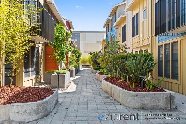
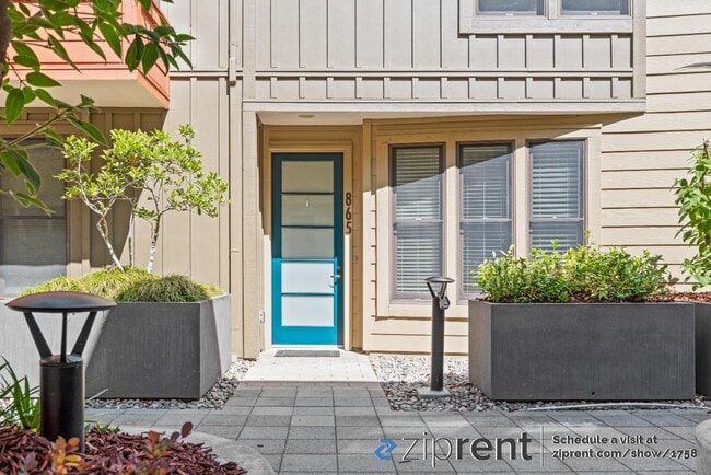
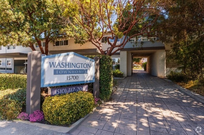
865 Altaire Walk
Palo Alto, CA 94303
2 Weeks Ago
Favorites
865 Altaire Walk

Favorites
Check Back Soon for Upcoming Availability
| Beds | Baths | Average SF |
|---|---|---|
| 3 Bedrooms 3 Bedrooms 3 Br | 2 Baths 2 Baths 2 Ba | 1,342 SF |
Fees and Policies
The fees below are based on community-supplied data and may exclude additional fees and utilities.
- Parking
-
Garage--
Details
Utilities Included
-
Water
-
Trash Removal
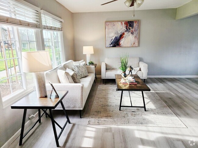
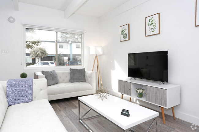
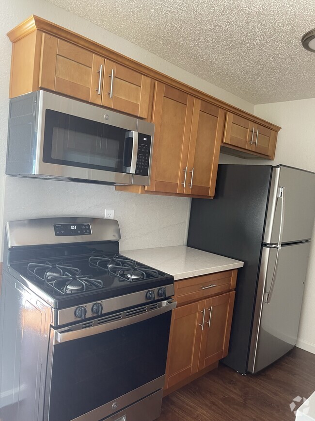
About This Property
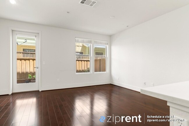
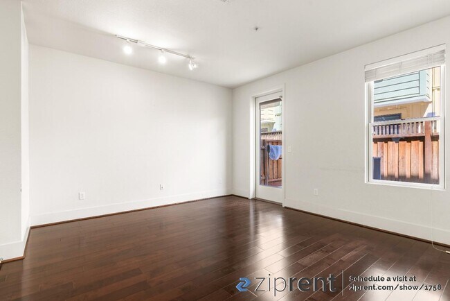
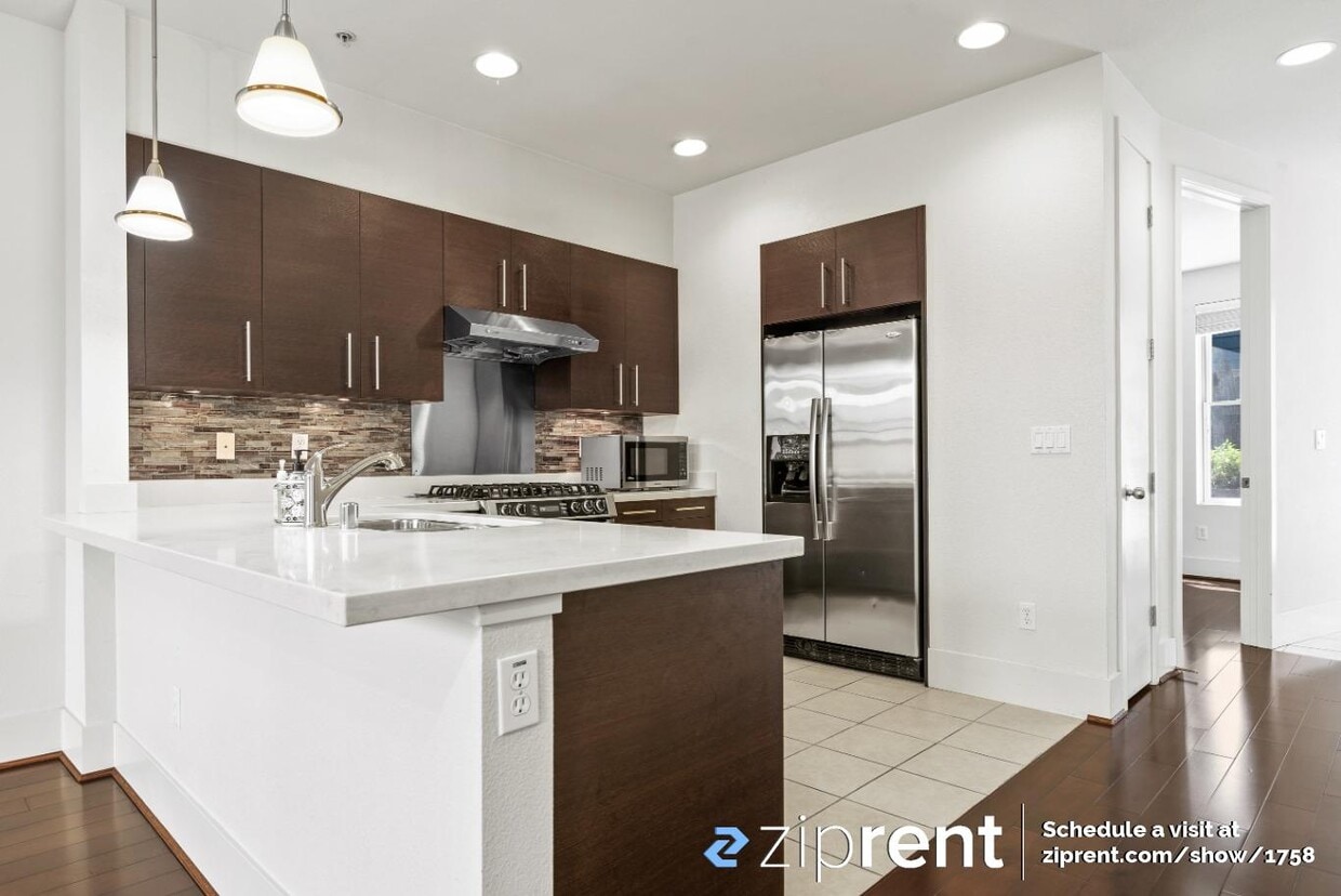
This property is available. Please inquire on this site to schedule a showing. Move-in ready! Enjoy this stunning 3 bedroom 2.5 bath home. It's located in one of the most sought after communities with top Palo Alto schools (Fairmeadow elementary, JLS Middle, Gunn High School). The gated community is adjacent to OFJCC which provides nice soccer fields and playground, access to the state of art gym including two pools (indoor and outdoor), fitness center, many free classes (membership required) and theater. Gourmet kitchen with European style cabinetry. Master suite with customized walk-in closet. Brand new washer and dryer. Dual-panel windows. Central heat and air conditioning. Energy efficient and Greenpoint certified. Easy access to highway 101 tech corridor, Google and many tech campuses. Close to Mitchell Park, library and shops, Costco and more. 2 front and back designated underground parking in the secured garage. Hot/cold water and garbage included. Non-smoking. Renter insurance required. Security Deposit $4550
865 Altaire Walk is a townhome located in Santa Clara County and the 94303 ZIP Code. This area is served by the Palo Alto Unified attendance zone.
Townhome Features
- Washer/Dryer
- Air Conditioning
- Heating
Location
Get Directions
Palo Alto is known as the birthplace of Silicon Valley and that unique heritage is proudly on display, with the Computer History Museum just down the street from Google’s world headquarters and countless other tech companies all over town. The restaurant scene rivals that of nearby San Francisco, with many small, independent eateries serving up some of the best food in the Bay Area.
With close proximity to the country’s tech center, it’s no surprise that Palo Alto apartments come with some of the most incredible amenities around. Residents also have access to dozens of options for outdoor recreation, including the gorgeous hiking and biking trails through the surrounding nature preserves, several golf courses, and easy access to San Francisco Bay. Bicycling is a popular mode of transportation around Palo Alto, with many bike-friendly routes around the city.
Palo Alto is famous as the home of Stanford University, and the campus is one of the most dominant landmarks in the area.
Learn more about living in Palo AltoBelow are rent ranges for similar nearby apartments
Amenities
- Washer/Dryer
- Air Conditioning
- Heating
Expenses
Utilities Included
Water, Trash Removal
Included
Education
| Colleges & Universities | Distance | ||
|---|---|---|---|
| Colleges & Universities | Distance | ||
| Walk: | 15 min | 0.8 mi | |
| Drive: | 13 min | 4.6 mi | |
| Drive: | 13 min | 5.4 mi | |
| Drive: | 16 min | 9.3 mi |
865 Altaire Walk is within 15 minutes or 0.8 mile from Foothill College, Middlefield. It is also near Stanford University and Foothill Coll., Los Altos.
Schools


Public Elementary School
Grades K-5
367 Students
Nearby
Public Elementary School
Grades K-5
403 Students
Attendance Zone
Public Middle School
Grades 6-8
996 Students
Attendance Zone
Public High School
Grades 9-12
1,787 Students
Attendance Zone
Private Elementary & Middle School
Grades PK-8
328 Students
Nearby
Private High School
Grades 9-12
188 Students
Nearby
School data provided by
 The GreatSchools Rating helps parents compare schools within a state based on a variety of school quality indicators and provides a helpful picture of how effectively each school serves all of its students. Ratings are on a scale of 1 (below average) to 10 (above average) and can include test scores, college readiness, academic progress, advanced courses, equity, discipline and attendance data. We also advise parents to visit schools, consider other information on school performance and programs, and consider family needs as part of the school selection process.
View GreatSchools Rating Methodology
View GreatSchools Rating Methodology
Transportation options available in Palo Alto include Bayshore Nasa Station, located 3.6 miles from 865 Altaire Walk. 865 Altaire Walk is near Norman Y Mineta San Jose International, located 11.2 miles or 16 minutes away, and San Francisco International, located 23.0 miles or 30 minutes away.
| Transit / Subway | Distance | ||
|---|---|---|---|
| Transit / Subway | Distance | ||
| Drive: | 6 min | 3.6 mi | |
|
|
Drive: | 6 min | 3.8 mi |
| Drive: | 6 min | 4.0 mi | |
|
|
Drive: | 6 min | 4.1 mi |
| Drive: | 7 min | 4.2 mi |
| Commuter Rail | Distance | ||
|---|---|---|---|
| Commuter Rail | Distance | ||
| Drive: | 4 min | 1.8 mi | |
| Drive: | 8 min | 3.1 mi | |
| Drive: | 9 min | 3.4 mi | |
| Drive: | 8 min | 3.6 mi | |
| Drive: | 9 min | 3.8 mi |
| Airports | Distance | ||
|---|---|---|---|
| Airports | Distance | ||
|
Norman Y Mineta San Jose International
|
Drive: | 16 min | 11.2 mi |
|
San Francisco International
|
Drive: | 30 min | 23.0 mi |
Time and distance from 865 Altaire Walk.
| Shopping Centers | Distance | ||
|---|---|---|---|
| Shopping Centers | Distance | ||
| Walk: | 13 min | 0.7 mi | |
| Walk: | 13 min | 0.7 mi | |
| Walk: | 15 min | 0.8 mi |
865 Altaire Walk has 3 shopping centers within 0.8 mile, which is about a 15-minute walk. The miles and minutes will be for the farthest away property.
| Parks and Recreation | Distance | ||
|---|---|---|---|
| Parks and Recreation | Distance | ||
|
J. Pearce Mitchell Park
|
Drive: | 4 min | 1.2 mi |
|
Terman Park
|
Drive: | 7 min | 2.3 mi |
|
Stevens Creek Shoreline Nature Study Area
|
Drive: | 7 min | 2.8 mi |
|
Bol Park
|
Drive: | 9 min | 3.0 mi |
|
The Environmental Volunteers EcoCenter
|
Drive: | 8 min | 3.7 mi |
865 Altaire Walk has 5 parks within 3.7 miles, including J. Pearce Mitchell Park, Terman Park, and Bol Park.
| Hospitals | Distance | ||
|---|---|---|---|
| Hospitals | Distance | ||
| Drive: | 8 min | 5.2 mi | |
| Drive: | 13 min | 5.2 mi | |
| Drive: | 15 min | 5.8 mi |
865 Altaire Walk has 3 hospitals within 5.8 miles, the nearest is El Camino Hospital which is 5.2 miles away and a 8 minute drive.
| Military Bases | Distance | ||
|---|---|---|---|
| Military Bases | Distance | ||
| Drive: | 9 min | 4.1 mi |
865 Altaire Walk is 4.1 miles and a 9 minute drive from Ames Research Center.
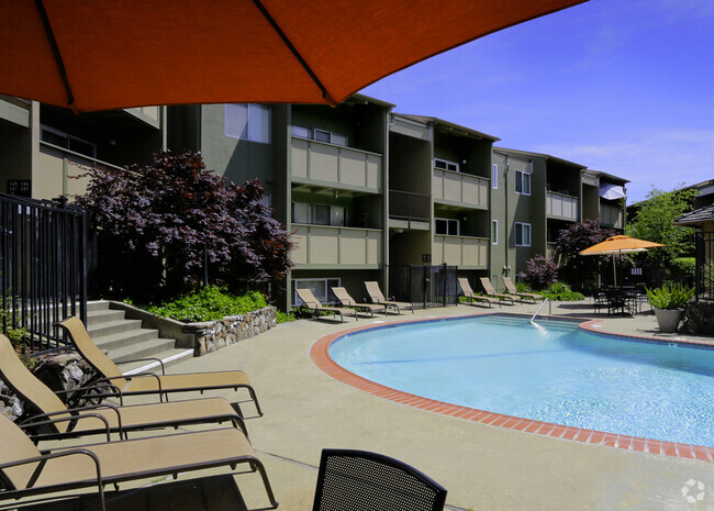
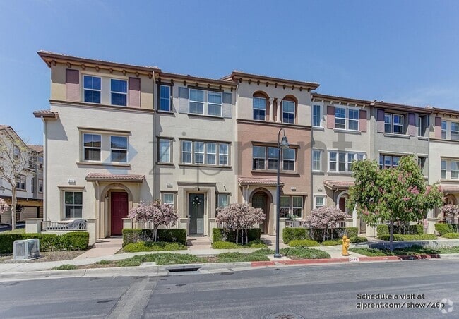
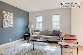
You May Also Like
Similar Rentals Nearby


What Are Walk Score®, Transit Score®, and Bike Score® Ratings?
Walk Score® measures the walkability of any address. Transit Score® measures access to public transit. Bike Score® measures the bikeability of any address.
What is a Sound Score Rating?
A Sound Score Rating aggregates noise caused by vehicle traffic, airplane traffic and local sources
865 Altaire Walk
Palo Alto, CA 94303