

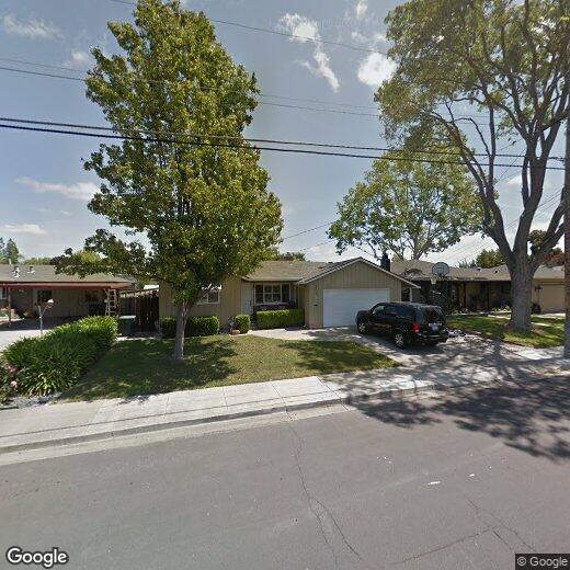
863 Kolln St
863 Kolln St
Pleasanton, CA 94566
2 Weeks Ago
|
Edit
Favorites
863 Kolln St

Favorites
Check Back Soon for Upcoming Availability
| Beds | Baths | Average SF |
|---|---|---|
| 3 Bedrooms 3 Bedrooms 3 Br | 2 Baths 2 Baths 2 Ba | — |
863 Kolln St,
Pleasanton,
CA
94566
Pleasanton, CA, sits in the heart of the Tri-Valley region. The city's downtown district preserves its historic character with independent shops and a weekly farmers' market that draws visitors from across the region. Pleasanton Ridge Regional Park stretches along the western edge of the city, while the Alameda County Fairgrounds anchors the community's event calendar.
The city houses both Amador Valley High School and Foothill High School, which consistently rank among California's academic leaders. Major employers in the area include the corporate headquarters of Workday, Safeway, and Veeva Systems. Shadow Cliffs Regional Park provides opportunities for swimming, fishing, and boating. The area's history stretches to the 1850s, when it was known as Alisal and earned notoriety as a Gold Rush-era haven for outlaws. Today, Pleasanton combines its historic roots with modern conveniences, including access to two BART stations for easy Bay Area commuting.
Learn more about living in Pleasanton
Education
| Colleges & Universities | Distance | ||
|---|---|---|---|
| Colleges & Universities | Distance | ||
| Drive: | 16 min | 7.6 mi | |
| Drive: | 15 min | 7.8 mi | |
| Drive: | 21 min | 12.4 mi | |
| Drive: | 28 min | 17.4 mi |
863 Kolln St is within 16 minutes or 7.6 miles from Diablo Valley Coll, San Ramon. It is also near Las Positas College and Ohlone College, Fremont Campus.
Transportation options available in Pleasanton include Dublin Pleasanton Station, located 3.9 miles from 863 Kolln St. 863 Kolln St is near Metro Oakland International, located 23.7 miles or 32 minutes away, and Norman Y Mineta San Jose International, located 27.3 miles or 38 minutes away.
| Transit / Subway | Distance | ||
|---|---|---|---|
| Transit / Subway | Distance | ||
|
|
Drive: | 8 min | 3.9 mi |
|
|
Drive: | 9 min | 5.3 mi |
|
|
Drive: | 25 min | 14.7 mi |
|
|
Drive: | 31 min | 16.6 mi |
| Commuter Rail | Distance | ||
|---|---|---|---|
| Commuter Rail | Distance | ||
| Drive: | 5 min | 1.4 mi | |
| Drive: | 12 min | 6.6 mi | |
| Drive: | 19 min | 12.1 mi | |
| Drive: | 27 min | 16.4 mi | |
| Drive: | 28 min | 16.5 mi |
| Airports | Distance | ||
|---|---|---|---|
| Airports | Distance | ||
|
Metro Oakland International
|
Drive: | 32 min | 23.7 mi |
|
Norman Y Mineta San Jose International
|
Drive: | 38 min | 27.3 mi |
Walkability Near 863 Kolln St Pleasanton, CA 94566
Getting Around
 What do Walkability, Transit, Drivability, and Bikeability mean?
Walkability measures the walking distance to day-to-day needs.
Transit measures access to public transportation.
Drivability measures congestion, parking availability, and access to major roads.
Bikeability measures the suitability for cycling.
How It Works
What do Walkability, Transit, Drivability, and Bikeability mean?
Walkability measures the walking distance to day-to-day needs.
Transit measures access to public transportation.
Drivability measures congestion, parking availability, and access to major roads.
Bikeability measures the suitability for cycling.
How It Works
Fairly Walkable
Walkability
50
/ 100
Limited Public Transit
Transit
30
/ 100
Very Drivable
Drivability
80
/ 100
Moderately Bikeable
Bikeability
60
/ 100
Scores provided by
-
Soundscore™
-
/ 100
Traffic
-Airport
-Businesses
-Scores provided by
HowLoud What is a Sound Score Rating? A Sound Score Rating aggregates noise caused by vehicle traffic, airplane traffic and local sources. How It WorksTime and distance from 863 Kolln St.
| Shopping Centers | Distance | ||
|---|---|---|---|
| Shopping Centers | Distance | ||
| Walk: | 12 min | 0.7 mi | |
| Walk: | 13 min | 0.7 mi | |
| Walk: | 16 min | 0.8 mi |
863 Kolln St has 3 shopping centers within 0.8 mile, which is about a 16-minute walk. The miles and minutes will be for the farthest away property.
| Parks and Recreation | Distance | ||
|---|---|---|---|
| Parks and Recreation | Distance | ||
|
Shadow Cliffs Regional Recreation Area
|
Drive: | 7 min | 2.5 mi |
|
Dublin Hills Regional Parks
|
Drive: | 20 min | 8.3 mi |
|
Bishop Ranch Regional Preserve
|
Drive: | 18 min | 10.9 mi |
|
Pleasanton Ridge Regional Park
|
Drive: | 23 min | 14.4 mi |
|
Garin/Dry Creek Pioneer Parks
|
Drive: | 31 min | 17.1 mi |
863 Kolln St has 5 parks within 17.1 miles, including Shadow Cliffs Regional Recreation Area, Dublin Hills Regional Parks, and Pleasanton Ridge Regional Park.
| Hospitals | Distance | ||
|---|---|---|---|
| Hospitals | Distance | ||
| Drive: | 4 min | 1.9 mi | |
| Drive: | 19 min | 12.0 mi | |
| Drive: | 25 min | 15.1 mi |
863 Kolln St has 3 hospitals within 15.1 miles, the nearest is Stanford Health Care - ValleyCare which is 1.9 miles away and a 4 minute drive.
| Military Bases | Distance | ||
|---|---|---|---|
| Military Bases | Distance | ||
| Drive: | 43 min | 30.0 mi |
863 Kolln St is 30.0 miles and a 43 minute drive from Ames Research Center.
You May Also Like
Similar Rentals Nearby


What Are Walk Score®, Transit Score®, and Bike Score® Ratings?
Walk Score® measures the walkability of any address. Transit Score® measures access to public transit. Bike Score® measures the bikeability of any address.
What is a Sound Score Rating?
A Sound Score Rating aggregates noise caused by vehicle traffic, airplane traffic and local sources.
863 Kolln St
Pleasanton, CA 94566