
$1,951
/ Month
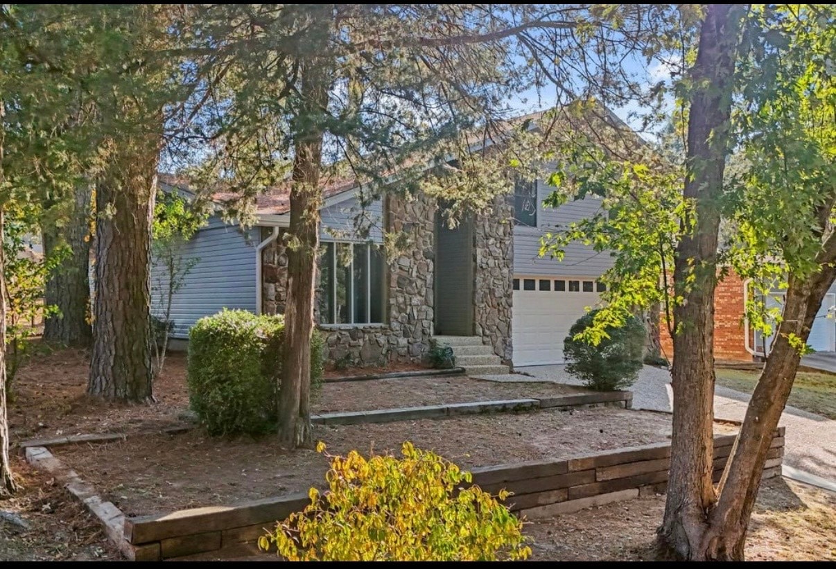
8615 Kennesaw Mountain Dr
Mabelvale, AR 72103
Today
|
Edit
Favorites
318-348-0559
-
Bedrooms
3
-
Bathrooms
2.5
-
Square Feet
1,837 sq ft
-
Available
Available Now
Highlight
- Balcony
8615 Kennesaw Mountain Dr

Favorites
About This Home
12 Month Lease,
$1,951 deposit,
Available Now
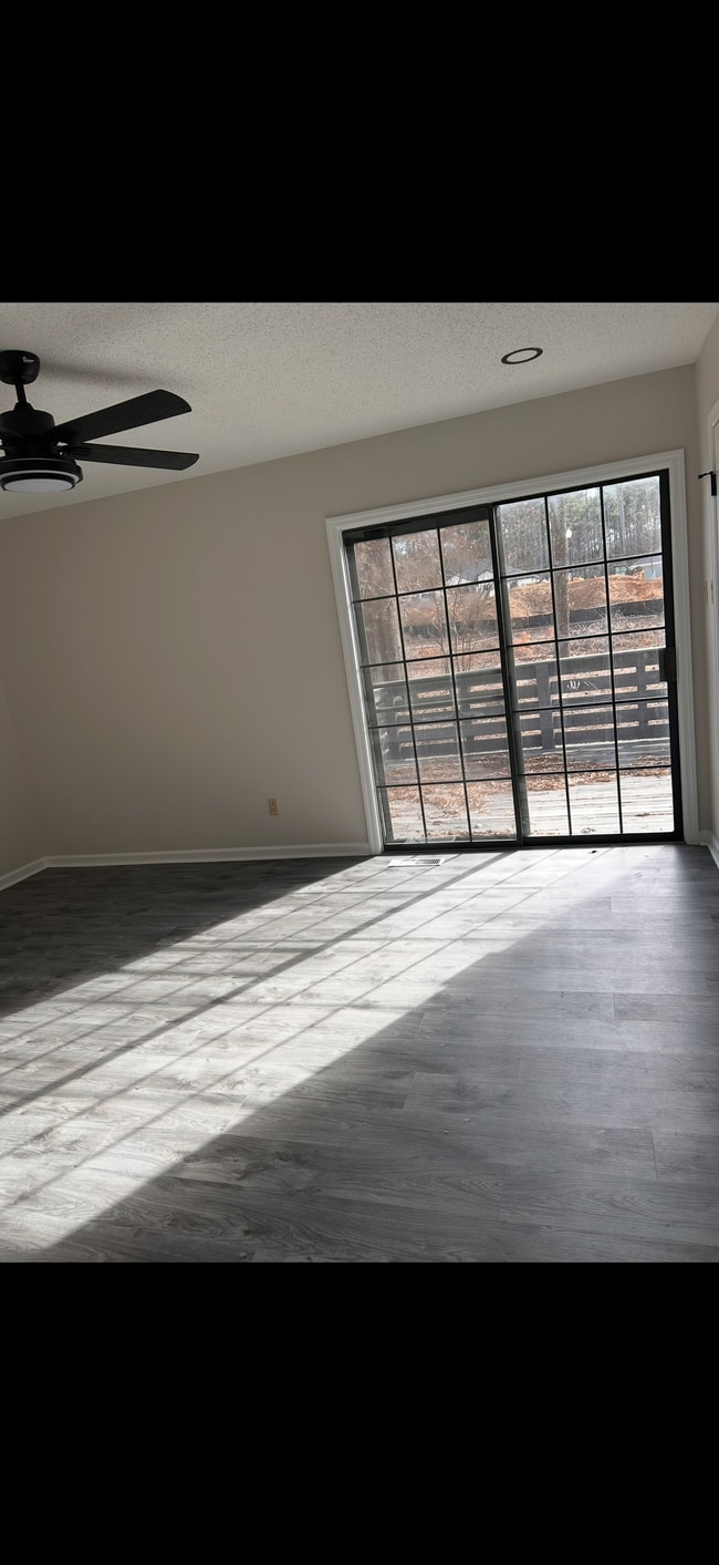
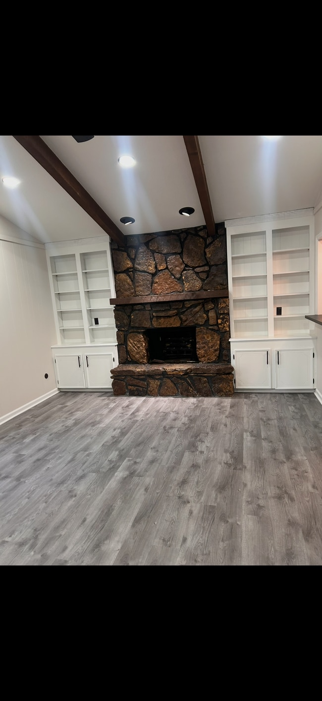
Home has a beautiful backyard with a balcony to overlook the backyard! Owner is also including the fridge, washer, and dryer in the home for convince. In the home there is also a separate dining room and a living room with a fire place! Home is located in Mabelvale near outlets of Little Rock. Nearby is also a movie theater and numerous restaurants!
8615 Kennesaw Mountain Dr is a house located in Pulaski County and the 72103 ZIP Code.
* Price shown is base rent. Excludes user-selected optional fees and variable or usage-based fees and required charges due at or prior to move-in or at move-out. Price, availability, fees, and any applicable rent special are subject to change without notice.
* Square footage definitions vary. Displayed square footage is approximate.
House Features
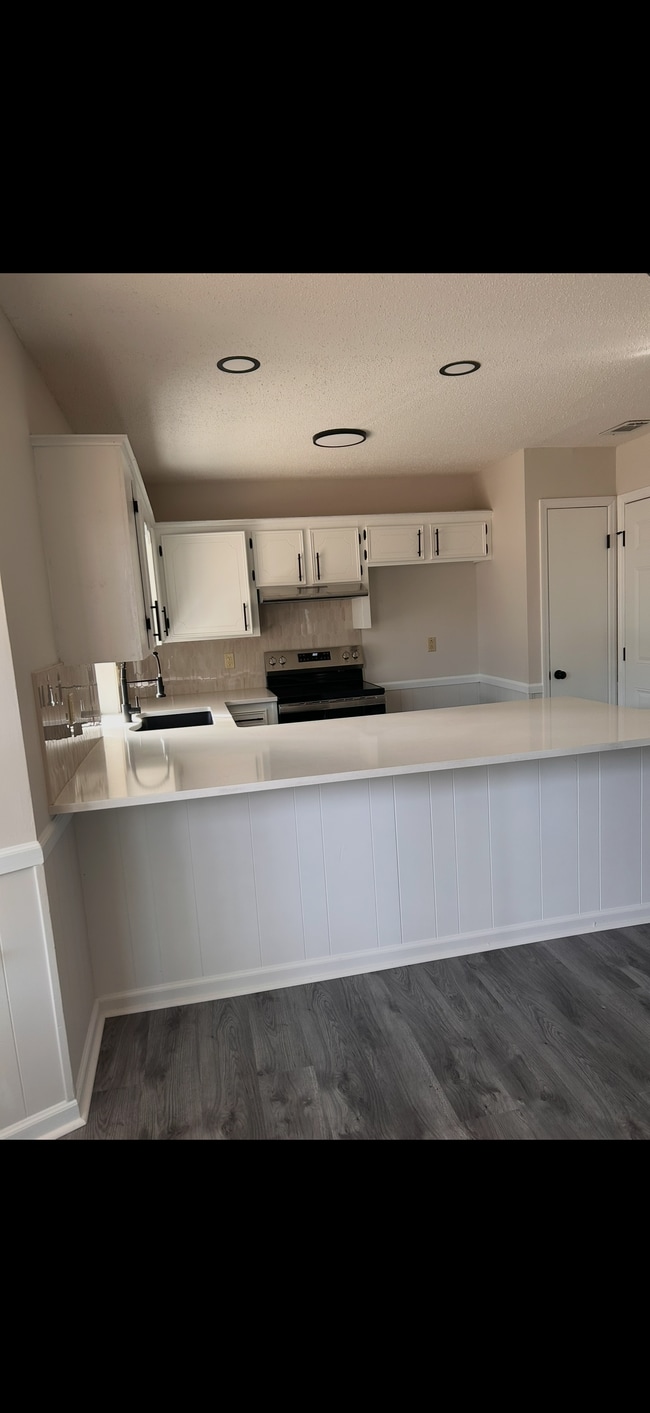
Washer/Dryer
Refrigerator
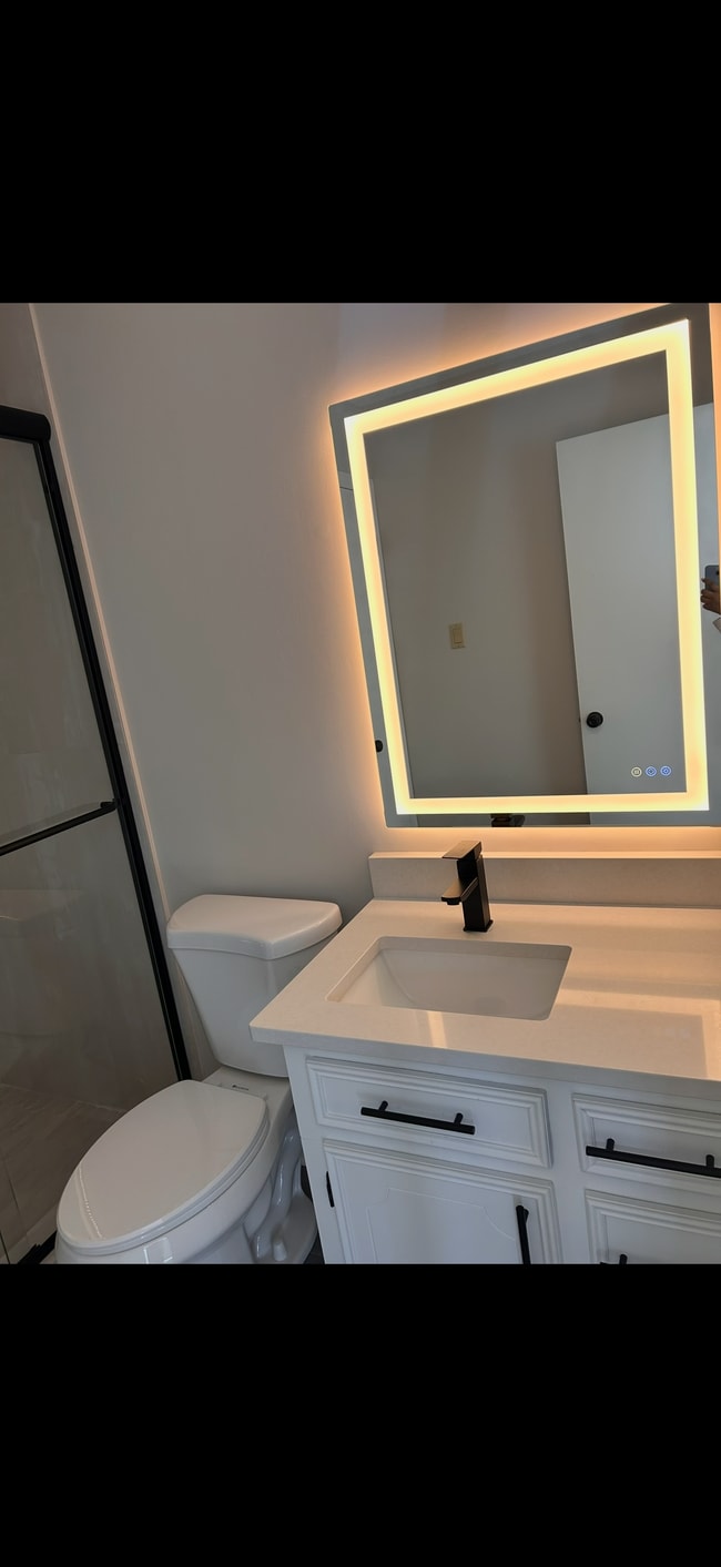
Tub/Shower
Ceiling Fans
- Washer/Dryer
- Heating
- Ceiling Fans
- Tub/Shower
- Refrigerator
- Dining Room
- Media Center/Movie Theatre
- Balcony
Fees and Policies
The fees below are based on community-supplied data and may exclude additional fees and utilities.
Details
Utilities Included
-
Gas
-
Water
-
Electricity
Contact
- Phone Number
- Contact
Location
Get Directions
The Chicot West section of Little Rock, located just south of Interstate 30, sits approximately 14 miles southwest of downtown's state government complex along the Arkansas River. Most of the residences and homes for rent lie in the northeast part of the neighborhood, near the intersection of I-30 and Chicot Road.
When the desire to eat out strikes, residents cross over I-30 for David's Burgers, which serves signature home-cut fries and fresh ground beef. For exercise, head to Morehart Park to tame the challenging nine-hole disc golf course. Navigate your disc among the tall trees to try to beat the par 65 score in the heart of this natural oasis.
Learn more about living in Chicot West I-30 South
Education
| Colleges & Universities | Distance | ||
|---|---|---|---|
| Colleges & Universities | Distance | ||
| Drive: | 15 min | 7.0 mi | |
| Drive: | 20 min | 9.7 mi | |
| Drive: | 19 min | 11.9 mi | |
| Drive: | 27 min | 16.3 mi |
8615 Kennesaw Mountain Dr is within 15 minutes or 7.0 miles from UA Little Rock. It is also near Univ. of Ark. Medical Scis. and Philander Smith College.
Transportation options available in Mabelvale include 2Nd St & Rock St, located 12.0 miles from 8615 Kennesaw Mountain Dr. 8615 Kennesaw Mountain Dr is near Bill and Hillary Clinton Ntl/Adams Field, located 12.9 miles or 20 minutes away.
| Transit / Subway | Distance | ||
|---|---|---|---|
| Transit / Subway | Distance | ||
| Drive: | 19 min | 12.0 mi | |
| Drive: | 19 min | 12.1 mi | |
| Drive: | 19 min | 12.1 mi | |
| Drive: | 19 min | 12.2 mi | |
| Drive: | 19 min | 12.4 mi |
| Commuter Rail | Distance | ||
|---|---|---|---|
| Commuter Rail | Distance | ||
|
|
Drive: | 20 min | 13.0 mi |
|
|
Drive: | 44 min | 36.4 mi |
| Airports | Distance | ||
|---|---|---|---|
| Airports | Distance | ||
|
Bill and Hillary Clinton Ntl/Adams Field
|
Drive: | 20 min | 12.9 mi |
Time and distance from 8615 Kennesaw Mountain Dr.
| Shopping Centers | Distance | ||
|---|---|---|---|
| Shopping Centers | Distance | ||
| Drive: | 6 min | 2.3 mi | |
| Drive: | 6 min | 2.4 mi | |
| Drive: | 6 min | 2.4 mi |
8615 Kennesaw Mountain Dr has 3 shopping centers within 2.4 miles, which is about a 6-minute drive. The miles and minutes will be for the farthest away property.
| Parks and Recreation | Distance | ||
|---|---|---|---|
| Parks and Recreation | Distance | ||
|
Little Rock Zoo
|
Drive: | 18 min | 8.7 mi |
|
Central High School National Historic Site
|
Drive: | 19 min | 9.1 mi |
|
Little Rock Audubon Center
|
Drive: | 17 min | 10.8 mi |
|
Museum of Discovery
|
Drive: | 19 min | 11.9 mi |
|
Lorance Creek Natural Area
|
Drive: | 27 min | 18.7 mi |
8615 Kennesaw Mountain Dr has 5 parks within 18.7 miles, including Little Rock Zoo, Central High School National Historic Site, and Little Rock Audubon Center.
| Hospitals | Distance | ||
|---|---|---|---|
| Hospitals | Distance | ||
| Drive: | 18 min | 9.3 mi | |
| Drive: | 19 min | 9.5 mi | |
| Drive: | 20 min | 10.8 mi |
8615 Kennesaw Mountain Dr has 3 hospitals within 10.8 miles, the nearest is Arkansas State Hospital which is 9.3 miles away and a 18 minute drive.
| Military Bases | Distance | ||
|---|---|---|---|
| Military Bases | Distance | ||
| Drive: | 43 min | 26.4 mi | |
| Drive: | 44 min | 29.2 mi | |
| Drive: | 48 min | 34.0 mi |
8615 Kennesaw Mountain Dr has 3 military bases within 34.0 miles, the nearest is Camp Joseph T. Robinson Hill which is 26.4 miles away and a 43 minute drive.
Amenities
- Washer/Dryer
- Heating
- Ceiling Fans
- Tub/Shower
- Refrigerator
- Dining Room
- Balcony
- Media Center/Movie Theatre
8615 Kennesaw Mountain Dr Photos
What Are Walk Score®, Transit Score®, and Bike Score® Ratings?
Walk Score® measures the walkability of any address. Transit Score® measures access to public transit. Bike Score® measures the bikeability of any address.
What is a Sound Score Rating?
A Sound Score Rating aggregates noise caused by vehicle traffic, airplane traffic and local sources
8615 Kennesaw Mountain Dr
Mabelvale, AR 72103