
MODA
153-30 89th Ave,
Jamaica, NY 11432
$2,595 - $3,195
Studio - 2 Beds
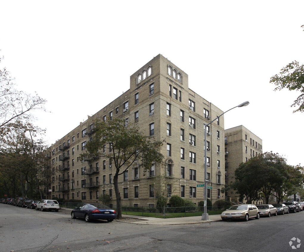
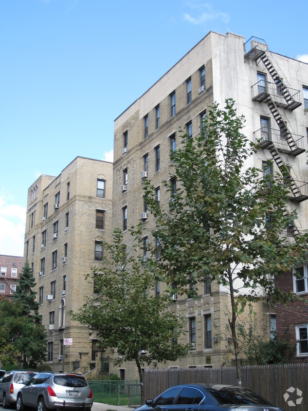
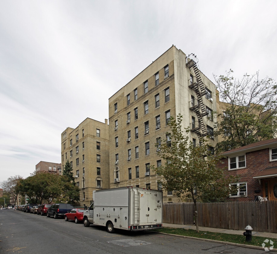
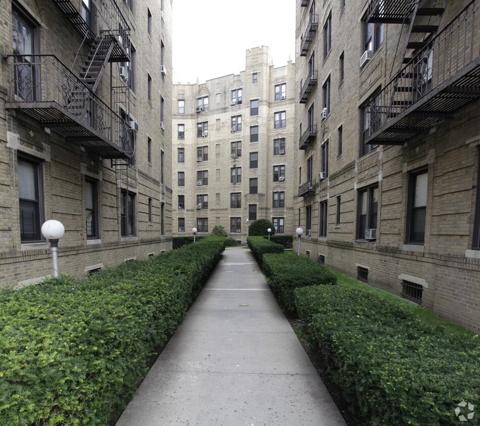
Welcome to 84-09 Talbot St in Jamaica, NY. You'll find this community at 84-09 Talbot St. in the 11415 area of Jamaica. The professional leasing team is available to help you find your new home. Drop by the leasing office to see available floor plans and make your move to 84-09 Talbot St.
84-09 Talbot St is an apartment community located in Queens County and the 11415 ZIP Code. This area is served by the New York City Geographic District #28 attendance zone.
Refrigerator
Heating
Oven
Range
Located in Queens, New York, Jamaica is a lively urban community with an abundance of cultural diversity. Jamaica houses the John F. Kennedy International Airport, providing residents the convenience of nearby international travel. An ideal blend of bustling city streets, residential areas, and wetlands, Jamaica has it all.
York College as well as multiple museums and pieces of Queens’ history reside in Jamaica. Visit King Manor Museum to admire the historic home of Rufus King and learn about his role in the anti-slavery movement, or enjoy Queens County Farm Museum, a historical colonial farmhouse with nearly 50 acres of sustainable lands that offers informational tours and family-friendly community events.
North Woodmere Park, Hook Creek Park, and Idewild Park all share a large green space filled with nature preserves, lakes, playgrounds, ball fields and courts, a swimming pool, and opportunities to kayak and canoe.
Learn more about living in JamaicaCompare neighborhood and city base rent averages by bedroom.
| Southeast Queens | Jamaica, NY | |
|---|---|---|
| Studio | $1,690 | $1,754 |
| 1 Bedroom | $2,110 | $2,221 |
| 2 Bedrooms | $2,675 | $2,756 |
| 3 Bedrooms | $3,298 | $3,478 |
| Colleges & Universities | Distance | ||
|---|---|---|---|
| Colleges & Universities | Distance | ||
| Drive: | 7 min | 2.8 mi | |
| Drive: | 5 min | 2.9 mi | |
| Drive: | 8 min | 3.3 mi | |
| Drive: | 13 min | 6.2 mi |


Transportation options available in Jamaica include Briarwood-Van Wyck Boulevard, located 0.7 mile from 84-09 Talbot St. 84-09 Talbot St is near LaGuardia, located 6.7 miles or 13 minutes away, and John F Kennedy International, located 6.8 miles or 10 minutes away.
| Transit / Subway | Distance | ||
|---|---|---|---|
| Transit / Subway | Distance | ||
|
|
Walk: | 12 min | 0.7 mi |
|
|
Walk: | 14 min | 0.8 mi |
|
|
Walk: | 16 min | 0.9 mi |
|
|
Drive: | 4 min | 1.3 mi |
|
|
Drive: | 3 min | 1.5 mi |
| Commuter Rail | Distance | ||
|---|---|---|---|
| Commuter Rail | Distance | ||
|
|
Walk: | 5 min | 0.3 mi |
|
|
Drive: | 5 min | 1.5 mi |
|
|
Drive: | 4 min | 1.5 mi |
|
|
Drive: | 7 min | 3.3 mi |
|
|
Drive: | 9 min | 3.9 mi |
| Airports | Distance | ||
|---|---|---|---|
| Airports | Distance | ||
|
LaGuardia
|
Drive: | 13 min | 6.7 mi |
|
John F Kennedy International
|
Drive: | 10 min | 6.8 mi |
Scores provided by
Traffic
-Airport
-Businesses
-Scores provided by
HowLoud What is a Sound Score Rating? A Sound Score Rating aggregates noise caused by vehicle traffic, airplane traffic and local sources. How It WorksTime and distance from 84-09 Talbot St.
| Shopping Centers | Distance | ||
|---|---|---|---|
| Shopping Centers | Distance | ||
| Walk: | 10 min | 0.5 mi | |
| Drive: | 3 min | 1.2 mi | |
| Drive: | 5 min | 2.0 mi |
| Parks and Recreation | Distance | ||
|---|---|---|---|
| Parks and Recreation | Distance | ||
|
Forest Park - Brooklyn-Queens
|
Drive: | 4 min | 1.8 mi |
|
Rufus King Park
|
Drive: | 5 min | 2.1 mi |
|
Detective Keith L. Williams Park
|
Drive: | 7 min | 3.0 mi |
|
Flushing Meadows Corona Park
|
Drive: | 8 min | 3.6 mi |
|
Queens Zoo
|
Drive: | 8 min | 4.1 mi |
| Hospitals | Distance | ||
|---|---|---|---|
| Hospitals | Distance | ||
| Walk: | 16 min | 0.8 mi | |
| Drive: | 5 min | 2.2 mi | |
| Drive: | 10 min | 4.3 mi |
| Military Bases | Distance | ||
|---|---|---|---|
| Military Bases | Distance | ||
| Drive: | 16 min | 9.1 mi | |
| Drive: | 22 min | 12.3 mi | |
| Drive: | 31 min | 13.8 mi |
What Are Walk Score®, Transit Score®, and Bike Score® Ratings?
Walk Score® measures the walkability of any address. Transit Score® measures access to public transit. Bike Score® measures the bikeability of any address.
What is a Sound Score Rating?
A Sound Score Rating aggregates noise caused by vehicle traffic, airplane traffic and local sources.


