
The Villas at Bryn Mawr Apartment Homes
105 Charles Dr,
Bryn Mawr, PA 19010
1-2 Beds $1,710 - $3,652

Conestoga Commons is a new to the student housing market property within walking distance to Villanova University. Residents will love the close proximity to campus, the large layouts, in unit laundry, and on-site parking. Close to Flip and Bailey's and Kelly's as well as all of the amenities of Lancaster Ave. Walk to the Paoli/Thorndale line to Center City, Philadelphia as well as the Norristown Highspeed Line.
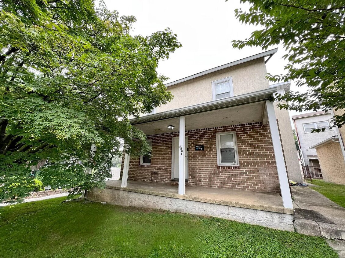
829-833 Conestoga Road is an apartment community located in Delaware County and the 19010 ZIP Code. This area is served by the Radnor Township attendance zone.
Air Conditioning
Refrigerator
Tub/Shower
Heating
Spacious houses sitting on sprawling tracts of land with meticulously landscaped grounds characterize the Philadelphia Main Line, one of the most sought-after regions in the Philadelphia metropolitan area. The Main Line in Delaware County encompasses the northern part of the neighborhood around Newtown Square, about five miles west of Downtown Philadelphia. Renters have options of modern apartments and Colonial-style homes.
Commuters appreciate the easy transportation offered by this neighborhood. Interstate 476 runs along the western edge of town while SEPTA and Amtrak lines provide mass transit. For shopping and dining within the neighborhood, West Chester Pike is the place to be. Retail centers filled with hotels, restaurants, and shops round out the modern amenities within town.
Learn more about living in Main Line-Delaware| Colleges & Universities | Distance | ||
|---|---|---|---|
| Colleges & Universities | Distance | ||
| Drive: | 6 min | 1.6 mi | |
| Drive: | 5 min | 1.7 mi | |
| Drive: | 5 min | 1.8 mi | |
| Drive: | 8 min | 2.9 mi |


Transportation options available in Bryn Mawr include Garrett Hill Station, located 0.2 mile from 829-833 Conestoga Road. 829-833 Conestoga Road is near Philadelphia International, located 21.0 miles or 35 minutes away, and Trenton Mercer, located 42.8 miles or 60 minutes away.
| Transit / Subway | Distance | ||
|---|---|---|---|
| Transit / Subway | Distance | ||
|
|
Walk: | 3 min | 0.2 mi |
| Walk: | 3 min | 0.2 mi | |
|
|
Walk: | 16 min | 0.9 mi |
|
|
Walk: | 17 min | 0.9 mi |
|
|
Drive: | 4 min | 1.2 mi |
| Commuter Rail | Distance | ||
|---|---|---|---|
| Commuter Rail | Distance | ||
|
|
Walk: | 14 min | 0.7 mi |
|
|
Drive: | 4 min | 1.6 mi |
|
|
Drive: | 5 min | 1.8 mi |
|
|
Drive: | 7 min | 2.4 mi |
|
|
Drive: | 7 min | 2.9 mi |
| Airports | Distance | ||
|---|---|---|---|
| Airports | Distance | ||
|
Philadelphia International
|
Drive: | 35 min | 21.0 mi |
|
Trenton Mercer
|
Drive: | 60 min | 42.8 mi |
Time and distance from 829-833 Conestoga Road.
| Shopping Centers | Distance | ||
|---|---|---|---|
| Shopping Centers | Distance | ||
| Walk: | 16 min | 0.9 mi | |
| Walk: | 20 min | 1.1 mi | |
| Drive: | 4 min | 1.5 mi |
| Parks and Recreation | Distance | ||
|---|---|---|---|
| Parks and Recreation | Distance | ||
|
Haverford College Arboretum
|
Drive: | 6 min | 2.7 mi |
|
Chanticleer Garden
|
Drive: | 8 min | 3.1 mi |
|
Saunders Woods Preserve
|
Drive: | 9 min | 3.4 mi |
|
Henry Botanic Garden
|
Drive: | 11 min | 4.0 mi |
|
Rolling Hill Park
|
Drive: | 14 min | 4.8 mi |
| Hospitals | Distance | ||
|---|---|---|---|
| Hospitals | Distance | ||
| Drive: | 3 min | 1.3 mi | |
| Drive: | 18 min | 7.1 mi | |
| Drive: | 22 min | 9.1 mi |
| Military Bases | Distance | ||
|---|---|---|---|
| Military Bases | Distance | ||
| Drive: | 36 min | 15.4 mi |
What Are Walk Score®, Transit Score®, and Bike Score® Ratings?
Walk Score® measures the walkability of any address. Transit Score® measures access to public transit. Bike Score® measures the bikeability of any address.
What is a Sound Score Rating?
A Sound Score Rating aggregates noise caused by vehicle traffic, airplane traffic and local sources

829-833 Conestoga Rd
Bryn Mawr, PA 19010


