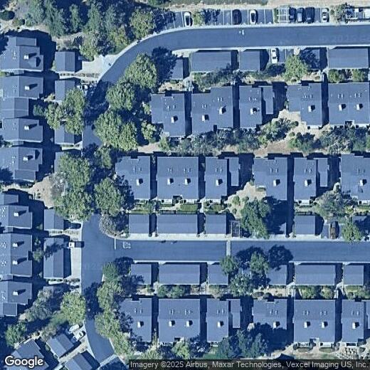

8185 Mountain View Dr
8185 Mountain View Dr
Pleasanton, CA 94588
2 Weeks Ago
|
Edit
Favorites
8185 Mountain View Dr

Favorites
Check Back Soon for Upcoming Availability
Location
Get Directions
Pleasanton, California sits in the heart of the Tri-Valley region, where the average rent for a one-bedroom apartment is $2,534. The city's downtown district preserves its historic character with independent shops and a weekly farmers' market that draws visitors from across the region. Pleasanton Ridge Regional Park stretches along the western edge of the city, while the Alameda County Fairgrounds anchors the community's event calendar. Studio apartments have seen a 10.1% increase in rent, while two-bedroom units average $3,022 monthly.
The city houses both Amador Valley High School and Foothill High School, which consistently rank among California's academic leaders. Major employers in the area include the corporate headquarters of Workday, Safeway, and Veeva Systems. Shadow Cliffs Regional Park provides opportunities for swimming, fishing, and boating. The area's history stretches to the 1850s, when it was known as Alisal and earned notoriety as a Gold Rush-era haven for outlaws.
Learn more about living in Pleasanton
Education
| Colleges & Universities | Distance | ||
|---|---|---|---|
| Colleges & Universities | Distance | ||
| Drive: | 14 min | 6.6 mi | |
| Drive: | 17 min | 10.2 mi | |
| Drive: | 19 min | 11.3 mi | |
| Drive: | 22 min | 12.9 mi |
8185 Mountain View Dr is within 14 minutes or 6.6 miles from Diablo Valley Coll, San Ramon. It is also near Las Positas College and Cal State East Bay.
Transportation options available in Pleasanton include West Dublin/Pleasanton Station, located 2.9 miles from 8185 Mountain View Dr. 8185 Mountain View Dr is near Metro Oakland International, located 17.6 miles or 24 minutes away, and Norman Y Mineta San Jose International, located 31.0 miles or 41 minutes away.
| Transit / Subway | Distance | ||
|---|---|---|---|
| Transit / Subway | Distance | ||
|
|
Drive: | 6 min | 2.9 mi |
|
|
Drive: | 6 min | 3.5 mi |
|
|
Drive: | 13 min | 9.2 mi |
|
|
Drive: | 15 min | 9.4 mi |
|
|
Drive: | 23 min | 12.4 mi |
| Commuter Rail | Distance | ||
|---|---|---|---|
| Commuter Rail | Distance | ||
| Drive: | 11 min | 6.2 mi | |
| Drive: | 12 min | 6.3 mi | |
|
|
Drive: | 17 min | 10.1 mi |
| Drive: | 17 min | 10.1 mi | |
| Drive: | 30 min | 20.2 mi |
| Airports | Distance | ||
|---|---|---|---|
| Airports | Distance | ||
|
Metro Oakland International
|
Drive: | 24 min | 17.6 mi |
|
Norman Y Mineta San Jose International
|
Drive: | 41 min | 31.0 mi |
Time and distance from 8185 Mountain View Dr.
| Shopping Centers | Distance | ||
|---|---|---|---|
| Shopping Centers | Distance | ||
| Drive: | 4 min | 1.9 mi | |
| Drive: | 4 min | 2.0 mi | |
| Drive: | 5 min | 2.2 mi |
8185 Mountain View Dr has 3 shopping centers within 2.2 miles, which is about a 5-minute drive. The miles and minutes will be for the farthest away property.
| Parks and Recreation | Distance | ||
|---|---|---|---|
| Parks and Recreation | Distance | ||
|
Dublin Hills Regional Parks
|
Drive: | 15 min | 4.7 mi |
|
Bishop Ranch Regional Preserve
|
Drive: | 14 min | 6.7 mi |
|
Don Castro Regional Recreation Area
|
Drive: | 12 min | 7.4 mi |
|
Cull Canyon Regional Recreation Area
|
Drive: | 14 min | 7.9 mi |
|
Pleasanton Ridge Regional Park
|
Drive: | 13 min | 8.0 mi |
8185 Mountain View Dr has 5 parks within 8.0 miles, including Dublin Hills Regional Parks, Pleasanton Ridge Regional Park, and Bishop Ranch Regional Preserve.
| Hospitals | Distance | ||
|---|---|---|---|
| Hospitals | Distance | ||
| Drive: | 9 min | 5.7 mi | |
| Drive: | 15 min | 9.5 mi | |
| Drive: | 15 min | 10.9 mi |
8185 Mountain View Dr has 3 hospitals within 10.9 miles, the nearest is Stanford Health Care - ValleyCare which is 5.7 miles away and a 9 minute drive.
| Military Bases | Distance | ||
|---|---|---|---|
| Military Bases | Distance | ||
| Drive: | 46 min | 33.8 mi |
8185 Mountain View Dr is 33.8 miles and a 46 minute drive from Ames Research Center.
You May Also Like
Similar Rentals Nearby


What Are Walk Score®, Transit Score®, and Bike Score® Ratings?
Walk Score® measures the walkability of any address. Transit Score® measures access to public transit. Bike Score® measures the bikeability of any address.
What is a Sound Score Rating?
A Sound Score Rating aggregates noise caused by vehicle traffic, airplane traffic and local sources