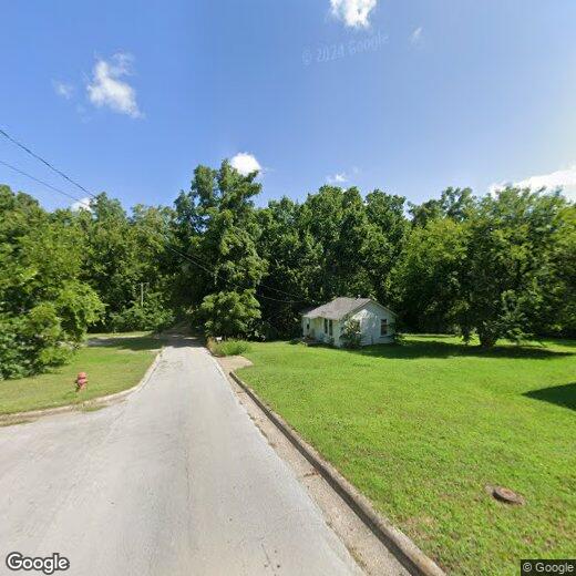

818 S Curry St
818 S Curry St
West Plains, MO 65775
Favorites
417-256-7159
-
Bedrooms
1
-
Bathrooms
1
-
Square Feet
--
-
Available
Available Jun 19
818 S Curry St

Favorites
About This Home
$550 deposit,
Available Jun 19
Recently updated Cute 2 bedroom with all new flooring.
Unique Features
- None
818 S Curry St is a house located in Howell County and the 65775 ZIP Code. This area is served by the West Plains R-Vii School District attendance zone.
* Price shown is base rent. Excludes user-selected optional fees and variable or usage-based fees and required charges due at or prior to move-in or at move-out. Price, availability, fees, and any applicable rent special are subject to change without notice.
* Square footage definitions vary. Displayed square footage is approximate.
Contact
- Listed by Grisham Properties LLC | Grisham Properties LLC
- Phone Number
- Contact
Location
Get Directions
West Plains is a secluded suburb in southern Missouri, offering a college town vibe, safe residential streets, and family-friendly amenities. In the heart of the city lies Mississippi State University and various community parks like People’s Park and Galloway Park. The county fairgrounds offer seasonal, kid-friendly events for the community, while the West Plains Country Club is a local favorite for bonding with fellow residents and enjoy the well-kept greens.
West Plains offers a historic downtown district featuring various small, family-owned restaurants and retailers. From coffee shops and a brewery to pizzerias and seafood shops, this spacious suburb has it all. Highways 160 and 63 make commuting simple, and families appreciate the excellent public schools in the area, like West Plains Middle School, and the affordable apartments and houses for rent.
Learn more about living in West Plains
Amenities
- None
Education
Schools


Public Elementary School
Grades PK-5
766 Students
Attendance Zone
Public Elementary & Middle School
Grades K-8
611 Students
Attendance Zone
Public High School
Grades 9-12
1,162 Students
Nearby
Public High School
Grades 9-12
1,162 Students
Attendance Zone
Private Elementary, Middle & High School
Grades PK-12
55 Students
Nearby
School data provided by
 The GreatSchools Rating helps parents compare schools within a state based on a variety of school quality indicators and provides a helpful picture of how effectively each school serves all of its students. Ratings are on a scale of 1 (below average) to 10 (above average) and can include test scores, college readiness, academic progress, advanced courses, equity, discipline and attendance data. We also advise parents to visit schools, consider other information on school performance and programs, and consider family needs as part of the school selection process.
View GreatSchools Rating Methodology
Data provided by GreatSchools.org © 2026. All rights reserved.
View GreatSchools Rating Methodology
Data provided by GreatSchools.org © 2026. All rights reserved.
Getting Around
 What do Walkability, Transit, Drivability, and Bikeability mean?
Walkability measures the walking distance to day-to-day needs.
Transit measures access to public transportation.
Drivability measures congestion, parking availability, and access to major roads.
Bikeability measures the suitability for cycling.
How It Works
What do Walkability, Transit, Drivability, and Bikeability mean?
Walkability measures the walking distance to day-to-day needs.
Transit measures access to public transportation.
Drivability measures congestion, parking availability, and access to major roads.
Bikeability measures the suitability for cycling.
How It Works
Somewhat Walkable
Walkability
30
/ 100
Exceptionally Drivable
Drivability
100
/ 100
Somewhat Bikeable
Bikeability
20
/ 100
Scores provided by
-
Soundscore™
-
/ 100
Traffic
-Airport
-Businesses
-Scores provided by
HowLoud What is a Sound Score Rating? A Sound Score Rating aggregates noise caused by vehicle traffic, airplane traffic and local sources. How It WorksSimilar Rentals Nearby
What Are Walk Score®, Transit Score®, and Bike Score® Ratings?
Walk Score® measures the walkability of any address. Transit Score® measures access to public transit. Bike Score® measures the bikeability of any address.
What is a Sound Score Rating?
A Sound Score Rating aggregates noise caused by vehicle traffic, airplane traffic and local sources.

818 S Curry St
West Plains, MO 65775