

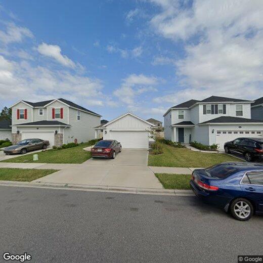
8123 Barley Way
8123 Barley Way
Jacksonville, FL 32222
Favorites
8123 Barley Way

Favorites
Check Back Soon for Upcoming Availability
| Beds | Baths | Average SF |
|---|---|---|
| 4 Bedrooms 4 Bedrooms 4 Br | 2 Baths 2 Baths 2 Ba | — |
8123 Barley Way,
Jacksonville,
FL
32222
Jacksonville covers more than 800 square miles, making it the largest city by land area in the contiguous United States — a distinction that shapes everything about daily life here. That sheer scale means neighborhoods feel distinct from one another: Riverside and Avondale offer historic architecture and an arts-forward atmosphere close to the St. Johns River, San Marco delivers a walkable, boutique-lined character near Downtown, and Southside sits near the University of North Florida and major commercial corridors. The economy runs deep, anchored by major employers like CSX Corporation, Fidelity Information Services, and Naval Air Station Jacksonville, giving the city a broad and stable employment base. Florida State College at Jacksonville adds an academic presence woven throughout the urban core.
Learn more about living in Jacksonville
Education
| Colleges & Universities | Distance | ||
|---|---|---|---|
| Colleges & Universities | Distance | ||
| Drive: | 21 min | 10.5 mi | |
| Drive: | 35 min | 17.2 mi | |
| Drive: | 35 min | 19.8 mi | |
| Drive: | 47 min | 22.5 mi |
8123 Barley Way is within 21 minutes or 10.5 miles from St. Johns River, Orange Park. It is also near Fla. State Coll. Jacksonville and Florida Coastal School of Law.
Walkability Near 8123 Barley Way Jacksonville, FL 32222
Getting Around
 What do Walkability, Transit, Drivability, and Bikeability mean?
Walkability measures the walking distance to day-to-day needs.
Transit measures access to public transportation.
Drivability measures congestion, parking availability, and access to major roads.
Bikeability measures the suitability for cycling.
How It Works
What do Walkability, Transit, Drivability, and Bikeability mean?
Walkability measures the walking distance to day-to-day needs.
Transit measures access to public transportation.
Drivability measures congestion, parking availability, and access to major roads.
Bikeability measures the suitability for cycling.
How It Works
Somewhat Walkable
Walkability
20
/ 100
Minimal Public Transit
Transit
0
/ 100
Exceptionally Drivable
Drivability
100
/ 100
Fairly Bikeable
Bikeability
40
/ 100
Scores provided by
-
Soundscore™
-
/ 100
Traffic
-Airport
-Businesses
-Scores provided by
HowLoud What is a Sound Score Rating? A Sound Score Rating aggregates noise caused by vehicle traffic, airplane traffic and local sources. How It WorksYou May Also Like
Similar Rentals Nearby
-
-
 4 Beds$2,210Total Monthly PriceTotal Monthly Price NewPrices include all required monthly fees.House for Rent
 -
 4 Beds$2,280Total Monthly PriceTotal Monthly Price NewPrices include all required monthly fees.House for Rent
 -
 4 Beds$2,150Total Monthly PriceTotal Monthly Price NewPrices include all required monthly fees.House for Rent
 -
 4 Beds$1,975Total Monthly PriceTotal Monthly Price NewPrices include all required monthly fees.House for Rent
 -
 4 Beds$2,055Total Monthly PriceTotal Monthly Price NewPrices include all required monthly fees.House for Rent
 -
 4 Beds$2,235Total Monthly PriceTotal Monthly Price NewPrices include all required monthly fees.House for Rent
 -
 4 Beds$2,215Total Monthly PriceTotal Monthly Price NewPrices include all required monthly fees.House for Rent
 -
 4 Beds$1,850Total Monthly PriceTotal Monthly Price NewPrices include all required monthly fees.House for Rent
 -
 4 Beds$1,900Total Monthly PriceTotal Monthly Price NewPrices include all required monthly fees.House for Rent
What Are Walk Score®, Transit Score®, and Bike Score® Ratings?
Walk Score® measures the walkability of any address. Transit Score® measures access to public transit. Bike Score® measures the bikeability of any address.
What is a Sound Score Rating?
A Sound Score Rating aggregates noise caused by vehicle traffic, airplane traffic and local sources.
8123 Barley Way
Jacksonville, FL 32222