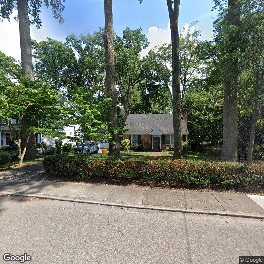

8 Sabine Ave
8 Sabine Ave
Narberth, PA 19072
2 Weeks Ago
Favorites
8 Sabine Ave

Favorites
Check Back Soon for Upcoming Availability
| Beds | Baths | Average SF |
|---|---|---|
| 3 Bedrooms 3 Bedrooms 3 Br | 3 Baths 3 Baths 3 Ba | — |
Location
Get Directions
Ranked among the best places to live in Pennsylvania, Narberth is a borough in Montgomery County surrounded by Lower Merion Township. One of many neighborhoods on the historic Pennsylvania Main Line, Narberth occupies a central locale equally convenient to Center City Philadelphia, King of Prussia, and Valley Forge National Park.
With a population of about 4,000 people, Narberth is home to a close-knit community. Families enjoy having access to Narberth’s excellent schools. Residents are afforded short commutes thanks Narberth’s convenient location near major roadways and public transportation.
Learn more about living in Narberth
Education
| Colleges & Universities | Distance | ||
|---|---|---|---|
| Colleges & Universities | Distance | ||
| Drive: | 9 min | 2.6 mi | |
| Drive: | 7 min | 2.8 mi | |
| Drive: | 8 min | 2.9 mi | |
| Drive: | 9 min | 3.4 mi |
8 Sabine Ave is within 9 minutes or 2.6 miles from Haverford College. It is also near St Joseph's Univ., Phila. and Harcum College.
Transportation options available in Narberth include Wynnewood Road, located 2.2 miles from 8 Sabine Ave. 8 Sabine Ave is near Philadelphia International, located 12.3 miles or 31 minutes away, and Trenton Mercer, located 36.6 miles or 64 minutes away.
| Transit / Subway | Distance | ||
|---|---|---|---|
| Transit / Subway | Distance | ||
|
|
Drive: | 5 min | 2.2 mi |
| Drive: | 6 min | 2.2 mi | |
|
|
Drive: | 6 min | 2.5 mi |
|
|
Drive: | 7 min | 2.8 mi |
|
|
Drive: | 7 min | 3.1 mi |
| Commuter Rail | Distance | ||
|---|---|---|---|
| Commuter Rail | Distance | ||
| Walk: | 12 min | 0.7 mi | |
| Walk: | 14 min | 0.8 mi | |
| Drive: | 5 min | 1.5 mi | |
| Drive: | 5 min | 1.9 mi | |
| Drive: | 6 min | 2.1 mi |
| Airports | Distance | ||
|---|---|---|---|
| Airports | Distance | ||
|
Philadelphia International
|
Drive: | 31 min | 12.3 mi |
|
Trenton Mercer
|
Drive: | 64 min | 36.6 mi |
Time and distance from 8 Sabine Ave.
| Shopping Centers | Distance | ||
|---|---|---|---|
| Shopping Centers | Distance | ||
| Walk: | 15 min | 0.8 mi | |
| Walk: | 16 min | 0.8 mi | |
| Walk: | 18 min | 0.9 mi |
8 Sabine Ave has 3 shopping centers within 0.9 mile, which is about a 18-minute walk. The miles and minutes will be for the farthest away property.
| Parks and Recreation | Distance | ||
|---|---|---|---|
| Parks and Recreation | Distance | ||
|
Haverford College Arboretum
|
Drive: | 6 min | 2.1 mi |
|
Merion Botanical Park
|
Drive: | 5 min | 2.2 mi |
|
Arboretum of the Barnes Foundation
|
Drive: | 7 min | 2.3 mi |
|
Saunders Woods Preserve
|
Drive: | 9 min | 3.1 mi |
|
Rolling Hill Park
|
Drive: | 12 min | 3.7 mi |
8 Sabine Ave has 5 parks within 3.7 miles, including Haverford College Arboretum, Merion Botanical Park, and Arboretum of the Barnes Foundation.
| Hospitals | Distance | ||
|---|---|---|---|
| Hospitals | Distance | ||
| Drive: | 9 min | 3.5 mi | |
| Drive: | 12 min | 4.4 mi | |
| Drive: | 14 min | 4.9 mi |
8 Sabine Ave has 3 hospitals within 4.9 miles, the nearest is Bryn Mawr Hospital which is 3.5 miles away and a 9 minute drive.
| Military Bases | Distance | ||
|---|---|---|---|
| Military Bases | Distance | ||
| Drive: | 26 min | 13.2 mi |
8 Sabine Ave is 13.2 miles and a 26 minute drive from Philadelphia Naval Busi Center.
You May Also Like
Similar Rentals Nearby


What Are Walk Score®, Transit Score®, and Bike Score® Ratings?
Walk Score® measures the walkability of any address. Transit Score® measures access to public transit. Bike Score® measures the bikeability of any address.
What is a Sound Score Rating?
A Sound Score Rating aggregates noise caused by vehicle traffic, airplane traffic and local sources

8 Sabine Ave
Narberth, PA 19072