
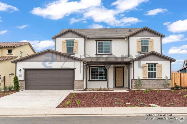
$4,500 / Month
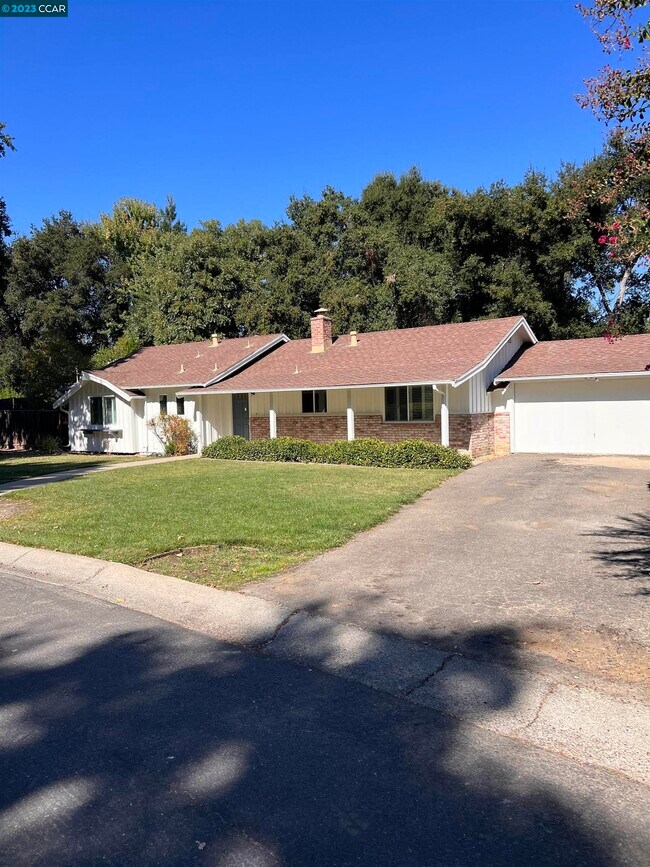
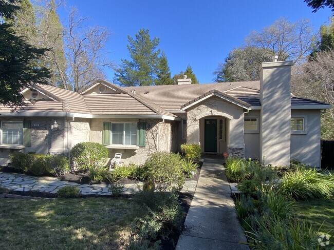
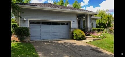
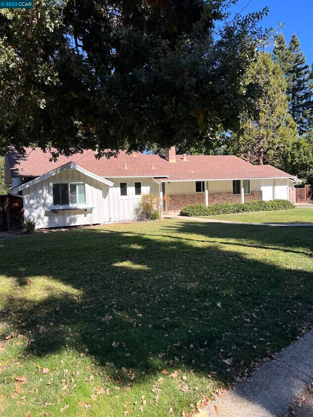
79 Mariposa Ct
Danville, CA 94526
2 Weeks Ago
Favorites
79 Mariposa Ct

Favorites
Check Back Soon for Upcoming Availability
| Beds | Baths | Average SF |
|---|---|---|
| 3 Bedrooms 3 Bedrooms 3 Br | 2 Baths 2 Baths 2 Ba | 1,373 SF |
About This Property
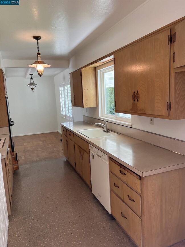
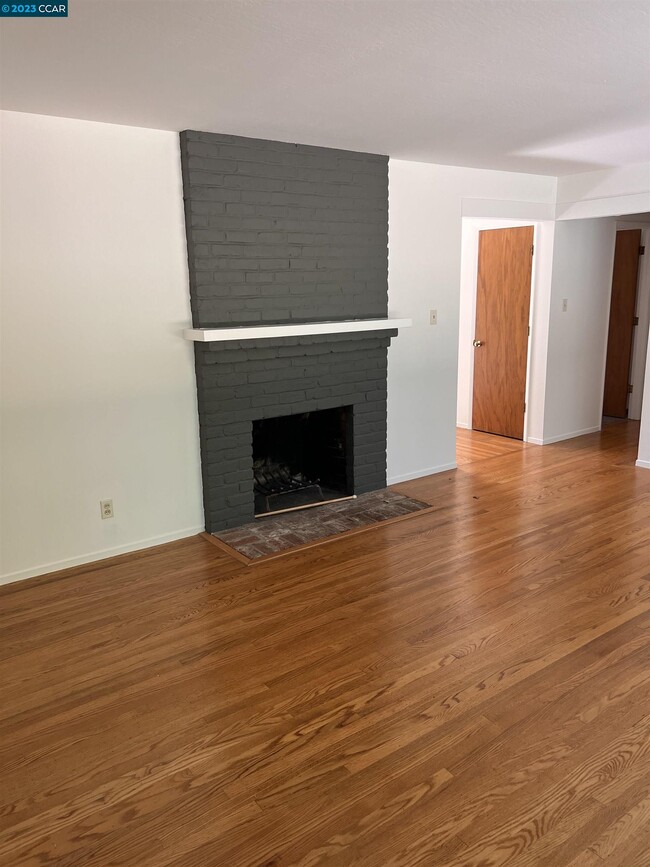
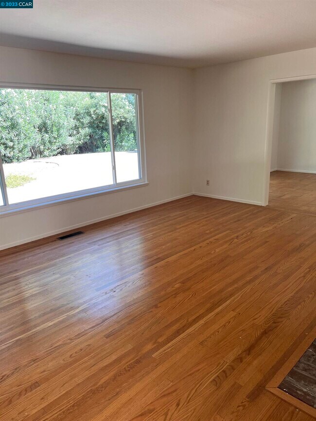
Westside Danville Home on Large Cul-de-sac lot,Clean fresh paint hardwood floors throughout. Owner prefers only two vehicle household No pets please shown by appointment Easy distance to many sevices as well as westside trails etc.
79 Mariposa Ct is a house located in Contra Costa County and the 94526 ZIP Code. This area is served by the San Ramon Valley Unified attendance zone.
Location
Get Directions
Danville is an upscale suburban community located just south of Walnut Creek and about twenty miles east of Oakland. Residents enjoy an ideal location, surrounded by scenic rolling hills and lush greenery while still being within minutes of the Bay Area’s biggest cities. The thriving Downtown district along Hartz Boulevard is packed with terrific restaurants, specialty shops, and bars, as well as unique attractions like the Village Theatre and Art Gallery and the Danville Farmers’ Market. The surrounding landscape offers terrific opportunities to make the most of California’s natural beauty, with Las Trampas Regional Wilderness and the Diablo Foothills just outside of town providing great venues for hiking and camping.
Learn more about living in Danville
Education
| Colleges & Universities | Distance | ||
|---|---|---|---|
| Colleges & Universities | Distance | ||
| Drive: | 18 min | 9.8 mi | |
| Drive: | 26 min | 13.3 mi | |
| Drive: | 22 min | 13.6 mi | |
| Drive: | 37 min | 24.8 mi |
79 Mariposa Ct is within 18 minutes or 9.8 miles from Diablo Valley Coll, San Ramon. It is also near Saint Marys Coll. of Calif. and Diablo Valley, Pleasant Hill.
Schools


Public Elementary School
Grades K-5
497 Students
Nearby
Public Elementary School
Grades K-5
503 Students
Attendance Zone
Public Middle School
Grades 6-8
580 Students
Attendance Zone
Public High School
Grades 9-12
1,981 Students
Attendance Zone
Private Elementary & Middle School
Grades PK-8
337 Students
Nearby
Private Elementary & Middle School
Grades K-8
355 Students
Nearby
Private Elementary & Middle School
Grades K-8
631 Students
Nearby
School data provided by
 The GreatSchools Rating helps parents compare schools within a state based on a variety of school quality indicators and provides a helpful picture of how effectively each school serves all of its students. Ratings are on a scale of 1 (below average) to 10 (above average) and can include test scores, college readiness, academic progress, advanced courses, equity, discipline and attendance data. We also advise parents to visit schools, consider other information on school performance and programs, and consider family needs as part of the school selection process.
View GreatSchools Rating Methodology
View GreatSchools Rating Methodology
Transportation options available in Danville include Walnut Creek Station, located 8.7 miles from 79 Mariposa Ct. 79 Mariposa Ct is near Metro Oakland International, located 28.1 miles or 37 minutes away, and San Francisco International, located 37.2 miles or 56 minutes away.
| Transit / Subway | Distance | ||
|---|---|---|---|
| Transit / Subway | Distance | ||
|
|
Drive: | 14 min | 8.7 mi |
|
|
Drive: | 13 min | 9.6 mi |
|
Pleasant Hill Station
|
Drive: | 16 min | 10.3 mi |
|
|
Drive: | 15 min | 10.7 mi |
|
|
Drive: | 16 min | 10.8 mi |
| Commuter Rail | Distance | ||
|---|---|---|---|
| Commuter Rail | Distance | ||
| Drive: | 20 min | 14.1 mi | |
|
|
Drive: | 28 min | 15.1 mi |
| Drive: | 28 min | 15.1 mi | |
| Drive: | 27 min | 18.8 mi | |
|
|
Drive: | 33 min | 24.0 mi |
| Airports | Distance | ||
|---|---|---|---|
| Airports | Distance | ||
|
Metro Oakland International
|
Drive: | 37 min | 28.1 mi |
|
San Francisco International
|
Drive: | 56 min | 37.2 mi |
Time and distance from 79 Mariposa Ct.
| Shopping Centers | Distance | ||
|---|---|---|---|
| Shopping Centers | Distance | ||
| Walk: | 3 min | 0.2 mi | |
| Walk: | 5 min | 0.3 mi | |
| Walk: | 6 min | 0.3 mi |
79 Mariposa Ct has 3 shopping centers within 0.3 mile, which is about a 6-minute walk. The miles and minutes will be for the farthest away property.
| Parks and Recreation | Distance | ||
|---|---|---|---|
| Parks and Recreation | Distance | ||
|
Eugene O'Neill National Historic Site
|
Drive: | 9 min | 2.9 mi |
|
Bishop Ranch Regional Preserve
|
Drive: | 10 min | 5.8 mi |
|
Rudgear Park
|
Drive: | 13 min | 6.1 mi |
|
Little Hills Picnic Ranch (By Reservation)
|
Drive: | 23 min | 8.5 mi |
|
Las Trampas Regional Wilderness
|
Drive: | 25 min | 9.0 mi |
79 Mariposa Ct has 5 parks within 9.0 miles, including Eugene O'Neill National Historic Site, Las Trampas Regional Wilderness, and Little Hills Picnic Ranch (By Reservation).
| Hospitals | Distance | ||
|---|---|---|---|
| Hospitals | Distance | ||
| Drive: | 9 min | 4.7 mi | |
| Drive: | 12 min | 7.1 mi | |
| Drive: | 15 min | 10.0 mi |
79 Mariposa Ct has 3 hospitals within 10.0 miles, the nearest is San Ramon Regional Medical Center which is 4.7 miles away and a 9 minute drive.
You May Also Like
Similar Rentals Nearby

What Are Walk Score®, Transit Score®, and Bike Score® Ratings?
Walk Score® measures the walkability of any address. Transit Score® measures access to public transit. Bike Score® measures the bikeability of any address.
What is a Sound Score Rating?
A Sound Score Rating aggregates noise caused by vehicle traffic, airplane traffic and local sources
79 Mariposa Ct
Danville, CA 94526