

$2,295
/ Month
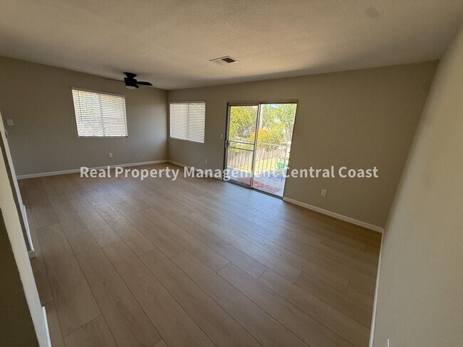
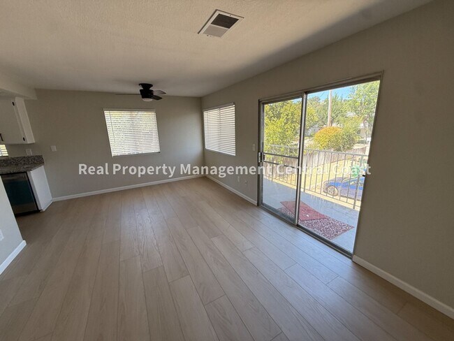
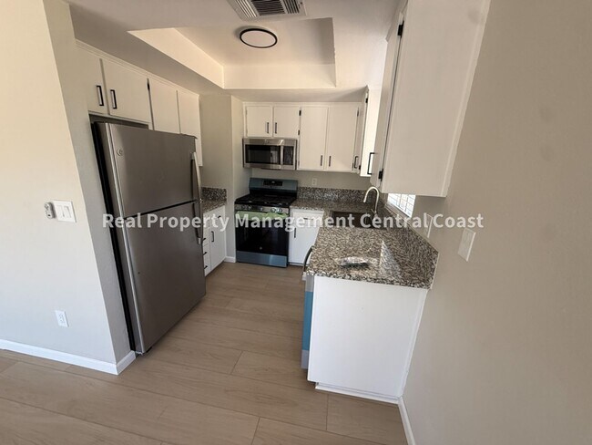
7828 Santa Ysabel Ave Unit D
Atascadero, CA 93422
2 Weeks Ago
|
Edit
Favorites
-
Bedrooms
2
-
Bathrooms
1
-
Square Feet
--
7828 Santa Ysabel Ave Unit D

Favorites
Contact
- Listed by Real | Real Property Management Central Coast
Location
Get Directions
Enjoy the small-town charm that Atascadero, California has in abundance. With annual local events at Atascadero Lake Park and regular fairs and farmers markets, this city provides residents access to unique and local industries.
Due to its small nature, all rental properties in Atascadero are in close proximity to features such as downtown art galleries, movie theaters, several parks with hiking trails, Morro Bay and other beach towns, and the famous Hearst Castle. Check out the Atascadero Faces of Freedom Memorial on Morro Road, one of the main thoroughfares in the city, dedicated to honor all the fallen San Luis Obispo County soldiers from World War I to the present. Dine in or order out for the family at Fig Good Food on Traffic Way, known for its fresh lemonade, chimichurri roast beef sandwiches, and whole rotisserie chickens.
Learn more about living in Atascadero/Templeton
Education
| Colleges & Universities | Distance | ||
|---|---|---|---|
| Colleges & Universities | Distance | ||
| Drive: | 20 min | 14.6 mi | |
| Drive: | 22 min | 16.9 mi | |
| Drive: | 29 min | 21.7 mi |
7828 Santa Ysabel Ave Unit D is within 20 minutes or 14.6 miles from Cuesta College, North County. It is also near Cal Poly and Cuesta Coll., San Luis Obispo.
Getting Around
 What do Walkability, Transit, Drivability, and Bikeability mean?
Walkability measures the walking distance to day-to-day needs.
Transit measures access to public transportation.
Drivability measures congestion, parking availability, and access to major roads.
Bikeability measures the suitability for cycling.
How It Works
What do Walkability, Transit, Drivability, and Bikeability mean?
Walkability measures the walking distance to day-to-day needs.
Transit measures access to public transportation.
Drivability measures congestion, parking availability, and access to major roads.
Bikeability measures the suitability for cycling.
How It Works
Fairly Walkable
Walkability
50
/ 100
Limited Public Transit
Transit
20
/ 100
Very Drivable
Drivability
80
/ 100
Somewhat Bikeable
Bikeability
30
/ 100
Scores provided by
-
Soundscore™
-
/ 100
Traffic
-Airport
-Businesses
-Scores provided by
HowLoud What is a Sound Score Rating? A Sound Score Rating aggregates noise caused by vehicle traffic, airplane traffic and local sources. How It WorksYou May Also Like
Similar Rentals Nearby


What Are Walk Score®, Transit Score®, and Bike Score® Ratings?
Walk Score® measures the walkability of any address. Transit Score® measures access to public transit. Bike Score® measures the bikeability of any address.
What is a Sound Score Rating?
A Sound Score Rating aggregates noise caused by vehicle traffic, airplane traffic and local sources.
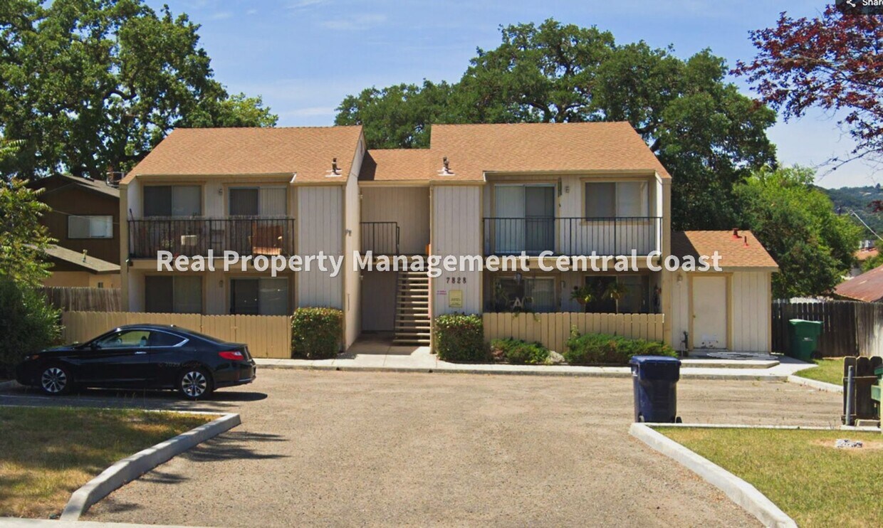
7828 Santa Ysabel Ave
Atascadero, CA 93422