
777 San Antonio Rd
777 San Antonio Rd,
Palo Alto,
CA
94303
2 Weeks Ago
Favorites
777 San Antonio Rd

Favorites
Check Back Soon for Upcoming Availability
Fees and Policies
The fees below are based on community-supplied data and may exclude additional fees and utilities.
- Parking
-
Garage--
Details
Lease Options
-
12 Months
About 777 San Antonio Rd Palo Alto, CA 94303
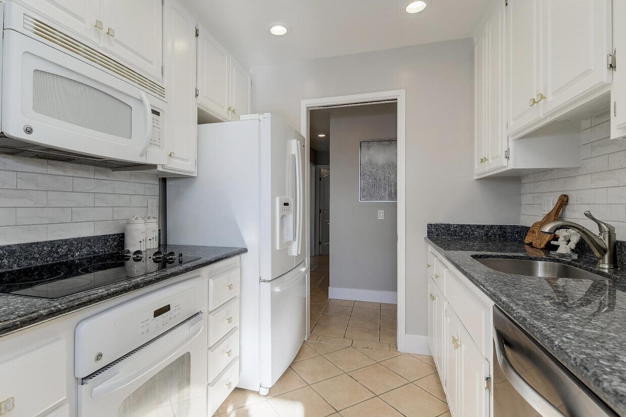
Welcome to 777 San Antonio Rd (Green House I) of Palo Alto, a sunny and quiet condo in the heart of Silicon Valley. Recently remodel 2b/2b condo, featuring an expansive living room, fresh paint, upgraded doors and lighting, kitchen with top name appliances, granite counter-tops with tons of cabinetry, spacious master bedroom with large walk-in closet and bathroom, hallway washer/dryer, and a bright balcony with storage closet. 1 car garage and another free parking space outside. Community features a pool, BBQ, clubhouse and beautiful greenery. Palo Alto School (PAUSD): Fair Meadow Elementary, JLS, Gunn High. Located near an abundance of shopping centers and all of life necessities. Walking or biking distance to Caltrain and variety of tech companies (Google, Facebook, Twitter etc) and several public park: Shoreline Park, JCC, Cubberley community Center, Mitchell Park library/park; Easy access to highway 101, 85.
777 San Antonio Rd is a condo located in Santa Clara County and the 94303 ZIP Code. This area is served by the Palo Alto Unified attendance zone.
Condo Features
Washer/Dryer
Walk-In Closets
Granite Countertops
Smoke Free
- Washer/Dryer
- Smoke Free
- Granite Countertops
- Kitchen
- Walk-In Closets
- Clubhouse
- Pool
- Balcony
Location
Get Directions
Palo Alto is known as the birthplace of Silicon Valley and that unique heritage is proudly on display, with the Computer History Museum just down the street from Google’s world headquarters and countless other tech companies all over town. The restaurant scene rivals that of nearby San Francisco, with many small, independent eateries serving up some of the best food in the Bay Area.
With close proximity to the country’s tech center, it’s no surprise that Palo Alto apartments come with some of the most incredible amenities around. Residents also have access to dozens of options for outdoor recreation, including the gorgeous hiking and biking trails through the surrounding nature preserves, several golf courses, and easy access to San Francisco Bay. Bicycling is a popular mode of transportation around Palo Alto, with many bike-friendly routes around the city.
Palo Alto is famous as the home of Stanford University, and the campus is one of the most dominant landmarks in the area.
Learn more about living in Palo Alto
Amenities
- Washer/Dryer
- Smoke Free
- Granite Countertops
- Kitchen
- Walk-In Closets
- Clubhouse
- Balcony
- Pool
Education
| Colleges & Universities | Distance | ||
|---|---|---|---|
| Colleges & Universities | Distance | ||
| Walk: | 10 min | 0.6 mi | |
| Drive: | 13 min | 5.2 mi | |
| Drive: | 14 min | 5.2 mi | |
| Drive: | 17 min | 9.4 mi |
777 San Antonio Rd is within 10 minutes or 0.6 mile from Foothill College, Middlefield. It is also near Stanford University and Foothill Coll., Los Altos.
Schools


Public Elementary School
Grades K-5
367 Students
Nearby
Public Elementary School
Grades K-5
403 Students
Attendance Zone
Public Middle School
Grades 6-8
996 Students
Attendance Zone
Public High School
Grades 9-12
1,787 Students
Attendance Zone
Private Elementary & Middle School
Grades PK-8
328 Students
Nearby
Private Elementary & Middle School
Grades K-8
Nearby
Private High School
Grades 9-12
188 Students
Nearby
School data provided by
 The GreatSchools Rating helps parents compare schools within a state based on a variety of school quality indicators and provides a helpful picture of how effectively each school serves all of its students. Ratings are on a scale of 1 (below average) to 10 (above average) and can include test scores, college readiness, academic progress, advanced courses, equity, discipline and attendance data. We also advise parents to visit schools, consider other information on school performance and programs, and consider family needs as part of the school selection process.
View GreatSchools Rating Methodology
Data provided by GreatSchools.org © 2025. All rights reserved.
View GreatSchools Rating Methodology
Data provided by GreatSchools.org © 2025. All rights reserved.
Transportation options available in Palo Alto include Mountain View Station, located 3.0 miles from 777 San Antonio Rd. 777 San Antonio Rd is near Norman Y Mineta San Jose International, located 11.3 miles or 17 minutes away, and San Francisco International, located 23.0 miles or 31 minutes away.
| Transit / Subway | Distance | ||
|---|---|---|---|
| Transit / Subway | Distance | ||
| Drive: | 7 min | 3.0 mi | |
|
|
Drive: | 7 min | 3.0 mi |
| Drive: | 7 min | 3.7 mi | |
|
|
Drive: | 7 min | 3.8 mi |
|
|
Drive: | 8 min | 4.3 mi |
| Commuter Rail | Distance | ||
|---|---|---|---|
| Commuter Rail | Distance | ||
| Drive: | 4 min | 1.6 mi | |
| Drive: | 9 min | 3.6 mi | |
| Drive: | 9 min | 3.6 mi | |
| Drive: | 10 min | 3.8 mi | |
| Drive: | 10 min | 3.9 mi |
| Airports | Distance | ||
|---|---|---|---|
| Airports | Distance | ||
|
Norman Y Mineta San Jose International
|
Drive: | 17 min | 11.3 mi |
|
San Francisco International
|
Drive: | 31 min | 23.0 mi |
Time and distance from 777 San Antonio Rd.
| Shopping Centers | Distance | ||
|---|---|---|---|
| Shopping Centers | Distance | ||
| Walk: | 10 min | 0.5 mi | |
| Walk: | 13 min | 0.7 mi | |
| Walk: | 13 min | 0.7 mi |
777 San Antonio Rd has 3 shopping centers within 0.7 mile, which is about a 13-minute walk. The miles and minutes will be for the farthest away property.
| Parks and Recreation | Distance | ||
|---|---|---|---|
| Parks and Recreation | Distance | ||
|
J. Pearce Mitchell Park
|
Drive: | 6 min | 1.6 mi |
|
Stevens Creek Shoreline Nature Study Area
|
Drive: | 8 min | 2.6 mi |
|
Terman Park
|
Drive: | 8 min | 2.8 mi |
|
Bol Park
|
Drive: | 10 min | 3.6 mi |
|
The Environmental Volunteers EcoCenter
|
Drive: | 9 min | 3.8 mi |
777 San Antonio Rd has 5 parks within 3.8 miles, including J. Pearce Mitchell Park, Terman Park, and Stevens Creek Shoreline Nature Study Area.
| Hospitals | Distance | ||
|---|---|---|---|
| Hospitals | Distance | ||
| Drive: | 9 min | 5.2 mi | |
| Drive: | 15 min | 5.8 mi | |
| Drive: | 16 min | 6.3 mi |
777 San Antonio Rd has 3 hospitals within 6.3 miles, the nearest is El Camino Hospital which is 5.2 miles away and a 9 minute drive.
| Military Bases | Distance | ||
|---|---|---|---|
| Military Bases | Distance | ||
| Drive: | 10 min | 4.1 mi |
777 San Antonio Rd is 4.1 miles and a 10 minute drive from Ames Research Center.
You May Also Like
Similar Rentals Nearby
-
-

-
-
-
-
1 / 7

-
-
1 / 7

-
-


What Are Walk Score®, Transit Score®, and Bike Score® Ratings?
Walk Score® measures the walkability of any address. Transit Score® measures access to public transit. Bike Score® measures the bikeability of any address.
What is a Sound Score Rating?
A Sound Score Rating aggregates noise caused by vehicle traffic, airplane traffic and local sources