
$4,200
/ Month
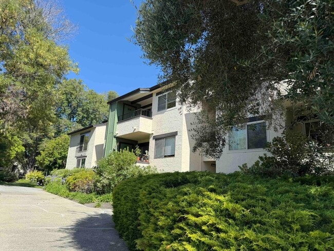
777 San Antonio Rd
Palo Alto, CA 94303
Favorites
-
Bedrooms
2
-
Bathrooms
2
-
Square Feet
1,068 sq ft
-
Available
Available Jun 12
Highlights
- Private Pool
- Community Pool
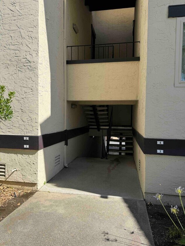
- 1 Car Detached Garage
- Forced Air Heating System
- Washer and Dryer
- Dining Area
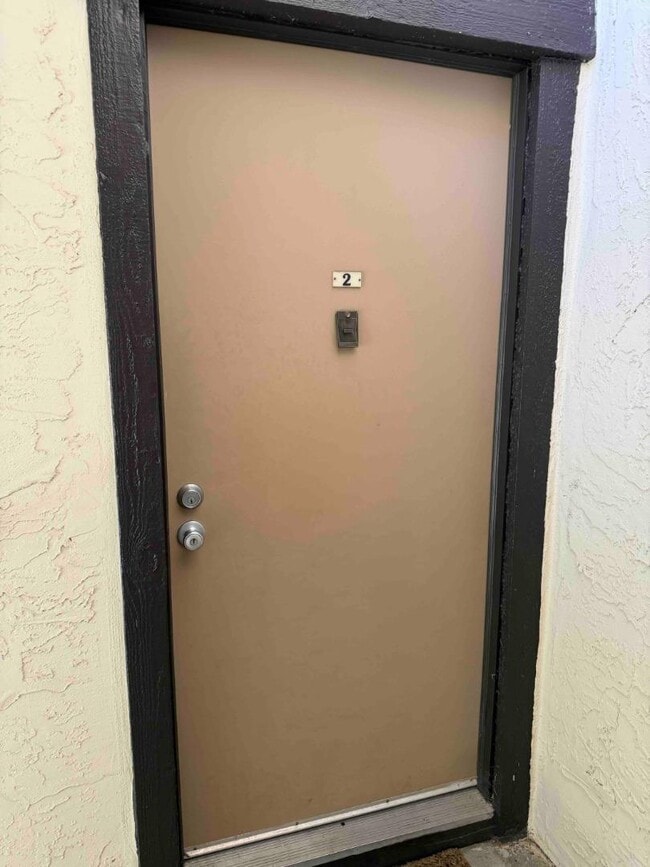
777 San Antonio Rd

Favorites
About This Home
Available Jun 12
Enjoy the best of Silicon Valley living in this beautifully maintained 2-bedroom, 2-bath townhome located in Palo Altos desirable Greenhouse community. Offering a thoughtfully designed floor plan, abundant natural light, and a private 1-car garage, this home combines comfort, convenience, and an unbeatable location. The spacious living and dining areas flow seamlessly to private outdoor space, while two well-appointed bedrooms and two full bathrooms provide flexibility for professionals, roommates, or those working from home. Residents enjoy access to community amenities including lush landscaped grounds, open green spaces, and a sparkling swimming pool. This home offers convenient access to Google, Meta, Apple, Intuit, NVIDIA, and numerous technology campuses. Stanford University and Stanford Medical Center are just a short drive away, making this location highly desirable for professionals, researchers, and graduate students alike. Enjoy easy access to Highway 101, Caltrain and the popular San Antonio Center featuring Trader Joes, Safeway, Whole Foods, and everyday conveniences. Located within the acclaimed Palo Alto school district. MLS # ML82050340
777 San Antonio Rd is a condo located in Santa Clara County and the 94303 ZIP Code.
* Price shown is base rent. Excludes user-selected optional fees and variable or usage-based fees and required charges due at or prior to move-in or at move-out. Price, availability, fees, and any applicable rent special are subject to change without notice.
* Square footage definitions vary. Displayed square footage is approximate.
Home Details
Bedrooms and Bathrooms
2 Full Bathrooms
2 Bedrooms
Home Design
Apartment
Interior Spaces
Dining Area
Carpet
1,068 Sq Ft Home
1-Story Property
Kitchen
Electric Cooktop
Electric Oven
Dishwasher
Laundry
Washer and Dryer
Listing and Financial Details
Security Deposit $8,400
Property Available on 6/9/26
Rent includes trash removal
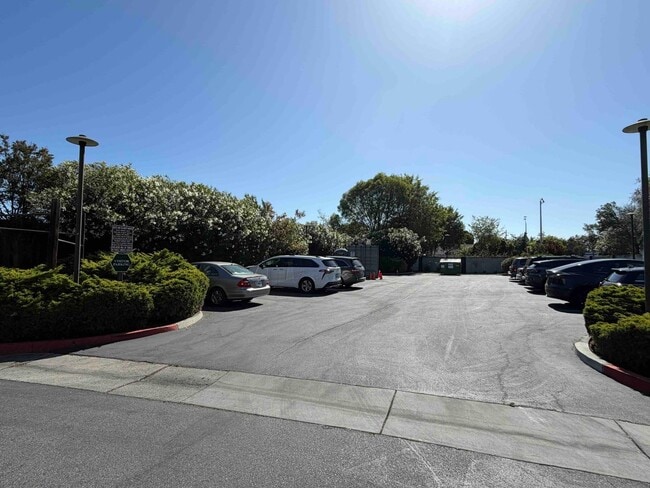
Parking
1 Car Detached Garage
Pool
Private Pool
Utilities
Forced Air Heating System
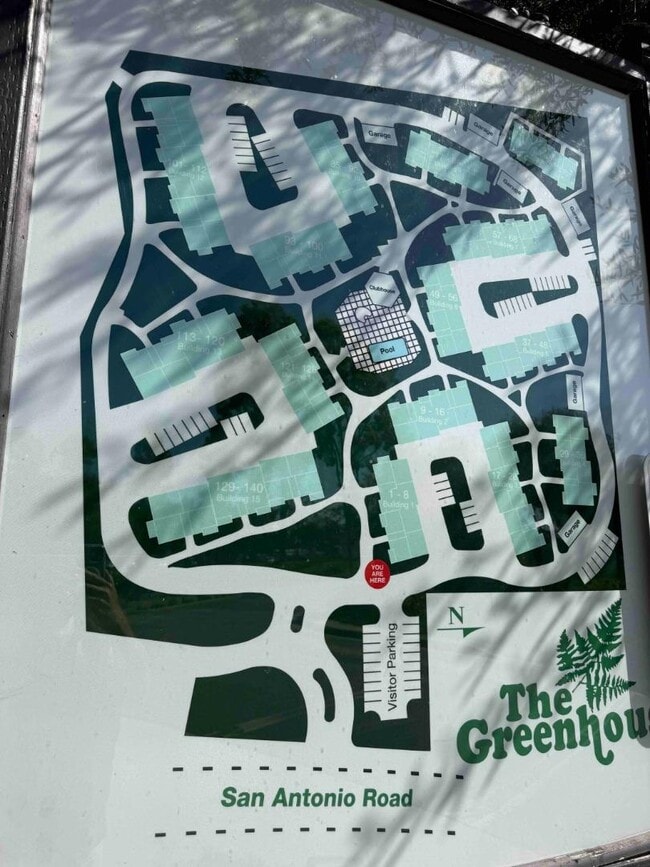
Community Details
Overview
140 Units
Property has a Home Owners Association
1,068 Sq Ft Building
Recreation
Community Pool
Contact
- Listed by David Kelsey | Compass
- Contact
-
Source
 MLSListings Inc.
Copyright © 2026 MLSListings Inc.
Location
Get Directions
Living in Palo Alto places you in Silicon Valley, where historic neighborhoods complement the city's technological presence. Tree-lined streets wind through the community, which is anchored by Stanford University. University Avenue features local boutiques and restaurants housed in preserved historic buildings, while the Stanford Shopping Center offers high-end retail destinations. The city maintains 36 parks and preserves, including the Baylands Nature Preserve and Foothills Park, where residents enjoy hiking trails and outdoor activities. Palo Alto's infrastructure supports alternative transportation, with dedicated bike lanes throughout the city.
The rental market in Palo Alto reflects the area's popularity, with current average rents ranging from $2,634 for studios to $6,139 for four-bedroom homes. Recent trends show steady growth, with rent increases varying from 1.8% to 17% across different unit sizes over the past year.
Learn more about living in Palo Alto
Amenities
- Pool
Education
| Colleges & Universities | Distance | ||
|---|---|---|---|
| Colleges & Universities | Distance | ||
| Walk: | 10 min | 0.6 mi | |
| Drive: | 13 min | 5.2 mi | |
| Drive: | 14 min | 5.2 mi | |
| Drive: | 17 min | 9.4 mi |
777 San Antonio Rd is within 10 minutes or 0.6 mile from Foothill College, Middlefield. It is also near Stanford University and Foothill Coll., Los Altos.
Transportation options available in Palo Alto include Mountain View Station, located 3.0 miles from 777 San Antonio Rd. 777 San Antonio Rd is near Norman Y Mineta San Jose International, located 11.3 miles or 17 minutes away, and San Francisco International, located 23.0 miles or 31 minutes away.
| Transit / Subway | Distance | ||
|---|---|---|---|
| Transit / Subway | Distance | ||
| Drive: | 7 min | 3.0 mi | |
| Drive: | 7 min | 3.7 mi | |
|
|
Drive: | 8 min | 4.3 mi |
|
|
Drive: | 8 min | 4.3 mi |
| Drive: | 8 min | 4.6 mi |
| Commuter Rail | Distance | ||
|---|---|---|---|
| Commuter Rail | Distance | ||
| Drive: | 5 min | 1.6 mi | |
| Drive: | 9 min | 3.6 mi | |
| Drive: | 10 min | 3.9 mi | |
| Drive: | 13 min | 5.1 mi | |
| Drive: | 12 min | 6.6 mi |
| Airports | Distance | ||
|---|---|---|---|
| Airports | Distance | ||
|
Norman Y Mineta San Jose International
|
Drive: | 17 min | 11.3 mi |
|
San Francisco International
|
Drive: | 31 min | 23.0 mi |
Getting Around
 What do Walkability, Transit, Drivability, and Bikeability mean?
Walkability measures the walking distance to day-to-day needs.
Transit measures access to public transportation.
Drivability measures congestion, parking availability, and access to major roads.
Bikeability measures the suitability for cycling.
How It Works
What do Walkability, Transit, Drivability, and Bikeability mean?
Walkability measures the walking distance to day-to-day needs.
Transit measures access to public transportation.
Drivability measures congestion, parking availability, and access to major roads.
Bikeability measures the suitability for cycling.
How It Works
Fairly Walkable
Walkability
50
/ 100
Limited Public Transit
Transit
30
/ 100
Exceptionally Drivable
Drivability
90
/ 100
Moderately Bikeable
Bikeability
60
/ 100
Scores provided by
-
Soundscore™
-
/ 100
Traffic
-Airport
-Businesses
-Scores provided by
HowLoud What is a Sound Score Rating? A Sound Score Rating aggregates noise caused by vehicle traffic, airplane traffic and local sources. How It WorksTime and distance from 777 San Antonio Rd.
| Shopping Centers | Distance | ||
|---|---|---|---|
| Shopping Centers | Distance | ||
| Walk: | 10 min | 0.5 mi | |
| Walk: | 13 min | 0.7 mi | |
| Walk: | 13 min | 0.7 mi |
777 San Antonio Rd has 3 shopping centers within 0.7 mile, which is about a 13-minute walk. The miles and minutes will be for the farthest away property.
| Parks and Recreation | Distance | ||
|---|---|---|---|
| Parks and Recreation | Distance | ||
|
J. Pearce Mitchell Park
|
Drive: | 6 min | 1.6 mi |
|
Stevens Creek Shoreline Nature Study Area
|
Drive: | 8 min | 2.6 mi |
|
Terman Park
|
Drive: | 8 min | 2.8 mi |
|
Bol Park
|
Drive: | 10 min | 3.6 mi |
|
The Environmental Volunteers EcoCenter
|
Drive: | 9 min | 3.8 mi |
777 San Antonio Rd has 5 parks within 3.8 miles, including J. Pearce Mitchell Park, Terman Park, and Stevens Creek Shoreline Nature Study Area.
| Hospitals | Distance | ||
|---|---|---|---|
| Hospitals | Distance | ||
| Drive: | 9 min | 5.2 mi | |
| Drive: | 15 min | 5.8 mi | |
| Drive: | 16 min | 6.3 mi |
777 San Antonio Rd has 3 hospitals within 6.3 miles, the nearest is El Camino Hospital which is 5.2 miles away and a 9 minute drive.
| Military Bases | Distance | ||
|---|---|---|---|
| Military Bases | Distance | ||
| Drive: | 10 min | 4.1 mi | |
| Drive: | 56 min | 39.2 mi | |
| Drive: | 56 min | 39.4 mi |
777 San Antonio Rd has 3 military bases within 39.4 miles, the nearest is Ames Research Center which is 4.1 miles away and a 10 minute drive.
You May Also Like
Similar Rentals Nearby


What Are Walk Score®, Transit Score®, and Bike Score® Ratings?
Walk Score® measures the walkability of any address. Transit Score® measures access to public transit. Bike Score® measures the bikeability of any address.
What is a Sound Score Rating?
A Sound Score Rating aggregates noise caused by vehicle traffic, airplane traffic and local sources.

777 San Antonio Rd
Palo Alto, CA 94303