
The Grove - Encore
8000 O’Connor Dr,
River Grove, IL 60171
$2,630 - $4,350
1-3 Beds

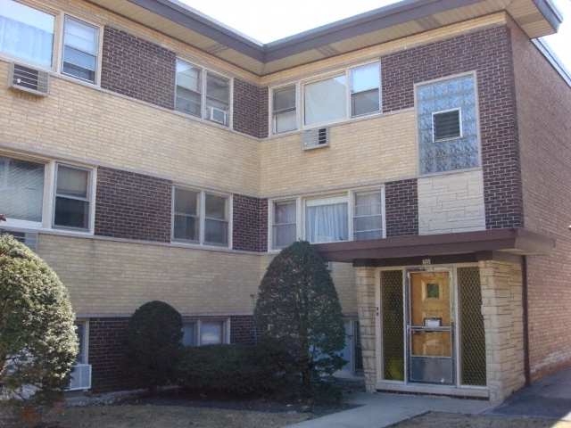
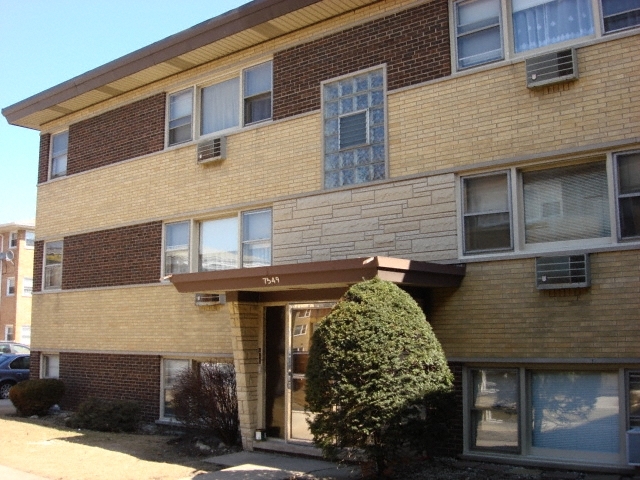

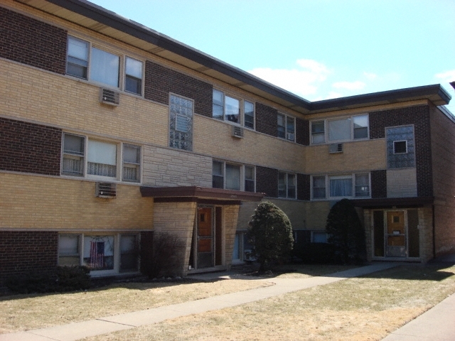
Experience Elmwood Park living at 7549-7551 Belmont Ave. The Belmont Ave address in the 60634 area of Elmwood Park makes a popular place for you to live. Come by to check out the apartment floorplan options. Here at this community, the community staff is excited to help you find the perfect new home. Visit 7549-7551 Belmont Ave today.
7549-7551 Belmont Ave is an apartment community located in Cook County and the 60634 ZIP Code. This area is served by the Chicago Public Schools attendance zone.
Located about 14 miles northwest of the Chicago Loop, Belmont Heights offers residents a suburban atmosphere within minutes of countless world-class amenities. While Belmont Heights is a predominantly residential neighborhood, a host of restaurants, shops, markets, and specialty stores line Harlem Avenue, providing plenty of modern conveniences for residents.
Belmont Heights is proximate to all kinds of recreational opportunities at Hiawatha Park, Shabbona Park, Norridge Park District, and several area golf and country clubs. Shopping options abound at the nearby Harlem Irving Plaza, the Brickyard, and Fashion Outlets of Chicago. Getting around from Belmont Heights is simple with access to I-90, I-294, the Metrarail, and O’Hare International Airport.
Learn more about living in Belmont HeightsCompare neighborhood and city base rent averages by bedroom.
| Belmont Heights | Elmwood Park, IL | |
|---|---|---|
| Studio | - | $1,262 |
| 1 Bedroom | $836 | $1,111 |
| 2 Bedrooms | $1,142 | $1,397 |
| 3 Bedrooms | - | $2,441 |
| Colleges & Universities | Distance | ||
|---|---|---|---|
| Colleges & Universities | Distance | ||
| Drive: | 7 min | 2.7 mi | |
| Drive: | 8 min | 3.2 mi | |
| Drive: | 7 min | 3.4 mi | |
| Drive: | 9 min | 4.6 mi |


Transportation options available in Elmwood Park include Harlem/Lake Station (Green Line), located 4.2 miles from 7549-7551 Belmont Ave. 7549-7551 Belmont Ave is near Chicago O'Hare International, located 7.8 miles or 14 minutes away, and Chicago Midway International, located 14.1 miles or 25 minutes away.
| Transit / Subway | Distance | ||
|---|---|---|---|
| Transit / Subway | Distance | ||
|
|
Drive: | 11 min | 4.2 mi |
|
|
Drive: | 11 min | 4.6 mi |
|
|
Drive: | 10 min | 5.6 mi |
|
|
Drive: | 10 min | 5.6 mi |
|
|
Drive: | 11 min | 6.2 mi |
| Commuter Rail | Distance | ||
|---|---|---|---|
| Commuter Rail | Distance | ||
|
|
Walk: | 20 min | 1.1 mi |
|
|
Drive: | 3 min | 1.6 mi |
|
|
Drive: | 4 min | 1.8 mi |
|
|
Drive: | 5 min | 2.4 mi |
|
|
Drive: | 7 min | 3.0 mi |
| Airports | Distance | ||
|---|---|---|---|
| Airports | Distance | ||
|
Chicago O'Hare International
|
Drive: | 14 min | 7.8 mi |
|
Chicago Midway International
|
Drive: | 25 min | 14.1 mi |
Scores provided by
Traffic
-Airport
-Businesses
-Scores provided by
HowLoud What is a Sound Score Rating? A Sound Score Rating aggregates noise caused by vehicle traffic, airplane traffic and local sources. How It WorksTime and distance from 7549-7551 Belmont Ave.
| Shopping Centers | Distance | ||
|---|---|---|---|
| Shopping Centers | Distance | ||
| Walk: | 16 min | 0.9 mi | |
| Walk: | 20 min | 1.1 mi |
| Parks and Recreation | Distance | ||
|---|---|---|---|
| Parks and Recreation | Distance | ||
|
Riis Park
|
Drive: | 6 min | 2.8 mi |
|
Schiller Woods
|
Drive: | 7 min | 3.1 mi |
|
Cernan Earth and Space Center
|
Drive: | 6 min | 3.2 mi |
|
Wonder Works Children's Museum
|
Drive: | 8 min | 3.6 mi |
|
Oriole Park
|
Drive: | 10 min | 3.7 mi |
| Hospitals | Distance | ||
|---|---|---|---|
| Hospitals | Distance | ||
| Drive: | 5 min | 2.3 mi | |
| Drive: | 5 min | 2.5 mi | |
| Drive: | 6 min | 3.1 mi |
| Military Bases | Distance | ||
|---|---|---|---|
| Military Bases | Distance | ||
| Drive: | 25 min | 15.8 mi | |
| Drive: | 38 min | 24.5 mi | |
| Drive: | 49 min | 29.5 mi |
What Are Walk Score®, Transit Score®, and Bike Score® Ratings?
Walk Score® measures the walkability of any address. Transit Score® measures access to public transit. Bike Score® measures the bikeability of any address.
What is a Sound Score Rating?
A Sound Score Rating aggregates noise caused by vehicle traffic, airplane traffic and local sources.
7549-7551 Belmont Ave
Elmwood Park, IL 60634


