

$1,250 / Month
7541 Banning Way
Inver Grove Heights, MN 55077
2 Weeks Ago
Favorites
7541 Banning Way

Favorites
Check Back Soon for Upcoming Availability
| Beds | Baths | Average SF |
|---|---|---|
| 2 Bedrooms 2 Bedrooms 2 Br | 1 Bath 1 Bath 1 Ba | 900 SF |
About This Property
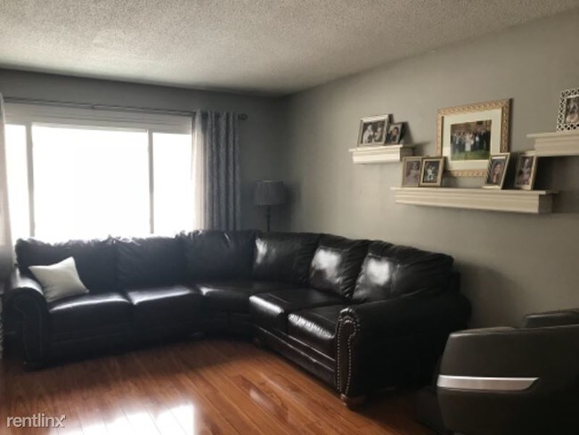
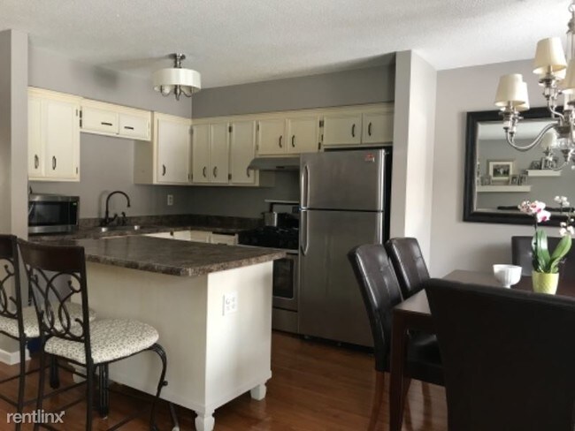
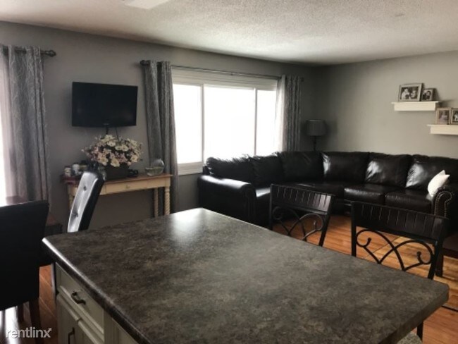
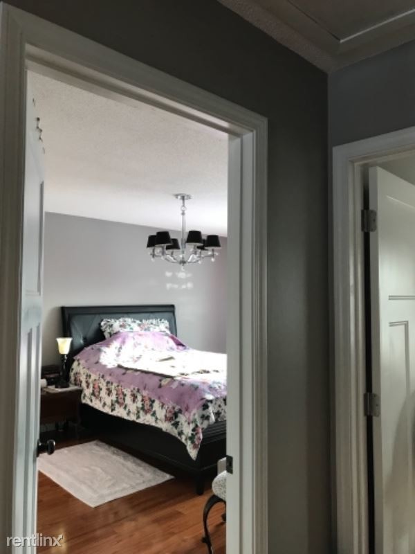
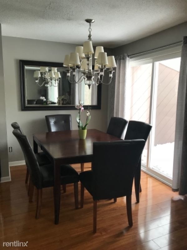
(952) 270-6739 - Updated 2br upper unit near trails and golf course - Property Id: 52988 Nice upper level unit of twin home, open floor plan with large master bedroom, private entrance and private use of rear deck, attached 1car garage and additional driveway parking, use of laundry, great semi private yard with wooded views in a quiet neighborhood in Inver Grove heights, great location near walking trails, easy access to Hwy 52 and 55. Trash, water and use of laundry facilities included. Tenant is responsible for cutting grass and shoveling. non smoking unit. Dog/cat friendly with pet deposit. Available April 1st, mid March option. Apply at TurboTenant: http://rental.turbotenant.com/properties/52988 Property Id 52988 (RLNE3924860) Other Amenities - Other- Cooling System: Central. Appliances - Dishwasher, Refrigerator, Range, Oven, Garbage Disposal, Washer & Dryer, Other- Freezer, Microwave. Lease lengths - 12 Months. Details regarding this property's Utilities - Water Included, Trash Pick-up Included. Pet policies - Small Dogs Allowed, Cats Allowed, Large Dogs Allowed.
7541 Banning Way is a condo located in Dakota County and the 55077 ZIP Code. This area is served by the Inver Grove Heights Schools attendance zone.
Location
Get Directions
Just off the eastern bank of the Mississippi River, Inver Grove Heights, Minnesota has all the natural beauty expected from the state known for its grassy rolling plains. South of the Twin Cities, Inver Grove Heights is a suburb of Saint Paul. This residential city provides easy access to the surrounding areas thanks to the highway that runs through the city, Highway 52.
Residents of this quiet town enjoy several events and volunteer opportunities that keeps people of Inver Grove Heights connected. There are also many local parks and a community center that provides the community with a variety of recreation opportunities and programs. The new development within the area makes Inver Grove a city with a pleasant mix of both old and new.
Learn more about living in Inver Grove HeightsBelow are rent ranges for similar nearby apartments
Education
| Colleges & Universities | Distance | ||
|---|---|---|---|
| Colleges & Universities | Distance | ||
| Drive: | 5 min | 1.6 mi | |
| Drive: | 13 min | 6.7 mi | |
| Drive: | 15 min | 9.5 mi | |
| Drive: | 17 min | 10.0 mi |
7541 Banning Way is within 5 minutes or 1.6 miles from Inver Hills Community College. It is also near Argosy University, Twin Cities and Saint Paul College.
Schools


Public Elementary School
Grades PK-5
655 Students
Nearby
Public Elementary School
Grades PK-5
312 Students
Attendance Zone
Public Middle School
Grades 6-8
761 Students
Attendance Zone
Public High School
Grades 9-12
1,062 Students
Attendance Zone
Private Elementary & Middle School
Grades PK-8
33 Students
Nearby
Private Middle & High School
Grades 6-12
258 Students
Nearby
School data provided by
 The GreatSchools Rating helps parents compare schools within a state based on a variety of school quality indicators and provides a helpful picture of how effectively each school serves all of its students. Ratings are on a scale of 1 (below average) to 10 (above average) and can include test scores, college readiness, academic progress, advanced courses, equity, discipline and attendance data. We also advise parents to visit schools, consider other information on school performance and programs, and consider family needs as part of the school selection process.
View GreatSchools Rating Methodology
Data provided by GreatSchools.org © 2025. All rights reserved.
View GreatSchools Rating Methodology
Data provided by GreatSchools.org © 2025. All rights reserved.
Transportation options available in Inver Grove Heights include Central Station, located 8.9 miles from 7541 Banning Way. 7541 Banning Way is near Minneapolis-St Paul International/Wold-Chamberlain, located 11.0 miles or 19 minutes away.
| Transit / Subway | Distance | ||
|---|---|---|---|
| Transit / Subway | Distance | ||
| Drive: | 14 min | 8.9 mi | |
| Drive: | 14 min | 8.9 mi | |
| Drive: | 15 min | 9.1 mi | |
|
|
Drive: | 16 min | 9.2 mi |
|
|
Drive: | 17 min | 10.0 mi |
| Commuter Rail | Distance | ||
|---|---|---|---|
| Commuter Rail | Distance | ||
|
|
Drive: | 15 min | 9.1 mi |
|
|
Drive: | 32 min | 16.5 mi |
|
|
Drive: | 35 min | 25.6 mi |
|
|
Drive: | 45 min | 33.8 mi |
|
|
Drive: | 47 min | 35.4 mi |
| Airports | Distance | ||
|---|---|---|---|
| Airports | Distance | ||
|
Minneapolis-St Paul International/Wold-Chamberlain
|
Drive: | 19 min | 11.0 mi |
Time and distance from 7541 Banning Way.
| Shopping Centers | Distance | ||
|---|---|---|---|
| Shopping Centers | Distance | ||
| Drive: | 4 min | 1.7 mi | |
| Drive: | 5 min | 2.0 mi | |
| Drive: | 5 min | 2.0 mi |
7541 Banning Way has 3 shopping centers within 2.0 miles, which is about a 5-minute drive. The miles and minutes will be for the farthest away property.
| Parks and Recreation | Distance | ||
|---|---|---|---|
| Parks and Recreation | Distance | ||
|
Dodge Nature Center
|
Drive: | 11 min | 5.7 mi |
|
Cherokee Regional Park
|
Drive: | 17 min | 9.0 mi |
|
Highland Park and Golf Course
|
Drive: | 16 min | 9.4 mi |
|
Crosby Farm Regional Park
|
Drive: | 16 min | 9.4 mi |
|
Fort Snelling State Park
|
Drive: | 21 min | 11.3 mi |
7541 Banning Way has 5 parks within 11.3 miles, including Dodge Nature Center, Cherokee Regional Park, and Highland Park and Golf Course.
| Hospitals | Distance | ||
|---|---|---|---|
| Hospitals | Distance | ||
| Drive: | 15 min | 9.4 mi | |
| Drive: | 15 min | 9.8 mi | |
| Drive: | 16 min | 9.8 mi |
7541 Banning Way has 3 hospitals within 9.8 miles, the nearest is St. Joseph's Hospital which is 9.4 miles away and a 15 minute drive.
| Military Bases | Distance | ||
|---|---|---|---|
| Military Bases | Distance | ||
| Drive: | 17 min | 9.8 mi |
7541 Banning Way is 9.8 miles and a 17 minute drive from Fort Snelling Military Reservation.
You May Also Like
Similar Rentals Nearby
-
-

-

-

-

-
 $1,9502 Beds, 1 Bath, 1,500 sq ftApartment for Rent
 -

-
 $1,5002 Beds, 1 Bath, 1,070 sq ftApartment for Rent
 -

-
 $1,2002 Beds, 1 Bath, 950 sq ftApartment for Rent
What Are Walk Score®, Transit Score®, and Bike Score® Ratings?
Walk Score® measures the walkability of any address. Transit Score® measures access to public transit. Bike Score® measures the bikeability of any address.
What is a Sound Score Rating?
A Sound Score Rating aggregates noise caused by vehicle traffic, airplane traffic and local sources
7541 Banning Way
Inver Grove Heights, MN 55077